This article does not cite any sources . (April 2012) (Learn how and when to remove this template message) |
Popponesset Creek is a small waterway in Mashpee, Massachusetts on Cape Cod. On both ends, it connects with Popponesset Bay.
A waterway is any navigable body of water. Broad distinctions are useful to avoid ambiguity, and disambiguation will be of varying importance depending on the nuance of the equivalent word in other languages. A first distinction is necessary between maritime shipping routes and waterways used by inland water craft. Maritime shipping routes cross oceans and seas, and some lakes, where navigability is assumed, and no engineering is required, except to provide the draft for deep-sea shipping to approach seaports (channels), or to provide a short cut across an isthmus; this is the function of ship canals. Dredged channels in the sea are not usually described as waterways. There is an exception to this initial distinction, essentially for legal purposes, see under international waters.
Mashpee is a town in Barnstable County, Massachusetts, United States, on Cape Cod. The population was 14,006 as of 2010. It is the site of the headquarters and most members of the federally recognized Mashpee Wampanoag Tribe, one of two Wampanoag.
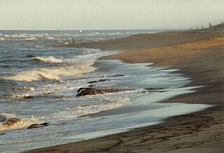
Cape Cod is a geographic cape extending into the Atlantic Ocean from the southeastern corner of mainland Massachusetts, in the northeastern United States. Its historic, maritime character and ample beaches attract heavy tourism during the summer months.
Popponesset Creek runs from Holly Marsh down to Popponesset Peninsula and serves to separate Popponesset Island from the bay. An automobile bridge crosses Popponesset Creek from Holly Marsh to Popponesset Island.
Holly Marsh is a small saltwater marshland in Mashpee, Massachusetts on the shores of Popponesset Bay, Cape Cod.
Popponesset Peninsula is a spit of land in Cape Cod, Massachusetts which extends from the southwestern shore of Popponesset Bay and separates it from Nantucket Sound.
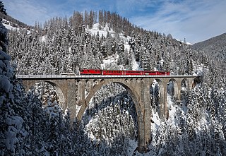
A bridge is a structure built to span a physical obstacle, such as a body of water, valley, or road, without closing the way underneath. It is constructed for the purpose of providing passage over the obstacle, usually something that can be detrimental to cross otherwise. There are many different designs that each serve a particular purpose and apply to different situations. Designs of bridges vary depending on the function of the bridge, the nature of the terrain where the bridge is constructed and anchored, the material used to make it, and the funds available to build it.
Both sides of the creek are lined with saltwater marshland.
A salt marsh or saltmarsh, also known as a coastal salt marsh or a tidal marsh, is a coastal ecosystem in the upper coastal intertidal zone between land and open saltwater or brackish water that is regularly flooded by the tides. It is dominated by dense stands of salt-tolerant plants such as herbs, grasses, or low shrubs. These plants are terrestrial in origin and are essential to the stability of the salt marsh in trapping and binding sediments. Salt marshes play a large role in the aquatic food web and the delivery of nutrients to coastal waters. They also support terrestrial animals and provide coastal protection.
A marsh is a wetland that is dominated by herbaceous rather than woody plant species. Marshes can often be found at the edges of lakes and streams, where they form a transition between the aquatic and terrestrial ecosystems. They are often dominated by grasses, rushes or reeds. If woody plants are present they tend to be low-growing shrubs. This form of vegetation is what differentiates marshes from other types of wetland such as swamps, which are dominated by trees, and mires, which are wetlands that have accumulated deposits of acidic peat.
Coordinates: 41°34′58.40″N70°27′40.52″W / 41.5828889°N 70.4612556°W
A geographic coordinate system is a coordinate system that enables every location on Earth to be specified by a set of numbers, letters or symbols. The coordinates are often chosen such that one of the numbers represents a vertical position and two or three of the numbers represent a horizontal position; alternatively, a geographic position may be expressed in a combined three-dimensional Cartesian vector. A common choice of coordinates is latitude, longitude and elevation. To specify a location on a plane requires a map projection.
This Barnstable County, Massachusetts geography–related article is a stub. You can help Wikipedia by expanding it. |
This article related to a river in Massachusetts is a stub. You can help Wikipedia by expanding it. |
New Seabury is a census-designated place (CDP) in the town of Mashpee in Barnstable County, Massachusetts, United States, on Cape Cod. The area consists primarily of summer homes for wealthy families. Attractions include a country club and the Fells Pond, Daniels Island, and Littleneck Bay neighborhoods. The population of the CDP was 717 at the 2010 census.
Popponesset is a census-designated place (CDP) in the town of Mashpee in Barnstable County, Massachusetts, United States. The population was 220 at the 2010 census.
Popponesset Island is a census-designated place (CDP) in the town of Mashpee in Barnstable County, Massachusetts, United States. The population was 26 at the 2010 census.
Chappaquiddick Island, a part of the town of Edgartown, Massachusetts, is a small peninsula and occasional island on the eastern end of Martha's Vineyard. Norton Point, a narrow barrier beach, connects Martha's Vineyard and Chappaquiddick between Katama and Wasque. Occasional breaches occur due to hurricanes and strong storms separating the islands for periods of time. Most recently, the two were separated for 8 years from 2007 to 2015. Though both land forms have, over the course of history, mostly been connected to one another, Chappaquiddick is nevertheless referred to as an island.
Lemon Creek is a stream located on the South Shore of Staten Island, one of the five boroughs of New York City. It is one of the few remaining ground-level creeks in New York City.
Abiels Ledge is a small barren rock located in Buzzards Bay, within Massachusetts. The rock is just off the southeast coast of Stony Point Dike, near Hog Island Channel and within the town limits of Wareham. This is a good place to catch stripers when they are running.
The Lloyd Center for the Environment is a non-profit organization that provides educational programs on aquatic environments in southeastern New England in the United States.
Cape Poge Wildlife Refuge is a wildlife refuge on Chappaquiddick Island owned and managed by The Trustees of Reservations. The refuge consists of 516 acres (2.09 km2) and includes the 1893 Cape Poge Lighthouse.
Mashpee River Reservation is a park in Mashpee, Massachusetts on the Mashpee River. The Trustees of Reservations owns and maintains the park.
The Santuit River, also known as the Cotuit River, is a 2.3-mile-long (3.7 km) river on the border between Mashpee and Cotuit, Massachusetts on Cape Cod.
Mashpee Pond 41°39′40″N 70°29′08″W and Wakeby Pond 41°40′30″N 70°29′08″W are adjoining ponds in Mashpee and Sandwich, Massachusetts. When considered together, these two ponds cover 729 acres (2.95 km2) and constitute the largest freshwater pond on Cape Cod. This pair is 85 feet (26 m) deep at its deepest point. The Fishing Record for most bass cought in a day belongs to Tim walls on August 21,2016. The record for most fishing trips without a single fish cought belongs to Brendan Kelliher at 26. These kettleholes are fed by groundwater and have no inlet streams. The ponds' sole outlet stream, the Mashpee River, flows south to Popponesset Bay.
Popponesset Bay System is a group of bays located at the towns of Mashpee and Barnstable (east), on Cape Cod, Massachusetts with a southern shore bounded by water from Nantucket Sound.
Washburn Island is a 330-acre (1.3 km2) island off the coast of East Falmouth, Massachusetts within Waquoit Bay. It is home to some primitive campsites and is part of the Waquoit Bay National Estuarine Research Reserve. It is part of the Town of Falmouth, in Barnstable County in the village of Waquoit.
San Leandro Bay is a body of water in the San Francisco Bay. It is connected to the Oakland Estuary today, but was originally separated by land which formerly connected Alameda with Oakland. It is located along the east of the Oakland International Airport and Bay Farm Island. The principal stream which flows into San Leandro Bay is San Leandro Creek. Other tributaries include the East Creek/Peralta Creek watershed and the Lion Creek/Arroyo Viejo watershed. Damon Marsh is located there.
The Lowell Holly Reservation is a 135-acre (0.55 km2) nature reserve in Mashpee and Sandwich, Massachusetts and is managed by the Trustees of Reservations. The area was extensively planted by Abbot Lawrence Lowell and Wilfred Wheeler with rhododendrons, mountain laurel and holly trees, for which the reservation gets its name. There are 4 miles (6.4 km) of hiking trails and two peninsular knolls that jut into Mashpee Pond and Wakeby Pond. Abbot Lawrence Lowell bequeathed the property to the Trustees of Reservations in 1943.
Glenn Martin National Wildlife Refuge includes the northern half of Smith Island, which lies 11 miles (18 km) west of Crisfield, Maryland, and Watts Island, which is located between the eastern shore of Virginia and Tangier Island. Both islands are situated in the lower Chesapeake Bay.
Mountain Creek is a 20.9-mile-long (33.6 km) tributary of Yellow Breeches Creek in Cumberland County, Pennsylvania.
The Popponesset Firing Range was a firing range of the United States Army located in Mashpee, Massachusetts. It was active from 1941 to 1942, and was dismantled after its use was ended. It was a satellite range of nearby Camp Edwards.