
Hanover is a town in Plymouth County, Massachusetts, United States. The population was 14,833 at the 2020 census.

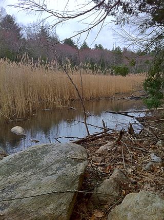
The Assonet River is located in Bristol County, Massachusetts. It flows 7.4 miles (11.9 km) in a westerly direction through Freetown and joins the Taunton River near Assonet Neck in Berkley, Massachusetts.

The York River is a 13-mile-long (21 km) stream in southeast Maine, United States. It is tidal for over half of its length. It rises at York Pond in Eliot, and conjoined by brooks and creeks, feeds the tidal section. The York River flows southeast to the Atlantic Ocean at York Harbor in the town of York.

The Naugatuck River is a 40.2-mile-long (64.7 km) river in the U.S. state of Connecticut. Its waters carve out the Naugatuck River Valley in the western reaches of the state, flowing generally due south and eventually emptying into the Housatonic River at Derby, Connecticut and thence 11 miles (18 km) to Long Island Sound. The Plume and Atwood Dam in Thomaston, completed in 1960 following the Great Flood of 1955, creates a reservoir on the river and is the last barrier to salmon and trout migrating up from the sea.

Webb Memorial State Park is a public recreation area located on a peninsula that extends nearly half a mile into the Hingham Bay area of Boston Harbor in Massachusetts. It is composed of three connected drumlins and a low marsh area. The state park forms the only mainland portion of the Boston Harbor Islands National Recreation Area.

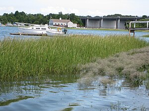
The Monatiquot River is a 4.9-mile-long (7.9 km) river in Braintree, Massachusetts, formed by the confluence of the Farm River and Cochato River in the Braintree Municipal Golf Course, flowing in swampy meanders to the northeast, and emptying into the tidal Weymouth Fore River estuary. The name roughly translates to either “at the deep tidal place” or “lookout place”. Its drainage area is 28.7 square miles (74 km2).
Weymouth Fore River is a small bay or estuary in eastern Massachusetts and is part of the Massachusetts Bay watershed.
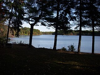
Lake Cochituate is a body of water in Natick, Wayland, and Framingham, Massachusetts, United States. Originally a reservoir serving Boston, it no longer serves that function, and is now a local recreational resource and home to Cochituate State Park.

The Indian Head River rises on the southern boundary of Hanover, Massachusetts and northern boundary line of Hanson, Massachusetts at the intersection of tributaries from Drinkwater River in Hanover and Indian Head Brook in Hanson. The river then flows east along the Hanover-Pembroke border. The river, 3.7 miles (6.0 km) long, is a tributary of the North River, which flows into Massachusetts Bay. The Indian Head River was an important fishing and water pathway for the Massachuset Indian village of Mattakeeset which was located around the Pembroke Ponds.

Cutler Park is a state-owned nature preserve and public recreation area that lies between Route 128/I-95 and the Charles River in Needham, Massachusetts. The state park's 739 acres (299 ha) contain the largest remaining freshwater marsh on the middle Charles River. Parts of its major trail run directly through the marsh via boardwalks; over 100 species of birds have been sighted here. The park is part of a plan by the Town of Needham to connect 18 public areas by 35 proposed trails. It is managed by the Massachusetts Department of Conservation and Recreation.

Great Esker Park is located in Weymouth, Massachusetts. The park mostly consists of a geological formation known as a winding ridge of stratified sand and gravel formed by a glacier 12,000 years ago. It is located along the Weymouth Back River, across from Bare Cove Park in Hingham, Massachusetts.
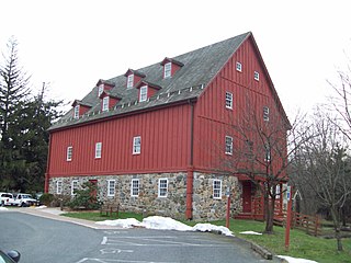
Gunpowder Falls State Park is a public recreation area comprising six non-contiguous areas covering 18,000 acres (7,300 ha) in northeastern Baltimore County and western Harford County, Maryland. The state park is primarily made up of the stream valleys of the Big and Little Gunpowder Falls and the Gunpowder River; its natural features range from tidal marshes to rugged interior slopes. The park has over 120 miles of trails for hiking, biking, horseback riding, and cross-country skiing plus facilities for picnicking, tubing, canoeing and kayaking, tide-water fishing and crabbing, fly fishing, and hunting, among other activities. It is managed by the Maryland Department of Natural Resources.

The Medomak River, historically known as the Muscongus River, is a 40-mile-long (64 km) river in Maine. From its source in Liberty, the river winds 32 miles (51 km) south to the head of its tidal river estuary in Waldoboro, then about 8 miles (13 km) south to Bremen. The river flows through Hockomock Channel into the head of Muscongus Bay. Medomak is Abenaki for "place (river) of many alewives".

The Sheepscot River is a 66-mile-long (106 km) river in the U.S. state of Maine. Its lower portion is a complex island estuary with connections to the Kennebec River downstream of Merrymeeting Bay.

Stony Brook Reservation is a woodland park in Boston and Dedham, Massachusetts, a unit of the Metropolitan Park System of Greater Boston, part of the state park system of Massachusetts. It was established in 1894 as one of the five original reservations created by the Metropolitan Park Commission. The park is served by the Stony Brook Reservation Parkways, a road system that was entered into the National Register of Historic Places in 2006.

Weymouth Back River Reservation is a protected coastal reservation in Hingham and Weymouth, Massachusetts. It contains parks on the west and east sides of the northern end of Weymouth Back River. On the west side in Weymouth, Abigail Adams Park is adjacent to and north of Route 3A Bridge and Great Esker Park is south of the bridge. On the east side in Hingham, Stodder's Neck is north of the bridge and Bare Cove Park is south of the bridge. It features Weymouth Back River views, walking trails and landscaped areas.
Old Furnace State Park is a public recreation area adjacent to Ross Pond State Park in the town of Killingly, Connecticut. The state parks covers 367 acres (149 ha), sits at an elevation of 390 feet (120 m), and is open year-round for hiking, hunting, and fishing. It is located east of Interstate 395, south of U.S. Route 6 and north of Connecticut Route 695. The park is the site of a former iron furnace. It was established as a town park in 1909 before being transferred to the state in 1918.

Hingham Bay is the easternmost of the three small bays of outer Boston Harbor, part of Massachusetts Bay and forming the western shoreline of the town of Hull and the northern shoreline of Hingham in the United States state of Massachusetts. It lies east of Quincy Bay and is met at the southwest by the mouth of Weymouth Fore River, also forming part of the waterfront of Weymouth. The bay is home to several of the Boston Harbor Islands.

Weir River is a short stream and estuary that empties into Hingham Bay, part of Boston Harbor in Massachusetts, United States. The name is attributed to the location of a fishing weir in the stream. The river gives its name to a larger watershed and Weir River Farm, a park and nature reserve owned by The Trustees of Reservations.

The Whiting River is a southward-flowing stream located in Massachusetts and the far northwest corner of Connecticut in the United States. The river runs for seven miles from its source at the Thousand Acre Swamp in New Marlborough before emptying into the Blackberry River in North Canaan. The river follows a curving southwesterly course for four miles in Massachusetts, passing over 100-foot-high Campbell Falls at Campbell Falls State Park Reserve, where it is joined by the northwest-flowing Ginger Creek. It flows south for 2.78 miles from the state line north of Canaan Valley to its mouth on the Blackberry River in Connecticut.


