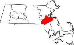
Weymouth, Massachusetts

Last updated

Town of Weymouth
City
Town Hall Weymouth.jpg
Town Hall, built in 1928 as a replica of Old State House in Boston
Seal of Weymouth, Massachusetts.png
Motto(s): 
Latin: Laborare Est Vincere
("To Work Is to Conquer")
Norfolk County Massachusetts incorporated and unincorporated areas Weymouth highlighted.svg
Location of Weymouth in Norfolk County, Massachusetts
Coordinates: 42°13′15″N70°56′25″W / 42.22083°N 70.94028°W / 42.22083; -70.94028
Country Flag of the United States.svg United States
State Flag of Massachusetts.svg  Massachusetts
County Norfolk
Settled1622
IncorporatedSeptember 2, 1635
Government
  Type Mayor-council
  Mayor Bob Hedlund (R)
Area
[1]
  Total21.57 sq mi (55.88 km2)
  Land16.77 sq mi (43.42 km2)
  Water4.81 sq mi (12.45 km2)
Elevation
200 ft (27 m)
Population
 (2020)
  Total57,437
  Density3,426.01/sq mi (1,322.79/km2)
Time zone UTC−5 (Eastern)
  Summer (DST) UTC−4 (Eastern)
ZIP Codes
02188–02191
Area code 339/781
FIPS code25-78865
GNIS feature ID0619462
Website www.weymouth.ma.us

Weymouth is a city [2] in Norfolk County, Massachusetts, United States. It is one of 13 municipalities in the state to have city forms of government while retaining "town of" in their official names. [3] It is named after Weymouth, Dorset, a coastal town in England, and is the second-oldest settlement in Massachusetts, second only to Plymouth. [4] It is one of the South Shore's more affordable towns and offers a short commute into Boston, MBTA bus [5] and rail service, [6] and a town beach.

Contents

At the 2020 census, Weymouth had a total population of 57,437. [7] It also had a crime rate of 12.42 per 1,000 residents. [8]

Demographics

Historical population
YearPop.±%
1840 3,738    
1850 5,369+43.6%
1860 7,742+44.2%
1870 9,010+16.4%
1880 10,570+17.3%
1890 10,866+2.8%
1900 11,324+4.2%
1910 12,895+13.9%
1920 15,057+16.8%
1930 20,882+38.7%
1940 23,868+14.3%
1950 32,690+37.0%
1960 48,177+47.4%
1970 54,610+13.4%
1980 55,601+1.8%
1990 54,063−2.8%
2000 53,988−0.1%
2010 53,743−0.5%
2020 57,437+6.9%
2022*57,410−0.0%
* = population estimate.
Source: United States census records and Population Estimates Program data. [9] [10] [11] [12] [13] [14] [15] [16] [17] [18] [19]
Source: U.S. Decennial Census [20]

As of the 2010 census, there were 53,743 people, 22,435 households, and 13,595 families residing in the city. The population density was 3,174.2 inhabitants per square mile (1,225.6/km2). There were 22,573 housing units at an average density of 1,327.1 per square mile (512.4/km2). 64% housing units were owner-occupied and 35% of housing units were renter-occupied. The racial makeup of the city was 82.7% White, 5.2% Black or African American, 0.2% Native American, 5.7% Asian, 0.0% Pacific Islander, 0.6% from other races, and 2.2% from two or more races. Hispanic or Latino of any race were 3.1% of the population. [21]

There were 22,028 households, out of which 27.3% had children under the age of 18 living with them, 48.6% were married couples living together, 10.3% had a female householder with no husband present, and 26.8% were non-families, 37% of which were non-family households with residents over 65 years of age. 30.6% of all households were made up of individuals, and 11.1% had someone living alone who was 65 years of age or older. The average household size was 2.42 and the average family size was 3.08.

In the city, the population was spread out, with 22.0% under the age of 18, 6.6% from 18 to 24, 32.7% from 25 to 44, 23.4% from 45 to 64, and 15.4% who were 65 years of age or older. The median age was 38 years. For every 100 females, there were 90.4 males. For every 100 females age 18 and over, there were 86.3 males.

The median income for a household in the city was $68,665, and the median income for a family was $52,083. Males had a median income of $42,497 versus $35,963 for females. The per capita income for was $24,976. About 9.1% of families and 9.8% of the population were below the poverty line, including 8.3% of those under age 18 and 9.4% of those age 65 or over.

Weymouth has the 10th highest Irish population in the United States, at 33%. [22] As "white flight" occurred in inner-city Boston exacerbated by the start of the cross-district busing program, in the 1960s and 70s thousands of white (predominantly of Irish descent) Bostonians moved to middle/working class suburbs such as Weymouth and Quincy. The blue collar city culture (example: The Boston accent) of places like South Boston and Dorchester is prevalent in the neighborhoods of Weymouth. Weymouth has colloquially been referred to as "Suburban Southie" and "Southie on the South Shore" due to the high influx of South Boston residents and Irish Catholic culture in the town. This trend continues in a different way again today as some longtime South Boston residents are now being priced out due to gentrification. Many are moving out to the more affordable towns on the South Shore.

Demographic breakdown by ZIP code

Income

Data is from the 2009–2013 American Community Survey 5-Year Estimates. [23] [24] [25]

RankZIP Code (ZCTA)Per capita
income
Median
household
income
Median
family
income
PopulationNumber of
households
Norfolk County $44,692$84,916$108,943677,296257,451
102190 (South Weymouth)$36,124$77,329$98,44216,7336,719
202188 (Weymouth Landing)$35,954$68,366$80,79914,6556,220
Massachusetts $35,763$66,866$84,9007,001,3992,530,147
Weymouth$32,832$68,113$81,98757,41022,526
302191 (North Weymouth)$31,652$64,365$86,5888,3693,558
402189 (East Weymouth)$29,185$60,059$78,07914,6096,029
United States$28,155$53,046$64,719334,914,895115,610,216

Geography and Environment

Population density and elevation above sea level in Greater Boston (2010). Weymouth is especially vulnerable to sea level rise. Urban-Rural Population and Land Area Estimates, v2, 2010 Greater Boston, U.S. (13873746295).jpg
Population density and elevation above sea level in Greater Boston (2010). Weymouth is especially vulnerable to sea level rise.

Weymouth is located at 42°12′23″N70°56′45″W / 42.20639°N 70.94583°W / 42.20639; -70.94583 (42.206458, −70.945919). [26]

According to the United States Census Bureau, the city has an area of 21.6 square miles (56 km2), of which 17 square miles (44 km2) is land and 4.6 square miles (12 km2) (comprising 21.29%) is water.

Weymouth contains the Weymouth Back River and the Weymouth Fore River; its surroundings, formerly industrial, are now set aside as parks and natural areas, including Webb Memorial State Park. There are many streets named after people and trees.

Weymouth residents often designate which of four "districts" they live in:

Weymouth is bordered on the north by Hingham Bay and Boston Harbor. Weymouth's territory includes Grape Island, Slate Island, and Sheep Island, all part of the Boston Harbor Islands National Recreation Area. Weymouth is bordered on the west by Quincy, Braintree, and Holbrook. It is bordered on the south by Abington and Rockland. Weymouth is bordered on the east by Hingham.

Climate

The climate in this area is characterized by hot, humid summers and generally mild to cool winters. According to the Köppen Climate Classification system, Weymouth has a humid subtropical climate, abbreviated "Cfa" on climate maps. [27]

Climate data for Weymouth, Massachusetts
MonthJanFebMarAprMayJunJulAugSepOctNovDecYear
Mean daily maximum °F (°C)39
(4)
42
(6)
49
(9)
59
(15)
70
(21)
79
(26)
85
(29)
83
(28)
75
(24)
65
(18)
54
(12)
43
(6)
61.9
(16.6)
Daily mean °F (°C)30
(−1)
32
(0)
40
(4)
49
(9)
59
(15)
69
(21)
74
(23)
73
(23)
65
(18)
54
(12)
45
(7)
35
(2)
52.1
(11.2)
Mean daily minimum °F (°C)21
(−6)
23
(−5)
30
(−1)
39
(4)
48
(9)
58
(14)
64
(18)
63
(17)
55
(13)
44
(7)
36
(2)
26
(−3)
42.2
(5.7)
Average precipitation inches (cm)4
(10)
4
(10)
4
(10)
3.9
(9.9)
3.2
(8.1)
2.8
(7.1)
2.8
(7.1)
3.8
(9.7)
3.3
(8.4)
3.8
(9.7)
4.5
(11)
4.2
(11)
44.3
(113)
Source: Weatherbase [28]

Wildlife

Weymouth is home to many species of wildlife that have adapted to the town's suburban environment and parks.

Small mammals such as Red and Gray foxes, Striped Skunks, Raccoons, Virginia Opossums, Eastern Cottontail Rabbits, Groundhogs, and Eastern Gray Squirrels can be commonly found in Weymouth. Some Larger mammals, such as Coyotes and White-tailed Deer live in the more forested areas such as Great Esker Park, and occasionally wander into the suburbs.

Weymouth is also home to many species of birds. Some common backyard species are Wild Turkeys, American Robins, Blue Jays, Mourning Doves, Black-capped Chickadees, Tufted Titmice, Common Grackles, and Northern Cardinals to name a few. There are many other species of birds that inhabit the diverse habitats that are located in Weymouth, such as Red-tailed Hawks, Ospreys, Red-winged Blackbirds, Great Egrets, Turkey Vultures, Great Blue Herons, along with various species of waterfowl, seagulls, and shorebirds. There are also two invasive bird species, those being the House Sparrow and European Starling.

The Herring Run runs through Weymouth, connecting the Back River to Whitman's Pond. Every spring, hundreds of thousands of Alewife Herring travel up the brook to spawn. The Herring Run was also a crucial resource for the early colonists of the area and the Native Massachusett People. [29]

Transportation

Weymouth is served by several MBTA bus routes as well as three MBTA Commuter Rail stations: two on the Greenbush Line, at Weymouth Landing and East Weymouth, and one on the Kingston Line at South Weymouth. Numbered routes that pass through Weymouth include Massachusetts Routes 3, 3A, 18, 53, 58 and 139.

Government

First Weymouth Town Hall. It was built in 1852 and destroyed by fire in 1914. Oldtownhall pc.jpg
First Weymouth Town Hall. It was built in 1852 and destroyed by fire in 1914.

Weymouth was founded in 1635, from the territory known as Wessagusett which was described in 1622—just two years after the Pilgrims landed in Plymouth. Weymouth held the distinction of having the oldest continuous town meeting form of government, for 365 years. In 1999, Weymouth residents voted to change to a city form of government. David M. Madden was elected as the city's first mayor and took office in 2000.

On July 10, 2007, Mayor David M. Madden announced he would not seek reelection. In 2008, Susan Kay was elected as the new mayor of Weymouth.

On November 3, 2015, Republican state senator Bob Hedlund was elected as the new mayor of Weymouth, succeeding long-incumbent mayor Susan M. Kay. Hedlund assumed office on January 4, 2016.

Weymouth is part of the Massachusetts Senate's Plymouth and Norfolk district.

Weymouth is one of the few places in the United States where self-service gas stations are illegal. The ban was introduced in 1977. [30]

Voter Registration and Party Enrollment as of October 15, 2008 [31]
PartyNumber of VotersPercentage
Democratic 12,25435.45%
Republican 3,69010.68%
Independent18,49753.52%
Libertarian 1230.36%
Total34,564100%

Education

Weymouth High School is the only high school in Weymouth. Prior to 2005, grades eight and nine were housed in Weymouth Junior High while grades ten, eleven, and twelve comprised the High School. This changed with the construction of a new wing on the Junior High building in South Weymouth, which subsequently became the new Weymouth High School housing grades nine through twelve. The old Weymouth High School in East Weymouth was converted into the Old Maria Weston Chapman Middle School. More than 2,000 students attend the high school. A brand new athletic surface was completed in 2005, giving Weymouth High School an artificial turf field and a track surface.

In 2008 Boston Magazine ranked Weymouth High School eighth among Boston-area high schools in academic performance and eighteenth in cost efficiency. [32] Weymouth High has a high graduation rate of 93.6%, as of 2022. [33] The Weymouth High School has a 4/10 rating on GreatSchools and a 3.0 star rating from the community. [34] Maria Weston Chapman Middle School has a 2.9 star rating from the community. [35] In June 2021, Weymouth High School was placed into a state program for schools or districts that disproportionately suspend nonwhite students or students with disabilities. [36] Along with this, the New Maria Weston Chapman Middle School made local news on two separate occasions due to the violent behavior of students. [37] [38]

There is one Middle School in Weymouth. It is the rebuilt version of the Maria Weston Chapman Middle School, locally known as "The New Chapman." It opened in August of 2022.

The other old middle school, Abigail Adams, is currently undergoing renovations with unknown future plans.

There are eight primary schools and one early childhood center, five of which are named after Weymouth's Congressional Medal of Honor recipients.

There is one Public Charter School which Weymouth is associated to

In addition, there are four private schools in Weymouth.

History

A failed colony

Weymouth was settled in 1622 as Wessagusset Colony founded by Thomas Weston, who had been the main financial backer of Plymouth Colony. [39] The settlement was a failure, as the 60 men from London were ill-prepared for the hardships required for survival. They also may have lacked the motivation of the Pilgrims, as this colony was purely economic in motivation and the men had not brought their families. [40]

Bichman House, c. 1650, is likely the oldest surviving house in Weymouth. Bickman House at 84 Sea Street in Weymouth Massachusetts USA circa 1650 Right side of building is the oldest house in Weymouth.jpg
Bichman House, c.1650, is likely the oldest surviving house in Weymouth.

By winter, poor planning and bad management led to supplies running out, and the Plymouth colonists had little to share. The situation grew desperate and Weymouth men began to sell their clothes, hire themselves out as laborers, and even steal from the local Massachusett Indians. The Indians were soon taunting the Weymouth men and robbing them of what little food they gathered clamming and foraging in the woods. [41] By now, many in the colony were starving or ill, and law and order had broken down. The lowest point came when a settler was accused of stealing supplies from the Massachusetts, and the Massachusett leaders demanded the thief's execution; the Weymouth men complied, but legend has it that they may have executed a dying, sick settler instead. [41]

By April 1623, word came of conflict between American Indians and the Virginia colonists, and tension increased between the Wessagusset colonists and the Indians. Massachusetts and other tribes began plotting to attack and destroy what was left of the floundering colony and the more successful Plymouth Colony. Wampanoag Chief Massasoit heard about the plot but soon fell ill and nearly died. A party from the Plymouth Colony came to his village and nursed him back to health, and he warned them of the plot. [41] Governor William Bradford decided to preempt the planned attack, and sent Myles Standish to Weymouth with the Plymouth militia and their Indian guide Hobbamock to end the threat. Using the promise of a meal of pork, Standish lured five of the more bellicose Massachusett Indians inside the stockade, including Wituwamat, a large man who had belittled Standish because he was short and had bragged about murdering a number of French shipwreck survivors. Once inside, there was a brief struggle and the Indian leaders were killed.

Ten of the original 60 colonists starved to death and two others were killed in conflicts with the Indians. Forty-five colonists joined Plymouth or went north to Maine, and from there most returned to England. Three men who had left the colony to live among the Indians as laborers could not be warned in time and were subsequently killed by them after Standish had released the women and children. [41]

Robert Gorges attempted to form a colony at the site later that year as the center of a more royalist and Anglican system of government for New England. [40] He brought William Morrell as religious leader and expected Governor Bradford to acknowledge his supremacy and act as his agent. [40] Within weeks, the New England winter caused Gorges to leave with most of the settlers. [39] Those who remained formed the nucleus of the permanent settlement. [42] and the oldest in what would become Massachusetts Bay Colony. [43] In 1630, it was officially incorporated into the Massachusetts Bay Colony; the name was changed to Weymouth in 1635 with the addition of 100 families under the leadership of Joseph Hull. These groups experienced some difficulty integrating together, especially due to conflicting pressures from the Puritans of Boston and the Pilgrims of Plymouth, but Weymouth was a stable and prominent town with its current boundaries by 1635. [40] It was included as part of Suffolk County when it was formed on May 10, 1643. The oldest surviving house in Weymouth is the Bickman House (c.1650) located at 84 Sea Street. [44]

Post-colonization

Weymouth was heavily involved in the shoemaking industry from the first years of the 18th century right through to 1973, when the Stetson Shoe Company closed its doors. The building is currently being used for medical offices. [45]

The original town hall was destroyed by fire in 1914 and was replaced in 1928 with a town hall that is a replica of the old Massachusetts State House in Boston. In May 2018, Massachusetts Governor Charlie Baker designated a tract of land near Lakeview Manor and the eastern and northern borders of Whitman's Pond as an "opportunity zone" under the Congressional Tax Cuts and Jobs Act of 2017. [46]

Points of interest

Abigail Adams birthplace Abigail Adams birthplace, Weymouth MA.jpg
Abigail Adams birthplace

Parks

Weymouth has 43 parks, playgrounds, memorials, recreation areas and facilities: [47]

Notable people

Abigail Adams Abigail Adams.jpg
Abigail Adams
Maria Weston Chapman Maria Weston Chapman BPL.jpg
Maria Weston Chapman
Jared Terrell Jared Terrell.jpg
Jared Terrell
Booker T. Washington Booker T Washington retouched flattened-crop.jpg
Booker T. Washington
Frank Lloyd Wright Frank Lloyd Wright portrait.jpg
Frank Lloyd Wright

See also

Related Research Articles

<span class="mw-page-title-main">Myles Standish</span> English military officer hired by the Pilgrims (1584–1656)

Myles Standish was an English military officer and colonist. He was hired as military adviser for Plymouth Colony in present-day Massachusetts, United States by the Pilgrims. Standish accompanied the Pilgrims on the ship Mayflower and played a leading role in the administration and defense of Plymouth Colony from its foundation in 1620. On February 17, 1621, the Plymouth Colony militia elected him as its first commander and continued to re-elect him to that position for the remainder of his life. Standish served at various times as an agent of Plymouth Colony on a return trip to England, as assistant governor of the colony, and as its treasurer.

<span class="mw-page-title-main">Watertown, Massachusetts</span> City in Massachusetts, United States

Watertown is a city in Middlesex County, Massachusetts, United States, part of Greater Boston. The population was 35,329 in the 2020 census. Its neighborhoods include Bemis, Coolidge Square, East Watertown, Watertown Square, and the West End.

<span class="mw-page-title-main">Weston, Massachusetts</span> Town in Massachusetts, United States

Weston is a town in Middlesex County, Massachusetts, United States, located approximately 15 miles (24 km) west of Boston. At the time of the 2020 United States Census, the population of Weston was 11,851.

<span class="mw-page-title-main">Cohasset, Massachusetts</span> Town in Massachusetts, United States

Cohasset is a town in Norfolk County, Massachusetts, United States. As of the 2020 census the population was 8,381.

<span class="mw-page-title-main">Quincy, Massachusetts</span> City in Massachusetts, United States

Quincy is a coastal U.S. city in Norfolk County, Massachusetts, United States. It is the largest city in the county and a part of Metropolitan Boston as one of Boston's immediate southern suburbs. Its population in 2020 was 101,636, making it the seventh-largest city in the state. Known as the "City of Presidents", Quincy is the birthplace of two U.S. presidents—John Adams and his son John Quincy Adams—as well as John Hancock, the first signer of the Declaration of Independence and the first and third governor of Massachusetts.

<span class="mw-page-title-main">Hanover, Massachusetts</span> Town in Massachusetts, United States

Hanover is a town in Plymouth County, Massachusetts, United States. The population was 14,833 at the 2020 census.

<span class="mw-page-title-main">Rockland, Massachusetts</span> Town in Massachusetts, United States

Rockland is a town in Plymouth County, Massachusetts, United States. The population was 17,803 at the 2020 census. As of December 31, 2009, there were 11,809 registered voters in the community.

<span class="mw-page-title-main">Charlestown, Boston</span> Neighborhood in Boston, Massachusetts, United States

Charlestown is the oldest neighborhood in Boston, Massachusetts, in the United States. Also called Mishawum by the Massachusett, it is located on a peninsula north of the Charles River, across from downtown Boston, and also adjoins the Mystic River and Boston Harbor waterways. Charlestown was laid out in 1629 by engineer Thomas Graves, one of its earliest settlers, during the reign of Charles I of England. It was originally a separate town and the first capital of the Massachusetts Bay Colony.

<span class="mw-page-title-main">Holbrook, Massachusetts</span> Town in Massachusetts, United States

Holbrook is a town in Norfolk County, Massachusetts, United States. As of 2023, the town's population was 12,284.

<span class="mw-page-title-main">Abington, Massachusetts</span> Town in Massachusetts, United States

Abington is a town in Plymouth County, Massachusetts, United States, 20 miles (32 km) southeast of Boston. The population was 17,062 at the 2020 census.

<span class="mw-page-title-main">Hull, Massachusetts</span> Town in Massachusetts, United States

Hull is a town in Plymouth County, Massachusetts, United States, located on a peninsula at the southern edge of Boston Harbor. Its population was 10,072 at the 2020 census. Hull is the smallest town by land area in Plymouth County and the eleventh smallest in the state. However, its population density is nearly four times that of Massachusetts as a whole.

<span class="mw-page-title-main">Bridgewater, Massachusetts</span> City in Massachusetts, United States

Bridgewater is a town located in Plymouth County, in the state of Massachusetts, United States. As of the 2020 U.S. Census, the town's population was 28,633. Bridgewater is located approximately 25 miles (40 km) south of Boston and approximately 35 miles east of Providence, Rhode Island.

<span class="mw-page-title-main">Duxbury, Massachusetts</span> Town in Massachusetts, United States

Duxbury is a historic seaside town in Plymouth County, Massachusetts, United States. A suburb located on the South Shore approximately 35 miles (56 km) to the southeast of Boston, the population was 16,090 at the 2020 census.

<span class="mw-page-title-main">Kingston, Massachusetts</span> Town in Massachusetts, United States

Kingston is a coastal town in Plymouth County, Massachusetts, United States. The population was 13,708 at the 2020 census.

<span class="mw-page-title-main">Marshfield, Massachusetts</span> Town in Massachusetts, United States

Marshfield is a town in Plymouth County, Massachusetts, United States, on Massachusetts's South Shore. The population was 25,825 at the 2020 census.

<span class="mw-page-title-main">Plymouth, Massachusetts</span> Town in Massachusetts, United States

Plymouth is a town and county seat of Plymouth County, Massachusetts, United States. Located in Greater Boston, the town holds a place of great prominence in American history, folklore, and culture, and is known as "America's Hometown". Plymouth was the site of the colony founded in 1620 by the Mayflower Pilgrims, where New England was first established. It is the oldest municipality in New England and one of the oldest in the United States. The town has served as the location of several prominent events, one of the more notable being the First Thanksgiving feast. Plymouth served as the capital of Plymouth Colony from its founding in 1620 until the colony's merger with the Massachusetts Bay Colony in 1691. The English explorer John Smith named the area Plymouth and the region 'New England' during his voyage of 1614. It was a later coincidence that, after an aborted attempt to make the 1620 trans-Atlantic crossing from Southampton, the Mayflower finally set sail for America from Plymouth, England.

<span class="mw-page-title-main">Scituate, Massachusetts</span> Town in Massachusetts, United States

Scituate is a seacoast town in Plymouth County, Massachusetts, United States, on the South Shore, midway between Boston and Plymouth. The population was 19,063 at the 2020 census.

<span class="mw-page-title-main">Hingham, Massachusetts</span> Town in Massachusetts, United States

Hingham is a town in metropolitan Greater Boston on the South Shore of the U.S. state of Massachusetts in northern Plymouth County. At the 2020 census, the population was 24,284. Hingham is known for its colonial history and location on Boston Harbor. The town was named after Hingham, Norfolk, England, and was first settled by English colonists in 1633.

<span class="mw-page-title-main">Greater Boston</span> Combined Statistical Area in the United States

Greater Boston is the metropolitan region of New England encompassing the municipality of Boston, the capital of the U.S. state of Massachusetts and the most populous city in New England, and its surrounding areas. The most stringent definition of the region consists of most of the eastern third of mainland Massachusetts, excluding the Merrimack Valley and most of Southeastern Massachusetts, though most definitions include much of these areas and portions of southern New Hampshire.

Wessagusset Colony was a short-lived English trading colony in New England located in Weymouth, Massachusetts. It was settled in August 1622 by between 50 and 60 colonists who were ill-prepared for colonial life. The colony was settled without adequate provisions, and was dissolved in late March 1623 after harming relations with local Indians. Surviving colonists joined Plymouth Colony or returned to England. It was the second settlement in Massachusetts, predating the Massachusetts Bay Colony by six years.

References

  1. "2020 U.S. Gazetteer Files". United States Census Bureau. Retrieved May 21, 2022.
  2. Although it is called the "Town of Weymouth," it is a statutory city of Massachusetts. See Office of the Secretary of the Commonwealth .
  3. "CIS: Massachusetts City and Town Incorporation and Settlement Dates". www.sec.state.ma.us.
  4. Adams, Charles Francis; Nash, Gilbert (1905). Wessagusset and Weymouth. p. 1.
  5. "222 | Bus | MBTA". www.mbta.com. Retrieved April 1, 2024.
  6. "Weymouth Landing/East Braintree | Stations | MBTA". www.mbta.com. Retrieved April 1, 2024.
  7. "Census - Geography Profile: Weymouth Town city, Norfolk County, Massachusetts". United States Census Bureau . Retrieved September 29, 2021.
  8. "Crime Overview 2022". ma.beyond2020.com. Retrieved May 2, 2023.
  9. "Total Population (P1), 2010 Census Summary File 1". American FactFinder, All County Subdivisions within Massachusetts. United States Census Bureau. 2010.
  10. "Massachusetts by Place and County Subdivision - GCT-T1. Population Estimates". United States Census Bureau. Retrieved July 12, 2011.
  11. "1990 Census of Population, General Population Characteristics: Massachusetts" (PDF). US Census Bureau. December 1990. Table 76: General Characteristics of Persons, Households, and Families: 1990. 1990 CP-1-23. Retrieved July 12, 2011.
  12. "1980 Census of the Population, Number of Inhabitants: Massachusetts" (PDF). US Census Bureau. December 1981. Table 4. Populations of County Subdivisions: 1960 to 1980. PC80-1-A23. Retrieved July 12, 2011.
  13. "1950 Census of Population" (PDF). Bureau of the Census. 1952. Section 6, Pages 21-10 and 21-11, Massachusetts Table 6. Population of Counties by Minor Civil Divisions: 1930 to 1950. Retrieved July 12, 2011.
  14. "1920 Census of Population" (PDF). Bureau of the Census. Number of Inhabitants, by Counties and Minor Civil Divisions. Pages 21-5 through 21-7. Massachusetts Table 2. Population of Counties by Minor Civil Divisions: 1920, 1910, and 1920. Retrieved July 12, 2011.
  15. "1890 Census of the Population" (PDF). Department of the Interior, Census Office. Pages 179 through 182. Massachusetts Table 5. Population of States and Territories by Minor Civil Divisions: 1880 and 1890. Retrieved July 12, 2011.
  16. "1870 Census of the Population" (PDF). Department of the Interior, Census Office. 1872. Pages 217 through 220. Table IX. Population of Minor Civil Divisions, &c. Massachusetts. Retrieved July 12, 2011.
  17. "1860 Census" (PDF). Department of the Interior, Census Office. 1864. Pages 220 through 226. State of Massachusetts Table No. 3. Populations of Cities, Towns, &c. Retrieved July 12, 2011.
  18. "1850 Census" (PDF). Department of the Interior, Census Office. 1854. Pages 338 through 393. Populations of Cities, Towns, &c. Retrieved July 12, 2011.
  19. "City and Town Population Totals: 2020-2022". United States Census Bureau . Retrieved November 10, 2023.
  20. "Census of Population and Housing". Census.gov. Retrieved June 4, 2015.
  21. 2010 American Fact Finder
  22. "ePodunk Irish Index". Archived from the original on October 23, 2019. Retrieved October 28, 2023.
  23. "SELECTED ECONOMIC CHARACTERISTICS 2009-2013 American Community Survey 5-Year Estimates". U.S. Census Bureau. Archived from the original on February 12, 2020. Retrieved January 12, 2015.
  24. "ACS DEMOGRAPHIC AND HOUSING ESTIMATES 2009-2013 American Community Survey 5-Year Estimates". U.S. Census Bureau. Archived from the original on February 12, 2020. Retrieved January 12, 2015.
  25. "HOUSEHOLDS AND FAMILIES 2009-2013 American Community Survey 5-Year Estimates". U.S. Census Bureau. Archived from the original on February 12, 2020. Retrieved January 12, 2015.
  26. "US Gazetteer files: 2010, 2000, and 1990". United States Census Bureau. February 12, 2011. Retrieved April 23, 2011.
  27. "Weymouth, Massachusetts Köppen Climate Classification (Weatherbase)". Weatherbase.
  28. "Weatherbase.com". Weatherbase. 2013. Retrieved on October 26, 2013.
  29. "Herring Run Pool Park". North and South Rivers Watershed Association. Retrieved April 1, 2024.
  30. "Weymouth holds tight to 41-year ban on self-service gas pumps". Archived from the original on July 18, 2019. Retrieved October 28, 2023.
  31. "Registration and Party Enrollment Statistics as of October 15, 2008" (PDF). Massachusetts Elections Division. Retrieved May 8, 2010.
  32. "The Best Public High Schools". Archived from the original on July 22, 2012. Retrieved January 8, 2010.
  33. "U.S. Census Bureau QuickFacts: Weymouth Town city, Massachusetts". www.census.gov. Retrieved May 2, 2023.
  34. "Explore Weymouth High School in Weymouth, MA". GreatSchools.org. Retrieved April 2, 2024.
  35. "Explore Maria Weston Chapman Middle School in Weymouth, MA". GreatSchools.org. Retrieved April 2, 2024.
  36. Trufant, Jessica (June 11, 2021). "Black students disproportionately suspended at schools in Quincy, Weymouth, Plymouth". The Patriot Ledger . Gannett . Retrieved June 12, 2021.
  37. "Recent Fighting Has Parents of Weymouth Middle Schoolers Worried". NBC Boston. April 3, 2023. Retrieved April 1, 2024.
  38. "Parents voice concerns after a brutal beating in Weymouth middle school caught on video". Boston 25 News. January 5, 2024. Retrieved April 1, 2024.
  39. 1 2 Clarke, Ted. "WEYMOUTH — THE FIRST HUNDRED YEARS". Archived from the original on May 4, 2011. Weymouth the First Hundred Years by Ted Clark
  40. 1 2 3 4 Nash, Gilbert (1885). Historical Sketch of the Town of Weymouth, Massachusetts, from 1622-1884. A. Mudge & Son, printers.
  41. 1 2 3 4 Mayflower: A story of Courage, Community, and War, Viking Press 2006 by Nathaniel Philbrick, pages 140-153
  42. Jeannette Paddock Nichols; Roy Franklin Nichols. The republic of the United States: a history, Volume 1. p. 48.
  43. Moore, Jacob Bailey (1848). Lives of the governors of New Plymouth, and Massachusetts bay. p. 235.
  44. "17th Century Homes" (PDF). Archived from the original (PDF) on October 22, 2019. Retrieved October 22, 2019.
  45. "The Stetson Shoe Company". Archived from the original on October 29, 2006. Retrieved October 24, 2006.
  46. Baker, Ed (May 2, 2018). "Opportunity Zone designated near Weymouth's Whitman's Pond". Weymouth News. GateHouse Media. Retrieved January 1, 2019.
  47. Parks & Recreation – Weymouth MA, Town of Weymouth, Massachusetts, retrieved June 22, 2017
  48. Who Was Who in America, Historical Volume, 1607–1896. Marquis Who's Who. 1967.
  49. Sullivan, Debbie Sargent; Tighe, Joanne Palmieri (2001). Images of America: Weymouth. Portsmouth, NH: Arcadia Publishing. p. 13. ISBN   978-0-7385-0926-6.
  50. "Jim Peckham Bio, Stats, and Results". Olympics at Sports-Reference.com. Archived from the original on April 18, 2020.
  51. Historical Timeline - North Weymouth Civic Association, North Weymouth Civic Association, April 6, 2012, retrieved February 16, 2016
  52. Harlan, Louis R. (1983), Booker T. Washington: The Wizard of Tuskegee, New York, NY: Oxford University Press, p. 282, ISBN   0-19-503202-0