Whitman, Massachusetts

Last updated

Whitman, Massachusetts
Whitman Town Hall.JPG
Whitman Town Hall
Seal of Whitman, Massachusetts.png
Motto: 
"The Birthplace Of The Chocolate Chip Cookie"
Plymouth County Massachusetts incorporated and unincorporated areas Whitman highlighted.svg
Location in Plymouth County in Massachusetts
Coordinates: 42°04′50″N70°56′10″W / 42.08056°N 70.93611°W / 42.08056; -70.93611
Country United States
State Massachusetts
County Plymouth
Settled1670
IncorporatedMarch 4, 1875
Government
  Type Open town meeting
Area
  Total7.1 sq mi (18.1 km2)
  Land7.0 sq mi (18.0 km2)
  Water0.0 sq mi (0.0 km2)
Elevation
110 ft (34 m)
Population
 (2020)
  Total15,121
  Density2,160.1/sq mi (840.1/km2)
Time zone UTC−5 (Eastern)
  Summer (DST) UTC−4 (Eastern)
ZIP Code
02382
Area code 339/781
FIPS code 25-79530
GNIS feature ID0618355
Website www.whitman-ma.gov

Whitman is a town in Plymouth County, Massachusetts, United States. The population was 15,121 at the 2020 census. It is notable as being the place where the chocolate chip cookie was invented.

Contents

History

Little Comfort, then part of Bridgewater was first settled by Europeans beginning around 1675. Abington (including Little Comfort) separated from Bridgewater in 1712. South Abington was established as a separate parish in the 19th century. [1] It was incorporated as a separate town on March 4, 1875. [2] [1] It was renamed Whitman by town vote on May 3, 1886. [3] The name was in honor of Jared Whitman, a local lawyer who served in the 1839 and 1840 state legislatures. [4] [5] Whitman's early industry included shoemaking. [1]

In the late 1930s, Ruth Graves Wakefield invented chocolate chip cookies in Whitman at the Toll House Inn on Bedford Street. [6] The Toll House burned completely on New Year's Eve 1984, in a fire that originated in the kitchen. The inn was not rebuilt. The site is marked with a historical marker, and that land is now home to a Wendy's restaurant and Walgreens pharmacy, with the Toll House sign still in existence. [7]

The former Whitman Savings Bank was the first in the country to offer savings bank life insurance (SBLI).[ citation needed ] From 1968 to 1994, Whitman was also home to King's Castle Land, a children's amusement park owned by the Whitney family and located near the intersection of Routes 18 and 14. [8]

In the 1970s, Whitman was home to a then-secret National Security Agency classified materials disposal facility built on Essex Street by American Thermogen Inc. It was code named "White Elephant No. 1" and it was to be the prototype for the government's premier "classified waste destructor". Reaching temperatures up to 3,400 degrees, the three-story incinerator did not work up to expectations—only operating a limited number of hours and not always fully destroying the material—and after spending $1.2 million to build the unit it was abandoned. It was one time used as a club house by children in the area, and later dismantled. The office section, and some of the warehouse area, still remain in use by new owners. [9]

Geography

According to the United States Census Bureau, the town has a total area of 7.0 square miles (18 km2), of which 7.0 square miles (18 km2) is land and 0.14% is water. Statistically, the town is the 327th of 351 communities in the Commonwealth by land area, and is the second smallest (above only Hull) in Plymouth County. Whitman is bordered by Abington to the north, Rockland to the northeast, Hanson to the southeast, East Bridgewater to the south, and the city of Brockton to the west. Whitman's town center is approximately 4.5 miles (7.2 km) east of the center of Brockton and approximately 20 miles (32 km) south of Boston.

The small town today is mostly residential, with a small town forest in the northeast corner of town. The eastern half of the town is divided by the Shumatuscacant River, which is dammed near the town center at the site of the town's mills. The eastern half of town is also dominated by two meadows, the Hobart Meadow to the north and the Bear Meadow to the south, both along the banks of the river.

Transportation

The center of town is about half a mile to the east of the intersection of Route 18 and Route 27, the actual center of town being at the intersection of Route 27 and Washington Street. Route 14 also intersects with Route 18, about three-quarters of a mile south of the intersection of Routes 27 and 18. Route 58 also crosses through the eastern corner of town. There are no interstates or divided highways in town; the nearest highway is Route 24 which passes through Brockton.

Whitman is served by the Kingston/Plymouth Line of the MBTA Commuter Rail, the town's station is located off route 27. The line passes through the eastern half of town, east of the mill ponds and meadows. There is no air service to the town; the nearest international air service can be reached at Logan International Airport in Boston, 26 miles north of Whitman.

Demographics

Historical population
YearPop.±%
1880 3,024    
1890 4,441+46.9%
1900 6,155+38.6%
1910 7,292+18.5%
1920 7,147−2.0%
1930 7,638+6.9%
1940 7,759+1.6%
1950 8,413+8.4%
1960 10,485+24.6%
1970 13,059+24.5%
1980 13,534+3.6%
1990 13,240−2.2%
2000 13,882+4.8%
2010 14,489+4.4%
2020 15,121+4.4%
2022*15,259+0.9%
* = population estimate. Source: United States Census records and Population Estimates Program data. [10] [11] [12] [13] [14] [15] [16] [17]

As of the census [18] of 2000, there were 13,882 people, 4,999 households, and 3,604 families residing in the town. The population density was 1,995.7 inhabitants per square mile (770.5/km2). There were 5,104 housing units at an average density of 733.8 per square mile (283.3/km2). The racial makeup of the town was 97.15% White, 0.65% African American, 0.16% Native American, 0.43% Asian, 0.01% Pacific Islander, 0.48% from other races, and 1.12% from two or more races. Hispanic or Latino of any race were 0.88% of the population.

There were 4,999 households, out of which 36.8% had children under the age of 18 living with them, 56.5% were married couples living together, 11.6% had a female householder with no husband present, and 27.9% were non-families. Of all households 22.4% were made up of individuals, and 8.0% had someone living alone who was 65 years of age or older. The average household size was 2.77 and the average family size was 3.30.

In the town, the population was spread out, with 26.7% under the age of 18, 8.4% from 18 to 24, 33.6% from 25 to 44, 21.8% from 45 to 64, and 9.5% who were 65 years of age or older. The median age was 35 years. For every 100 females, there were 96.4 males. For every 100 females age 18 and over, there were 93.1 males.

The median income for a household in the town was $55,303, and the median income for a family was $63,706. Males had a median income of $41,950 versus $30,629 for females. The per capita income for the town was $23,002. About 2.0% of families and 3.3% of the population were below the poverty line, including 2.8% of those under age 18 and 8.0% of those age 65 or over.

Statistically, Whitman is the 133rd largest community by population and 52nd most densely populated in the state. On average, Whitman's population is below the average but above the median, and its population density is well above the state average.

Government

On the national level, Whitman is a part of Massachusetts's 8th congressional district (as of the 2013 redistricting), and has been represented since 2001 by Stephen Lynch. The state's senior (Class I) senator, elected in 2012, is Elizabeth Warren. The junior (Class II) member of the United States Senate is Ed Markey. Markey was elected in 2013 to finish out the remainder of the term vacated by John Kerry when he became Secretary of State.

On the state level, Whitman is represented in the Massachusetts House of Representatives as a part of the Seventh Plymouth district, which includes the towns of Abington and East Bridgewater and is currently represented by Abington resident Alyson Sullivan. The town is represented in the Massachusetts Senate as a part of the Second Plymouth and Bristol district, which includes Brockton, Halifax, Hanover, Hanson and portions of East Bridgewater and Easton and the seat is currently held by Michael Brady. [19] The town is patrolled by the First (Norwell) Barracks of Troop D of the Massachusetts State Police. [20]

Whitman is governed by the open town meeting form of government, and is led by a town manager and a board of selectmen. The town's police department is located in a newly constructed building on a site formerly used for a succession of schools. [21] The town's fire department is located further west along Route 27. It has its own ambulance service, and patients needing emergency care are brought to Brockton Hospital, Good Samaritan Hospital in Brockton or South Shore Hospital in South Weymouth. The town's post office is located just east of the town hall. The Whitman Public Library is located a block south of Route 27, having moved into its first stand-alone branch in 1982 after seventy-five years in the town hall. Between the library and the fire department is a National Guard armory. The town also operates a playground and pool at the Whitman town park (which was designed by the Olmsted Brothers firm), just north of the town hall.

Education

Since the mid-1960s, Whitman has been paired with Hanson as a part of what was the Whitman-Hanson Regional High School School District but later joined as Whitman-Hanson Regional School District with the addition of the elementary and middle schools. There are two elementary schools in town; the Duval and Conley Schools (in the east and west parts of town, respectively), which serve students from kindergarten through fifth grade. The Whitman Middle School, located south of Route 27 in the western part of town, serves students from sixth to eighth grades. Students from both Whitman and Hanson attend Whitman-Hanson Regional High School, located along Route 27 on the Hanson side of the road. Students moved into the new, more technologically advanced school building in 2005 from the previous school, which was closer to the road (the former Whitman-Hanson High School is no longer standing and its old location is now home to athletic fields.) Whitman-Hanson's teams are known as the Panthers, and their colors are red and black. One of their chief rivals is nearby Abington, against whom they have played 109 annual Thanksgiving Day football games through 2019. In 2010, Whitman-Hanson played the 100th-anniversary game against Abington. [22] Whitman-Hanson leads the series, 60–46–3, through the 2019 season, [23] although Abington won the 2019 meeting. [24] In addition to Whitman-Hanson, students may choose to attend South Shore Regional Vocational Technical High School in Hanover free of charge. There are no private schools in the town, but both Hanson and Brockton have private schools. The nearest college is Massasoit Community College in neighboring Brockton.

Notable people

Publications

The novel Little Comfort by Edwin Hill ( ISBN   978-1496715906) was named for the town. The author's father and grandmother grew up in Whitman.

In his introduction to the award-winning essay collection Hobby Games: The 100 Best, editor James Lowder mentions "Playing Dungeons & Dragons in a house behind the now-defunct King's Castle Land kiddie amusement park in Whitman, Massachusetts." [25] :xv

See also

Related Research Articles

<span class="mw-page-title-main">Plymouth County, Massachusetts</span> County in Massachusetts, United States

Plymouth County is a county in the U.S. state of Massachusetts, south of Boston. As of the 2020 census, the population was 530,819. Its county seats are Plymouth and Brockton. In 1685, the county was created by the Plymouth General Court, the legislature of Plymouth Colony, predating its annexation by the Massachusetts Bay Colony.

<span class="mw-page-title-main">Raynham, Massachusetts</span> Town in Massachusetts, United States

Raynham is a town in Bristol County, Massachusetts, United States, located approximately 32 miles (51 km) south of Boston and 22 miles (35 km) northeast of Providence, Rhode Island. The population was 15,082 at the 2020 census. It has one village, Raynham Center.

<span class="mw-page-title-main">Avon, Massachusetts</span> Town in Massachusetts, United States

Avon is a town in Norfolk County, Massachusetts, United States. The population was 4,777 at the 2020 census.

<span class="mw-page-title-main">Brockton, Massachusetts</span> City in Massachusetts, United States

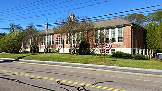
Brockton is a city in Plymouth County, Massachusetts, United States; the population was 105,643 at the 2020 United States census. Along with Plymouth, it is one of the two county seats of Plymouth County. It is the sixth-largest city in Massachusetts and is sometimes referred to as the "City of Champions", due to the success of native boxers Rocky Marciano and Marvin Hagler, as well as its successful Brockton High School sports programs. Two villages within it are Montello and Campello, both of which have MBTA Commuter Rail Stations and post offices. Campello is the smallest neighborhood, but also the most populous. Brockton hosts a baseball team, the Brockton Rox. It is the second-windiest city in the United States, with an average wind speed of 14.3 mph (23.0 km/h).

<span class="mw-page-title-main">Carver, Massachusetts</span> Town in Massachusetts, United States

Carver is a town in Plymouth County, Massachusetts, United States. The population was 11,645 at the 2020 census. It is named for John Carver, the first governor of the Plymouth Colony. The town features two popular tourist attractions: Edaville USA theme park and King Richard's Faire, the largest and longest-running renaissance fair in New England.

<span class="mw-page-title-main">East Bridgewater, Massachusetts</span> Town in Massachusetts, United States

East Bridgewater is a town in Plymouth County, Massachusetts, United States. The population was 14,440 at the 2020 census. It is also a part of Massachusetts' 8th congressional district, of which it is represented by Stephen Lynch.

<span class="mw-page-title-main">Halifax, Massachusetts</span> Town in Massachusetts, United States

Halifax is a town in Plymouth County, Massachusetts, United States. The population was 7,749 at the 2020 census.

<span class="mw-page-title-main">Hanover, Massachusetts</span> Town in Massachusetts, United States

Hanover is a town in Plymouth County, Massachusetts, United States. The population was 14,833 at the 2020 census.

<span class="mw-page-title-main">Norwell, Massachusetts</span> Town in Massachusetts, United States

Norwell is a town in Plymouth County, Massachusetts, United States. The population was 11,351 at the 2020 United States census. The town's southeastern border runs along the North River.

<span class="mw-page-title-main">Pembroke, Massachusetts</span> Town in Massachusetts, United States

Pembroke is an historic town in Plymouth County, Massachusetts, United States. Pembroke is a South Shore suburb of the Boston metropolitan area. The town is located about halfway between Boston and Cape Cod. The town is considered rural with pockets of suburban neighborhoods. The population was 18,361 at the 2020 census with a median household income of $119,827.

<span class="mw-page-title-main">Plympton, Massachusetts</span> Town in Massachusetts, United States

Plympton is a town in Plymouth County, Massachusetts, United States. The population was 2,930 at the 2020 census. The United States senator William Bradford was born here.

<span class="mw-page-title-main">Rockland, Massachusetts</span> Town in Massachusetts, United States

Rockland is a town in Plymouth County, Massachusetts, United States. The population was 17,803 at the 2020 census. As of December 31, 2009, there were 11,809 registered voters in the community.

<span class="mw-page-title-main">West Bridgewater, Massachusetts</span> Town in Massachusetts, United States

West Bridgewater is a town in Plymouth County, Massachusetts, United States. The population was 7,707 at the 2020 census.

<span class="mw-page-title-main">Abington, Massachusetts</span> Town in Massachusetts, United States

Abington is a town in Plymouth County, Massachusetts, United States, 20 miles (32 km) southeast of Boston. The population was 17,062 at the 2020 census.

<span class="mw-page-title-main">Bridgewater, Massachusetts</span> City in Massachusetts, United States

Bridgewater is a town located in Plymouth County, in the state of Massachusetts, United States. As of the 2020 U.S. Census, the town's population was 28,633. Bridgewater is located approximately 25 miles (40 km) south of Boston and approximately 35 miles east of Providence, Rhode Island.

<span class="mw-page-title-main">Hanson, Massachusetts</span> Town in the United States

Hanson is a town in Plymouth County, Massachusetts, United States. Part of Greater Boston, Hanson is located 20 miles (32 km) south of Boston and is one of the inland towns of the South Shore. The population was 10,639 at the 2020 census.

<span class="mw-page-title-main">Kingston, Massachusetts</span> Town in Massachusetts, United States

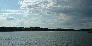
Kingston is a coastal town in Plymouth County, Massachusetts, United States. The population was 13,708 at the 2020 census.

<span class="mw-page-title-main">Marshfield, Massachusetts</span> Town in Massachusetts, United States

Marshfield is a town in Plymouth County, Massachusetts, United States, on Massachusetts's South Shore. The population was 25,825 at the 2020 census.

<span class="mw-page-title-main">Massachusetts's 9th congressional district</span> U.S. House district for Massachusetts

Massachusetts's 9th congressional district is located in eastern Massachusetts. It is represented by Democrat William R. Keating. With a Cook Partisan Voting Index rating of D+6, it is the least Democratic district in Massachusetts, a state with an all-Democratic congressional delegation.

<span class="mw-page-title-main">Massachusetts's 11th congressional district</span> Former U.S. House district from 1795 to 1993

Massachusetts's 11th congressional district is an obsolete district that was active during three periods: 1795–1843, 1853–1863, and 1873–1993. The district was located in several different areas of the state. It was most recently eliminated in 1993 after the 1990 U.S. census. Its last congressman was Brian J. Donnelly.

References

  1. 1 2 3 "MHC Reconnaissance Survey Town Report: Whitman" (PDF). Massachusetts Historical Commission. 1981.
  2. "South Abington". The Boston Globe. March 12, 1875. p. 1 via Newspapers.com.
  3. "Town History". Town of Whitman.
  4. "South Abington Named Whitman". The Boston Globe. May 4, 1886. p. 1 via Newspapers.com.
  5. Hobart, Benjamin (1866). History of the Town of Abington, Plymouth County, Massachusetts, from Its First Settlement. T.H. Carter and Son. p. 178.
  6. "Inventor of the Week: Archive". Massachusetts Institute of Technology. Archived from the original on April 3, 2003. Retrieved September 14, 2011.
  7. Fontes, Kristina. "A Taste of Old Colony History: Bake historical recipes with Old Colony History Museum". Taunton Daily Gazette. Retrieved October 18, 2023.
  8. "King's Castle Land" . Retrieved September 15, 2011.
  9. Bamford, James (2001). Body of secrets : anatomy of the ultra-secret National Security Agency : from the Cold War through the dawn of a new century (1st ed.). New York: Doubleday. ISBN   0-385-49907-8. OCLC   44713235.
  10. "Census - Geography Profile: Whitman town, Plymouth County, Massachusetts". United States Census Bureau . Retrieved November 10, 2021.
  11. "Massachusetts by Place and County Subdivision - GCT-T1. Population Estimates". United States Census Bureau. Archived from the original on February 12, 2020. Retrieved July 12, 2011.
  12. "1990 Census of Population, General Population Characteristics: Massachusetts" (PDF). US Census Bureau. December 1990. Table 76: General Characteristics of Persons, Households, and Families: 1990. 1990 CP-1-23. Archived (PDF) from the original on March 13, 2003. Retrieved July 12, 2011.
  13. "1980 Census of the Population, Number of Inhabitants: Massachusetts" (PDF). US Census Bureau. December 1981. Table 4. Populations of County Subdivisions: 1960 to 1980. PC80-1-A23. Archived (PDF) from the original on August 5, 2010. Retrieved July 12, 2011.
  14. "1950 Census of Population" (PDF). 1: Number of Inhabitants. Bureau of the Census. 1952. Section 6, Pages 21-10 and 21-11, Massachusetts Table 6. Population of Counties by Minor Civil Divisions: 1930 to 1950. Archived (PDF) from the original on June 9, 2011. Retrieved July 12, 2011.{{cite journal}}: Cite journal requires |journal= (help)
  15. "1920 Census of Population" (PDF). Bureau of the Census. Number of Inhabitants, by Counties and Minor Civil Divisions. Pages 21-5 through 21-7. Massachusetts Table 2. Population of Counties by Minor Civil Divisions: 1920, 1910, and 1920. Retrieved July 12, 2011.
  16. "1890 Census of the Population" (PDF). Department of the Interior, Census Office. Pages 179 through 182. Massachusetts Table 5. Population of States and Territories by Minor Civil Divisions: 1880 and 1890. Retrieved July 12, 2011.
  17. "City and Town Population Totals: 2020-2022". United States Census Bureau . Retrieved October 29, 2023.
  18. "U.S. Census website". United States Census Bureau . Retrieved January 31, 2008.
  19. Index of Legislative Representation by City and Town, from Mass.gov
  20. Station D-1, SP Norwell
  21. "Police Department Webpage" . Retrieved February 26, 2014.
  22. "Rivalry reaches 100 years". Boston.com . Retrieved May 21, 2014.
  23. "Seniors lead the way for Whitman-Hanson in shutout of Abington". The Boston Globe . Retrieved December 4, 2019.
  24. "H.S. ,FOOTBALL: Gillette-bound Abington tops stubborn Whitman-Hanson". The Enterprise (Brockton) . Retrieved December 4, 2019.
  25. James Lowder, ed. (2007). Hobby Games: The 100 Best. Green Ronin. ISBN   978-1932442960.