Watertown, Massachusetts

Last updated

Watertown, Massachusetts
City
Main Street Watertown MA 2.jpg
Watertown's Main Street, facing westward
Flag of Watertown, Massachusetts.png
Seal of Watertown, Massachusetts.png
Motto(s): 
In pace condita(Latin)
"Founded in peace"
Middlesex County Massachusetts incorporated and unincorporated areas Watertown highlighted.svg
Location in Middlesex County in Massachusetts
Usa edcp location map.svg
Red pog.svg
Watertown
Location in the United States
Coordinates: 42°22′15″N71°11′00″W / 42.37083°N 71.18333°W / 42.37083; -71.18333
CountryUnited States
State Massachusetts
County Middlesex
SettledJuly 1630
IncorporatedSeptember 7, 1630
Government
  Type Council-manager
   City Manager George Proakis
Area
[1]
  Total4.12 sq mi (10.68 km2)
  Land4.00 sq mi (10.35 km2)
  Water0.13 sq mi (0.33 km2)
Elevation
36 ft (11 m)
Population
 (2020)
  Total35,329
  Density8,841.09/sq mi (3,413.41/km2)
Time zone UTC−5 (Eastern)
  Summer (DST) UTC−4 (Eastern)
ZIP Code
02472
Area code 617/857
FIPS code 25-73440
GNIS feature ID0612401
Website www.watertown-ma.gov

Watertown is a city in Middlesex County, Massachusetts, United States, part of Greater Boston. The population was 35,329 in the 2020 census. Its neighborhoods include Bemis, Coolidge Square, East Watertown, Watertown Square, and the West End.

Contents

Watertown was one of the first Massachusetts Bay Colony settlements organized by Puritan settlers in 1630. The city is home to the Perkins School for the Blind, the Armenian Library and Museum of America, and the historic Watertown Arsenal, which produced military armaments from 1816 through World War II.

History

Archeological evidence suggests that Watertown was inhabited for thousands of years before colonization. In the 1600s, two groups of Massachusett, the Pequossette and the Nonantum, had settlements on the banks of the river later called the Charles, [2] and a contemporary source lists "Pigsgusset" as the native name of "Water towne." [3] The Pequossette built a fishing weir to trap herring at the site of the current Watertown Dam. The annual fish migration, as both alewife and blueback herring swim upstream from their adult home in the sea to spawn in the fresh water where they were hatched, still occurs every spring. [4]

Watertown, first known to settlers as Saltonstall Plantation, was one of the earliest of the Massachusetts Bay Colony settlements. Founded in early 1630 by a group of settlers led by Richard Saltonstall and George Phillips, it was officially incorporated that same year. The alternate spelling "Waterton" is seen in some early documents. [5]

The first buildings were upon land now included within the limits of Cambridge known as Gerry's Landing. For its first quarter century Watertown ranked next to Boston in population and area. Since then its limits have been greatly reduced. Thrice portions have been added to Cambridge, and it has contributed territory to form the new towns of Weston (1712), Waltham (1738), Lincoln (1754) and Belmont (1859). In 1632 the residents of Watertown protested against being compelled to pay a tax for the erection of a stockade fort at Cambridge; this was the first protest in America against taxation without representation and led to the establishment of representative democracy in the colony. As early as the close of the 17th century, Watertown was the chief horse and cattle market in New England and was known for its fertile gardens and fine estates. Here about 1632 was erected the first gristmill in the colony, and in 1662 one of the first woolen mills in America was built here. [6] The first burying ground, on Arlington Street, was established in the 1660s. It contains a monument to Joseph Coolidge, the only Watertown resident killed during the British retreat from Concord in April 1775. [6]

Saltonstall's landing spot in Watertown, also known as Elbridge Gerry Landing Gerry Landing.jpg
Saltonstall's landing spot in Watertown, also known as Elbridge Gerry Landing

Revolutionary War era

Much excitement was generated in Watertown towards the start of the American Revolutionary War period. In 1773, many of its citizens were engaged with the Sons of Liberty in another tax protest, this time against the British Tea Tax which resulted in the famous Boston Tea Party protest. [7]

Then later (April 1775), some 134 Watertown minutemen responded to the alarm from Lexington to rout the British soldiers from their march to Concord. Thereafter many of these citizen soldiers were part of the first battle line formed at the Siege of Boston. Another Watertown citizen, Israel Bissel, was the first rider to take the news of the British attack and rode all the way to Connecticut, New York and Philadelphia. [8] [9]

Edmund Fowle House, built in the 1700s and used by the Massachusetts government during the Revolutionary War Fowle House - Watertown, Massachusetts.JPG
Edmund Fowle House, built in the 1700s and used by the Massachusetts government during the Revolutionary War

The Massachusetts Provincial Congress, after adjournment from Concord, met from April to July 1775 in the First Parish Church, the site of which is marked by a monument. On July 3, George Washington was greeted in Watertown; the following day he took command of the Army in Cambridge. [10] The Massachusetts General Court held its sessions here from 1775 to 1778. Committees met in the nearby Edmund Fowle House. Boston town meetings were held here during the siege of Boston, when many Boston families made their homes in the neighborhood. For several months early in the American Revolution the committees of safety and committee of correspondence made Watertown their headquarters and it was from here that General Joseph Warren set out for Bunker Hill. [6] [11]

Browne House, built c. 1694 Browne House - Watertown, Massachusetts.JPG
Browne House, built c.1694

The Treaty of Watertown, the first treaty signed between the newly formed United States of America and a foreign power, the St. John's and Mi'kmaq First Nations of Nova Scotia, was signed in this house.[ clarification needed ] [12] [13]

The Coolidge Tavern, built in 1742, was frequented by minutemen during the war. Here, Washington was entertained on his New England tour in 1789. [6] The tavern was demolished in 1918 to make way for a trolley terminal. [14] [ better source needed ]

Industrial era

From 1832 to 1834 Theodore Parker conducted a private school and his name is still preserved in the Parker School, [6] though the building no longer operates as a public school.

Mount Auburn Cemetery was founded in 1831, creating the first garden cemetery in the United States. The landscape of Mount Auburn provided inspiration for the nation's first public parks and picturesque suburbs designed by the early generations of American landscape architects. Mount Auburn has been recognized as one of the most significant designed landscapes in the country. Although perceived as a Cambridge institution, almost all of the cemetery is actually in Watertown.

The Watertown Arsenal operated continuously as a military munitions and research facility from 1816 until 1995, when the Army sold the property, by then known as the Army Materials Technology Laboratory, [15] to the town of Watertown. The Arsenal is notable for being the site of a 1911 strike prompted by the management methods of operations research pioneer Frederick Winslow Taylor (Taylor and 1911 Watertown Arsenal Strike). Taylor's method, which he dubbed "Scientific Management," broke tasks down into smaller components. Workers no longer completed whole items; instead, they were timed using stopwatches as they did small tasks repetitively, as Taylor attempted to find the balance of tasks that resulted in the maximum output from workers. The strike and its causes were controversial enough that they resulted in Congressional hearings in 1911; Congress passed a law in 1915 banning the method in government owned arsenals. Taylor's methods spread widely, influencing such industrialists as Henry Ford, and the idea is one of the underlying inspirations of the factory (assembly) line industrial method. The Watertown Arsenal was the site of a major superfund clean-up in the 1990s, and has now become a center for shopping, dining and the arts, with the opening of several restaurants and a new theatre. The site includes the Arsenal Center for the Arts, a regional arts center that opened in 2005. The Arsenal is now owned by athenahealth. Arsenal Street features two shopping malls across the street from one another, with the Watertown Mall on one side and Arsenal Yards on the other.

The Stanley Brothers built the first of their steam-powered cars, which came to be known as Stanley Steamers, in Watertown in 1897. [16]

The Locomobile Company of America, founded in 1899, also produced steam-powered cars in Watertown until the company moved to Bridgeport, Connecticut.

21st century

Shortly after midnight of April 18–19, 2013, the two suspects in the Boston Marathon bombing engaged in a protracted battle with police, in Watertown involving the use of firearms and explosives. Tamerlan Tsarnaev was critically wounded and later pronounced dead and the town was completely locked down for hours as police, FBI, and Army National Guard personnel patrolled it, looking for the remaining suspect, Dzhokhar Tsarnaev, who was captured wounded but alive in a boat shortly after the lockdown ended on the following evening. In the November 2021 Election, the citizens voted to amend the official name of the city to "The City of Watertown" [17] (from "The City Known as the Town of Watertown")

Geography

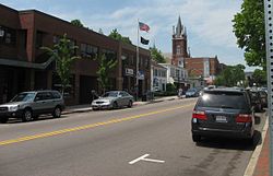
Watertown is located at 42°22′17″N71°10′55″W / 42.37139°N 71.18194°W / 42.37139; -71.18194 (42.37139, −71.18194). [18] To the north, it is bordered by the town of Belmont, along Belmont Street; to the south, it is bordered by the city of Newton. The city of Boston's Brighton neighborhood also lies to the south and east—the border being largely formed by the Charles River. Though the majority of the town lies north of the Charles, from Watertown Square, the nexus of the town, the town's border extends south of the Charles to encompass the neighborhood surrounding Casey Playground. To the east lies the City of Cambridge, the border to which is almost entirely the well-known Mount Auburn Cemetery, most of which is actually in Watertown. To the west lies the more expansive city of Waltham, but there is no distinct geographic feature or major road dividing the two municipalities.

According to the United States Census Bureau, the city has a total area of 4.2 square miles (11 km2), of which 4.1 square miles (11 km2) is land and 0.1 square miles (0.1 km2 or 1.20%) is water.

Adjacent cities and towns

Demographics

Historical population
YearPop.±%
1840 1,810    
1850 2,837+56.7%
1860 3,270+15.3%
1870 4,326+32.3%
1880 5,426+25.4%
1890 7,073+30.4%
1900 9,766+38.1%
1910 12,875+31.8%
1920 21,457+66.7%
1930 34,913+62.7%
1940 35,427+1.5%
1950 37,329+5.4%
1960 39,092+4.7%
1970 39,307+0.5%
1980 34,384−12.5%
1990 33,284−3.2%
2000 32,986−0.9%
2010 31,915−3.2%
2020 35,329+10.7%
2022*35,022−0.9%
* = population estimate.
Source: United States census records and Population Estimates Program data. [19] [20] [21] [22] [23] [24] [25] [26] [27] [28] [29]
Source:
U.S. Decennial Census [30]

As of the census [31] of 2000, there were 32,986 people, 14,629 households, and 7,329 families residing in the city. The population density was 8,025.7 inhabitants per square mile (3,098.7/km2). There were 15,008 housing units at an average density of 3,651.5 per square mile (1,409.9/km2). The racial makeup of the city was 91.42% White, 1.73% African American, 0.16% Native American, 3.87% Asian, 0.02% Pacific Islander, 0.85% from other races, and 1.95% from two or more races. Hispanic or Latino of any race were 2.68% of the population.

There were 14,629 households, out of which 17.8% had children under the age of 18 living with them, 37.9% were married couples living together, 8.7% had a female householder with no husband present, and 49.9% were non-families. 34.1% of all households were made up of individuals, and 12.4% had someone living alone who was 65 years of age or older. The average household size was 2.17 and the average family size was 2.86.

In the city, the population was spread out, with 14.1% under the age of 18, 9.4% from 18 to 24, 39.8% from 25 to 44, 20.0% from 45 to 64, and 16.7% who were 65 years of age or older. The median age was 37 years. For every 100 females, there were 86.1 males. For every 100 females age 18 and over, there were 83.8 males.

The median income for a household in the city was $59,764, and the median income for a family was $67,441. Males had a median income of $46,642 versus $39,840 for females. The per capita income for the city was $33,262. About 4.5% of families and 6.3% of the population were below the poverty line, including 8.6% of those under age 18 and 7.5% of those age 65 or over.

Armenian population

St. Stephen Armenian Apostolic Church St. Stephen Armenian Church Watertown, MA.JPG
St. Stephen Armenian Apostolic Church
Hairenik Association building - Watertown, Mass. Hairenik Association building - Watertown, Mass.JPG
Hairenik Association building – Watertown, Mass.

Watertown is a major center of the Armenian diaspora in the United States, with the third-largest Armenian community in the United States, estimated as numbering 7,000 [32] to over 8,000 [33] as of 2007. [34] Watertown ranks only behind the California cities of Glendale and Fresno. Watertown is also the venue for the publication of long-running Armenian newspapers in English and Armenian, including:

Several Armenian grocery stores are found in East Watertown that sell produce and imported Armenian and Mediterranean products. [35]

Economy

Major employers based in Watertown include the Tufts Health Plan, New England Sports Network, the Perkins School for the Blind, Exergen Corporation, [36] Vanasse Hangen Brustlin, Inc., and athenahealth. [37]

Transportation

Watertown borders Soldiers Field Road and the Massachusetts Turnpike, major arteries into downtown Boston. Watertown is served by several MBTA bus and formerly trackless trolley routes. Most of them pass through or terminate in Watertown Square or Watertown Yard. The former A-Watertown branch of the MBTA's Green Line ran to Watertown until 1969.

Education

Public schooling is provided for approximately 2,600 students by Watertown Public Schools, which operates three elementary schools, one middle school, and one high school (Watertown High School). [38] [39]

Private day schools:

There is also a supplementary Armenian language school, St. James Erebuni Armenian School (Armenian : Սբ. Հակոբ Էրեբունի հայկական դպրոց), affiliated with the St. James Armenian Apostolic Church  [ hy ], which teaches both Western Armenian and Eastern Armenian to children. It originated as a solely Eastern Armenian supplementary school established in 1988 by the Armenian Society of Boston (Iranahye Miutyun); it was Greater Boston's first Eastern Armenian supplementary school. It became church-affiliated in 2015, and it merged with a Western Armenian school, [40] St. Sahag & St. Mesrob Armenian School, in September of that year. [41]

Notable people

Benjamin Robbins Curtis BRCurtis.jpg
Benjamin Robbins Curtis
Eliza Dushku Eliza Dushku 2009.jpg
Eliza Dushku

Culture

See also

Related Research Articles

<span class="mw-page-title-main">Cambridge, Massachusetts</span> City in the Commonwealth of Massachusetts

Cambridge is a city in Middlesex County, Massachusetts, in the United States. It is a suburb in the Greater Boston metropolitan area, located directly across the Charles River from Boston. The city's population as of the 2020 U.S. census was 118,403, making it the most populous city in the county, the fourth-largest in Massachusetts, behind Boston, Worcester, and Springfield, and ninth-largest in New England. The city was named in honor of the University of Cambridge in Cambridge, England, which was an important center of the Puritan theology that was embraced by the town's founders.

<span class="mw-page-title-main">Waltham, Massachusetts</span> City in Massachusetts, United States

Waltham is a city in Middlesex County, Massachusetts, United States, and was an early center for the labor movement as well as a major contributor to the American Industrial Revolution. The original home of the Boston Manufacturing Company, the city was a prototype for 19th century industrial city planning, spawning what became known as the Waltham-Lowell system of labor and production. The city is now a center for research and higher education, home to Brandeis University and Bentley University as well as industrial powerhouse Raytheon Technologies. The population was 65,218 at the census in 2020.

<span class="mw-page-title-main">Middlesex County, Massachusetts</span> County in Massachusetts, United States

Middlesex County is located in the Commonwealth of Massachusetts, in the United States. As of the 2020 census, the population was 1,632,002, making it the most populous county in both Massachusetts and New England and the 22nd most populous county in the United States. Middlesex County is one of two U.S. counties to be amongst the top 25 counties with the highest household income and the 25 most populated counties. It is included in the Census Bureau's Boston–Cambridge–Newton, MA–NH Metropolitan Statistical Area. As part of the 2020 United States census, the Commonwealth's mean center of population for that year was geo-centered in Middlesex County, in the town of Natick.

<span class="mw-page-title-main">Suffolk County, Massachusetts</span> County in Massachusetts, United States

Suffolk County is located in the Commonwealth of Massachusetts, in the United States. As of the 2020 census, the population was 797,936, making it the fourth-most populous county in Massachusetts. The county comprises the cities of Boston, Chelsea, Revere, and Winthrop. The traditional county seat is Boston, the state capital and the largest city in Massachusetts. The county government was abolished in 1999, and so Suffolk County today functions only as an administrative subdivision of state government and a set of communities grouped together for some statistical purposes. Suffolk County is located at the core of the Boston-Cambridge-Newton, MA-NH Metropolitan Statistical Area as well as the greater Boston-Worcester-Providence, MA-RI-NH-CT Combined Statistical Area.

<span class="mw-page-title-main">Auburn, Maine</span> City in Maine, United States

Auburn is a city in south-central Maine, within the United States. The city serves as the county seat of Androscoggin County. The population was 24,061 at the 2020 census. Auburn and its sister city Lewiston are known locally as the Twin Cities or Lewiston–Auburn (L–A).

<span class="mw-page-title-main">Lisbon, Maine</span> Town in the state of Maine, United States

Lisbon is a town in Androscoggin County, Maine, United States. The population was 9,711 at the 2020 census. It is included in both the Lewiston-Auburn, Maine metropolitan statistical area and the Lewiston–Auburn, Maine Metropolitan New England city and town area. The town of Lisbon includes the villages of Lisbon and Lisbon Falls.

<span class="mw-page-title-main">Minot, Maine</span> Town in the state of Maine, United States

Minot is a town in Androscoggin County, Maine, United States. The population was 2,766 at the 2020 census. The town includes the villages of West Minot and Minot Center. It is part of both the Lewiston-Auburn, Maine metropolitan statistical area and the Lewiston-Auburn, Maine metropolitan New England city and town area.

<span class="mw-page-title-main">New Gloucester, Maine</span> Town in the state of Maine, United States

New Gloucester is a town in Cumberland County, Maine, United States. New Gloucester is included in the Lewiston-Auburn, Maine metropolitan New England city and town area. It is home to the Sabbathday Lake Shaker Village, the last active Shaker village in the U.S. The town's population was 5,676 at the 2020 census.

<span class="mw-page-title-main">Monmouth, Maine</span> Town in the state of Maine, United States

Monmouth is a town in Kennebec County, Maine, United States. Monmouth is included in the Lewiston-Auburn, Maine metropolitan New England city and town area. The population was 4,066 at the 2022 census.

<span class="mw-page-title-main">Paris, Maine</span> Town in Maine, United States

Paris is a town in and the county seat of Oxford County, Maine, United States. Paris is included in the Lewiston-Auburn, Maine metropolitan New England City and town area. The population was 5,179 at the 2020 census. The census-designated place of South Paris is located within the town. Because the U.S. Post Office refers to the entire town as South Paris, the town as a whole is commonly referred to as South Paris. The main exception is the area known as Paris Hill, which is a scenic historic district popular with tourists. On May 30, 2019, the town declared itself to be a second amendment sanctuary.

<span class="mw-page-title-main">West Paris, Maine</span> Town in Oxford County, Maine, United States

West Paris is a town in Oxford County, Maine, United States. Originally settled in 1771 for land that what was deemed "superior for pasturage, hay crops, and orchards", West Paris became a center of Finnish immigrant settlement in the 19th century, with many if the town's current residents being descendants of the original Finnish settlers. Once part of the neighboring town of Paris, Maine, West Paris seceded from Paris and was incorporated in September 1957. The population was 1,766 at the 2020 census.

<span class="mw-page-title-main">Lincoln, Massachusetts</span> Town in Massachusetts, United States

Lincoln is a town in Middlesex County, Massachusetts. The population was 7,014 according to the 2020 United States Census, including residents of Hanscom Air Force Base that live within town limits. The town, located in the MetroWest region of Boston's suburbs, has a rich colonial history and large amounts of public conservation land.

<span class="mw-page-title-main">Belmont, Massachusetts</span> Town in eastern Massachusetts

Belmont is a town in Middlesex County, Massachusetts, United States. It is a western suburb of Boston, Massachusetts, United States; and is part of the Greater Boston metropolitan area. At the 2020 U.S. census, its population was 27,295, up 10.4% from 2010.

<span class="mw-page-title-main">Brighton, Boston</span> Neighborhood of Boston in Suffolk, Massachusetts, United States

Brighton is a former town and current neighborhood of Boston, Massachusetts, United States, located in the northwestern corner of the city. It is named after the English city of Brighton. Initially Brighton was part of Cambridge, and known as "Little Cambridge". Brighton separated from Cambridge in 1807 after a bridge dispute, and was annexed to Boston in 1874. For much of its early history, it was a rural town with a significant commercial center at its eastern end.

<span class="mw-page-title-main">Shahan Natalie</span> Armenian writer (1884–1983)

Shahan Natalie was an Armenian writer and political activist who was the principal organizer of Operation Nemesis, a campaign of revenge against officials of the former Ottoman Empire who organized the Armenian genocide during World War I. Originally a member of the Armenian Revolutionary Federation, he later left the party over disagreements regarding its policy towards Turkey. Of his writings on Armenian national philosophy, his essay The Turks and Us is the best known. The main argument of Natalie's writings is that it is impossible for Armenians to come to any kind of understanding with Turks, whom he considered the chief enemy of Armenians, let alone cooperate with Turkey against the Soviet Union.

Stephen P. Mugar was the founder of the Star Market chain of supermarkets in New England. He was also a philanthropist and the most prominent member of the Mugar family of Greater Boston.

<i>Armenian Weekly</i> English-language newspaper published in the US

Armenian Weekly is an English Armenian publication published by Hairenik Association, Inc. in Watertown, Massachusetts in the United States. It is the sister publication to the Armenian language weekly Hairenik. It was started as Hairenik Weekly in 1934 and its name was changed to Armenian Weekly, the name under which it is still published, in 1969. Armenian Weekly also runs an online publication.

<span class="mw-page-title-main">Dixfield, Maine</span> Town in the state of Maine, United States

Dixfield is a town in Oxford County, Maine, United States. Dixfield is included in the Lewiston-Auburn, Maine metropolitan New England city and town area. The population was 2,253 at the 2020 census. The town motto of Dixfield is "The Only One", because it is the only town in the world to claim that name. Dr. Elijeh Dix, a substantial landowner in the area, bought the town which bears his name.

<span class="mw-page-title-main">Topsham, Maine</span> Town in the state of Maine, United States

Topsham is a town in Sagadahoc County, Maine, United States. Topsham was included in the Lewiston-Auburn, Maine metropolitan New England city and town area. The population was 9,560 at the 2020 census. It is part of the Portland–South Portland–Biddeford, Maine metropolitan statistical area. The town is home to the annual Topsham Fair.

<span class="mw-page-title-main">Horace H. Coolidge</span> American politician

Horace Hopkins Coolidge was a Massachusetts lawyer and politician who served in the Massachusetts House of Representatives, and as a member and President of the Massachusetts Senate.

References

  1. "2020 U.S. Gazetteer Files". United States Census Bureau. Retrieved May 21, 2022.
  2. "History & Tourism – Watertown, MA – Official Website". www.ci.watertown.ma.us.
  3. Wood, William (2002). Wood's Vocabulary of Massachusett. Merchantsville, NJ: Evolution Publishing: American Language Reprints. p. 14. ISBN   978-1-889758-97-8.
  4. "Watertown Tab "Zubrowski: The herring run through Watertown from Mother's Day to Father's Day" (June 10, 2009)". Wicked Local. Retrieved October 7, 2014.
  5. Young, Alexander (1846). Chronicles of the First Planters of the Colony of Massachusetts Bay, 1623–1636, pp. 313–14. Boston: Charles C. Little and James Brown.
  6. 1 2 3 4 5 Wikisource-logo.svg One or more of the preceding sentences incorporates text from a publication now in the public domain :  Chisholm, Hugh, ed. (1911). "Watertown". Encyclopædia Britannica . Vol. 28 (11th ed.). Cambridge University Press. p. 411.
  7. "Watertown Tour". maintour.com.
  8. "Bissell Outrode Paul Revere But History Left Him in the Dust", Hartford Courant , April 16, 2007
  9. "The Five Riders". www.constitutionfacts.com.
  10. "Did You Know? | Watertown, MA – Official Website". www.ci.watertown.ma.us. Retrieved February 14, 2020.
  11. Hodges, Maud deLeigh. 1980. Crossroads on the Charles. Phoenix Publishing, Canaan, NH
  12. Maine Historical Society. "Documentary history of the state of Maine ." Portland via Internet Archive.
  13. Paul, Daniel N. (2000). We Were Not the Savages: A Mi'kmaq Perspective on the Collision Between European and Native American Civilizations (2nd ed.). Fernwood. pp. 169–170. ISBN   978-1-55266-039-3. (includes full text of both treaties).
  14. sverdrupian (November 13, 2019). "Reddit | Lost Architecture | Coolidge Tavern" . Retrieved February 14, 2020.
  15. John Pike. "History of the AMTL" . Retrieved October 7, 2014.
  16. "1906 Stanley Steamer Rocket Images, Information and History". Conceptcarz.com. Retrieved January 19, 2013.
  17. Breitrose, Charlie (November 3, 2021). "See Precinct Results for 2021 Town Council, School Committee, Library Trustees Races and the Charter Questions". Watertown News. Retrieved August 3, 2023.
  18. "US Gazetteer files: 2010, 2000, and 1990". United States Census Bureau. February 12, 2011. Retrieved April 23, 2011.
  19. "Total Population (P1), 2010 Census Summary File 1". American FactFinder, All County Subdivisions within Massachusetts. United States Census Bureau. 2010.
  20. "Massachusetts by Place and County Subdivision - GCT-T1. Population Estimates". United States Census Bureau. Retrieved July 12, 2011.
  21. "1990 Census of Population, General Population Characteristics: Massachusetts" (PDF). US Census Bureau. December 1990. Table 76: General Characteristics of Persons, Households, and Families: 1990. 1990 CP-1-23. Retrieved July 12, 2011.
  22. "1980 Census of the Population, Number of Inhabitants: Massachusetts" (PDF). US Census Bureau. December 1981. Table 4. Populations of County Subdivisions: 1960 to 1980. PC80-1-A23. Retrieved July 12, 2011.
  23. "1950 Census of Population" (PDF). Bureau of the Census. 1952. Section 6, Pages 21-10 and 21-11, Massachusetts Table 6. Population of Counties by Minor Civil Divisions: 1930 to 1950. Retrieved July 12, 2011.
  24. "1920 Census of Population" (PDF). Bureau of the Census. Number of Inhabitants, by Counties and Minor Civil Divisions. Pages 21-5 through 21-7. Massachusetts Table 2. Population of Counties by Minor Civil Divisions: 1920, 1910, and 1920. Retrieved July 12, 2011.
  25. "1890 Census of the Population" (PDF). Department of the Interior, Census Office. Pages 179 through 182. Massachusetts Table 5. Population of States and Territories by Minor Civil Divisions: 1880 and 1890. Retrieved July 12, 2011.
  26. "1870 Census of the Population" (PDF). Department of the Interior, Census Office. 1872. Pages 217 through 220. Table IX. Population of Minor Civil Divisions, &c. Massachusetts. Retrieved July 12, 2011.
  27. "1860 Census" (PDF). Department of the Interior, Census Office. 1864. Pages 220 through 226. State of Massachusetts Table No. 3. Populations of Cities, Towns, &c. Retrieved July 12, 2011.
  28. "1850 Census" (PDF). Department of the Interior, Census Office. 1854. Pages 338 through 393. Populations of Cities, Towns, &c. Retrieved July 12, 2011.
  29. "City and Town Population Totals: 2020-2022". United States Census Bureau . Retrieved November 10, 2023.
  30. "U.S. Census Bureau QuickFacts: United States". Census.gov. Retrieved September 16, 2021.
  31. "U.S. Census website". United States Census Bureau . Retrieved January 31, 2008.
  32. Armenians in Watertown, MA in Hayk the Ubiquitous Armenian
  33. Watertown in Armeniapedia.org
  34. Keith O'Brien, "ADL local leader fired on Armenian issue", The Boston Globe, August 18, 2007.
  35. Chudy, Katie (July 15, 2015). "An Armenian Food Treasure Trove in Watertown: Lamejun, Boregs, and More". Eater Boston. Retrieved July 3, 2023.
  36. "Changing The Way The World Takes Temperature". Exergen. Retrieved November 28, 2017.
  37. "Labor Market Information" . Retrieved December 16, 2014.
  38. "Schools". Town of Watertown. Retrieved December 27, 2018.
  39. "About Us". Watertown Public Schools. Retrieved December 27, 2018.
  40. "Erebuni School at St. James Celebrates 30th Anniversary". Armenian Mirror-Spectator . April 19, 2018. Retrieved June 18, 2019.
  41. "St. James Erebuni Armenian School". St. James Armenian Church. Retrieved June 18, 2019.
  42. Watertown, Massachusetts at IMDb
  43. "Today at the WFPL" . Retrieved October 7, 2014.
  44. "Plumbing Museum Leaving Space in Watertown".
  45. "David J. Russo". www.davidjrusso.com. Retrieved July 3, 2023.
  46. "HSW". www.historicalsocietyofwatertownma.org. Retrieved July 3, 2023.
  47. "Washington Tower | Mount Auburn Cemetery".

Further reading