Newton Lower Falls

Last updated

Newton Lower Falls, Massachusetts
Village
Lower Falls Wine Company, Newton Lower Falls MA.jpg
Lower Falls Wine Company
Location map Boston Metropolitan Area.png
Red pog.svg
Newton Lower Falls
USA Massachusetts location map.svg
Red pog.svg
Newton Lower Falls
Usa edcp location map.svg
Red pog.svg
Newton Lower Falls
Coordinates: 42°20′N71°15′W / 42.333°N 71.250°W / 42.333; -71.250
Country Flag of the United States.svg United States
State Massachusetts
County Middlesex
City Newton
Elevation
90 m (300 ft)
Time zone UTC-5 (Eastern (EST))
  Summer (DST) UTC-4 (EDT)
ZIP Code
  • 02462
  • 02466
Area code 617

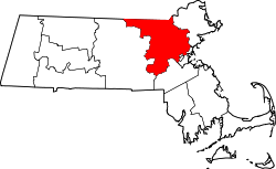
Newton Lower Falls is one of the thirteen villages within the city of Newton in Middlesex County, Massachusetts, United States. The commercial area extends across the Charles River into Wellesley, where it is known as Wellesley Lower Falls, where a majority of the retail businesses are located.

Contents

The Charles River drops 18 feet over less than one-quarter mile at Lower Falls. A series of three small dams with fish ladders are located along the drop. The primary roads through the village of Lower Falls are Grove Street, Washington Street (Route 16), and Concord Street. The area is now a suburban neighborhood centered on the park at the old Hamilton elementary school (now Lower Falls Community Center), and bordered on the northwest by the Charles River and the Leo J. Martin public golf course. [1] The historic heart of the Lower Falls village, St. Mary's Episcopal Church, and the adjacent residential area on Grove Street, are listed on the National Register of Historic Places as the Newton Lower Falls Historic District.

Notable people

Attractions

Historic landmarks

Other

Related Research Articles

<span class="mw-page-title-main">Newton, Massachusetts</span> City in Massachusetts, United States

Newton is a city in Middlesex County, Massachusetts, United States. It is approximately 7 miles (11 km) west of downtown Boston, and comprises a patchwork of thirteen villages without a city center. It is home to the Charles River, Crystal Lake, and Heartbreak Hill, among other landmarks. It is served by several streets and highways, as well as the Green Line D branch run by the MBTA.

<span class="mw-page-title-main">Glens Falls, New York</span> City in New York, United States

Glens Falls is a city in Warren County, New York, United States and is the central city of the Glens Falls Metropolitan Statistical Area. The population was 14,830 at the 2020 census. The name was given by Colonel Johannes Glen, the falls referring to a large waterfall in the Hudson River at the southern end of the city.

<span class="mw-page-title-main">Auburndale, Massachusetts</span> Village in Massachusetts, United States

Auburndale is one of the thirteen villages within the city of Newton in Middlesex County, Massachusetts, United States. It lies at the western end of Newton near the intersection of interstate highways 90 and 95. It is bisected by the Massachusetts Turnpike. Auburndale is surrounded by three other Newton villages as well as the city of Waltham and the Charles River. Auburndale is the home of Williams and Burr elementary schools, as well as Lasell College. Auburndale Square is the location of the Plummer Memorial Library, which is run by the Auburndale Community Library and no longer affiliated with the Newton Free Library, the Turtle Lane Playhouse, and many small businesses.

<span class="mw-page-title-main">Newton Highlands, Massachusetts</span> Village in Massachusetts, United States

Newton Highlands is one of the thirteen villages within the city of Newton in Middlesex County, Massachusetts, United States. The Newton Highlands Historic District includes residential and commercial businesses back to the late 19th century.

<span class="mw-page-title-main">Newton Lower Falls Branch</span>

The Newton Lower Falls Branch was a short branch of the Boston and Albany Railroad in Massachusetts, running between Riverside station in Newton and Lower Falls in Wellesley. It opened in 1847; passenger service ran until 1957 and freight service until 1972.

<span class="mw-page-title-main">Newton Upper Falls</span> Village in Massachusetts

Newton Upper Falls is one of the thirteen villages within the city of Newton in Massachusetts, United States. The village is listed as the Newton Upper Falls Historic District on the National Register of Historic Places.

<span class="mw-page-title-main">West Newton, Massachusetts</span> Village in Massachusetts, United States

West Newton is one of the thirteen villages within the city of Newton in Middlesex County, Massachusetts, United States.

<span class="mw-page-title-main">Waban, Massachusetts</span> Village in Massachusetts, United States

Waban is one of the thirteen villages within the city of Newton in Middlesex County, Massachusetts, United States.

<span class="mw-page-title-main">National Register of Historic Places listings in Massachusetts</span>

The National Register of Historic Places is a United States federal official list of places and sites considered worthy of preservation. In the state of Massachusetts, there are over 4,300 listings, representing about 5% of all NRHP listings nationwide and the second-most of any U.S. state, behind only New York. Listings appear in all 14 Massachusetts counties.

<span class="mw-page-title-main">Alexander H. Rice</span> American politician (1818–1895)

Alexander Hamilton Rice was an American politician and businessman from Massachusetts. He served as Mayor of Boston from 1856 to 1857, a U.S. Congressman during the American Civil War, and as the 30th Governor of Massachusetts from 1876 to 1878. He was part owner and president of Rice-Kendall, one of the nation's largest paper products distributors.

<span class="mw-page-title-main">Cochituate Aqueduct</span> Brought water to Boston, MA, USA from 1848 to 1951

The Cochituate Aqueduct was an aqueduct in Massachusetts that brought water to Boston from 1848 to 1951.

<span class="mw-page-title-main">Arthur T. Gregorian</span>

Arthur T. Gregorian,, was a Greater Boston oriental rug dealer and author of books on oriental rugs. He is considered by some to be the world's leading collector of rare, inscribed Armenian rugs.

<span class="mw-page-title-main">Woodland station</span> Light rail station in Newton, Massachusetts, US

Woodland station is a light rail stop on the MBTA Green Line D branch, located off Washington Street (MA-16) between the Newton Lower Falls and Auburndale villages of Newton, Massachusetts, United States. It serves as access to the Newton-Wellesley Hospital, as well as a park and ride station for nearby Route 128.

<span class="mw-page-title-main">St. Mary's Episcopal Church (Newton Lower Falls, Massachusetts)</span> Historic church in Massachusetts, United States

St. Mary's Episcopal Church and Cemetery is a historic church and cemetery at 258 Concord Street, in the village of Newton Lower Falls, Massachusetts, United States. St. Mary's Parish was formed in 1811. The church, built in 1813–14 and restyled in 1838, is the oldest church in Newton, and is a fine example of Gothic Revival/Federal style architecture. The cemetery, which dates from 1812, is the oldest non-government-owned cemetery in Newton. The property was listed on the National Register of Historic Places in 1980.

<span class="mw-page-title-main">Newton-Wellesley Hospital</span> Hospital in Newton, Massachusetts, US

Newton-Wellesley Hospital (NWH) is a community teaching medical center located in Newton, Massachusetts on Washington Street. It is affiliated with Tufts University School of Medicine and Harvard Medical School. Founded in 1881, part of its campus is listed on the National Register of Historic Places as the Newton Cottage Hospital Historic District.

<span class="mw-page-title-main">Newton Lower Falls Historic District</span> Historic district in Massachusetts, United States

The Newton Lower Falls Historic District encompasses the historic colonial village center of Newton Lower Falls, on the west side of Newton, Massachusetts. This area lies north of Washington Street, along Concord and Grove Streets, between Washington and Hagar Streets. The district was listed on the National Register of Historic Places in 1986.

<span class="mw-page-title-main">Hartwell and Richardson</span> American architectural firm

Hartwell and Richardson was a Boston, Massachusetts architectural firm established in 1881, by Henry Walker Hartwell (1833–1919) and William Cummings Richardson (1854–1935). The firm contributed significantly to the current building stock and architecture of the greater Boston area. Many of its buildings are listed on the National Register of Historic Places.

Charles Rice was a brigadier general in the Massachusetts Militia, a selectman in Needham, a justice of the peace and a member of the Massachusetts House of Representatives.

References

  1. "Newton Lower Falls". www.newtonlowerfalls.org. Retrieved November 26, 2017.
  2. "Thomas Wilmer Dewing". National Gallery of Art. Archived from the original on December 23, 2017. Retrieved January 26, 2024.
  3. 1 2 3 4 5 "Newton Lower Falls Improvement Association - The History of Lower Falls". newtonlowerfalls.org. Archived from the original on August 10, 2020. Retrieved January 25, 2024.
  4. Shea, Deborah; Jenkins, Candace; Abele, Susan (1988). "FORM A - AREA" (PDF). mhc-macris.net. Retrieved January 25, 2024.
  5. "Sports: Participatory". The Boston Phoenix . June 4, 1985. p. 30. Retrieved January 25, 2024.
  6. "Facility Directory Standard Map | City of Newton, MA". www.newtonma.gov. Retrieved January 25, 2024.