Shirley (CDP), Massachusetts

Last updated

Shirley, Massachusetts
The United Church of Shirley, Shirley MA.jpg
The United Church of Shirley
Middlesex County Massachusetts incorporated and unincorporated areas Shirley (CDP) highlighted.svg
Location in Middlesex County in Massachusetts
Coordinates: 42°32′36″N71°39′4″W / 42.54333°N 71.65111°W / 42.54333; -71.65111
Country United States
State Massachusetts
County Middlesex
Town Shirley
Area
[1]
  Total1.33 sq mi (3.46 km2)
  Land1.32 sq mi (3.41 km2)
  Water0.02 sq mi (0.04 km2)
Elevation
285 ft (87 m)
Population
 (2020) [2]
  Total1,611
  Density1,222.31/sq mi (471.87/km2)
Time zone UTC-5 (Eastern (EST))
  Summer (DST) UTC-4 (EDT)
ZIP code
01464
Area code 978
FIPS code 25-61555
GNIS feature ID0610789

Shirley is a census-designated place (CDP) comprising the main village in the town of Shirley in Middlesex County, Massachusetts, United States. The population was 1,611 at the 2020 census, [2] out of 7,431 in the entire town of Shirley.

Contents

Geography

The village of Shirley is located in northwestern Middlesex County at 42°32′36″N71°39′04″W / 42.54324°N 71.650987°W / 42.54324; -71.650987 (42.54324, -71.650987), [3] in the southern part of the town of Shirley. It is bordered to the east by the Devens regional enterprise zone and to the south by the town of Lancaster in Worcester County. The western edge of the CDP follows Bow Brook, a tributary of Catacoonamug Brook, which flows through the village center and joins the Nashua River in Devens.

No numbered state highways run through the village. It is 7 miles (11 km) east of Leominster and 3 miles (5 km) southwest of Ayer.

According to the United States Census Bureau, the Shirley CDP has a total area of 1.34 square miles (3.47 km2), of which 0.02 square miles (0.05 km2), or 1.27%, are water. [1]

Demographics

Historical population
CensusPop.Note
1950 1,082
1960 1,76262.8%
1970 1,718−2.5%
1980 1,630−5.1%
1990 1,559−4.4%
2000 1,427−8.5%
2010 1,4411.0%
2020 1,61111.8%
U.S. Decennial Census [4]

As of the census [5] of 2000, there were 1,427 people, 632 households, and 343 families residing in the CDP. The population density was 408.1/km2 (1,059.4/mi2). There were 664 housing units at an average density of 189.9/km2 (493.0/mi2). The racial makeup of the CDP was 92.15% White, 3.99% Black or African American, 0.07% Native American, 1.82% Asian, 0.42% from other races, and 1.54% from two or more races. Hispanic or Latino of any race were 2.03% of the population.

There were 632 households, out of which 26.7% had children under the age of 18 living with them, 40.0% were married couples living together, 10.3% had a female householder with no husband present, and 45.7% were non-families. 38.9% of all households were made up of individuals, and 14.1% had someone living alone who was 65 years of age or older. The average household size was 2.26 and the average family size was 3.08.

In the CDP, the population was spread out, with 23.2% under the age of 18, 7.0% from 18 to 24, 33.6% from 25 to 44, 21.4% from 45 to 64, and 14.9% who were 65 years of age or older. The median age was 39 years. For every 100 females, there were 94.7 males. For every 100 females age 18 and over, there were 93.6 males.

The median income for a household in the CDP was $40,956, and the median income for a family was $56,950. Males had a median income of $40,742 versus $32,143 for females. The per capita income for the CDP was $22,256. About 5.4% of families and 6.2% of the population were below the poverty line, including 4.5% of those under age 18 and none of those age 65 or over.

Related Research Articles

<span class="mw-page-title-main">East Harwich, Massachusetts</span> Census-designated place in Massachusetts, United States

East Harwich is a census-designated place (CDP) and village in the town of Harwich in Barnstable County, Massachusetts, United States. The population was 4,872 at the 2010 census.

<span class="mw-page-title-main">Housatonic, Massachusetts</span> Census-designated place in Massachusetts, United States

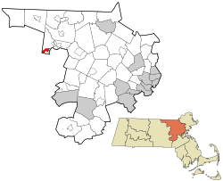
Housatonic is a census-designated place (CDP) in the town of Great Barrington in Berkshire County, Massachusetts. It is part of the Pittsfield, Massachusetts Metropolitan Statistical Area. The population was 1,109 at the 2010 census. It was named after the Housatonic River.

<span class="mw-page-title-main">South Amherst, Massachusetts</span> Census-designated place in Massachusetts, United States

South Amherst is a census-designated place (CDP) in the town of Amherst in Hampshire County, Massachusetts, United States. The population was 4,994 at the 2010 census. The CDP includes the village of South Amherst and residential subdivisions south of the Amherst town center.

<span class="mw-page-title-main">Cochituate, Massachusetts</span> Census-designated place in Massachusetts, United States

Cochituate is a census-designated place (CDP) in the town of Wayland in Middlesex County, Massachusetts, United States. The population was 6,927 at the 2020 census, out of 13,943 in the entire town of Wayland.

<span class="mw-page-title-main">East Pepperell, Massachusetts</span> Census-designated place in Massachusetts, United States

East Pepperell is a village and census-designated place (CDP) in the town of Pepperell in Middlesex County, Massachusetts, United States. The population was 2,120 at the 2020 census.

<span class="mw-page-title-main">Littleton Common, Massachusetts</span> Census-designated place in Massachusetts, United States

Littleton Common is a census-designated place (CDP) in the town of Littleton in Middlesex County, Massachusetts, United States. The population was 3,065 at the 2020 census, up from 2,789 in 2010.

<span class="mw-page-title-main">Pinehurst, Massachusetts</span> Census-designated place in Massachusetts, United States

Pinehurst is an unincorporated village and census-designated place (CDP) in the town of Billerica, Middlesex County, Massachusetts, United States. The population was 7,368 at the 2020 census. It is in the southeastern part of town along Massachusetts Route 3A.

<span class="mw-page-title-main">West Concord, Massachusetts</span> Census-designated place in Massachusetts, United States

West Concord is an unincorporated village and census-designated place (CDP) in the town of Concord in Middlesex County, Massachusetts, United States. The population was 6,320 at the 2020 census.

<span class="mw-page-title-main">Heathcote, New Jersey</span> Populated place in Middlesex County, New Jersey, US

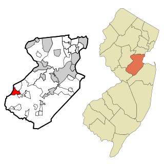
Heathcote is an unincorporated community and census-designated place (CDP) located within South Brunswick, in Middlesex County, in the U.S. state of New Jersey. As of the 2010 United States Census, the CDP's population was 5,821.

<span class="mw-page-title-main">Rowley (CDP), Massachusetts</span> Census-designated place in Massachusetts, United States

Rowley is a census-designated place (CDP) in the town of Rowley in Essex County, Massachusetts, United States. The population was 1,416 at the 2010 census.

<span class="mw-page-title-main">Ayer (CDP), Massachusetts</span> Census-designated place in Massachusetts, United States

Ayer is a census-designated place (CDP) and the primary settlement in the town of Ayer in Middlesex County, Massachusetts, United States. The population of the CDP was 2,986 at the 2020 census, out of 8,479 in the entire town.

<span class="mw-page-title-main">Walpole (CDP), Massachusetts</span> Census-designated place in Massachusetts, United States

Walpole is a small census-designated place (CDP) located within the much larger town of Walpole in Norfolk County, Massachusetts, United States. Walpole Town as it is called by the US Census Bureau, also includes a much larger population. The population of the Census Designated Place was 5,918 at the 2010 census.

<span class="mw-page-title-main">Lunenburg (CDP), Massachusetts</span> CDP in Massachusetts, United States

Lunenburg is a census-designated place (CDP) in the town of Lunenburg in Worcester County, Massachusetts, United States. The population was 1,760 at the 2010 census.

Fort Devens was a census-designated place (CDP) in the towns of Ayer and Shirley, in Middlesex County and Harvard in Worcester County in the U.S. state of Massachusetts. It encompassed the former Fort Devens. The population was 1,017 at the 2000 census. Prior to the 2010 census, the area was redefined as the Devens census-designated place.

<span class="mw-page-title-main">Groton (CDP), Massachusetts</span> Census-designated place in Massachusetts, United States

Groton is a census-designated place (CDP) comprising the main village in the town of Groton in Middlesex County, Massachusetts, United States. The population of the CDP was 1,353 at the 2020 census, out of 11,315 in the entire town of Groton.

<span class="mw-page-title-main">Hudson (CDP), Massachusetts</span> Census-designated place in Massachusetts, United States

Hudson is a census-designated place (CDP) comprising the densely developed central part of the town of Hudson in Middlesex County, Massachusetts, United States. The population of the CDP was 15,749 at the 2020 census, out of 20,092 in the entire town.

<span class="mw-page-title-main">Pepperell (CDP), Massachusetts</span> Census-designated place in Massachusetts, United States

Pepperell is a census-designated place (CDP) comprising the main village in the town of Pepperell in Middlesex County, Massachusetts, United States. The population was 2,390 at the 2020 census, out of 11,604 in the entire town of Pepperell.

<span class="mw-page-title-main">Shirley, Massachusetts</span> Town in Massachusetts, United States

Shirley is a town in Middlesex County, Massachusetts, United States. It is approximately thirty miles west-northwest of Boston. The population was 7,431 at the 2020 census. The town has a well-preserved historic New England town center.

<span class="mw-page-title-main">Townsend (CDP), Massachusetts</span> Census-designated place in Massachusetts, United States

Townsend is a census-designated place (CDP) comprising the main village in the town of Townsend in Middlesex County, Massachusetts, United States. The population was 1,213 at the 2020 census, out of 9,127 in the entire town.

<span class="mw-page-title-main">Dover (CDP), Massachusetts</span> CDP in Massachusetts, United States

Dover is a census-designated place (CDP) in the town of Dover in Norfolk County, Massachusetts, United States. The population was 2,265 at the 2010 census.

References

  1. 1 2 "2022 U.S. Gazetteer Files: Massachusetts". United States Census Bureau. Retrieved June 13, 2023.
  2. 1 2 "P1. Race – Shirley CDP, Massachusetts: 2020 DEC Redistricting Data (PL 94-171)". U.S. Census Bureau. Retrieved June 13, 2023.
  3. "US Gazetteer files: 2010, 2000, and 1990". United States Census Bureau. February 12, 2011. Retrieved April 23, 2011.
  4. "Census of Population and Housing". Census.gov. Retrieved June 4, 2016.
  5. "U.S. Census website". United States Census Bureau . Retrieved January 31, 2008.