On July 11, 1997, Massachusetts abolished the executive government of Middlesex County primarily due to the county's insolvency.[3] Middlesex County continues to exist as a geographic boundary[4] and is used primarily as district jurisdictions within the court system and for other administrative purposes; for example, as an election district. The National Weather Service weather alerts (such as severe thunderstorm warning) continue to localize based on Massachusetts's counties.
On April 19, 1775, Middlesex was the site of the first armed conflict of the American Revolutionary War.
In 1855, the Massachusetts State Legislature created a minor Registry of Deeds for the Northern District of Middlesex County in Lowell.[5]
In the late 19th century and early 20th century, Boston annexed several of its adjacent cities and towns including Charlestown and Brighton from Middlesex County, resulting in an enlargement and accretion toward Suffolk County.[5]
Beginning prior to the dissolution of the executive county government, the county comprised two regions with separate county seats for administrative purposes:
The Middlesex-South District (larger) with the county seat in Cambridge[6] consisted of the remaining 44 cities and towns of Middlesex County.[7]
Since the start of the 21st century, much of the current and former county offices have physically decentralized from the Cambridge seat, with the sole exceptions being the Registry of Deeds and the Middlesex Probate and Family Court, which both retain locations in Cambridge and Lowell. Since the first quarter of 2008, the Superior Courthouse[8][9] has been seated in the city of Woburn;[10][11] the Sheriff's Office is now administratively seated in the city of Medford and the Cambridge-based County Jail[12] has since been amalgamated with another county jail facility in Billerica.[13] The Cambridge District Court (which has jurisdiction for Arlington, Belmont and Cambridge); along with the Middlesex County District Attorney's Office, although not a part of the Middlesex County government, was also relatedly forced to relocate to Medford at the time of the closure of the Superior Courthouse building in Cambridge.[14][15]
Government and politics
Of the fourteen counties of Massachusetts, Middlesex is one of eight[16] which have had no county government or county commissioners since July 1, 1998, when county functions were assumed by state agencies at local option following a change in state law.[4] Immediately prior to its dissolution, the executive branch consisted of three County Commissioners elected at-large to staggered four-year terms. There was a County Treasurer elected to a six-year term. The county derived its revenue primarily from document filing fees at the Registries of Deeds and from a Deeds Excise Tax; also a transfer tax was assessed on the sale price of real estate and collected by the Registries of Deeds.[17]
Budgets as proposed by the County Commissioners were approved by a County Advisory Board that consisted of a single representative of each of the 54 cities and towns in Middlesex County. The votes of the individual members of the advisory board were weighted based on the overall valuation of property in their respective communities.
The County Sheriff and two Registers of Deeds (one for the Northern District at Lowell and another for the Southern District at Cambridge) are each elected to serve six-year terms.[18] Besides the employees of the Sheriff's Office and the two Registries of Deeds, the county had a Maintenance Department, a Security Department, some administrative staff in the Treasurer's and Commissioners' Offices, and the employees of the hospital.
The county government also owned and operated the Superior Courthouse, one of which was formerly in Cambridge (since 2008 relocated to Woburn.)[8] and one in Lowell; and the defunct Middlesex County Hospital in the city of Waltham.
The legislation abolishing the Middlesex County executive retained the Sheriff and Registers of Deeds as independently elected officials, and transferred the Sheriff's Office under the state Department of Public Safety and the two Registry of Deeds offices to the Massachusetts Secretary of State's Office.[19] Additionally, all county maintenance and security employees were absorbed into the corresponding staffs of the Massachusetts Trial Court. The legislation also transferred ownership of the two Superior Courthouses to the Commonwealth of Massachusetts. The hospital was closed. Finally, the office of County Commissioner was immediately abolished and the office of County Treasurer was abolished as of December 31, 2002.[20] Any county roads transferred to the Commonwealth as part of the dissolution. The other administrative duties (such as Sheriff, Department of Deeds and court system, etc.) and all supporting staff were transferred under the Commonwealth as well.
Records of land ownership in Middlesex County continue to be maintained at the two Registries of Deeds. Besides the Sheriff and the two Registers of Deeds, the Middlesex District Attorney, the Middlesex Register of Probate and the Middlesex Clerk of Courts (which were already part of state government before the abolition of Middlesex County government) are all elected countywide to six-year terms.
In Middlesex County (as in the entirety of the Commonwealth of Massachusetts), the governmental functions such as property tax assessment and collection, public education, road repair and maintenance, and elections were all conducted at the municipal city and town level and not by the county government.
In 2012 the 22-story Superior Court Building in Cambridge which was transferred from the abolished Executive County government was sold[23][24] by the Commonwealth of Massachusetts.[25] Due to its transfer from state control,[26] many local residents had tried to force the private developers to reduce the overall height of the structure.[27][28]
Even following the abolition of the executive branch for county government in Middlesex, communities are still granted a right by the Massachusetts state legislature to form their own regional compacts for sharing of services and costs thereof.
According to the U.S. Census Bureau, the county has a total area of 847 square miles (2,190km2), of which 818 square miles (2,120km2) is land and 29 square miles (75km2) (3.5%) is water.[32] It is the third-largest county in Massachusetts by land area.
U.S. Decennial Census[35] 1790-1960[36] 1900-1990[37] 1990-2000[38] 2010-2020[39]
2020 census
As of the 2020 census, the county had a population of 1,632,002. Of the residents, 19.5% were under the age of 18 and 16.1% were 65 years of age or older; the median age was 38.6 years.[40]
For every 100 females there were 95.6 males, and for every 100 females age 18 and over there were 93.5 males. 96.5% of residents lived in urban areas and 3.5% lived in rural areas.[40]
There were 625,916 households in the county, of which 29.1% had children under the age of 18 living with them and 26.8% had a female householder with no spouse or partner present. About 26.9% of all households were made up of individuals and 11.2% had someone living alone who was 65 years of age or older.[42]
There were 658,283 housing units, of which 4.9% were vacant. Among occupied housing units, 59.6% were owner-occupied and 40.4% were renter-occupied. The homeowner vacancy rate was 0.7% and the rental vacancy rate was 4.9%.[42]
In 2006, Middlesex County contained the tenth most millionaires of any county in the United States.[43]
Population density of Middlesex County by census block (2020)
Middlesex County, Massachusetts – Racial and ethnic composition Note: the US Census treats Hispanic/Latino as an ethnic category. This table excludes Latinos from the racial categories and assigns them to a separate category. Hispanics/Latinos may be of any race.
As of the 2010 United States census, there were 1,503,085 people, 580,688 households, and 366,656 families residing in the county.[48] The population density was 1,837.9 inhabitants per square mile (709.6/km2). There were 612,004 housing units at an average density of 748.3 per square mile (288.9/km2).[49] The racial makeup of the county was 80.0% white, 9.3% Asian, 4.7% black or African American, 0.2% American Indian, 3.3% from other races, and 2.5% from two or more races. Those of Hispanic or Latino origin made up 6.5% of the population.[48]
Of the 580,688 households, 31.0% had children under the age of 18 living with them, 49.5% were married couples living together, 10.1% had a female householder with no husband present, 36.9% were non-families, and 27.8% of all households were made up of individuals. The average household size was 2.49 and the average family size was 3.10. The median age was 38.5 years.[48]
The median income for a household in the county was $77,377 and the median income for a family was $97,382. Males had a median income of $64,722 versus $50,538 for females. The per capita income for the county was $40,139. About 5.1% of families and 7.6% of the population were below the poverty line, including 8.0% of those under age 18 and 8.0% of those age 65 or over.[51]
The ranking of unincorporated communities that are included on the list is reflective if the census-designated locations and villages were included as cities or towns. Data is from the 2007-2011 American Community Survey 5-Year Estimates.[54][55][56]
The primary responsibility of the Middlesex Sheriff's Office is oversight of the Middlesex House of Correction and Jail in Billerica. It formerly ran the Middlesex Jail in Cambridge, which closed on June 28, 2014. In addition, the Sheriff's Office operates the Office of Civil Process and, the Lowell Community Counseling Centers, and crime prevention and community service programs. The office of sheriff was created in 1692, making it one of the oldest law enforcement agencies in the United States. The sheriff is elected to a 6-year term.[57]
Prior to 1960, Middlesex County was a Republican Party stronghold, backing only two Democratic Party presidential candidates from 1856 to 1956. From the 1960 election the trend reversed; the county has exclusively supported Democratic presidential candidates. This has intensified in recent decades, as George H. W. Bush in 1988 was the most recent Republican presidential candidate to receive over 40 percent of the county's votes and Mitt Romney in 2012 the last Republican to receive over 30 percent. In 2020, Joe Biden won 71% of the county’s votes, the highest share for any presidential candidate since 1964.
United States presidential election results for Middlesex County, Massachusetts[59]
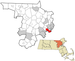
1889 map of Middlesex CountyMap of Middlesex County, with Cambridge highlighted
Most municipalities in Middlesex County have a town form of government; the remainder are cities, and are so designated on this list. Villages listed below are census or postal divisions but have no separate corporate or statutory existence from the cities and towns in which they are located.
Middlesex County is home to the Middlesex County Volunteers, a fife and drum corps that plays music from the 17th, 18th, 19th and 20th centuries. Founded in 1982 at the end of the United States Bicentennial celebration, the group performs extensively throughout New England. They have also performed at the Boston Pops, throughout the British Isles and Western Europe, and at the Edinburgh Military Tattoo's Salute to Australia in Sydney, Australia.
↑Redmond, Lisa (March 10, 2008). "Middlesex Superior Court moving to Woburn". Digital First Media. Lowell Sun. Archived from the original on January 29, 2018. Retrieved January 31, 2018. WOBURN – Middlesex Superior Court, currently located in the Edward J. Sullivan Courthouse in Cambridge, will move to a new facility in Woburn in the TradeCenter on Sylvan Road beginning Friday, according to Chief Justice for Administration and Management Robert A. Mulligan.
↑"Press Release: Middlesex Superior Court Moves to Woburn". Cummings Properties, LLC. March 17, 2008. Archived from the original on January 30, 2018. Retrieved January 31, 2018. Woburn, MA, March 17, 2008 – The new furniture has been installed, years of case files have been dusted off, moved and organized, and the computers are all hooked up and ready to go. After 40 years in Cambridge, the Superior Court is open and ready for business in Woburn. [ ... ] Serving nearly all of the 54 communities in Middlesex County, the new Woburn building houses 15 courtrooms, clerks' offices, judges' chambers, the probation department, the law library, and more. In addition, the Court estimates that more than 400 people will use the building every day, including, lawyers, judges, administrative staff, jurors, plaintiffs, defendants, visitors, and others who work at the building and use the system.
↑Properties, Cummings (September 20, 2013). "Press Release:Middlesex Superior Court renews lease in Woburn". Cummings Properties, Business. Patch Media. Archived from the original on January 29, 2018. Retrieved January 31, 2018. The Commonwealth of Massachusetts has extended its lease for the Middlesex County Superior Courthouse at TradeCenter 128 in Woburn for a seven-year term. This renewal comes five years after the Court moved from the Edward J. Sullivan Courthouse in Cambridge, which was in need of extensive renovations and has since been slated for redevelopment.
↑Hanson, Melissa (June 28, 2014). "Middlesex Jail in Cambridge closes". The Boston Globe. Archived from the original on January 29, 2018. Retrieved February 10, 2018. The Middlesex Jail at the Edward J. Sullivan Courthouse in Cambridge closed Saturday after 32 years of operation, according to Middlesex Sheriff Peter J. Koutoujian.
↑Barry, Rob (February 26, 2009). "Cambridge Court opens in Medford". WickedLocal. GateHouse Media, LLC. Archived from the original on January 29, 2018. Retrieved February 10, 2018. The Cambridge District Court moved into Medford this week, placing itself in the former Cross Country building at 4040 Mystic Valley Pkwy.
↑Kenney, Joan; Whiting, Charlotte (February 17, 2009). "Third District Court of Middlesex County Relocates From Cambridge to Medford"(PDF). Public Information Office. Massachusetts Supreme Judicial Court. Boston Bar Association. Archived(PDF) from the original on January 29, 2018. Retrieved February 10, 2018. Chief Justice for Administration and Management Robert A. Mulligan today announced that the Third District Court of Middlesex County, currently located in the Edward J. Sullivan Courthouse in Cambridge, will move to a new court facility on the Mystic Valley Parkway in Medford after the close of business on February 20, 2009, and open for business at this new site on Monday, February 23, 2009.
↑Baldassari, Erin (December 17, 2012). "Leggat McCall wins bid for Sullivan Courthouse redevelopment in Cambridge". WickedLocal. GateHouse Media, LLC. Archived from the original on January 30, 2018. Retrieved December 17, 2012. Leggat McCall Properties was selected from a pool of seven bidders to redevelop the 22-story, 600,000-square-foot EJ Sullivan Courthouse in East Cambridge, the state announced Friday, Dec. 14.
↑Goodison, Donna (July 20, 2017). "Cambridge courthouse judged fit for redo". Boston Herald and Herald Media. Archived from the original on January 30, 2018. Retrieved February 10, 2018. The Appeals Court upheld a 2015 Land Court decision that determined the former Edward J. Sullivan Courthouse, when transferred from state ownership to private ownership under Boston developer Leggat McCall Properties, would still be considered a legal, preexisting nonconforming structure despite losing its government immunity from zoning rules.
↑Chesto, Jon (August 8, 2017). "A towering dilemma in East Cambridge". The Boston Globe. Archived from the original on August 11, 2017. Retrieved February 10, 2018. The developers who want to remodel the imposing former courthouse tower in East Cambridge and enliven its ground floor had hoped an appeals court decision last month was the final green light they needed.
↑Staff writer (July 20, 2017). "40 Thorndike Street". Bldup.com. BLDUP. Archived from the original on January 30, 2018. Retrieved February 10, 2018. Upcoming mixed-use development located steps from Kendall Square that will transform the existing 22-story Sullivan Courthouse and Middlesex Jail tower in East Cambridge into a 20-story mixed-use tower. The new 40 Thorndike Street will feature approximately 430,000 square feet of office, research & development space and 15,000 square feet of ground-floor retail, along with 24 apartment residences on lower floors. Lower office floors will be marketed to startup companies as innovation space. Retail will include a grocery store and a health club; a daycare could be included as well.
Jedidiah Morse (1797). "Middlesex". The American Gazetteer. Boston, Massachusetts: At the presses of S. Hall, and Thomas & Andrews. OL23272543M.
Edwin P. Conklin, Middlesex County and Its People: A History. In Four Volumes. New York: Lewis Historical Pub. Co., 1927.
Samuel Adams Drake, History of Middlesex County, Massachusetts: Containing Carefully Prepared Histories of Every City and Town in the County. Boston: Estes and Lauriat, 1880. Volume 1 | Volume 2
D. Hamilton Hurd, History of Middlesex County, Massachusetts: With Biographical Sketches of Many of its Pioneers and Prominent Men. In Three Volumes. Philadelphia, PA: J.W. Lewis & Co., 1890. Volume 1 | Volume 2 | Volume 3
Robert H. Rodgers, Middlesex County in the Colony of the Massachusetts Bay in New England: Records of Probate and Administration, February 1670/71 – June 1676. Rockport, ME: Picton Press, 2005.
This page is based on this Wikipedia article Text is available under the CC BY-SA 4.0 license; additional terms may apply. Images, videos and audio are available under their respective licenses.


