Pingryville, Massachusetts

Last updated
Pingryville, Massachusetts
Village
L'Ecole de Ballet, Pingryville MA.jpg
L'Ecole de Ballet on Willow Road
USA Massachusetts location map.svg
Red pog.svg
Pingryville, Massachusetts
Coordinates: 42°33′06″N71°32′11″W / 42.55167°N 71.53639°W / 42.55167; -71.53639 Coordinates: 42°33′06″N71°32′11″W / 42.55167°N 71.53639°W / 42.55167; -71.53639
Country United States
State Massachusetts
County Middlesex
Towns Ayer, Littleton
Elevation
253 ft (77 m)
Time zone UTC-5 (Eastern (EST))
  Summer (DST) UTC-4 (EDT)
ZIP code
01460 [1]
Area code(s) 978 & 351
GNIS feature ID611156 [2]

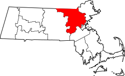
Pingryville is a village in the towns of Ayer and Littleton, Middlesex County, Massachusetts, United States. Massachusetts Route 2A and Massachusetts Route 110 pass through the community. [3] It is named after John Pingry VIII (1799-1860) who was a local farmer and deacon of the church. [4]

The community was mentioned in the song "Massachusetts" by Norwegian comedy duo Ylvis. [5]

Related Research Articles

Suffolk County, Massachusetts County in Massachusetts

Suffolk County is a county in the Commonwealth of Massachusetts, in the United States. As of 2018, the population was 807,252 making it the fourth-most populous county in Massachusetts. The traditional county seat is Boston, the state capital and the largest city in Massachusetts. The county government was abolished in late 1999, and so Suffolk County today functions only as an administrative subdivision of state government and a set of communities grouped together for some statistical purposes. Suffolk County constitutes the core of the Boston-Cambridge-Newton, MA-NH Metropolitan Statistical Area as well as the greater Boston-Worcester-Providence, MA-RI-NH-CT Combined Statistical Area.

Pingry School Private day school in Basking Ridge and Short Hills, NJ, United States

The Pingry School is a coeducational, independent, college preparatory country day school in New Jersey, with a Lower School (K-5) campus in the Short Hills neighborhood of Millburn, and a Middle (6-8) and Upper School (9-12) campus in the Basking Ridge section of Bernards Township. The school was founded in 1861 by John F. Pingry. The school has been accredited by the Middle States Association of Colleges and Schools Commission on Secondary Schools since 1998 and is considered one of the most prestigious in the state and country.

Washington State Route 119 highway in Washington

State Route 119 (SR 119) is a 10.93-mile-long (17.59 km) state highway in the U.S. state of Washington, serving Lake Cushman in Mason County within Olympic National Forest. The highway, known locally as Lake Cushman Road, travels northwest into the Olympic Mountains from U.S. Route 101 (US 101) in Hoodsport to Lake Cushman and ends at a gravel road east of the entrance to Olympic National Park on Forest Highway 24 (FFH-24). A gravel road connecting Lake Cushman to the state highway system has existed since the late 1950s and was codified into the current state highway system in 1991, prior to being completely paved by 1999.

Massachusetts Route 71 and New York State Route 71 (NY 71) are adjoining state highways in the states of Massachusetts and New York in the United States. The two highways form a continuous roadway connecting NY 22 in Hillsdale, Columbia County, New York, to Route 23 and Route 41 in Great Barrington, Berkshire County, Massachusetts. Combined, Route 71 and NY 71 extend for 7.93 miles (12.76 km) as a two-lane road through mostly rural areas in the Taconic Mountains, serving only small, unincorporated communities in both states. Both routes are part of the Henry Knox Trail.

Ylvis Norwegian comedy duo

Ylvis is a Norwegian comedy duo consisting of brothers Vegard and Bård Ylvisåker. They debuted as professional variety artists in 2000 and have since appeared in several countries in variety shows, comedy concerts, television shows, radio shows and music videos. They are currently the hosts of the Norwegian talk show I kveld med Ylvis. Their song and music video "The Fox ", written and filmed for the talk show, went viral on YouTube in September 2013. The video currently has over 912 million views as of December 2019. They released an album called Ylvis: Volume I, a compilation of ten older singles.

Amigo, West Virginia Unincorporated community in West Virginia, United States

Amigo is an unincorporated community in Raleigh County, West Virginia, United States. The community is located on West Virginia Route 16 at the confluence of the Guyandotte River and Winding Gulf. The Amigo Post Office closed on 10/22/2011, it was established in 1915 The community most likely derives its name from the Amigo Coal Company.

Tams, West Virginia Unincorporated community in West Virginia, United States

Tams is an unincorporated community in Raleigh County, West Virginia, United States. Tams is located on West Virginia Route 16 and Winding Gulf 4 miles (6.4 km) southwest of Sophia.

Ury, West Virginia Unincorporated community in West Virginia, United States

Ury is an unincorporated community in Raleigh County, West Virginia, United States. Ury is located on West Virginia Route 16 and Winding Gulf 3 miles (4.8 km) north of Rhodell.

Pardee, West Virginia Unincorporated community in West Virginia, United States

Pardee is an unincorporated community in Logan County, West Virginia, United States. Pardee is located on County Route 16 and Buffalo Creek 10.7 miles (17.2 km) east-northeast of Man.

Crites, West Virginia Unincorporated community in West Virginia, United States

Crites is an unincorporated community in Logan County, West Virginia, United States. Crites is located on County Route 16 and Buffalo Creek 7.5 miles (12.1 km) east-northeast of Man.

Beckwith, West Virginia Unincorporated community in West Virginia, United States

Beckwith is an unincorporated community in Fayette County, West Virginia, United States. Beckwith is located on West Virginia Route 16 and Laurel Creek 4.1 miles (6.6 km) northwest of Fayetteville. Beckwith had a post office, which closed on October 3, 1998. The community has the name of P. D. Beckwith.

Brownton, West Virginia Unincorporated community in West Virginia, United States

Brownton is an unincorporated community and coal town in Barbour County, West Virginia, United States. Brownton is located along County Route 16 3.35 miles (5.39 km) south-southwest of Flemington. Brownton had a post office, which closed on January 24, 2004.

Bear Mountain, West Virginia Unincorporated community in West Virginia, United States

Bear Mountain is an unincorporated community in Barbour County, West Virginia, United States. Bear Mountain is located along County Route 16 3.9 miles (6.3 km) south-southwest of Flemington.

Cuzzart, West Virginia Unincorporated community in West Virginia, United States

Cuzzart is an unincorporated community in Preston County, West Virginia, United States. Cuzzart is located at the junction of County Routes 5, 11, 20, and 28, 10.5 miles (16.9 km) northeast of Kingwood. Cuzzart had a post office, which closed on April 16, 1994.

Delano, Tennessee Unincorporated community in Tennessee, United States

Delano is an unincorporated community in Polk County, Tennessee, United States. Delano is located near the junction of U.S. Route 411, Tennessee State Route 30, and Tennessee State Route 163 4.3 miles (6.9 km) south-southwest of Etowah. Delano has a post office with ZIP code 37325, which opened on August 14, 1909.

Oldfort, Tennessee Unincorporated community in Tennessee, United States

Old Fort is an unincorporated community in Polk County, Tennessee, United States. Old Fort is located along U.S. Route 411, Tennessee State Route 33 and a CSX Transportation line 8.75 miles (14.08 km) south-southwest of Benton. Oldfort has a post office with ZIP code 37362.

Frozencamp, West Virginia Unincorporated community in West Virginia, United States

Frozencamp is an unincorporated community in Jackson County, West Virginia, United States. Frozencamp is located on Little Mill Creek at the junction of U.S. Route 33 and County Route 16, 7.2 miles (11.6 km) east of Ripley.

The Fox (What Does the Fox Say?) 2013 electronic dance novelty song and viral video by Norwegian comedy duo Ylvis

"The Fox " is an electronic dance novelty song and viral video by Norwegian comedy duo Ylvis. The top trending video of 2013 on YouTube, "The Fox" was posted on the video-sharing website on 3 September 2013, and has received over 900 million views as of December 2019. "The Fox" peaked at the top of the Norwegian Singles Chart and was hugely successful in the United States, where it peaked at number six on the Billboard Hot 100 for three consecutive weeks, and was, before the U.S. release of "Am I Wrong" by Nico & Vinz, the highest-ranked song by a Norwegian artist on the chart since A-ha's number-one song "Take On Me" in 1985.

References

  1. United States Postal Service (2012). "USPS - Look Up a ZIP Code" . Retrieved 2012-02-15.
  2. "Pingryville". Geographic Names Information System . United States Geological Survey.
  3. Massachusetts Official Transportation Map (PDF) (Map). Massachusetts Department of Transportation. 2012.
  4. Pingry, William M (1881). A genealogical record of the descendants of Moses Pengry, of Ipswich, Mass., so far as ascertained. Ludlow VT: Warner & Hyde. pp. 35–36. Retrieved 16 August 2018.
  5. Reed, James (October 23, 2013). "'Massachusetts,' new song by Ylvis, takes off, falls flat". The Boston Globe . Retrieved January 16, 2014.