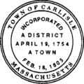
English colonists first settled the area now incorporated as the town of Carlisle in 1651 on parcels of land of the neighboring towns of Acton, Billerica, Chelmsford and Concord. Carlisle became a district of Concord in 1780 and was incorporated as a town by an act of the legislature in 1805. The town was named for Carlisle, England, the hometown of one of Carlisle's earliest settlers James Adams.[2]
Activities
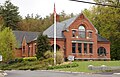
Carlisle contains a library, a book store, a dentist's office, a school (Carlisle Public School), and many residential homes. There are two ice cream stores: one of the four branches of Kimball Farms, and Great Brook Farm State Park which is home to the first robotic milking system in Massachusetts[3] and serves ice cream made from the farm's milk. Great Brook Farm is also the site of one of the premiere cross-country ski touring centers in New England.[4] On the east end of town there is an auto body shop, the (closed in 2025) Ferns Country Stores, and the (closed in 2012) Blue Jay Recording Studio, where artists such as the Platters, Aerosmith, Aimee Mann, Amy Grant, Alice Cooper, Boston, John Williams and the Boston Pops, Buckwheat Zydeco, Billy Joel, Lauryn Hill, Rihanna, Roy Orbison, k. d. lang, Pat Metheny, Yo Yo Ma, Carly Simon, the Pussycat Dolls, Genesis and Lady Gaga have recorded.[5]
The town newspaper, the Carlisle Mosquito, has appeared as the weekly independent newspaper of the town since 1972. It is a non-profit publication distributed free to all town residents. The paper includes local news, announcements, and logs.[6]
Cultural organizations include the Carlisle Chamber Orchestra,[8] the Carlisle Community Chorus,[9] and the Savoyard Light Opera Company.[10]
Carlisle Old Home Day[11] has been held for over 100 years on the weekend prior to the Fourth of July as a free public event with family-friendly games and activities.
According to the United States Census Bureau, the town has a total area of 15.5 square miles (40km2), of which 15.4 square miles (40km2) is land and 0.2 square miles (0.52km2) (1.09%) is water.
As of the census[23] of 2000, there were 4,717 people, 1,618 households, and 1,372 families residing in the town. The population density was 307.1 inhabitants per square mile (118.6/km2). There were 1,655 housing units at an average density of 107.7 per square mile (41.6/km2). The racial makeup of the town was 93.47% White, 0.17% African American, 0.06% Native American, 4.69% Asian, 0.04% Pacific Islander, 0.13% from other races, and 1.29% from two or more races. Hispanic or Latino of any race were 1.19% of the population.
There were 1,618 households, out of which 46.4% had children under the age of 18 living with them, 78.6% were married couples living together, 4.7% had a female householder with no husband present, and 15.2% were non-families. 11.4% of all households were made up of individuals, and 4.9% had someone living alone who was 65 years of age or older. The average household size was 2.92 and the average family size was 3.18.
In the town, the population was spread out, with 30.6% under the age of 18, 3.4% from 18 to 24, 23.3% from 25 to 44, 34.3% from 45 to 64, and 8.4% who were 65 years of age or older. The median age was 42 years. For every 100 females, there were 98.3 males. For every 100 females age 18 and over, there were 96.4 males.
The median income for a household in the town $176,228 (Average household income is $244,544). The per capita income for the town was $87,470.
Carlisle maintains a minimum 2-acre (8,100m2) zoning law on new development.[24]
↑"1950 Census of Population"(PDF). Bureau of the Census. 1952. Section 6, Pages 21-10 and 21-11, Massachusetts Table 6. Population of Counties by Minor Civil Divisions: 1930 to 1950. Retrieved July 12, 2011.
↑"1920 Census of Population"(PDF). Bureau of the Census. Number of Inhabitants, by Counties and Minor Civil Divisions. Pages 21-5 through 21-7. Massachusetts Table 2. Population of Counties by Minor Civil Divisions: 1920, 1910, and 1920. Retrieved July 12, 2011.
↑"1890 Census of the Population"(PDF). Department of the Interior, Census Office. Pages 179 through 182. Massachusetts Table 5. Population of States and Territories by Minor Civil Divisions: 1880 and 1890. Retrieved July 12, 2011.
↑"1870 Census of the Population"(PDF). Department of the Interior, Census Office. 1872. Pages 217 through 220. Table IX. Population of Minor Civil Divisions, &c. Massachusetts. Retrieved July 12, 2011.
↑"1860 Census"(PDF). Department of the Interior, Census Office. 1864. Pages 220 through 226. State of Massachusetts Table No. 3. Populations of Cities, Towns, &c. Retrieved July 12, 2011.
↑"1850 Census"(PDF). Department of the Interior, Census Office. 1854. Pages 338 through 393. Populations of Cities, Towns, &c. Retrieved July 12, 2011.
This page is based on this Wikipedia article Text is available under the CC BY-SA 4.0 license; additional terms may apply. Images, videos and audio are available under their respective licenses.