Amesbury, Massachusetts

Last updated

Amesbury, Massachusetts
City of Amesbury
Amesbury Town Hall.JPG
Amesbury City Hall
Seal of Amesbury, Massachusetts.png
Logo of Amesbury, Massachusetts (arched).png
Nickname: 
Carriagetown
Motto: 
"Make history here!" [1]
Essex County Massachusetts incorporated and unincorporated areas Amesbury highlighted.svg
Location in Essex County and Massachusetts
Usa edcp location map.svg
Red pog.svg
Amesbury, Massachusetts
Location in the United States
Coordinates: 42°51′30″N70°55′50″W / 42.85833°N 70.93056°W / 42.85833; -70.93056
CountryUnited States
State Massachusetts
County Essex
Settled1642
Incorporated (town)1668
Incorporated (city)1996
Government
  Type Mayor-council city
   Mayor Kassandra Gove
Area
[2]
  Total13.73 sq mi (35.57 km2)
  Land12.29 sq mi (31.84 km2)
  Water1.44 sq mi (3.73 km2)
Elevation
50 ft (15 m)
Population
 (2020)
  Total17,366
  Density1,412.79/sq mi (545.48/km2)
Time zone UTC−5 (Eastern)
  Summer (DST) UTC−4 (Eastern)
ZIP code
01913
Area code 351 / 978
FIPS code 25-01260, 25-01185
GNIS feature ID0618292
Website City of Amesbury Official Web Site

Amesbury is a city in Essex County, Massachusetts, United States, located on the left bank of the Merrimack River near its mouth, upstream from Salisbury and across the river from Newburyport and West Newbury. The population was 17,366 at the 2020 United States Census. [3] A former farming and mill town, Amesbury is today largely residential. It is one of the two northernmost towns in Massachusetts (the other being neighboring Salisbury).

Contents

History

Settlement period

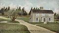
In 1637, the first English settler in the Salisbury-Amesbury region, John Bayly, crossed the Merrimack River from the new settlement at Newbury, built a log cabin, and began to clear the land for cultivation. He intended to send for his wife and children in England, but they never joined him. [4] He and his hired man, William Schooler, were arrested for a murder Schooler had committed. [4] Schooler was hanged for the murder but Bayly was acquitted. [4] Given the fishing rights on the river by the subsequent settlement, provided he would sell only to it, he abandoned agriculture for fishing. [5]

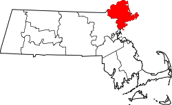
On September 6, 1638, the General Court of Massachusetts created a plantation on behalf of several petitioners from Newbury, on the left bank of the Merrimack, as far north as Hampton, to be called Merrimac. [6] [7] [8] They were given permission to associate together as a township. [8] The area remained in possession of the tribes along the Merrimack, who hunted and fished there. [8]

The settlers of the plantation, who entered Massachusetts Bay Colony, were rebels in a cause that was settled by the English Civil War (1642–1651). [9] Although nominally subjects of the crown, they did not obey it. [10] The settlers maintained close ties with the Parliamentary cause in Britain. [9] The supreme government of the colony was the General Court, which functioned autonomously, passing its own laws, establishing courts, incorporating townships and providing for the overall defense of the colony. [10] They established a Puritan church rather than the Church of England. [9]

In the early spring of 1639, approximately 60 planters took up residence on land cleared by the natives. In May, an elected planning committee laid out the green, the initial streets, the burial ground, and the first division into lots, apportioning the size of a lot to the wealth of the settler. [11] In November, the General Court appointed a government of six, which required that every lot owner take up residence on his lot. [12] They began to assign lots west of the Pow-wow river. The town was originally named Colchester, but was renamed Salisbury in October 1640, potentially at the suggestion of Christopher Batt, from Salisbury, England. [5] Batt trained the militia in the town. [5] The incorporation of the town granted it legal recognition by the colony to a township of that name, with its own government, empowered by citizens populating a territory of legally defined boundaries. [5] The original Salisbury was many times larger than the present. From it several townships were later separated. [13]

On January 12, 1641, a town meeting ordered the first roads north and west of the Pow-wow River to be built. [14] On April 21, another meeting granted William Osgood 50 acres of "upland" and 10 of "meadow" along the Pow-wow River, provided he build a sawmill for the town to use. It utilized a water wheel driven by the Pow-wow River. [14] The mill produced lumber for local use and pipe-staves for export. [14] A gristmill was added to the Pow-wow river location in 1642. [15] The Powwow River provided water power for a subsequent mill complex. [15] In 1642, the town wanted families to take up residence west of the Pow-wow and form a "New Town." No volunteers responded. [15]

In 1643, the General Court divided Massachusetts Bay Colony into four counties: Essex, Norfolk, Middlesex and Suffolk. [16] Norfolk contained Salisbury, Hampton, Haverhill, Exeter, Dover, and Strawberry Bank (Portsmouth). [16] This division was a legal convenience based on the distribution of courts. [16] Since the first establishment of four courts on March 3, 1635, the General Court had found it necessary to multiply and distribute courts, so that the magistrates would not spend time in travel that they needed for settling case loads. The main requirement for membership in a shire was incorporation. [17]

Private occupation of the west bank of the Pow-wow River went on as East Salisbury citizens sold their property and moved to New Town. [18] However, New Town remained a paper construct without enforcement. [18] On January 14, 1654, articles of agreement adopted at town meeting divided Salisbury into Old Town and New Town, each to conduct its own affairs. [18] The border was the Pow-wow. [18] The agreement went into effect on January 19, 1655. In New Town, a new government was voted in, which claimed authority over "all matters of publicke concernment." [19] They still paid taxes to Old Town and expected services from it. The board of Old Town contained some members from New Town for fair representation. [20] This agreement also was known as a "settlement".

On May 26, 1658, New Town petitioned the General Court for independent town status, but the Old Town denied the petition. [21] The Old Town required all inhabitants, including those in the New Town, to attend church in Old Town and fined settlers for each missed meeting [21] The church and preacher were maintained from taxes. [21] Minister Joseph Peasley of New Town and his congregation attempting to defy the General Court were summoned into District Court at Ipswich "to answer for their disobedience", were fined there and Peasly was enjoined from preaching. [21] Another petition for separation was denied in 1660. [22]

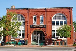
The burden of attending church several miles away became so great that New Town built a new meeting house and requested the General Court to find a preacher. [23] The court yielded to the petition of 1666, granting the "liberty of a township" to New Town. [23] The town was unofficially incorporated, meaning a government was constituted and officers elected, on June 15. [23] It was named New Salisbury, but in 1667 the name was changed to Amesbury on the analogy of Amesbury, England, which was next to Salisbury, England. [24] Amesbury was officially granted incorporation under that name on April 29, 1668. [24]

After King Phillips War (1675–1678), an effort by the natives to rid themselves of the colonists, the Royal Province of New Hampshire was created and took away several towns in northern Norfolk shire. [17] [25] Massachusetts was reduced in size from most of New England to roughly its current borders. The Court dissolved Norfolk Shire, transferring Salisbury and Amesbury to Essex County. [17]

In 1876, Merrimac was created out of West Amesbury. [26] In 1886, West Salisbury was annexed to Amesbury, unifying the mill areas on both banks of the Pow-wow River. [27]

Post-settlement

Beginning as a modest farming community, it developed a maritime and industrial economy. Shipbuilding, shipping and fishing were also important. [28] [29] The ferry across the Merrimack River to Newburyport was a business until the construction of bridges to cross the river. [30] Newton, New Hampshire, was set off from Amesbury in 1741, when the border between the two colonies was adjusted. [31] [32]

In the 19th century, textile mills were built at the falls, [29] as was a nail-making factory. [33] Beginning around 1800, Amesbury began building carriages, [34] a trade which evolved into the manufacture of automobile bodies. [35] Prominent manufacturers included Walker Body Company, Briggs Carriage Company, and Biddle and Smart. [36] [37] The industry ended with the Great Depression. [35] The Merrimac Hat Company was founded in 1856 and became one of the top hat producers in the nation. [38] Amesbury also produced Hoyt's Buffalo Brand Peanut Butter Kisses. [39]

In 1876, the town of Merrimac was set off from Amesbury. [40]

Newspapers in the 19th century included the Amesbury Daily News, Merrimac Journal, Morning Courier, Evening Courier, New England Chronicle, Transcript, and the Villager. [41] [42] Newspapers in the 20th century included the Amesbury Advocate, Amesbury News, Amesbury Times, and Leader. [42]

Twentieth century and beyond

In 1996, the town changed its status to a city, and adopted the mayor and municipal council form of government, although it retained the title "Town of Amesbury", as voters "thought Amesbury was too small and quaint to be a city". [43] Voters approved a charter amendment in November 2011 changing the city's official name to the "City of Amesbury" and removing references to the old "Town of Amesbury" name. [44] The name change took effect in March 2012. [45] The city's seal still bears the name "Town of Amesbury", although the City put forth a bill in 2013 to correct the seal with the new name. [43]

The community has several buildings that feature early architecture, particularly in the Federal and Victorian styles. [46] The "Doughboy", a memorial sculpture by Leonard Craske, stands on the front lawn of the Amesbury Middle School. [47] It was dedicated November 11, 1929. [47] Craske is best known as sculptor for the "Fishermens' Memorial" in Gloucester. [48] There is also a monument erected to Josiah Bartlett, the first signer of the Declaration of Independence, who was born in Amesbury. [49]

Geography

View northeast from Powwow Hill View from Powwow Hill, Amesbury, MA.jpg
View northeast from Powwow Hill

Amesbury is located at 42°51′29″N70°55′50″W / 42.85806°N 70.93056°W / 42.85806; -70.93056 . [50] According to the United States Census Bureau, the city has a total area of 13.7 square miles (35.5 km2), of which 12.3 square miles (31.8 km2) is land and 1.5 square miles (3.8 km2), or 10.65%, is water. [51] Amesbury is drained by the Powwow River. Powwow Hill, elevation 331 feet (101 m), is the highest point in town. Once the site of Indian gatherings, or "powwows", it has views to Maine and Cape Ann. Amesbury is the second northernmost town in Massachusetts, its northernmost point coming just south of the northernmost point of the state, in Salisbury. Amesbury lies along the northern banks of the Merrimack River and is bordered by Salisbury to the east, Newburyport to the southeast, West Newbury to the southwest, Merrimac to the west, and South Hampton, New Hampshire, to the north.

The Powwow River bisects the town, joined by the Back River near the town center. The river flows through Lake Gardner and Tuxbury Pond, which are two of several inland bodies of water in town, including Lake Attitash (which is partially in Merrimac), Meadowbrook Pond, and Pattens Pond. Several brooks also flow through the town. Amesbury has a town forest, which is connected to Woodsom Farm, as well as Powwow Conservation Area, Victoria Batchelder Park and Amesbury Golf & Country Club.

Transportation

Whittier Memorial Bridge, which conducts Route 95, a major highway, between Newburyport and Amesbury Amesbury - Whittier View 1.JPG
Whittier Memorial Bridge, which conducts Route 95, a major highway, between Newburyport and Amesbury

Amesbury is served by two interstate highways. Interstate 495 runs from west to east through town, ending at Interstate 95 just over the Salisbury town line. It has two exits in town, Exit 54 at Massachusetts Route 150 (which lies entirely within Amesbury, and leads to New Hampshire Route 150) and Exit 55 at Massachusetts Route 110, which also provides the town's only direct access to Interstate 95 at Exit 58. I-95 crosses the southeast corner of town, entering along the John Greenleaf Whittier Memorial Bridge, a steel through-truss bridge crossing the Merrimack River. The Whittier Memorial Bridge lies just west of the town's only other bridges across the Merrimack, the Derek S. Hines Memorial Bridge, which connects Amesbury to Deer Island (which is still part of Amesbury), and the Chain Bridge, the only suspension bridge in Massachusetts, which spans from Deer Island to Newburyport. The current version was built in 1909, but was predated by the 1810 suspension bridge, one of the oldest suspension bridges in the country. The Chain Bridge and its counterparts over the years have been the main entryways into town across the Merrimack, and until the building of the Newburyport Turnpike Bridge, it was the easternmost bridge on the Merrimack River.

MVRTA provides bus service in Amesbury. Route 51 connects to the Haverhill train station. Route 54 connects to Newburyport train station.

Historical population
YearPop.±%
1840 2,471    
1850 3,143+27.2%
1860 3,877+23.4%
1870 5,581+44.0%
1880 3,355−39.9%
1890 9,798+192.0%
1900 9,473−3.3%
1910 9,894+4.4%
1920 10,036+1.4%
1930 11,899+18.6%
1940 10,862−8.7%
1950 10,851−0.1%
1960 10,787−0.6%
1970 11,388+5.6%
1980 13,971+22.7%
1990 14,997+7.3%
2000 16,450+9.7%
2010 16,283−1.0%
2020 17,366+6.7%
2022*17,179−1.1%
* population estimate.
Source: United States census records and Population Estimates Program data. [52] [53] [54] [55] [56] [57] [58] [59] [60] [61] [62]
Source:
U.S. Decennial Census [63]

Government

Amesbury is part of the Massachusetts Senate's 1st Essex district. [64]

Demographics

Main Street from Market Square in 1911 Main Street from Market Square, Amesbury, MA.jpg
Main Street from Market Square in 1911
Lowell's Boat Shop Lowell's Boat Shop, Amesbury MA.jpg
Lowell's Boat Shop

As of the census of 2000, there were 16,450 people, 6,380 households, and 4,229 families residing in the city. [65] The population density was 1,326.3 inhabitants per square mile (512.1/km2). There were 6,623 housing units at an average density of 206.2 persons/km2 (534.0 persons/sq mi). The racial makeup of the city was 97.2% White, 0.6% African American, 0.22% Native American, 0.9% of the population were Hispanic or Latino of any race.

There were 6,380 households, out of which 34.5% had children under the age of 18 living with them, 51.2% were married couples living together, 11.3% have a woman whose husband does not live with her, and 33.7% were non-families. 26.8% of all households were made up of individuals, and 8.9% had someone living alone who was 65 years of age or older. The average household size was 2.52 and the average family size was 3.09.

In the city, the population was spread out, with 26.1% under the age of 18, 6.1% from 18 to 24, 33.8% from 25 to 44, 22.0% from 45 to 64, and 12.0% who were 65 years of age or older. The median age was 37 years. For every 100 females, there were 93.1 males. For every 100 females age 18 and over, there were 89.7 males.

The median income for a household in the city was $34,906, and the median income for a family was $62,875. Males had a median income of $25,489 versus $31,968 for females. The per capita income for the city was $23,103. 5.9% of the population and 3.9% of families were below the poverty line.

Education

The major educational institutions are:

In 2023, the Amesbury Elementary School closed following the construction of the Shay Memorial School, built on the same property as the Cashman Elementary School. Prior to this, both Amesbury Elementary School and Cashman Elementary School housed K-4 students, with students attending whichever school they lived closer to. Beginning in the 2024-2025 school year, all K-5 students were housed on the same property and divided by age between the Shay Memorial Lower Elementary School and the preexisting Cashman Elementary School.

Amesbury's high school football rival is Newburyport; the two teams play against each other every Thanksgiving Day. The Amesbury mascot is "Red Hawks," formerly the "Indians." [66] [67]

Public library

As of 2012, the Amesbury Public Library pays for access to information resources produced by Brainfuse, Cengage Learning, EBSCO Industries, LearningExpress, Library Ideas, Mango Languages, NewsBank, Online Computer Library Center (OCLC), ProQuest, TumbleBook Library, World Book of Berkshire Hathaway, and World Trade Press. [68]

The Public Library houses an extensive Local History and genealogy collection which is open and available for research. [69]

Points of interest

Notable people

International relations

Twin towns – Sister cities

Amesbury is twinned with:

See also

Related Research Articles

<span class="mw-page-title-main">Essex County, Massachusetts</span> County in Massachusetts, United States

Essex County is a county in the northeastern part of the U.S. state of Massachusetts. At the 2020 census, the total population was 809,829, making it the third-most populous county in the state, and the seventy-eighth-most populous in the country. It is part of the Greater Boston area. The largest city in Essex County is Lynn. The county was named after the English county of Essex. It has two traditional county seats: Salem and Lawrence. Prior to the dissolution of the county government in 1999, Salem had jurisdiction over the Southern Essex District, and Lawrence had jurisdiction over the Northern Essex District, but currently these cities do not function as seats of government. However, the county and the districts remain as administrative regions recognized by various governmental agencies, which gathered vital statistics or disposed of judicial case loads under these geographic subdivisions, and are required to keep the records based on them. The county has been designated the Essex National Heritage Area by the National Park Service.

<span class="mw-page-title-main">Lawrence, Massachusetts</span> City in Massachusetts, United States

Lawrence is a city located in Essex County, Massachusetts, United States, on the Merrimack River. At the 2020 census, the city had a population of 89,143. Surrounding communities include Methuen to the north, Andover to the southwest, and North Andover to the east. Lawrence and Salem were the county seats of Essex County, until the state abolished county government in 1999. Lawrence is part of the Merrimack Valley.

<span class="mw-page-title-main">Merrimac, Massachusetts</span> Town in Massachusetts, United States

Merrimac is a small town in Essex County, Massachusetts, United States, and on the southeastern border of New Hampshire, approximately 34 miles (55 km) northeast of Boston and 10 miles (16 km) west of the Atlantic Ocean. It was incorporated on April 11, 1876. It is situated along the north bank of the Merrimack River in the Merrimack Valley. The population was 6,723 at the 2020 census. Historically a mill town, it has long since become a largely residential community. It is part of the Greater Boston metropolitan area.

<span class="mw-page-title-main">Newbury, Massachusetts</span> Town in Massachusetts, United States

Newbury is a town in Essex County, Massachusetts, USA. The population was 6,716 at the 2020 census. Newbury includes the villages of Old Town, Plum Island and Byfield. Each village is a precinct with its own voting district, various town offices, and business center.

<span class="mw-page-title-main">Newburyport, Massachusetts</span> City in Massachusetts, United States

Newburyport is a coastal city in Essex County, Massachusetts, United States, 35 miles (56 km) northeast of Boston. The population was 18,289 at the 2020 census. A historic seaport with a vibrant tourism industry, Newburyport includes part of Plum Island. The mooring, winter storage, and maintenance of recreational boats, motor and sail, still contribute a large part of the city's income. A Coast Guard station oversees boating activity, especially in the sometimes dangerous tidal currents of the Merrimack River.

<span class="mw-page-title-main">West Newbury, Massachusetts</span> Town in Massachusetts, United States

West Newbury is a town in Essex County, Massachusetts, United States. Situated on the Merrimack River, its population was 4,500 at the 2020 census.

<span class="mw-page-title-main">Newton, New Hampshire</span> Place in New Hampshire, United States

Newton is a town in Rockingham County, New Hampshire, United States. The population was 4,820 at the 2020 census.

<span class="mw-page-title-main">South Hampton, New Hampshire</span> Town in New Hampshire, United States

South Hampton is a town in Rockingham County, New Hampshire, United States. The population was 894 at the 2020 census. South Hampton is home to Cowden State Forest and Powwow River State Forest.

<span class="mw-page-title-main">Merrimack River</span> River in New Hampshire and Massachusetts, United States

The Merrimack River is a 117-mile-long (188 km) river in the northeastern United States. It rises at the confluence of the Pemigewasset and Winnipesaukee rivers in Franklin, New Hampshire, flows southward into Massachusetts, and then flows northeast until it empties into the Gulf of Maine at Newburyport. From Pawtucket Falls in Lowell, Massachusetts, onward, the Massachusetts–New Hampshire border is roughly calculated as the line three miles north of the river.

<span class="mw-page-title-main">Salisbury, Massachusetts</span> Town in Massachusetts, United States

Salisbury is a small coastal beach town and summer tourist destination in Essex County, Massachusetts, United States. The community is a popular summer resort beach town situated on the Atlantic Ocean, north of Boston on the New Hampshire border. It is home to the new Salisbury Beach Boardwalk, full of souvenir shops, restaurants, cafes, arcades and panoramic views of the Atlantic Ocean. The population was 9,236 at the 2020 census. Parts of town comprise the census-designated place of Salisbury.

Amesbury High School is a coeducational public high school in the city of Amesbury, Massachusetts, serving as the primary high school for students from Amesbury and, South Hampton, New Hampshire, along with also drawing some students from other parts of the lower Merrimack Valley region.

<span class="mw-page-title-main">North Shore (Massachusetts)</span> Region of Massachusetts in the United States

The North Shore is a region in the U.S. state of Massachusetts, loosely defined as the sea coast between Boston and New Hampshire. Its counterpart is the South Shore region extending south and east of Boston.

<span class="mw-page-title-main">Massachusetts's 6th congressional district</span> U.S. House district for Massachusetts

Massachusetts's 6th congressional district is located in northeastern Massachusetts. It contains most of Essex County, including the North Shore and Cape Ann, as well as part of Middlesex County. It is represented by Seth Moulton, who has represented the district since January 2015. The shape of the district went through minor changes effective from the elections of 2012 after Massachusetts congressional redistricting to reflect the 2010 census. The towns of Tewksbury and Billerica were added, along with a small portion of the town of Andover.

<span class="mw-page-title-main">Maudslay State Park</span> Massachusetts state park located in Newburyport

Maudslay State Park is a Massachusetts state park located in Newburyport. The park is managed by the Department of Conservation and Recreation. It is available for weddings and other programs.

The Back River is a 6.5-mile-long (10.5 km) river located in New Hampshire and Massachusetts in the United States. It is a tributary to the Powwow River, part of the Merrimack River watershed. Approximately 3.0 miles (4.8 km) of the river are in New Hampshire, with the remaining 3.5 miles (5.6 km) in Massachusetts.

<span class="mw-page-title-main">Merrimack Valley Transit</span> Regional public transportation system in Northeastern Massachusetts

Merrimack Valley Transit, formerly known as Merrimack Valley Regional Transit Authority is a public, non-profit organization in Massachusetts, United States, charged with providing public transportation to an area consisting of the cities and towns of Amesbury, Andover, Boxford, Georgetown, Groveland, Haverhill, Lawrence, Merrimac, Methuen, Newbury, Newburyport, North Andover, Rowley, Salisbury and West Newbury, as well as a seasonal service to the popular nearby summer destination of Hampton Beach, New Hampshire.

<span class="mw-page-title-main">Chain Bridge (Massachusetts)</span> Bridge in Newburyport, Massachusetts

The Chain Bridge in Newburyport, Massachusetts, is a "look-alike" replica built in 1910 to replace the "first suspension bridge" constructed in the United States in 1810. Since the current structure is one of a series of bridges at this location since 1793, it is "the oldest continually occupied, long span, bridge crossing" in the US. It has also been called the Essex-Merrimac Bridge or Newburyport Chain Bridge.

<span class="mw-page-title-main">Merrimack Valley</span> Region in the U.S. states of New Hampshire and Massachusetts

The Merrimack Valley is a bi-state region along the Merrimack River in the U.S. states of New Hampshire and Massachusetts. The Merrimack is one of the larger waterways in New England and has helped to define the livelihood and culture of those living along it for millennia.

Fort Nichols was a fort that existed in 1775 in Amesbury, Massachusetts during the American Revolutionary War. It was also known as Fort Merrimac during its existence. Two possible locations for the fort exist. One is a location named Salisbury Point on modern topographic maps, where Interstate 95 crosses the Merrimack River; this is the location of the coordinates given. Another possibility is the mouth of the Merrimack at Salisbury Beach in Salisbury. One source (Heitman) states that the American Civil War Fort at Salisbury Point was built at the same location as Fort Nichols, which is given as "at Salisbury Point, opposite Newburyport". The Civil War fort was sometimes referred to as Fort Nichols by local civilians.

<span class="mw-page-title-main">Massachusetts House of Representatives' 1st Essex district</span> American legislative district

Massachusetts House of Representatives' 1st Essex district in the United States is one of 160 legislative districts included in the lower house of the Massachusetts General Court. It covers part of Essex County. Republican James Kelcourse of Amesbury served the district from 2015-2022. Following Kelcourse's resignation in late-June 2022, the seat remained vacant until the election of Democrat Dawne Shand of Newburyport. Rep. Shand took office on January 4, 2023.

References

  1. "City of Amesbury Brand Guidelines". amesburyma.gov. Retrieved February 25, 2024.
  2. "2020 U.S. Gazetteer Files". United States Census Bureau. Retrieved May 21, 2022.
  3. ""Census - Geography Profile: Amesbury Town city, Massachusetts"". United States Census Bureau. Retrieved September 25, 2021.
  4. 1 2 3 Merrill 1880 , pp. 6–7.
  5. 1 2 3 4 Merrill 1880 , p. 22
  6. Ryder, Jill (March 1, 2003). The Carriage Journal: Vol 40 No 2 March 2002. Carriage Assoc. of America. p. 57.
  7. The New England Historical and Genealogical Register,: Volume 46 1892. Heritage Books. June 1997. p. 160. ISBN   978-0-7884-0651-5.
  8. 1 2 3 Merrill 1880 , pp. 8.
  9. 1 2 3 Massachusetts., Colonial Society of (1980). Seafaring in colonial Massachusetts : a conference held by the Colonial Society of Massachusetts, November 21 and 22, 1975. The Society. p. 17. OCLC   7321509.
  10. 1 2 Barnes, Viola Florence (1923). The Dominion of New England. Yale University Press. pp. 6–7.
  11. Merrill 1880 , pp. 9–10.
  12. Merrill 1880 , pp. 10–14
  13. Arrington 1922 , p. 17.
  14. 1 2 3 Merrill 1880 , pp. 18–20.
  15. 1 2 3 Merrill 1880 , pp. 22–25.
  16. 1 2 3 Merrill 1880 , pp. 28–29.
  17. 1 2 3 Arrington 1922 , pp. 41–43.
  18. 1 2 3 4 Merrill 1880 , pp. 50–51.
  19. Merrill 1880 , p. 54.
  20. Merrill 1880 , p. 56.
  21. 1 2 3 4 Merrill 1880 , pp. 60–61.
  22. Merrill 1880 , pp. 74–75.
  23. 1 2 3 Merrill 1880 , pp. 84–86
  24. 1 2 Merrill 1880 , pp. 90–92.
  25. "On July 24, 1679, New Hampshire became..." Chicago Tribune . July 24, 1986.
  26. Leonard-Solis, Liam (July 24, 2015). "Merrimac asks to add Town Hall to national historic register". The Daily News of Newburyport. Archived from the original on July 15, 2021. Retrieved July 15, 2021.
  27. Court, Massachusetts General (1887). A Manual for the Use of the General Court. p. 112.
  28. Brown, Nell Porter (June 16, 2015). "Dedicated to Craft". Harvard Magazine. Retrieved July 15, 2021.
  29. 1 2 "Exploring Historic Amesbury, Massachusetts". New England Today. February 12, 2020. Retrieved July 15, 2021.
  30. Callahan, Joe (August 11, 2016). "George Carr, pioneer in local ferry industry". The Daily News of Newburyport. Archived from the original on July 15, 2021. Retrieved July 15, 2021.
  31. Suneson, Grant; Harrington, John. "From Alabama to Wyoming, this is how each state got its shape". USA TODAY. Archived from the original on April 10, 2021. Retrieved July 15, 2021.
  32. Merrill 1880 , p. 164
  33. Rockdale: The Growth of an American Village in the Early Industrial Revolution. U of Nebraska Press. January 1, 2005. p. 208. ISBN   978-0-8032-9853-8.
  34. Merrill 1880 , pp. 315–316
  35. 1 2 "Travel: Amesbury". Northshore Magazine. January 24, 2013. Retrieved July 15, 2021.
  36. Berry, Melissa (March 28, 2015). "Booming carriage industry brought Amesbury prominence". The Daily News of Newburyport. Archived from the original on March 2, 2021. Retrieved July 15, 2021.
  37. Sullivan, Jim (June 30, 2018). "Antiques to highlight Amesbury car show". The Daily News of Newburyport. Archived from the original on June 30, 2018. Retrieved July 15, 2021.
  38. "Hats off to a bygone era". Boston.com. Archived from the original on April 18, 2016. Retrieved July 15, 2021.
  39. Lockwood, J. C. "Little city, big history: Author looks at Amesbury's industrial past". Wicked Local. Retrieved July 15, 2021.
  40. Ryder, Jill (March 1, 2003). The Carriage Journal: Vol 40 No 2 March 2002. Carriage Assoc. of America. p. 59.
  41. Rowell's American Newspaper Directory. NY: Printers' Ink Pub. Co. 1909. Retrieved May 13, 2012.
  42. 1 2 Boston Public Library, Microtext Department. "Massachusetts Newspapers" (PDF). Newspapers on Microfilm. Archived from the original on June 25, 2003. Retrieved May 13, 2012.
  43. 1 2 Cerullo, Mac (January 8, 2013). "Putting the seal on 'City of Amesbury'". Newburyport News.
  44. Laidler, John (November 13, 2011). "Incumbent mayors all keep seats". The Boston Globe. Archived from the original on December 3, 2016.
  45. "Town becomes a city on March 20". February 28, 2012. Archived from the original on August 11, 2023.
  46. Editorial Staff (January 1, 2008). Massachusetts Historic Places Dictionary: Barnstable County-middlesex County/ Nantucket County-worcester County. State History Publications. ISBN   978-1-878592-67-5.
  47. 1 2 Rogers, Dave (May 19, 2014). "Amesbury gathers for rededication of Doughboy". The Daily News of Newburyport. Archived from the original on July 15, 2021. Retrieved July 15, 2021.
  48. "Doughboy statue to be rededicated - The Boston Globe". BostonGlobe.com. Archived from the original on May 23, 2014. Retrieved July 15, 2021.
  49. "A GREAT DAY FOR AMESBURY.; THE STATUE OF JOSIAH BARTLETT TO BE UNVEILED". The New York Times. July 4, 1888. ISSN   0362-4331 . Retrieved July 15, 2021.
  50. "US Gazetteer files: 2010, 2000, and 1990". United States Census Bureau. February 12, 2011. Retrieved April 23, 2011.
  51. "Geographic Identifiers: 2010 Demographic Profile Data (G001): Amesbury Town city, Massachusetts". United States Census Bureau . Retrieved August 30, 2012.
  52. "Total Population (P1), 2010 Census Summary File 1". American FactFinder, All County Subdivisions within Massachusetts. United States Census Bureau. 2010.
  53. "Massachusetts by Place and County Subdivision - GCT-T1. Population Estimates". United States Census Bureau. Retrieved July 12, 2011.
  54. "1990 Census of Population, General Population Characteristics: Massachusetts" (PDF). US Census Bureau. December 1990. Table 76: General Characteristics of Persons, Households, and Families: 1990. 1990 CP-1-23. Retrieved July 12, 2011.
  55. "1980 Census of the Population, Number of Inhabitants: Massachusetts" (PDF). US Census Bureau. December 1981. Table 4. Populations of County Subdivisions: 1960 to 1980. PC80-1-A23. Retrieved July 12, 2011.
  56. "1950 Census of Population" (PDF). Bureau of the Census. 1952. Section 6, Pages 21-10 and 21-11, Massachusetts Table 6. Population of Counties by Minor Civil Divisions: 1930 to 1950. Retrieved July 12, 2011.
  57. "1920 Census of Population" (PDF). Bureau of the Census. Number of Inhabitants, by Counties and Minor Civil Divisions. Pages 21-5 through 21-7. Massachusetts Table 2. Population of Counties by Minor Civil Divisions: 1920, 1910, and 1920. Retrieved July 12, 2011.
  58. "1890 Census of the Population" (PDF). Department of the Interior, Census Office. Pages 179 through 182. Massachusetts Table 5. Population of States and Territories by Minor Civil Divisions: 1880 and 1890. Retrieved July 12, 2011.
  59. "1870 Census of the Population" (PDF). Department of the Interior, Census Office. 1872. Pages 217 through 220. Table IX. Population of Minor Civil Divisions, &c. Massachusetts. Retrieved July 12, 2011.
  60. "1860 Census" (PDF). Department of the Interior, Census Office. 1864. Pages 220 through 226. State of Massachusetts Table No. 3. Populations of Cities, Towns, &c. Retrieved July 12, 2011.
  61. "1850 Census" (PDF). Department of the Interior, Census Office. 1854. Pages 338 through 393. Populations of Cities, Towns, &c. Retrieved July 12, 2011.
  62. "City and Town Population Totals: 2020−2022". United States Census Bureau . Retrieved November 24, 2023.
  63. "Census of Population and Housing". Census.gov. Retrieved June 4, 2015.
  64. Massachusetts General Court, "An Act Establishing Executive Councillor and Senatorial Districts", Session Laws: Acts (2011), retrieved April 15, 2020
  65. Census 2000 Archived February 12, 2020, at archive.today
  66. Kyle, Gaudet (December 6, 2022). "Amesbury picks 'Red Hawks' as new nickname". Newburyport Daily News. Retrieved March 16, 2023.
  67. "These Massachusetts schools still have Native American themed nicknames, mascots, or logos". February 16, 2017.
  68. Amesbury Public Library. "Downloads & Databases" . Retrieved May 13, 2012.
  69. Amesbury Public Library. "Local History" . Retrieved February 27, 2013.
  70. "James Henry Bannon". Baseball-Reference.com. Retrieved January 16, 2014.
  71. "Josiah Bartlett". Independence Hall Association. Archived from the original on February 13, 2014. Retrieved January 16, 2014.
  72. "BLAISDELL, Daniel, (1762 - 1833)". Biographical Directory of the United States Congress. Retrieved January 16, 2014.
  73. "Currier & Ives - The History of the Firm". The Currier and Ives Foundation. Retrieved January 16, 2014.
  74. "Jeffrey Donovan 'Burns' hot". Miami Herald. Archived from the original on October 4, 2013. Retrieved January 16, 2014.
  75. "AMESBURY, MASSACHUSETTS". Longyear Museum. Archived from the original on August 25, 2014. Retrieved January 16, 2014.
  76. Fagan, Deirdre J. (2007). Critical Companion to Robert Frost: A Literary Reference to His Life and Wor. Infobase Publishing. p. 412. ISBN   9781438108544.
  77. "Susannah Martin: Accused Witch from Salisbury". History of Massachusetts. February 14, 2012. Retrieved January 16, 2014.
  78. Basic Books, Editors Of Perseus Publishing (2003). Movers and Shakers: The 100 Most Influential Figures in Modern Business. Basic Books. p. 266. ISBN   9780738209142.{{cite book}}: |last= has generic name (help)
  79. "Harriet Elizabeth Prescott Spofford Collection". Five College Archives & Manuscripts Collections. Retrieved January 16, 2014.
  80. "WINGATE, Paine, (1739 - 1838)". Biographical Directory of the United States Congress. Retrieved January 16, 2014.
  81. "Tour the Home". Whittier Home Association. Retrieved January 16, 2014.
  82. "Sister Cities | AMESBURY for AFRICA". amesburyforafrica.org. Retrieved March 27, 2017.

Publications

Books and articles

Maps