Georgetown was originally settled in 1639 as a part of the town of Rowley by the Reverend Ezekiel Rogers. The town at the time stretched from the Atlantic coast to the Merrimack River, south of Newbury and north of Ipswich. Several farmers, finding suitable meadowlands in the western half of the settlement, began settling along the Penn Brook by the middle of the seventeenth century, creating Rowley's West Parish. Though not directly involved in King Philip's War, the village nonetheless did become a victim of Indian raids. The village, which became known as New Rowley, grew for many years, with small mills and eventually a shoe company opening up in the town. By 1838, the town was sufficiently large enough for its own incorporation, and was renamed Georgetown. Small industry continued, and today the town is mostly residential in nature, a distant suburb of Boston's North Shore.[2]
Geography
According to the United States Census Bureau, the town has a total area of 13.2 square miles (34.1km2), of which 12.9 square miles (33.3km2) is land and 0.31 square miles (0.8km2), or 2.20%, is water.[3] Georgetown is located on the edge of the hills and coastal plain of northeastern Massachusetts. It has many streams and brooks, as well as two major ponds, Rock Pond and Pentucket Pond. The town has several areas of protected land, including the Georgetown-Rowley State Forest to the south, the Crane Pond Wildlife Management Area to the north, the Lufkins Brook Area to the west, and a small portion of the Boxford State Forest in the southwest.
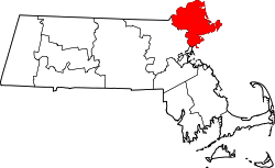
Georgetown is located approximately 10 miles (16km) east of Lawrence, 11 miles (18km) south-southwest of Newburyport, and 28 miles (45km) north of Boston, north of the center of Essex County. It is bordered by Groveland to the northwest, Newbury to the northeast, Rowley to the southeast, and Boxford to the southwest. Interstate 95 crosses through the eastern half of town, with one exit within the town, at Route 133. Route 133 crosses from east to west through town, with Route 97 crossing from northwest to south. Both state routes share a short stretch of road near the town center. The town has no mass transit; the nearest rail service can be found along the Newburyport/Rockport Line of the MBTA Commuter Rail in Rowley. The nearest air service is at Logan International Airport.
As of the census[15] of 2010, there were 8,183 people, 2,937 households, and 2,290 families residing in the town. The population density was 619.9 inhabitants per square mile (239.3/km2). There were 3,044 housing units at an average density of 230.6 per square mile (89.0/km2). The racial makeup of the town was 96.9% White, 0.5% Black or African American, 0.2% American Indian and Alaska Native, 0.9% Asian, 0.3% from other races, and 1.2% from two or more races. Hispanic or Latino of any race were 1.7% of the population.
There were 2,937 households, out of which 40.9% had children under the age of 18 living with them, 66.9% were married families, 3.1% had a male householder with no wife present, 8.0% had a female householder with no husband present, and 22.0% were non-families. Of all households, 17.8% were made up of individuals, and 7.7% had someone living alone who was 65 years of age or older. The average household size was 2.78 and the average family size was 3.18.
In the town, the population was spread out, with 27.0% under the age of 18, 5.4% from 18 to 24, 23.4% from 25 to 44, 33.0% from 45 to 64, and 11.3% who were 65 years of age or older. The median age was 41.8 years. For every 100 females, there were 97.5 males. For every 100 females age 18 and over, there were 93.8 males.
According to the 2010 census the median income for a household in the town was $108,137, and in 2008 the median income for a family was $79,649. Males had a median income of $58,806 versus $36,108 for females. The per capita income for the town was $28,846. About 2.7% of families and 4.2% of the population were below the poverty line, including 3.8% of those under age 18 and 5.5% of those age 65 or over.
Government
Town offices
Georgetown employs the open town meeting form of government, and is led by a board of selectmen and a town administrator. The current board of selectmen consist of Amy Smith (Chair), Douglas Dawes, Daryle J. LaMonica, Rachel Bancroft, and Robert Hoover (Clerk).[16] Georgetown has its own police department, two fire stations (Central Station in downtown and Erie Station in the Northern sector of town), a post office, library, electric department and highway department. The nearest hospitals to the town are in Haverhill, Newburyport and Beverly.
Georgetown, unlike its neighboring municipalities, has its own municipal school district, and is not part of a regional school association or district. Georgetown has two (formerly three) schools:
Penn Brook Elementary School is an elementary school on Elm Street in Georgetown for grades preschool–5.
Georgetown Middle-High School is the only high school/middle school in the town and serves grades 6–12.
The "Old Nancy" cannon, a relic of the Revolutionary War, may be viewed at the Town Hall.[19]
Union Cemetery. Cuffee Dole, an African-American man, was buried on the outskirts of the cemetery, but as it grew his plot became more centrally located.
Georgetown Peabody Library is the town's only public library and named for the noted philanthropist George Peabody who provided the funds to build the library to honor his mother. Peabody provided the funds necessary for the building of the Peabody Institute Libraries in Danvers and Peabody, as well Georgetown (Washington, D.C.), Baltimore, Thetford, Austin and others. He funded the establishment of the Peabody Museums at Harvard and Yale and in Salem. The Georgetown Peabody Library finished an addition and renovation in September 2007.
↑"1950 Census of Population"(PDF). Bureau of the Census. 1952. Section 6, Pages 21-10 and 21-11, Massachusetts Table 6. Population of Counties by Minor Civil Divisions: 1930 to 1950. Retrieved July 12, 2011.
↑"1920 Census of Population"(PDF). Bureau of the Census. Number of Inhabitants, by Counties and Minor Civil Divisions. Pages 21-5 through 21-7. Massachusetts Table 2. Population of Counties by Minor Civil Divisions: 1920, 1910, and 1920. Retrieved July 12, 2011.
↑"1890 Census of the Population"(PDF). Department of the Interior, Census Office. Pages 179 through 182. Massachusetts Table 5. Population of States and Territories by Minor Civil Divisions: 1880 and 1890. Retrieved July 12, 2011.
↑"1870 Census of the Population"(PDF). Department of the Interior, Census Office. 1872. Pages 217 through 220. Table IX. Population of Minor Civil Divisions, &c. Massachusetts. Retrieved July 12, 2011.
↑"1860 Census"(PDF). Department of the Interior, Census Office. 1864. Pages 220 through 226. State of Massachusetts Table No. 3. Populations of Cities, Towns, &c. Retrieved July 12, 2011.
↑"1850 Census"(PDF). Department of the Interior, Census Office. 1854. Pages 338 through 393. Populations of Cities, Towns, &c. Retrieved July 12, 2011.
This page is based on this Wikipedia article Text is available under the CC BY-SA 4.0 license; additional terms may apply. Images, videos and audio are available under their respective licenses.


