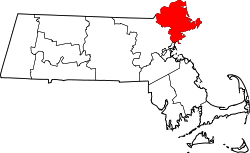
Merrimacport, Massachusetts

Last updated
Merrimacport
Merrimacport United Methodist Church, Merrimacport MA.jpg
Merrimacport United Methodist Church
USA Massachusetts location map.svg
Red pog.svg
Merrimacport
Coordinates: 42°49′40″N70°59′18″W / 42.82778°N 70.98833°W / 42.82778; -70.98833 Coordinates: 42°49′40″N70°59′18″W / 42.82778°N 70.98833°W / 42.82778; -70.98833
Country United States
State Massachusetts
County Essex
town Merrimac, Massachusetts
Time zone UTC-5 (Eastern)
Zip Code
01860

Merrimacport is an unincorporated village and the oldest section of the town of Merrimac, Massachusetts, located along the Merrimack River.

Settled in 1638, it began as a fishing village and was long a part of the section of Amesbury, Massachusetts known as West Amesbury. During the Industrial Revolution, a nearby village developed around the newly formed Merrimac square. In 1876, West Amesbury, including Merrimacport (aka: South Amesbury), split from Amesbury, incorporating itself as the town of Merrimac.

Merrimacport is divided from the rest of Merrimac by Interstate 495. It goes from the Southern Border of Amesbury to Locust Street.


Related Research Articles

Essex County, Massachusetts County in Massachusetts

Essex County is a county in the northeastern part of the U.S. state of Massachusetts. As of the 2010 census, the total population was 743,159, making it the third-most populous county in the state. It is part of the Greater Boston area. The largest city in Essex County is Lynn. The county was named after the English county of Essex.

Merrimac, Massachusetts Town in Massachusetts, United States

Merrimac is a small town in Essex County, Massachusetts, United States, and on the southeastern border of New Hampshire, approximately 34 miles (55 km) northeast of Boston and 10 miles (16 km) west of the Atlantic Ocean. It was incorporated on April 11, 1876. It is situated along the north bank of the Merrimack River in the Merrimack Valley. The population was 6,338 at the 2010 census. Historically a manufacturing center, it has long since become a largely residential community. It is part of the Greater Boston metropolitan area.

Newton, New Hampshire Place in New Hampshire, United States

Newton is a town in Rockingham County, New Hampshire, United States. The population was 4,603 at the 2010 census.

Merrimack River river in New Hampshire and Massachusetts, United States

The Merrimack River is a 117-mile-long (188 km) river in the northeastern United States. It rises at the confluence of the Pemigewasset and Winnipesaukee rivers in Franklin, New Hampshire, flows southward into Massachusetts, and then flows northeast until it empties into the Gulf of Maine at Newburyport. From Pawtucket Falls in Lowell, Massachusetts, onward, the Massachusetts–New Hampshire border is roughly calculated as the line three miles north of the river.

Amesbury, Massachusetts City in Massachusetts, United States

Amesbury is a city in Essex County, Massachusetts, located on the left bank of the Merrimack River near its mouth, upstream from Salisbury and across the river from Newburyport and West Newbury. The population was 16,283 at the 2010 census. A former farming and mill town, Amesbury is today largely residential. It is one of the two northernmost towns in Massachusetts.

Merrimac may refer to:

Ephraim Morse American businessman

Ephraim W. Morse was an early settler of the city of San Diego, and was partially responsible for many of its expansions as a city, such as attracting the Atchison, Topeka and Santa Fe Railway and proposing Balboa Park.

Lake Attitash lake of the United States of America

Lake Attitash is a lake located on the border of Merrimac, Massachusetts and Amesbury, Massachusetts, and constitutes at least a portion of Amesbury's water supply.

Route 110 is a 69.24-mile-long (111.43 km) southwest–northeast state highway in Massachusetts. The route travels from Route 12 in West Boylston in Central Massachusetts to U.S. Route 1 and Route 1A in Salisbury near the coast. Route 110 is paralleled by Interstate 495 (I-495) for most of its length, and interchanges with the freeway several times along its journey.

Massachusettss 6th congressional district U.S. House district in northeastern Massachusetts

Massachusetts's 6th congressional district is located in northeastern Massachusetts. It contains most of Essex County, including the North Shore and Cape Ann, as well as part of Middlesex County. It is represented by Seth Moulton, who has represented the district since January 2015. The shape of the district went through minor changes effective from the elections of 2012 after Massachusetts congressional redistricting to reflect the 2010 census. The towns of Tewksbury and Billerica were added, along with a small portion of the town of Andover.

The Jewish Journal is an independent, community-sponsored Jewish newspaper serving the Jewish community of Essex County, Massachusetts north of Boston, and published bi-weekly on Fridays since 1976. It is managed by a Board of Overseers representing points of view of the entire Jewish community.

George W. Weymouth American politician from Massachusetts.

George Warren Weymouth was a U.S. Representative from Massachusetts.

The Daily News of Newburyport is an American daily newspaper covering northeastern Essex County, Massachusetts, USA. The newspaper is published Monday through Saturday mornings by North of Boston Media Group, a subsidiary of Community Newspaper Holdings Inc.

Merrimack Valley Regional Transit Authority

The Merrimack Valley Regional Transit Authority (MVRTA) is a public, non-profit organization in Massachusetts, United States, charged with providing public transportation to an area consisting of the cities and towns of Amesbury, Andover, Boxford, Georgetown, Groveland, Haverhill, Lawrence, Merrimac, Methuen, Newbury, Newburyport, North Andover, Rowley, Salisbury and West Newbury, as well as a seasonal service to the popular nearby summer destination of Hampton Beach, New Hampshire.

Newton Junction, New Hampshire Unincorporated community in New Hampshire, United States

Newton Junction is an unincorporated community in the town of Newton in Rockingham County, New Hampshire. It is located in the western portion of Newton, between the main portion of Newton and South Kingston.

West Amesbury Branch Railroad

The West Amesbury Branch Railroad was a railroad line between Newton Junction, New Hampshire, and Merrimac, Massachusetts. It opened in 1873 and was immediately leased by the connecting Boston and Maine Railroad. Passenger service on the branch ended in 1927; freight service continued until the 1972 abandonment of the line.

Fort Nichols was a fort that existed in 1775 in Amesbury, Massachusetts. It was also known as Fort Merrimac during its existence. Two possible locations for the fort existed, although the coordinates lead to the one at a location named Salisbury Point on maps.

John B Judkins Company of West Amesbury, Massachusetts, carriage and automobile body manufacturers built their first automobiles in the 1890s. West Amesbury, since re-named Merrimac, was an early center of American carriage-building.

The Merrimac Hat Company was a prominent manufacturer of hats from the 1860s until the 1950s, employing up to 500 people in its manufacturing facilities in Amesbury, Massachusetts and another 1,500 in facilities from Alabama to Nova Scotia. Vintage hats of the Merrimac Hat Company are displayed at the Salisbury Point Railroad & Hat Museum in Amesbury.