Beverly Farms

Last updated
Beverly Farms
Beverly Farms Fire Station.JPG
Beverly Farms Fire Station on the 4th of July in 2006.
Nickname: 
Farms
Motto(s): 
"Filled with History and Tradition"
CountryUnited States
State Massachusetts
County Essex
Neighborhood of Beverly
Population
7,929
Time zone UTC-5 (Eastern)
Zip Code
01915
Area code 351 / 978

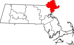
Beverly Farms is a neighborhood comprising the eastern part of the city of Beverly, Massachusetts, in the state's North Shore region, approximately 20 miles north of Boston. Beverly Farms is an oceanfront community with a population of about 3,500, extending west from the Manchester-by-the-Sea border to another section of Beverly, known as Prides Crossing. The western boundary of Beverly Farms is in dispute. For instance, the boundaries of West Beach were defined by Chapter 157 of the Massachusetts Acts and Resolves of 1852, in terms of landmarks and property lines that existed at the time, and those are sometimes used as the boundaries of Beverly Farms. Others have demarcated the Western border as the location at which a local trolley line from downtown Beverly ended; more specifically, this location is called "Chapman's Corner" and is at the corner of Hale and Boyle's Streets. [1]

Contents

History

Beverly Farms and the adjacent Prides Crossing were originally farming communities. In the late eighteenth and early nineteenth centuries, wealthy residents of Boston, Philadelphia, Chicago, Washington, D.C., and New York City built summer cottages along the seashore. These properties were the size and stature of those in Newport, Rhode Island, though only a few of the original mansions remain in the neighborhood today.

In 1887, Beverly Farms unsuccessfully petitioned the Massachusetts legislature for incorporation as a town. [2] Town Selectman John Baker argued against the incorporation and in response to a bribery scandal, Oliver Ames vetoed the Act. [3]

By the mid-twentieth century, Beverly Farms resembled a small town, somewhat secluded from the rest of Beverly and culturally interlinked with Prides Crossing. A number of working-class neighborhoods appeared around the town. As of 2020, 82% of individuals in the workforce are in White-collar jobs, with 18% working Blue-collar jobs. [4]

Beverly Hills, California, was named in 1907 after Beverly Farms, which was a vacation spot of then-President Taft. [5] [6]

A photograph of Marian Hooper Adams riding on horseback in Beverly Farms. Marian Hooper Adams on horseback at Beverly Farms, 1869.jpg
A photograph of Marian Hooper Adams riding on horseback in Beverly Farms.

Institutions

The community is served by three churches: St. John's Episcopal Church, whose altarpiece was sculpted by artist Hildreth Meiere, North Shore Baptist Community Church and St. Margaret of Scotland Catholic Church designed by architect William Ralph Emerson. [7] Among other public buildings are a community center, a fire station, a railroad station on the MBTA Commuter Rail, and a recently expanded branch of the Beverly Public Library.

A view of the Beverly Farms public library. Beverly Farms Branch Library, Beverly Farms MA.jpg
A view of the Beverly Farms public library.

Lifestyle

The Beverly Farms community is most active during the summer months.

The local community beach, West Beach, is owned by the residents of Beverly Farms and Prides Crossing, and is a major attraction during the summer. Current and former residents of the areas are entitled to beach permits, allowing access to West Beach. Non-residents must apply for an access permit; the waiting period is around six to ten years, because of the limited size of the facility. [8]

Annually on the Fourth of July holiday, a private organization of residents raises upwards of $60,000 through fundraisers to fund a weekend-long agenda of activities. The weekend's activities include community dances, children's events, softball games, fireworks above West Beach and the well-known "Horribles" parade. [9] Since 2016, the Horribles parade has generated significant local and State controversy. [10]

The Oliver Wendell Holmes House is registered on the list of National Register of Historic Places. BeverlyMA OliverWendellHolmesHouse.jpg
The Oliver Wendell Holmes House is registered on the list of National Register of Historic Places.

Notable people

See also

Related Research Articles

<span class="mw-page-title-main">Brookline, Massachusetts</span> Town in Massachusetts, United States

Brookline is a town in Norfolk County, Massachusetts, United States, and part of the Boston metropolitan area. Brookline borders six of Boston's neighborhoods: Brighton, Allston, Fenway–Kenmore, Mission Hill, Jamaica Plain, and West Roxbury. The city of Newton lies to the west of Brookline. Brookline was first settled in 1638 as a hamlet in Boston, known as Muddy River; it was incorporated as a separate town in 1705.

<span class="mw-page-title-main">Dartmouth, Massachusetts</span> Town of historical importance in the United States

Dartmouth is a coastal town in Bristol County, Massachusetts. Old Dartmouth was the first area of Southeastern Massachusetts to be settled by Europeans, primarily English. Dartmouth is part of New England's farm coast, which consists of a chain of historic coastal villages, vineyards, and farms. June 8, 2014 marked the 350th year of Dartmouth's incorporation as a town. It is also part of the Massachusetts South Coast. The local weekly newspapers are The Dartmouth/Westport Chronicle and Dartmouth Week. The Portuguese municipality of Lagoa is twinned with the town; along with several other Massachusetts and Rhode Island towns and cities around Bristol County.

<span class="mw-page-title-main">Beverly, Massachusetts</span> City in the United States

Beverly is a city in Essex County, Massachusetts, and a suburb of Boston. The population was 42,670 at the time of the 2020 United States Census. A resort, residential, and manufacturing community on the Massachusetts North Shore, Beverly includes Ryal Side, North Beverly, Montserrat, Beverly Farms and Prides Crossing. Beverly is a rival of Marblehead for the title of being the "birthplace of the U.S. Navy".

<span class="mw-page-title-main">Littleton, Massachusetts</span> Town in Massachusetts, United States

Littleton is a town in Middlesex County, Massachusetts, United States. The population was 10,141 at the 2020 census.

<span class="mw-page-title-main">Quincy, Massachusetts</span> City in Massachusetts, United States

Quincy is a coastal U.S. city in Norfolk County, Massachusetts, United States. It is the largest city in the county and a part of Metropolitan Boston as one of Boston's immediate southern suburbs. Its population in 2020 was 101,636, making it the seventh-largest city in the state. Known as the "City of Presidents", Quincy is the birthplace of two U.S. presidents—John Adams and his son John Quincy Adams—as well as John Hancock, the first signer of the Declaration of Independence and the first and third governor of Massachusetts.

<span class="mw-page-title-main">Roxbury, Boston</span> Neighborhood of Boston in Massachusetts, United States

Roxbury is a neighborhood within the City of Boston, Massachusetts, United States.

<span class="mw-page-title-main">Lexington, Massachusetts</span> Town in Massachusetts, United States

Lexington is a suburban town in Middlesex County, Massachusetts, United States, located 10 miles (16 km) from Downtown Boston. The population was 34,454 as of the 2020 census. The area was originally inhabited by Native Americans, and was first settled by Europeans in 1641 as a farming community. Lexington is well known as the site of the first shots of the American Revolutionary War, in the Battle of Lexington on April 19, 1775, where the "Shot heard 'round the world" took place. It is home to Minute Man National Historical Park.

<span class="mw-page-title-main">Swampscott, Massachusetts</span> Town in Massachusetts, United States

Swampscott is a town in Essex County, Massachusetts, United States, located 15 miles (24 km) up the coast from Boston in an area known as the North Shore. The population was 15,111 as of the 2020 United States Census. A former summer resort on Massachusetts Bay, Swampscott is today a fairly affluent residential community and includes the village of Beach Bluff, as well as part of the neighborhood of Clifton.

<span class="mw-page-title-main">Winthrop, Massachusetts</span> Town in Massachusetts, United States

Winthrop is a town in Suffolk County, Massachusetts, United States. The population was 19,316 at the 2020 census. Winthrop is an ocean-side suburban community in Greater Boston situated at the north entrance to Boston Harbor, close to Logan International Airport. It is located on a peninsula, 1.6 square miles (4.2 km2) in area, connected to Revere by a narrow isthmus and to multiple portions of Boston by a bridge over the harbor inlet to the Belle Isle Marsh Reservation in the Neighborhood of East Boston, a shared border at the Boston Logan International Airport, and at Deer Island.

<span class="mw-page-title-main">Jamaica Plain</span> Neighborhood in Boston

Jamaica Plain is a neighborhood of 4.4 square miles (11 km2) in Boston, Massachusetts. Settled by Puritans seeking farmland to the south, it was originally part of Roxbury, Massachusetts. The community seceded from Roxbury during the formation of West Roxbury in 1851 and became part of Boston when West Roxbury was annexed in 1874. In the 19th century, Jamaica Plain became one of the first streetcar suburbs in America and home to a significant portion of Boston's Emerald Necklace of parks, designed by Frederick Law Olmsted.

<span class="mw-page-title-main">Roslindale</span> Neighborhood of Boston in Suffolk, Massachusetts, United States

Roslindale is a primarily residential neighborhood of Boston, Massachusetts, bordered by Jamaica Plain, Hyde Park, West Roxbury and Mattapan. It is served by an MBTA Commuter Rail line, several MBTA bus lines and the MBTA Orange Line in nearby Jamaica Plain. Roslindale has its own branch of the Boston Public Library, the neighborhood is covered by Boston Police District E-5 in West Roxbury, Boston EMS Ambulance 17 is stationed in Roslindale, and the Boston Fire Department has a station on Canterbury Street which houses Ladder 16, Engine 53 & District Chief 12. Roslindale's original Engine Company 45, was deactivated on April 10, 1981, due to budget cuts. Roslindale was once called the "garden suburb" of Boston. The portion of the Arnold Arboretum south of Bussey Street is located in Roslindale.

<span class="mw-page-title-main">Massachusetts Route 127</span> State highway in Essex County, Massachusetts, US

Route 127 is a 26.70-mile-long (42.97 km) north–south Massachusetts state route that runs from Beverly to Gloucester. Much of the northern part of the route is in Cape Ann. Route 127's southern terminus is at Route 1A and the southern terminus of Route 22 in Beverly and the northern terminus is at Route 128 in Gloucester.

<span class="mw-page-title-main">Salem Willows</span> Oceanfront park in Salem, Massachusetts

Salem Willows is an oceanfront park in Salem, Massachusetts. It is named for the European white willow trees planted there in 1801 to form a shaded walk for patients convalescing at a nearby smallpox hospital. The area became a public park in 1858, and became a summer destination for residents of Boston's North Shore, many of whom escaped the heat of the city on newly popular streetcars. Construction on the amusement park began in the summer of 1877 by the Naumkeag Street Railway Company which had extended its horsecar system to the park. On June 10, 1880 the park opened with many amusement park additions. By 1911, electric streetcar service had been increased to include two tracks from Derby Street along Fort Ave. to the end of the line at what is now the parking lot at the arcade.

<span class="mw-page-title-main">Prides Crossing station</span> Former railway station in Beverly, Massachusetts

Prides Crossing station is a former MBTA Commuter Rail station on the Newburyport/Rockport Line, located in the village of Prides Crossing in Beverly, Massachusetts. It was opened by the Eastern Railroad as a flag stop in the mid-19th century. A stick style wooden station building was constructed around 1880 as wealthy residents built summer homes in the area. The Eastern Railroad was acquired in 1885 by the Boston and Maine Railroad (B&M), which operated commuter service to Prides Crossing until the Massachusetts Bay Transportation Authority (MBTA) took over in the 1970s. Prides Crossing was reduced to peak-hour-only service in 1981. It was temporarily closed in December 2020 because of low ridership and a lack of accessibility, with the closure becoming indefinite in April 2021. The former station building, not used by the railroad since the mid-20th century, is occupied by a private business.

<span class="mw-page-title-main">West Beach, Beverly, Massachusetts</span> Beach in Massachusetts, United States

West Beach is a 1.13 mile long beach on the North Shore of Massachusetts located in the City of Beverly, Massachusetts. It is located along West Street, in Beverly Farms. The beach is part of a strip of sandy coastline about one mile long, extending from a rocky enclave at Lees crossing Westerly to the Prides Crossing area of Beverly. There is a beach parking area is owned by the residents of Beverly Farms. The residents of Beverly Farms has ownership for about 1/4 of the length of this stretch. The Beach is open year round. During the nine-month off-season, the membership requirements are not enforced.

<span class="mw-page-title-main">Squantum</span>

Squantum is a neighborhood of Quincy, Massachusetts, connected to the mainland by a causeway that crosses over a wetland area of the bay. Often thought of as a peninsula, Squantum proper is technically a barrier island as it is surrounded on all four sides by water and is only connected to the mainland and Moon Island via causeways. Located in the northernmost portion of the city, Squantum is bordered on the north by Dorchester Bay and Boston Harbor, on the east by Moon Island and Quincy Bay, on the south by Quincy Bay and North Quincy, and on the west by the Marina Bay development. The population of the neighborhood in 2010 according to the United States Census Bureau was 2,365. Squantum has scenic, waterfront views of Boston Harbor and the Boston skyline and has many of Quincy’s most expensive homes. Squantum residents are the wealthiest of any neighborhood in Quincy, according to the 2010 United States Census Bureau, and the home ownership rate is approximately 92%. The neighborhood is further characterized by its tree-lined streets, its "island getaway" feel, close-knit community, and its annual Squantum Fourth of July Parade. As described in a 2020 book, "One road leads in and out of a square mile of land that is a playground for children and a haven for adults." Squantum also has one of the largest Irish populations, on a per capita basis, of any neighborhood in the United States.

<span class="mw-page-title-main">Prides Crossing</span>

Prides Crossing is a neighborhood of the city of Beverly, Massachusetts in the North Shore region. It is bordered to the east by Beverly Farms, and to the west by the Beverly Cove areas of Beverly.

<span class="mw-page-title-main">Shepard S. Woodcock</span> American architect

Shepard S. Woodcock (1824–1910) was an American architect practicing in Boston, Massachusetts during the second half of the nineteenth century.

<span class="mw-page-title-main">Fort Hill, Boston</span> United States historic place

Fort Hill is a 0.4 square mile neighborhood and historic district of Roxbury, in Boston, Massachusetts. The approximate boundaries of Fort Hill are Malcolm X Boulevard on the north, Washington Street on the southeast, and Columbus Avenue on the southwest.

<span class="mw-page-title-main">John I. Baker</span> Deceased politician (Mayor)

John Israel Baker was an American politician and historian from Beverly, Massachusetts.

References

  1. City of Beverly Report. Secretary of State of Massachusetts https://www.sec.state.ma.us/mhc/mhcpdf/townreports/Essex/bev.pdf . Retrieved October 29, 2022.{{cite web}}: Missing or empty |title= (help)
  2. Opening argument of Fred H. Williams, testimony, and closing argument of Hon. George M. Stearns, before the Legislative Committee on Towns, 1887, in favor of the incorporation of the town of Beverly Farms. Boston: Rand Avery Co. 1887.
  3. "Acts and resolves passed by the General Court". 1663.
  4. Weichert (2020). Beverly Farms Beverly, MA Overview. https://www.weichert.com/search/community/neighborhood.aspx?hood=16157
  5. Bright, William; Erwin G. Gudde (1998). 1500 California Place Names: Their Origin and Meaning. University of California Press. p. 23. ISBN   0-520-21271-1.
  6. Beverly, Mass (1 October 2012). Municipal Documents of the City of Beverly, Massachusetts. US, Massachusetts, Beverly: Saraswati Press. ISBN   9781249929239 . Retrieved 3 November 2020.
  7. Murray, P. (2020). History of Beverly Farms. https://primaryresearch.org/history-of-beverly-farms/
  8. "West Beach", beverlyfarms.org
  9. Fourth of July Celebrations - Beverly Farms website
  10. "Fourth of July parade draws ire for reportedly racist content, personal attacks".
  11. Pitch Pine Hill, at 26 Juniper St., Beverly Farms, MA, was built for Adams and his wife Clover in 1876. David S. Brown, The Last American Aristocrat: The Brilliant Life and Improbable Education of Henry Adams (New York: Scribner, 2020), p. 9.