Originally inhabited by Agawam or Naumkeag peoples, West Newbury was settled by English colonists in 1635 as part of neighboring Newbury. After 15 years of English colonization, a 30 acre section of land around Indian Hill in current day West Newbury was purchased from an indigenous man Great Tom for three pounds.[2]
On February 18, 1819, the General Court of Massachusetts passed an act "to incorporate the town of Parsons."[3] The initial proposals had been made in the late 18th century, but determined resistance from the town of Newbury, which had already lost Newburyport, blocked the measure for decades. On June 14, 1820, the legislature passed another act to change the name to West Newbury.
West Newbury has evolved from a rural farming town into a community[4] facing the issues of balancing development and need for affordable housing[5][6] against the townspeople's desire to maintain West Newbury's rural charm and character[7][8] have been in play for at least fifty years. In 1969 local writer Margaret Coit called West Newbury a "hill-framed town that Lowell Thomas once described as 'the Garden of Eden of America,'" saying that as active farming faded away, West Newbury had become, "in its population and pattern of thinking ... virtually a suburb."[9]
Between 1820 and the early 1900s, an active Quaker community existed in West Newbury. The Quaker Meetinghouse stood at what is now 114 Turkey Hill Street[10] and the Quaker Burial Ground, which was established in the 1850s, is located along the Artichoke Reservoir [11]
During the 19th century, West Newbury was home to a vibrant industrial scene.[12] The town was renowned for its comb making industry. Beginning in the 1840s, small home-based comb shops gave way to large-scale factories that produced horn combs and hair adornments. S.C. Noyes, located at 320 Main Street, was the last remaining comb factory in town and shut its doors in 1904.[13] In addition to comb making, a shoe factory operated where the West Newbury Pizza Company currently exists.
The West Newbury Historical Society, a non-profit, maintains the Hills House Museum at the historic William Hills and Hannah Chase House. The home was built in 1780 and the property contains several outbuildings, one of which is a cobbler's shop. The museum boasts a collection of horn combs and adornments manufactured in West Newbury, along with cooper's tools original to the house.
In 1952, Julian D. Steele became the first African-American town Moderator in Massachusetts when he was elected to the position in West Newbury.[14]
The town's oldest continually-operating farm is Long Hill Orchard.[15] The farm has been active since 1896, and has a long and intriguing history. Today, in addition to the apple orchard, the farm is home to a popular community-supported agriculture program and farm to table dining events.
Geography
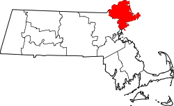
West Newbury is a part of Massachusetts' North Shore, as well as the Merrimack Valley regions of the state. It lies along the south banks of the Merrimack River, 10 miles (16km) upstream from the Atlantic Ocean. The town is located approximately 13 miles (21km) northeast of Lawrence and 34 miles (55km) north of Boston. It is bordered by Merrimac and Amesbury to the north, Newburyport to the east, Newbury to the southeast, Groveland to the southwest, and Haverhill to the west. The Rocks Village Bridge across the Merrimack River is the only access to the northern banks of the river in town; there is no direct route into Merrimac and Amesbury.
Rocks Village Bridge, West Newbury, 2019
West Newbury is separated from Newburyport by the Artichoke River and its upper and lower reservoirs. Several other rivers and brooks, including the Indian River, flow through the town. The southern corner of town is part of the Crane Pond Wildlife Management Area, and two other protected areas, the Riverbend Recreation Area and Mill Pond Recreation Area, are located in the northern part of town. The town's highest point is on Archelaus Hill in the center of town. Significant efforts have been made by residents to maintain the rural character of the town through advocacy for the preservation of open spaces. West Newbury is well known for its many hills: Pipestave Hill, Archelaus Hill, Brake Hill, Ilsey Hill, Indian Hill, Long Hill and Meetinghouse Hill.
According to the United States Census Bureau, the town has a total area of 14.7 square miles (38.1km2), of which 13.4 square miles (34.8km2) is land and 1.3 square miles (3.3km2), or 8.65%, is water.[16]
In 2000 the 4149 were distributed into 1,392 households, and 1,183 families.[31] The racial makeup of the town was 98.5% White, 0.2% African American, 0.5% Asian, 0.4% from other races, and 0.4% from two or more races. Hispanic or Latino of any race were 0.7% of the population. In March 1952, Julian Steele, the sole African-American voter among some 1,500 residents at the time, was elected West Newbury's town meeting moderator. He was the first African-American town moderator in Massachusetts,[32] and remained the only African-American town moderator in the state for at least a decade.[33]
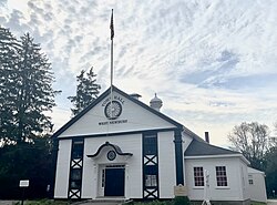
West Newbury Town Center, 2019
Of 1,686 households in 2010, 46.6% had their own children under the age of 18 living with them, 76.8% were married couples, 6.2% were a female householder with no husband present, and 15.0% were non-families. 11.9% of all households were made up of individuals, and 5.2% were individuals living alone who were 65 years of age or older. The average household size was 2.98 and the average family size was 3.25.
By age, 30.0% were under the age of 18, 4.3% from 18 to 24, 27.0% from 25 to 44, 29.9% from 45 to 64, and 8.8% were 65 years of age or older. The median age was 39.6 years. For every 100 females, there were 99.5 males. For every 100 females age 18 and over, there were 93.9 males.
The median income for a household in the town was $164,250, and the median income for a family was $193,951.[34] Males had a median income of $100,670 versus $80,189 for females. The per capita income for the town was $35,323. About 2.8% of families and 4.6% of the population were below the poverty line, including 3.8% of those under the age of 18 and 9.8% of those 65 and older.
Many farms remain in West Newbury. In 2019 the town, in conjunction with Essex County Greenbelt Association, purchased an agricultural preservation restriction for Brown Spring Farm, permanently eliminating rights to develop the farmland and making it affordable for a new farmer.[38][39] Long Hill Orchard is the town's oldest continually-operating farm. A number of smaller farms exist in West Newbury, including Maple Crest Farm, several Christmas tree farms, and numerous horse stables and equestrian facilities.
The town has two primary outdoor recreational areas, Mill Pond and Pipestave Hill, which offer walking trails, horseback riding trails, as well as space for canoeing, fishing, and kayaking. Equestrian events are regularly held by the West Newbury Riding and Driving Club throughout the riding season. Additionally, the Myopia Hunt Club holds an annual fox hunt through the town during the fall.
Efforts to maintain West Newbury's rural charm have been ongoing; the Town has purchased large swaths of land designated as Open Space by the West Newbury Open Space Committee.
Interstate 95 crosses through the eastern corner of town, with an exit lying just over the line in Newbury providing access to the town. Massachusetts Route 113 is the main road through town, roughly parallel to the contour of the Merrimack River. The town lies between the termini of two lines of the MBTA Commuter Rail, the Haverhill Line to the west and Newburyport/Rockport Line to the east. A small airstrip, Plum Island Airport (2B2), is located in neighboring Newburyport; the nearest national air service is in Boston at Logan International Airport.
↑ West Newbury Historical Commission (November 2019). "Quaker Meetinghouse"(PDF). Historical Commission. Town of West Newbury. Retrieved December 25, 2019.
↑ West Newbury Historical Commission (December 2019). "Quaker Cemetery"(PDF). Historical Commission. Town of West Newbury. Retrieved December 25, 2019.
↑ "1950 Census of Population"(PDF). Bureau of the Census. 1952. Section 6, Pages 21-10 and 21-11, Massachusetts Table 6. Population of Counties by Minor Civil Divisions: 1930 to 1950. Retrieved July 12, 2011.
↑ "1920 Census of Population"(PDF). Bureau of the Census. Number of Inhabitants, by Counties and Minor Civil Divisions. Pages 21-5 through 21-7. Massachusetts Table 2. Population of Counties by Minor Civil Divisions: 1920, 1910, and 1920. Retrieved July 12, 2011.
↑ "1890 Census of the Population"(PDF). Department of the Interior, Census Office. Pages 179 through 182. Massachusetts Table 5. Population of States and Territories by Minor Civil Divisions: 1880 and 1890. Retrieved July 12, 2011.
↑ "1870 Census of the Population"(PDF). Department of the Interior, Census Office. 1872. Pages 217 through 220. Table IX. Population of Minor Civil Divisions, &c. Massachusetts. Retrieved July 12, 2011.
↑ "1860 Census"(PDF). Department of the Interior, Census Office. 1864. Pages 220 through 226. State of Massachusetts Table No. 3. Populations of Cities, Towns, &c. Retrieved July 12, 2011.
↑ "1850 Census"(PDF). Department of the Interior, Census Office. 1854. Pages 338 through 393. Populations of Cities, Towns, &c. Retrieved July 12, 2011.
↑ "Slideshow: Yankee Homecoming Weekend". Newburyport Daily News. August 6, 2017. Retrieved August 25, 2019. West Newbury's and founder Pat Badger plays with Eagles cover band Dark Desert Eagles
↑ "Greeley and Moody Boynton". Boston Globe. July 18, 1897. p.25. Retrieved January 13, 2020. No more singular character has been in evidence before the Massachusetts legislature for many years than E. Moody Boynton, the sage and inventor of West Newbury.
↑ "The Nineteenth Regiment". Newburyport Herald. December 25, 1862. p.1. Retrieved September 26, 2022. At the taking of Fredericksburg, [soldiers including] George Y. Bradley were slightly wounded. They were all of West Newbury.
↑ "West Newbury: High School Reception". Newburyport Daily News and Newburyport Herald. June 22, 1935. p.2. Retrieved August 25, 2019. the president of the graduating class, Bertrand Russell Brinley
↑ "Addison Brown Dies: Ex-District Judge"(PDF). New York Times. April 10, 1913. p.11. Retrieved February 14, 2020. He was born in West Newbury, Mass., Feb. 21, 1830, of Pilgrim stock.
↑ "John Appleton Brown". Standard Union. Brooklyn, NY. January 20, 1902. p.2. Retrieved January 26, 2020. He was born in West Newbury, Mass., [i]n 1844, and studied in Europe under the best masters....
↑ Downes, William Howe (1923). "John Appleton Brown, Landscapist". The American Magazine of Art. 14 (8): 436–39. JSTOR23927935.
↑ Schaffer, Noah (July 5, 2023). "Singer Cidny Bullens traces a journey toward transitioning in his new memoir". The Boston Globe. Retrieved July 10, 2023. This week Bullens kicks off a series of local readings and performances with an event at Jabberwocky Books in Newburyport, just a few miles from his childhood home of West Newbury. 'Now it's a bedroom community, but when I was growing up it was a farming town,' says Bullens from his Nashville home. 'It was small and rural and perfect for me.'
↑ "Grid coaching great, Burnham, dead at 82". South Bend Tribune. March 17, 1977. p.44. Retrieved October 6, 2019. A native of West Newbury, Mass., ... where an athletic field is named in his honor.
↑ Muldoon, Michael (October 23, 2011). "Under the Lights: Dyer an American hero". The Eagle Tribune. North Andover, Massachusetts. Retrieved August 25, 2019. Red Sox killer Rawly Eastwick of West Newbury
↑ "Amherst Prof 50 Years Wed". The Boston Globe. October 21, 1923. p.31. Retrieved October 6, 2019. Born Aug 30, 1845, in West Newbury ...
↑ "Ex-Sox pitcher graduates from Firefighting Academy". The Daily News of Newburyport. March 15, 2022. Retrieved March 15, 2022. I want to congratulate Firefighter Haley on completing the academy…," Chief Michael Dwyer said in a press release. "Firefighter Haley's commitment to his family helped lead him here, and he will be a great asset to our department and community here in West Newbury.
↑ "A masterful showing". The Boston Globe. August 16, 2012. p.4. Retrieved November 5, 2019. Masters Hall of Famer Mary Harada, 77, of West Newbury, won the 800 and 5,000 meters.
↑ Gasper, Christopher L. (June 1, 2006). "She's outrunning Father Time"(contains photos of Mary Harada). The Boston Globe. p.60. Retrieved November 5, 2019.
↑ "Head of First WAACS in Africa Was Simmons Grad in '16". The Boston Globe. January 30, 1943. p.3. Retrieved October 6, 2019. Capt. Marquis was born in West Newbury, Mass., and graduated from that town's high school at the age of 14.
↑ Pearlstein, Steven. "Robinson Professor of Public Affairs". Schar School of Policy and Government. George Mason University. Retrieved July 14, 2020. He is a former moderator of West Newbury, Mass.
↑ Pearlstein, Steven (March 16, 1986). "Subverting Wishes of Majority". Boston Globe. p.A25,125. Retrieved July 14, 2020. On my reading list this time each year is a little red book called 'Town Meeting Time,' which guides me as I try to guide the discussions at the annual West Newbury town meeting.
This page is based on this Wikipedia article Text is available under the CC BY-SA 4.0 license; additional terms may apply. Images, videos and audio are available under their respective licenses.