Manchester-by-the-Sea, Massachusetts

Last updated

Manchester-by-the-Sea, Massachusetts
Manchester First Parish Church.JPG
The First Parish Church in central Manchester-by-the-Sea
Seal of Manchester-by-the-Sea, Massachusetts.svg
Essex County Massachusetts incorporated and unincorporated areas Manchester-by-the-Sea highlighted.svg
Location in Essex County and Massachusetts.
Coordinates: 42°34′40″N70°46′10″W / 42.57778°N 70.76944°W / 42.57778; -70.76944
Country United States
State Massachusetts
County Essex
Settled1629
Incorporated1645
Government
  Type Open town meeting
Area
  Total18.3 sq mi (47.3 km2)
  Land9.2 sq mi (23.9 km2)
  Water9.0 sq mi (23.4 km2)
Elevation
30 ft (9 m)
Population
 (2020)
  Total5,395
  Density300/sq mi (110/km2)
Time zone UTC-5 (Eastern)
  Summer (DST) UTC-4 (Eastern)
ZIP code
01944
Area code 351 / 978
FIPS code 25-37995
GNIS feature ID0619451
Website www.manchester.ma.us

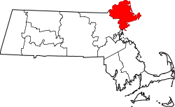
Manchester-by-the-Sea (also known simply as Manchester, its name prior to 1990) is a coastal town on Cape Ann, in Essex County, Massachusetts, United States. The town is known for scenic beaches and vista points. According to the 2020 population census, the population is 5,395. [1]

Contents

The town lies on the southern side of Cape Ann, at the point where the peninsula meets the mainland. The North Shore was populated by the Agawam people prior to European settlement, which began in 1629, about a decade after an epidemic killed much of the native people. Fishing was the major industry in the town almost from its incorporation in 1645, but in the mid-19th century it began to grow as a popular seaside resort community. The town has appeared, either by name or as a filming location, in a number of films and TV shows, notably the eponymous 2016 film Manchester by the Sea .

History

Singing Beach in 1914 Singing Beach, Manchester-by-the-Sea, MA.jpg
Singing Beach in 1914

Native Americans inhabited what would become northeastern Massachusetts for thousands of years prior to European colonization of the Americas. The area that would become Manchester was inhabited by Agawam people at the time of contact in the early 1600s, [2] [3] who were decimated by virgin soil epidemics especially in 1617–1619, after which fewer than 50 indigenous individuals are estimated to have survived within the modern bounds of Manchester. [4]

Manchester was first settled by English colonists in 1629 and was officially incorporated in 1645. It was formed from territory taken from Salem (that portion since given to Beverly) and Gloucester. In 1700, Manchester selectmen paid three grandchildren of Agawam sachem Masconomet three pounds and nineteen shillings for the rights to the land. [2]

The community thrived primarily as a fishing community for more than 200 years. Beginning in 1845, it started to attract summer residents from the Boston area after poet Richard Dana built a house in the town. Over the next fifty years, development of summer houses along the coastline established the community as Boston society's community of choice for summer residency. [5] The trend continued with designs of houses by architects, such as "Sunnywaters", designed by John Hubbard Sturgis for his older brother, Russell, in 1863. [6]

The best known of these "summer cottages" was Kragsyde, completed in 1885. Commissioned by George Nixon Black, the Peabody and Stearns-designed residence has been hailed as the zenith of the Shingle style substyle of the Queen Anne style of architecture. It was demolished in 1929. [7]

Name

To prevent confusion with the nearby and much larger city of Manchester, New Hampshire, the name of the town was officially changed in 1989 following a close town meeting vote that year; the decision was extremely close and passed only by a vote of 97 to 95. [8] This was ratified by an act of the state legislature passed on September 25, 1989. [9] "Manchester by the Sea" was a familiar alternative town name since it was first used in 1877 by Boston publisher James T. Fields while attending an annual summer picnic of the "Manchester Elder Brethren" that still takes place today. [10] The name change was driven by Edward Corley, a longtime resident of Manchester. [11]

Geography

According to the United States Census Bureau, the town has a total area of 18.3 square miles (47.3 km2), of which 9.2 square miles (23.9 km2) is land and 9.0 square miles (23.4 km2), or 49.47%, is water. The town lies along the North Shore of Massachusetts Bay, which in turn leads to the Atlantic Ocean. There are seven beaches lining the coast, and several small islands dot the coast, the largest being Kettle Island and House Island.

Several small coves edge the coast, the largest being Manchester Harbor, which is fed by Sawmill Brook and other small bodies of water. There are several protected areas within town, including Cedar Swamp Conservation Area, Cheever Commons Conservation Area, Coolidge Reservation, Dexter Pond, Owl's Nest Nature Preservation Land, Powder House Hill Reservation, and Wyman Hill Conservation Area.

Manchester-by-the-Sea is bordered by Beverly and Wenham to the west, Hamilton to the northwest, Essex to the north, and Gloucester to the east. The town is located 9 miles (14 km) northeast of Salem and 24 miles (39 km) northeast of Boston.

Transportation

Manchester-by-the-Sea lies along Massachusetts Route 128, the inner of two beltways around Greater Boston. Route 128 has two exits within town as it passes from Beverly to Gloucester, with a small portion crossing through the corner of Essex. Route 127 also passes from west to east through town, traveling through the center of town. There is no bus service directly into town, with service passing east via the Cape Ann Transportation Authority in Gloucester, and an MBTA bus route providing service to Beverly.

The town is served by a stop along the Newburyport/Rockport Line of the MBTA Commuter Rail, providing service from Rockport along the North Shore to Boston's North Station. The nearest airport is the Beverly Municipal Airport, with the nearest national and international service at Boston's Logan International Airport.

Demographics

Historical population
YearPop.±%
1850 1,638    
1860 1,698+3.7%
1870 1,665−1.9%
1880 1,640−1.5%
1890 1,789+9.1%
1900 2,522+41.0%
1910 2,673+6.0%
1920 2,466−7.7%
1930 2,636+6.9%
1940 2,472−6.2%
1950 2,868+16.0%
1960 3,932+37.1%
1970 5,151+31.0%
1980 5,424+5.3%
1990 5,286−2.5%
2000 5,228−1.1%
2010 5,136−1.8%
2020 5,395+5.0%
2022*5,354−0.8%
* = population estimate.
Source: United States census records and Population Estimates Program data. [12] [13] [14] [15] [16] [17] [18] [19] [20] [21] [22]

As of the census of 2010, [23] there were 5,136 people, 2,147 households, and 1,444 families residing in the town. The population density was 562.7 inhabitants per square mile (217.3/km2). The racial makeup of the town was 97.6% White, (5,012); 0.9% Asian, (46); 0.2% Native American, (10); 0.1% African American, (5); 0.1% from other races, and 1.1% from two or more races. Hispanic or Latino of any race were 1.5% (77) of the population. The median income for a household in the town was $95,243, and the median income for a family was $109,760. About 4.5% of families and 5.1% of the population were below the poverty line, including 3.9% of those under age 18 and 3.7% of those age 65 or over. [23]

Journalism

The local newspaper, The Manchester Cricket, has published weekly since 1888. [24] The newspaper has been owned by just three families since it began. Within the Cricket, there is a special section dedicated to the neighboring town, Essex. This section is called The Essex Echo. The town is also served by a regional newspaper, the Gloucester Daily Times.

Education

The community lies within the Manchester Essex Regional School District. [25]

Controversies

The Manchester-by-the-Sea Police Department have been subject to controversy, including sexual harassment by sworn officers, with allegations "that officials had permitted a sexually hostile environment, and that Christopher Locke, an officer in the police department, made a secret recording of [a young woman], violating the state's wiretap law." [26]

Howard Lewis, who had been appointed as a reserve officer in 2008 and a full-time officer in 2010, had been assigned to the 12 to 8 a.m. shift and served as the department's primary firearms instructor, when he was placed on administrative leave amid an internal affairs investigation on December 15, according to Manchester-by-the-Sea Police Chief Edward Conley. An internal affairs investigation determined he stole a firearm from the police station and sold it to a pawn shop for $650. [27]

Manchester-by-the-Sea Police Department Sergeant John "Jay" Swallow was sentenced to jail for the vicious beating of his wife and weapons charges. He engaged in a physical altercation while pointing a handgun at both his wife and the family dog. [28]

Points of interest

Singing Beach

One mile (1.6 km) from the town center is Singing Beach, so named because the sand comprising the beach squeaks when walked upon. The sand is an iridescent color when the sun sets. [29] This beach is quite popular during summer months in particular, because it is easily accessible from Boston by a one-half-mile (800 m) walk from the MBTA train station. Also located on this historic beach is the famous tourist attraction "Eaglehead", a rock composite that is the focal point of rock climbing and other recreation activities.

Other points of interest

Film and television references

The town provided the backdrop for these films:

It was also featured in a season of the TV series This Old House , and was featured in a "Main Streets and Back Roads" episode of Chronicle , a newsmagazine program in New England.

Notable people

Related Research Articles

<span class="mw-page-title-main">Essex County, Massachusetts</span> County in Massachusetts, United States

Essex County is a county in the northeastern part of the U.S. state of Massachusetts. At the 2020 census, the total population was 809,829, making it the third-most populous county in the state, and the seventy-eighth-most populous in the country. It is part of the Greater Boston area. The largest city in Essex County is Lynn. The county was named after the English county of Essex. It has two traditional county seats: Salem and Lawrence. Prior to the dissolution of the county government in 1999, Salem had jurisdiction over the Southern Essex District, and Lawrence had jurisdiction over the Northern Essex District, but currently these cities do not function as seats of government. However, the county and the districts remain as administrative regions recognized by various governmental agencies, which gathered vital statistics or disposed of judicial case loads under these geographic subdivisions, and are required to keep the records based on them. The county has been designated the Essex National Heritage Area by the National Park Service.

<span class="mw-page-title-main">Beverly, Massachusetts</span> City in the United States

Beverly is a city in Essex County, Massachusetts, United States, and a suburb of Boston. The population was 42,670 at the time of the 2020 United States Census. A resort, residential, and manufacturing community on the Massachusetts North Shore, Beverly includes Ryal Side, North Beverly, Montserrat, Beverly Farms and Prides Crossing. Beverly is a rival of Marblehead for the title of being the "birthplace of the U.S. Navy".

<span class="mw-page-title-main">Georgetown, Massachusetts</span> Town in Massachusetts, United States

Georgetown is a town in Essex County, Massachusetts, United States. The population was 8,470 at the 2020 census. It was incorporated in 1838 from part of Rowley.

<span class="mw-page-title-main">Gloucester, Massachusetts</span> City in Massachusetts, United States

Gloucester is a city in Essex County, Massachusetts, United States. It sits on Cape Ann and is a part of Massachusetts's North Shore. The population was 29,729 at the 2020 U.S. Census. An important center of the fishing industry and a popular summer destination, Gloucester consists of an urban core on the north side of the harbor and the outlying neighborhoods of Annisquam, Bay View, Lanesville, Folly Cove, Magnolia, Riverdale, East Gloucester, and West Gloucester.

<span class="mw-page-title-main">Hamilton, Massachusetts</span> Town in Massachusetts, United States

Hamilton is a town in the eastern central portion of Essex County in eastern Massachusetts, United States. At the 2020 census, it had a population of 7,561. Currently the town has no manufacturing industry and no industrially zoned land.

<span class="mw-page-title-main">Middleton, Massachusetts</span> Town in Massachusetts, United States

Middleton is a town in Essex County, Massachusetts, United States. The population was 9,779 at the 2020 census.

<span class="mw-page-title-main">Newbury, Massachusetts</span> Town in Massachusetts, United States

Newbury is a town in Essex County, Massachusetts, United States. The population was 6,716 at the 2020 census. Newbury includes the villages of Old Town, Plum Island and Byfield. Each village is a precinct with its own voting district, various town offices, and business center.

<span class="mw-page-title-main">Wenham, Massachusetts</span> Town in Massachusetts, United States

Wenham is a town in Essex County, Massachusetts, United States. The population was 4,979 at the time of the 2020 census.

<span class="mw-page-title-main">Billerica, Massachusetts</span> Town in Massachusetts, United States

Billerica is a town in Middlesex County, Massachusetts, United States. The population was 42,119 according to the 2020 census. It takes its name from the town of Billericay in Essex, England.

<span class="mw-page-title-main">Essex, Massachusetts</span> Town in Massachusetts, United States

Essex is a coastal town in Essex County, Massachusetts, United States, 26 miles (42 km) north of Boston and 13 miles (21 km) southeast of Newburyport. It is known for its former role as a center of shipbuilding. The population was 3,675 at the 2020 census.

<span class="mw-page-title-main">Danvers, Massachusetts</span> Town in Massachusetts, United States

Danvers is a town in Essex County, Massachusetts, United States, located on the Danvers River near the northeastern coast of Massachusetts. The suburb is a fairly short ride from Boston and is also in close proximity to the beaches of Gloucester, Ipswich and Revere. Originally known as Salem Village, the town is most widely known for its association with the 1692 Salem witch trials. It was also the site of Danvers State Hospital, one of the state's 19th-century psychiatric hospitals. Danvers is a local center of commerce, hosting many car dealerships and the Liberty Tree Mall. As of the 2020 United States Census, the town's population was 28,087.

<span class="mw-page-title-main">Lynnfield, Massachusetts</span> Town in Massachusetts, United States

Lynnfield is a town in Essex County, Massachusetts, United States. At the 2020 census, the town population was 13,000.

<span class="mw-page-title-main">Nahant, Massachusetts</span> Town in Massachusetts, United States

Nahant is a town in Essex County, Massachusetts, United States. The population was 3,334 at the 2020 census, which makes it the smallest municipality by population in Essex County. With just 1.0 square mile (2.7 km2) of land area, it is also the smallest municipality by area in the state and is primarily a residential community. The town is situated on a peninsula consisting of two near-islands connected to the mainland by a narrow sandy isthmus traversed by a single causeway known as "Nahant Road". Numerous tourist beaches line the shores, with the most popular being the so-called "Long Beach" and "Short Beach" along the eastern side of the causeway.

<span class="mw-page-title-main">Swampscott, Massachusetts</span> Town in Massachusetts, United States

Swampscott is a town in Essex County, Massachusetts, United States, located 15 miles (24 km) up the coast from Boston in an area known as the North Shore. The population was 15,111 as of the 2020 United States Census. A former summer resort on Massachusetts Bay, Swampscott is today a fairly affluent residential community and includes the village of Beach Bluff, as well as part of the neighborhood of Clifton.

<span class="mw-page-title-main">Wilmington, Massachusetts</span> Town in Massachusetts, United States

Wilmington is a town in Middlesex County, Massachusetts, United States. Its population was 23,349 at the 2020 United States census.

<span class="mw-page-title-main">Boxford, Massachusetts</span> Town in Massachusetts, United States

Boxford is a town in Essex County, Massachusetts, United States. According to the U.S. Census Bureau, the town's population was 8,203 in 2020.

<span class="mw-page-title-main">Ipswich, Massachusetts</span> Town in Massachusetts, United States

Ipswich is a coastal town in Essex County, Massachusetts, United States. The population was 13,785 at the 2020 census. Home to Willowdale State Forest and Sandy Point State Reservation, Ipswich includes the southern part of Plum Island. A residential community with a vibrant tourism industry, the town is famous for its clams, celebrated annually at the Ipswich Chowderfest, and for Crane Beach, a barrier beach near the Crane estate. Ipswich was incorporated as a town in 1634.

<span class="mw-page-title-main">Rowley, Massachusetts</span> Town in Massachusetts, United States

Rowley is a town in Essex County, Massachusetts, United States. The population was 6,161 at the 2020 census.

<span class="mw-page-title-main">Topsfield, Massachusetts</span> Town in Massachusetts, United States

Topsfield is a town in Essex County, Massachusetts, United States. The population was 6,569 at the 2020 census. Topsfield is located in the North Shore region of Massachusetts. Part of the town comprises the census-designated place of Topsfield.

<span class="mw-page-title-main">Rockport, Massachusetts</span> Town in Massachusetts, United States

Rockport is a seaside town in Essex County, Massachusetts, United States. The population was 6,992 in 2020. Rockport is located approximately 40 miles (64 km) northeast of Boston, at the tip of the Cape Ann peninsula. Rockport borders Gloucester to its west, and is surrounded by the Atlantic Ocean in all other directions.

References

  1. "Census - Geography Profile: Manchester-by-the-Sea town, Essex County, Massachusetts". United States Census Bureau . Retrieved November 7, 2021.
  2. 1 2 Perley, Sidney (1912). The Indian land titles of Essex County, Massachusetts. The Library of Congress. Salem, Mass. : Essex Book and Print Club.
  3. Smith, John (1837). A description of New England; or, The observations, and discoveries of Captain Iohn Smith (admirall of that country) in the north of America, in the year of our Lord 1614; with the successe of sixe ships, that went the next yeare 1615; and the accidents befell him among the French men of warre: with the proofe of the present benefit this countrey affoords; whither this present yeare, 1616, eight voluntary ships are gone to make further tryall. Washington: P. Force.
  4. MHC Reconnaissance Survey Town Report: Manchester-By-The-Sea (PDF). Massachusetts Historical Commission (Report). Secretary of the Commonwealth of Massachusetts. 1985.
  5. Lamson, Darius Francis (1895). History of the town of Manchester, Essex County, Massachusetts, 1645-1895. Manchester, Mass.: Town of Manchester. pp. 192–194. Retrieved January 24, 2024.
  6. Floyd, Margaret Henderson; Barlow, Margaret (2011). Marter, Joan M. (ed.). The Grove Encyclopedia of American Art, Volume 1. Oxford University Press. p. 603. ISBN   978-0-19-533579-8 . Retrieved January 24, 2024.
  7. Goodrich, Jane. "Curious George: Woodlawn's Enigmatic Benefactor" (PDF). WoodlawnMuseum.com. Woodlawn Museum. pp. 4–5. Archived from the original (PDF) on February 15, 2016. Retrieved January 24, 2024.
  8. "Digital Archives of the Manchester Cricket ::". manchestercricket.advantage-preservation.com. Retrieved May 17, 2021.
  9. Manchester-by-the-Sea official website; accessed August 10, 2015.
  10. "N.H. city hopes to make big splash with whitewater park, new name". Boston.com Real Estate. April 28, 2021. Retrieved May 17, 2021.
  11. "Edward F. Corley, 68, Leader in Manchester-by-the-Sea". The Boston Globe , January 13, 1991. Retrieved February 28, 2017.
  12. "Total Population (P1), 2010 Census Summary File 1". American FactFinder, All County Subdivisions within Massachusetts. United States Census Bureau. 2010.
  13. "Massachusetts by Place and County Subdivision - GCT-T1. Population Estimates". United States Census Bureau. Retrieved July 12, 2011.
  14. "1990 Census of Population, General Population Characteristics: Massachusetts" (PDF). US Census Bureau. December 1990. Table 76: General Characteristics of Persons, Households, and Families: 1990. 1990 CP-1-23. Retrieved July 12, 2011.
  15. "1980 Census of the Population, Number of Inhabitants: Massachusetts" (PDF). US Census Bureau. December 1981. Table 4. Populations of County Subdivisions: 1960 to 1980. PC80-1-A23. Retrieved July 12, 2011.
  16. "1950 Census of Population" (PDF). Bureau of the Census. 1952. Section 6, Pages 21-10 and 21-11, Massachusetts Table 6. Population of Counties by Minor Civil Divisions: 1930 to 1950. Retrieved July 12, 2011.
  17. "1920 Census of Population" (PDF). Bureau of the Census. Number of Inhabitants, by Counties and Minor Civil Divisions. Pages 21-5 through 21-7. Massachusetts Table 2. Population of Counties by Minor Civil Divisions: 1920, 1910, and 1920. Retrieved July 12, 2011.
  18. "1890 Census of the Population" (PDF). Department of the Interior, Census Office. Pages 179 through 182. Massachusetts Table 5. Population of States and Territories by Minor Civil Divisions: 1880 and 1890. Retrieved July 12, 2011.
  19. "1870 Census of the Population" (PDF). Department of the Interior, Census Office. 1872. Pages 217 through 220. Table IX. Population of Minor Civil Divisions, &c. Massachusetts. Retrieved July 12, 2011.
  20. "1860 Census" (PDF). Department of the Interior, Census Office. 1864. Pages 220 through 226. State of Massachusetts Table No. 3. Populations of Cities, Towns, &c. Retrieved July 12, 2011.
  21. "1850 Census" (PDF). Department of the Interior, Census Office. 1854. Pages 338 through 393. Populations of Cities, Towns, &c. Retrieved July 12, 2011.
  22. "City and Town Population Totals: 2020-2022". United States Census Bureau . Retrieved November 23, 2023.
  23. 1 2 "U.S. Census website". United States Census Bureau . Retrieved January 14, 2014.
  24. Cricket, The. "thecricket.com | A Local Tradition Since 1888". The Cricket. Retrieved May 17, 2021.
  25. "2020 CENSUS - SCHOOL DISTRICT REFERENCE MAP: Essex County, MA" (PDF). U.S. Census Bureau . Retrieved April 16, 2023. - Text list
  26. "Town admits liability for officer's harassment". May 18, 2018.
  27. "Manchester-by-the-Sea cop resigns after investigation found he stole and sold civilian's gun". January 12, 2019.
  28. "Manchester-by-the-Sea Sergeant Pleads Guilty to Assault, Gun Charges". January 28, 2013.
  29. "Singing Beach". Manchester-by-the-Sea, MA.
  30. "Kiosk Completed at Wilderness Conservation Area Gateway". www.mect.org. Archived from the original on April 25, 2016. Retrieved April 28, 2016.