North Station

Last updated • 9 min readFrom Wikipedia, The Free Encyclopedia

North Station
North Station from north August 2024.jpg
MBTA Commuter Rail trains at North Station in August 2024
General information
Location126 Causeway Street
Boston, Massachusetts
United States
Coordinates 42°21′59″N71°03′44″W / 42.36630°N 71.06222°W / 42.36630; -71.06222
Owned by Massachusetts Bay Transportation Authority
Line(s)
Platforms5 island platforms
Tracks10
Connections MBTA.svg  GreenLine   OrangeLine  at North Station
Aiga bus trans.svg MBTA bus: 4
Aiga bus trans.svg EZRide
Construction
Parking1,275 spaces (privately owned garage)
Bicycle facilities20 spaces; Bluebikes dock
AccessibleYes
Other information
Station code Amtrak: BON
Fare zone1A (MBTA Commuter Rail)
History
Opened1893 (North Union Station)
Rebuilt1928, 1989, 1995, January 2007
Passengers
201218,427 daily boardings [1] (MBTA Commuter Rail)
Preceding station BSicon LOGO Amtrak2.svg Amtrak Following station
Terminus Downeaster Woburn
toward Brunswick
Preceding station MBTA.svg MBTA Following station
Porter
toward Wachusett
Fitchburg Line Terminus
West Medford
toward Lowell
Lowell Line
Ballardvale
toward Haverhill
Haverhill Line
(limited service via Wildcat Branch)
Terminus Haverhill Line Malden Center
toward Haverhill
Newburyport/​Rockport Line Chelsea
Former services
Preceding station MBTA.svg MBTA Following station
Cambridge
toward Bedford
Lexington Branch
(closed 1977)
Terminus
Cambridge Central Mass Branch
(closed 1971)
Preceding station Boston and Maine Railroad Following station
Cambridge
toward Northampton
Central Mass Branch Terminus
Cambridge
toward Fitchburg
Boston – Fitchburg
Fitchburg
toward Montreal
Green Mountain Flyer / Mount Royal
Cambridge
toward Troy
Boston – Troy
Union Square
toward Waltham
Watertown Branch
Prospect Hill
toward Concord, NH
Boston – Concord, NH
TerminusWestern Route East Somerville
toward Portland
Eastern Route
Boston – Dover
until 1967
East Somerville
toward Dover
Boston – Haverhill East Somerville
toward Haverhill
Medford Branch East Somerville
toward Medford
Location
North Station

North Station is a commuter rail and intercity rail terminal station in Boston, Massachusetts. It is served by four MBTA Commuter Rail lines – the Fitchburg Line, Haverhill Line, Lowell Line, and Newburyport/Rockport Line – and the Amtrak Downeaster intercity service. The concourse is located under the TD Garden arena, with the platforms extending north towards drawbridges over the Charles River. The eponymous subway station, served by the Green Line and Orange Line, is connected to the concourse with an underground passageway.

Contents

Description

Platforms and drawbridges at North Station North Station platforms and drawbridges, April 2014.jpg
Platforms and drawbridges at North Station

The concourse of the station, named for longtime Boston Celtics coach and executive Red Auerbach, is located under the TD Garden arena, with two entrances from Causeway Street, as well as entrances from Nashua Street to the west. Five island platforms serving ten tracks run north from the concourse. Just north of the platforms, a pair of two-track drawbridges cross the Charles River. Eight commuter rail lines and three Amtrak services terminate at South Station about 1 mile (1.6 km) to the south, with no direct rail link between the two stations. The proposed North–South Rail Link would link the two halves of the commuter rail system, with new underground platforms at both stations.

North Station is accessible on all modes. MBTA bus route 4 runs on Causeway Street, with stops near Canal Street. The EZRide Shuttle loops on Red Auerbach Way with a stop near the secondary entrance to North Station. [3]

Lovejoy Wharf, located off Beverly Street northeast of North Station, is the head of navigation of the Charles River due to the adjacent Charles River Dam. [3] It is served by water taxi services to Logan Airport and the Boston waterfront by two private companies, and a Lovejoy Wharf – Fan Pier ferry route. [4]

History

Previous stations

The B&M terminal around 1894 Boston and Maine Railroad station in Haymarket Square, circa 1894.jpg
The B&M terminal around 1894

The four major northside railroads originally built separate terminal stations in Boston. The Boston and Lowell Railroad (B&L) was the first to open, with service beginning on June 24, 1835. [5] :26 The first station was built later in 1835 along Lowell Street (now Lomasney Way) and was several blocks north of Causeway Street. A new station was built at Causeway Street east of Nashua Street in 1857, with the original depot converted to a freight house. [5] :33 An even larger third station on the Causeway Street site, constructed of brick with towers at the front corners, was opened on November 24, 1873. [5] :33

The Boston and Maine Railroad (B&M) opened in July 1845, with a temporary station at Canal and Traverse streets. The permanent station, opened on October 20, was between Canal and Haverhill streets and fronted on Haymarket Square. Trains had to cross busy Causeway Street to reach the station; at first, a city ordinance required the railroad to pull cars across the street with oxen rather than locomotives. In 1867, the station was extended northwards from Market Street to Traverse Street. [5] :38

The 1843-opened Fitchburg Railroad originally terminated in Charlestown, near the north end of the Warren Bridge. On August 9, 1848, the railroad opened a new station with large Norman style towers at Causeway Street, just east of the B&M tracks. [5] :5 The second floor was the largest auditorium in New England at the time; it was the site of two performances by Jenny Lind in October 1850 during her tour of the United States. [5] :9

The Eastern Railroad opened in 1838 with an East Boston terminal; ferries carried passengers between there and Lewis Wharf in Boston. [5] :17 On April 10, 1854, the railroad opened its Boston terminal on Causeway Street opposite Friend Street – west of the B&M tracks and east of the soon-to-be-built B&L station. [5] :18 This "temporary" station was destroyed by fire on June 21, 1862. [5] :22 The brick replacement station, completed the next year, "had a reputation of being dirty, unattractive, and uninviting." [5] :23

North Union Station

North Union Station around 1897 North Union Station, 1897.png
North Union Station around 1897

The B&M leased the Eastern in 1884, though it continued to use its own terminal. [5] :23 As a condition of the B&M's 1887 lease of the B&L, the state required the B&M to construct a union station for use by the combined B&M system plus the Fitchburg. [5] :43 After years of resistance by the B&M, construction on North Union Station began in 1893. [5] :47 The station was built as an eastward expansion of the B&L station, with a total frontage of 568 feet (173 m) on Causeway Street. The center of the new facade was an 80-foot (24 m)-high granite triumphal arch flanked by four massive columns. [5] :50 The east side was formed by a five-story baggage and express building. [5] :53 The station was designed by the firm of Shepley, Rutan and Coolidge, which designed South Station several years later. [6] :129

The new station was opened in stages from August 1893 to June 1894. [5] :50 The Eastern depot had been demolished in 1893 to allow construction to proceed. [5] :23 The B&M depot was demolished in 1897, with the site used for the Canal Street incline of the Tremont Street subway. [5] :42 The Fitchburg was leased by the B&M in 1900, after which the former Fitchburg depot was used as the B&M offices. [5] :10 By that time, the station was popularly known as "North Station". [7] The former Fitchburg depot burned on January 17, 1925; it was demolished in 1926–28. [5] :12

North Station

North Station c. 1928 New North Station, Boston, Mass.jpg
North Station c.1928

In 1926, the B&M began work on an expansion and modernization of the freight yards north of North Station in Somerville. [8] The next November, the railroad announced plans for a new North Station complex. [9] Demolition of the old station began the next month. [5] :65 The partially-complete station was opened on August 19, 1928; it was formally opened on November 14, 1928 – one year after the original announcement. [5] :74

The new station had 22 tracks paired around island platforms, largely similar to its previous configuration. [5] :72 The concourse was topped with the Boston Garden arena, with a 14-story office building to the east and a hotel to the west. (Early plans had called for these to be integrated into the station like the arena. [6] :156) The complex fronted on Causeway Street for 700 feet (210 m) from Nashua Street to Beverly Street. [10] A project lasting from August 26, 1930 to mid-1931 rebuilt the approach to the station, with four new drawbridges crossing a relocated Charles River channel. [5] :76

Until the 1960s, the station was the hub for long-distance B&M service to multiple locales north and west of Boston, usually in conjunction with other railroads. [11] [12] [13] Service cutbacks began in the 1950s, and service soon dwindled down to commuter rail operations. The last intercity service to Portland, Maine and to north of Concord, New Hampshire ended on January 4, 1965. [14] By this point, the intercity train itineraries consisted of self-propelled Budd Rail Diesel Cars, often just one or two cars for the trip. Single commuter-oriented daily round trips on these routes to Concord and Dover, New Hampshire lasted until June 30, 1967. [14] (Limited MBTA Commuter Rail service to Concord was run from January 28, 1980 to March 1, 1981 as part of a federally funded experiment. [14] ) In the 1960s, the B&M removed two drawbridges and cut the station to ten tracks. The south end of the platforms were removed to make room for a parking lot. [5] :79

Prior interstate train service from North Station:

NameFinal B & M station at peak levelPartner railroad in continuing joint train serviceFinal destinationYear discontinued
Minute Man Troy, New York via Fitchburg, Massachusetts and Greenfield, Massachusetts New York Central Chicago, Illinois 1957
The Cheshire Bellows Falls, Vermont via Fitchburg, Massachusetts and Keene, New Hampshire --1958
Green Mountain Flyer Bellows Falls, Vermont Rutland Railway Burlington, Vermont, Montreal, Quebec 1953
Mount RoyalBellows Falls, Vermont Rutland Railway Burlington, Vermont, Montreal, Quebec 1953
Ambassador [15] White River Junction, Vermont via Lowell, Massachusetts and Concord, New Hampshire Central Vermont Railway Essex Junction, Vermont, Montreal, Quebec1956
Alouette [16] Wells River, Vermont via Lowell, Massachusetts and Concord, New Hampshire Canadian Pacific Railway Montreal, Quebec1956 (unnamed train from 1956–1965)
Connecticut Yankee Travelling as the Red Wing via Concord, New Hampshire and Plymouth, New Hampshire, then connecting with main route from New York City at White River Junction, Vermont Central Vermont Railway
Quebec Central Railway
Quebec City, Quebec via Sherbrooke, Quebec c.1952
Flying Yankee Portland, Maine via Dover, New Hampshire Maine Central Railroad Bangor, Maine 1957
The Gull [16] Portland, Maine Maine Central Railroad
Canadian Pacific Railway
Canadian National Railway
Halifax, Nova Scotia via Saint John, New Brunswick 1960
Kennebec LimitedPortland, MaineMaine Central RailroadVanceboro, Maine1958
Mountaineer (summer only) Littleton, New Hampshire via North Conway, and Crawford Notch in the White Mountains Maine Central RailroadIntervale, New Hampshire1955
PenobscotPortland, MaineMaine Central RailroadBangor, Maine1957
Pine Tree LimitedPortland, MaineMaine Central RailroadBangor, Maine1958
Red Wing Wells River, Vermont via Lowell, Massachusetts and Concord, New Hampshire Canadian Pacific Railway Montreal, Quebec1959

MBTA era

New station

Trains at North Station in 1988, viewed from the north end of the island platforms MBTA trains at North Station (1), June 10, 1988.jpg
Trains at North Station in 1988, viewed from the north end of the island platforms

On January 20, 1984, a fire destroyed the wooden trestles leading to the North Station drawbridges. Temporary terminals were soon established: Haverhill/Reading trains terminated at Oak Grove, Rockport/Ipswich trains at a temporary platform at Sullivan, and Lowell and Gardner trains at a temporary station near Lechmere. [14] On June 28, 1984, the MBTA awarded a $11.3 million contract for construction of replacement trestles plus new tracks and platforms. [17] The rebuilt station opened on April 20, 1985. [14] On March 29, 1989, the MBTA awarded a $13.7 million construction contract to raise the five commuter rail platforms for accessibility. [17] (Until then, a modified forklift was used as a mobile lift.) [18] Groundbreaking was held for the underground garage on June 25, 1990, followed by the platform project on July 12. [17] However, the nearest accessible subway transfer was State station over half a mile away; not until 2001 were the North Station and Haymarket subway stations made accessible. [18]

In February 1993, the state reached a deal with a developer for the replacement of the aging Boston Garden. In exchange for the land and easements to construct the FleetCenter, the developer would construct a new train shed and waiting area on the ground floor of the new arena. The MBTA would also be granted easements for a Green Line tunnel under the arena to replace the Causeway Street Elevated, for a combined underground "superstation" for the Green and Orange lines, and for pedestrian access to North Station. [19] The FleetCenter, North Station concourse, and garage opened in 1995. [20] [21]

Two MBTA Boat routes – the F3 Lovejoy Wharf – Boston Navy Yard and F5 Lovejoy Wharf – World Trade Center via Moakley Courthouse – began operation in 1997 during Big Dig construction. [22] They were discontinued on January 21, 2005 due to low ridership. [22] [23] The F5X Lovejoy Wharf – World Trade Center Express route, which did not rely on MBTA funding, was run until February 24, 2006. [23] A one-year pilot of the privately funded Fan Pier route, intended mostly as a private employee shuttle, began in January 2019. [24]

The 2007-expanded waiting area in 2017 North Station waiting area, January 2017.jpg
The 2007-expanded waiting area in 2017

In 2001, intercity service returned to North Station with Amtrak's Downeaster to Portland, Maine (later extended to Brunswick). [14] In April 2006, the MBTA announced plans for an enlargement of the waiting area at North Station. [25] The project covered over the southern 80 feet (24 m) of the platforms, adding 20,000 square feet (1,900 m2) of waiting and retail space. The $5 million project was completed in February 2007. [26] [27] Two large train information displays, with electronic noises to imitate Solari boards, were added in November 2007. [28]

Beginning in early 2016, Boston Properties built 'The Hub On Causeway', a mixed-use development including two towers, on the former Boston Garden site. The development included a new entrance to the rail station from Causeway Street opposite Canal Street, plus an underground passageway from the rail station to the subway station. [29] [30] The passageway opened on January 6, 2019. [31] Installation of fare gates on the North Station concourse began on March 24, 2022. [32] [33] The gates were activated on October 1, 2022. [34]

Drawbridge replacement

The two aging two-track drawbridges at North Station are planned to be replaced by three new two-track spans, which will be more reliable and have higher capacity. The unfinished sixth platform will be completed to serve long out-of-service tracks 11 and 12, the Fitchburg mainline will be slightly relocated to provide more layover space near the maintenance facility, and FX interlocking will be reconfigured. [35] [36] The signals contract associated with the new drawbridges was awarded in May 2019. [37] By November 2022, signal work was expected to be completed in August 2023. [38] Design of the new vertical lift bridges began in 2019 and was 75% complete by May 2023, with design completion expected in 2024. [35] In September 2024, the MBTA was awarded a $472 million federal grant for the bridge replacement. [39] The draft environmental assessment was released in December 2024, with bridge construction expected to last from 2026 to 2034. Platform F construction is expected to take place from 2025 to 2027, and track and interlocking work from 2025 to 2028. [40]

Related Research Articles

<span class="mw-page-title-main">South Station</span> Rail station in Boston, Massachusetts, US

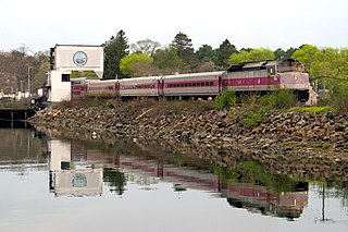
South Station, officially The Governor Michael S. Dukakis Transportation Center at South Station, is the largest railroad station and intercity bus terminal in Greater Boston and New England's second-largest transportation center after Logan International Airport. Located at the intersection of Atlantic Avenue and Summer Street in Dewey Square, Boston, Massachusetts, the historic station building was constructed in 1899 to replace the downtown terminals of several railroads. Today, it serves as a major intermodal domestic transportation hub, with service to the Greater Boston region and the Northeastern and Midwestern United States. It is used by thousands of commuter rail and intercity rail passengers daily. Connections to the rapid transit Red Line and bus rapid transit Silver Line are made through the adjacent subway station.

<span class="mw-page-title-main">Alewife station</span> Rapid transit station in Cambridge, Massachusetts, US

Alewife station is a Massachusetts Bay Transportation Authority (MBTA) intermodal transit station in the North Cambridge neighborhood of Cambridge, Massachusetts. It is the northwest terminal of the rapid transit Red Line and a hub for several MBTA bus routes. The station is at the confluence of the Minuteman Bikeway, Alewife Linear Park, Fitchburg Cutoff Path, and Alewife Greenway off Alewife Brook Parkway adjacent to Massachusetts Route 2, with a five-story parking garage for park and ride use. The station has three bike cages. Alewife station is named after nearby Alewife Brook Parkway and Alewife Brook, themselves named after the alewife fish.

<span class="mw-page-title-main">Porter station</span> Transit station in Cambridge, Massachusetts, US

Porter station is a Massachusetts Bay Transportation Authority (MBTA) transit station in Cambridge, Massachusetts. It serves the Red Line rapid transit line, the MBTA Commuter Rail Fitchburg Line, and several MBTA bus lines. Located at Porter Square at the intersection of Massachusetts and Somerville Avenues, the station provides rapid transit access to northern Cambridge and the western portions of Somerville. Porter is 14 minutes from Park Street on the Red Line, and about 10 minutes from North Station on commuter rail trains. Several local MBTA bus routes also stop at the station.

<span class="mw-page-title-main">MBTA Commuter Rail</span> Greater Boston commuter rail system

The MBTA Commuter Rail system serves as the commuter rail arm of the Massachusetts Bay Transportation Authority's (MBTA's) transportation coverage of Greater Boston in the United States. Trains run over 394 mi (634 km) of track to 135 stations. It is operated under contract by Keolis, which took over operations on July 1, 2014, from the Massachusetts Bay Commuter Railroad Company (MBCR).

<span class="mw-page-title-main">Ruggles station</span> Transit hub in Boston, Massachusetts, US

Ruggles station is an intermodal transfer station in Boston, Massachusetts. It serves Massachusetts Bay Transportation Authority (MBTA) rapid transit, bus, and commuter rail services and is located at the intersection of Ruggles and Tremont streets, where the Roxbury, Fenway–Kenmore, and Mission Hill neighborhoods meet. It is surrounded by the campus of Northeastern University. Ruggles is a station stop for the Orange Line subway, as well as the Providence/Stoughton Line, Franklin/Foxboro Line, and Needham Line of the MBTA Commuter Rail system. Thirteen MBTA bus routes stop at Ruggles.

<span class="mw-page-title-main">Malden Center station</span> Transit station in Malden, Massachusetts, US

Malden Center station is a Massachusetts Bay Transportation Authority (MBTA) intermodal transit station in Malden, Massachusetts. Located on an elevated grade above Pleasant Street in downtown Malden, it serves the rapid transit Orange Line and the MBTA Commuter Rail Haverhill Line. The station has one island platform for the two Orange Line tracks and a single side platform for the single commuter rail track. Two busways are used by 12 MBTA bus routes.

The Grand Junction Railroad is an 8.55-mile (13.76 km) long railroad in the Boston, Massachusetts, area, connecting the railroads heading west and north from Boston. The line is notable for its railroad bridge over the Charles River that passes under the Boston University Bridge between Boston and Cambridge, Massachusetts.

<span class="mw-page-title-main">Fitchburg Line</span> MBTA Commuter Rail line

The Fitchburg Line is a branch of the MBTA Commuter Rail system which runs from Boston's North Station to Wachusett station in Fitchburg, Massachusetts. The line is along the tracks of the former Fitchburg Railroad, which was built across northern Massachusetts, United States, in the 1840s. Winter weekend service includes a specially equipped seasonal "ski train" to Wachusett Mountain.

<span class="mw-page-title-main">Community College station</span> Rapid transit station in Charlestown, Massachusetts, US

Community College station is a rapid transit station on the MBTA Orange Line in Boston, Massachusetts. It is located in the Charlestown neighborhood off Austin Street near New Rutherford Avenue (MA-99), under the double-decked elevated structure carrying Interstate 93 to the Zakim Bunker Hill Bridge. The station is named for the adjacent Bunker Hill Community College. The station opened in April 1975, replacing the City Square and Thompson Square stations of the Charlestown Elevated. It was made accessible around 2005.

<span class="mw-page-title-main">Newburyport/Rockport Line</span> Commuter rail service in Massachusetts, US

The Newburyport/Rockport Line is a branch of the MBTA Commuter Rail system, running northeast from downtown Boston, Massachusetts towards Cape Ann and the Merrimack Valley, serving the North Shore. The first leg, operating via the Eastern Route of the former Boston and Maine Railroad, serves Chelsea, Lynn, Swampscott, Salem, and Beverly. From there, a northern branch continues via the Eastern Route to serve Hamilton, Ipswich, Rowley, and Newburyport, while other trains operate east from Beverly via the Gloucester Branch, serving Manchester, Gloucester, and Rockport. A bicycle coach is offered on the Rockport branch during the summer. With over 11,000 daily riders in October 2022, the line is the second-busiest on the system.

<span class="mw-page-title-main">Haverhill station (Massachusetts)</span> Train station in Haverhill, Massachusetts

Haverhill station is an intercity and regional rail station located in downtown Haverhill, Massachusetts, United States. It is served by Amtrak's Downeaster service and the MBTA Commuter Rail Haverhill/Reading Line; it is the northern terminus of MBTA service on the line. Haverhill is one of two major hubs for MVRTA local bus service; the Washington Square Transit Center is located 15 mile (0.3 km) east of the rail station.

<span class="mw-page-title-main">Silver Hill station</span> Railway station in Weston, Massachusetts, US

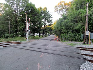
Silver Hill station is an MBTA Commuter Rail Fitchburg Line station in Weston, Massachusetts, United States. The station has a small shelter, parking area, and a gravel boarding area; it is not accessible. It was the least-used station in the entire MBTA system in 2018, with an average of just eleven daily boardings. Silver Hill station opened in 1844 as one of the original stops on the Fitchburg Railroad. The Boston and Maine Railroad unsuccessfully attempted to close the station in 1959. It remained in use until its temporary closure by the Massachusetts Bay Transportation Authority (MBTA) in December 2020 due to low ridership and a lack of accessibility, with indefinite closure effective April 2021. It reopened on November 18, 2024.

<span class="mw-page-title-main">Waverley station (MBTA)</span> Railroad station in Belmont, Massachusetts, US

Waverley station is an MBTA Commuter Rail station in Belmont, Massachusetts. It serves the Fitchburg Line. It is located below grade in Waverley Square in the triangle of Trapelo Road, Lexington Street, and Church Street in western Belmont.

<span class="mw-page-title-main">Waltham station</span> Railroad station in Waltham, Massachusetts, US

Waltham station is an MBTA Commuter Rail station in Waltham, Massachusetts, served by the Fitchburg Line. It is located in downtown Waltham adjacent to Central Square. The station is the transit hub of Waltham, with MBTA bus routes 61, 70, 553, 554, 556, and 558 stopping on Carter Street adjacent to the station.

<span class="mw-page-title-main">Kendal Green station</span> MBTA Commuter Rail station in Weston, Massachusetts

Kendal Green station is an MBTA Commuter Rail station in Weston, Massachusetts, US, served by the Fitchburg Line. The station has a single platform serving two tracks; it is not accessible. It originally opened with the Fitchburg Railroad in 1844 as "Weston"; it was renamed Kendal Green after the green cloth around 1886. A new station building was constructed in 1896. Service passed to the Boston and Maine Railroad in 1900, and to the Massachusetts Bay Transportation Authority (MBTA) in the 1970s. The former station building, reused as a private residence, was added to the National Register of Historic Places in 2000 as a contributing property to the Kendal Green Historic District.

<span class="mw-page-title-main">Hastings station (MBTA)</span> Former railway station in Weston, Massachusetts, US

Hastings station was an MBTA Commuter Rail Fitchburg Line station in Weston, Massachusetts. The station had a small parking area but no platforms; passengers boarded trains from the Viles Street grade crossing. It was originally opened in the 1890s to serve the adjacent Hook & Hastings organ factory. The factory closed in 1935, but the station remained open with limited service. It was temporarily closed by the Massachusetts Bay Transportation Authority (MBTA) in December 2020 due to its low ridership and lack of accessibility; indefinite closure became effective in April 2021.

<span class="mw-page-title-main">Fitchburg Intermodal Transportation Center</span> Regional rail and bus station

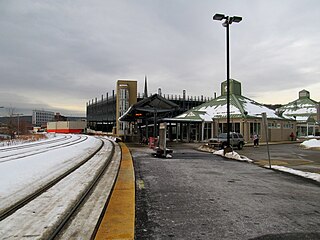
The Fitchburg Intermodal Transportation Center is a regional rail and bus station located in downtown Fitchburg, Massachusetts. It is a stop on the MBTA Commuter Rail Fitchburg Line and a hub for Montachusett Regional Transit Authority local and intercity bus routes.

<span class="mw-page-title-main">Union Station (Worcester, Massachusetts)</span> Railway station in Worcester, Massachusetts, US

Union Station is a railway station located at Washington Square in downtown Worcester, Massachusetts. It is the western terminus of the MBTA Commuter Rail Framingham/Worcester Line and a stop for the Amtrak Lake Shore Limited service. A bus terminal adjacent to the station is the hub for Worcester Regional Transit Authority (WRTA) local bus service; it is also used by PVTA, MART, Peter Pan, and Greyhound intercity buses.

<span class="mw-page-title-main">Back Bay station</span> Railway station in Boston, Massachusetts, US

Back Bay station is an intermodal passenger station in Boston, Massachusetts. It is located just south of Copley Square in Boston's Back Bay and South End neighborhoods. It serves MBTA Commuter Rail and MBTA subway routes, and also serves as a secondary Amtrak intercity rail station for Boston. The present building, designed by Kallmann McKinnell & Wood, opened in 1987. It replaced the New Haven Railroad's older Back Bay station – which opened in 1928 as a replacement for an 1899-built station – as well as the New York Central's Huntington Avenue and Trinity Place stations which had been demolished in 1964.

References

  1. Central Transportation Planning Staff (2019). "2018 Commuter Rail Counts". Massachusetts Bay Transportation Authority.
  2. "Amtrak Fact Sheet, Fiscal Year 2023: Commonwealth of Massachusetts" (PDF). Amtrak. March 2024. Retrieved June 27, 2024.
  3. 1 2 "North Station Neighborhood Map" (PDF). Massachusetts Bay Transportation Authority. April 2012. Archived from the original (PDF) on December 20, 2016. Retrieved November 25, 2015.
  4. "Water Transport: Water Shuttles and Water Taxis". Massachusetts Port Authority. Archived from the original on July 2, 2017. Retrieved December 8, 2015.
  5. 1 2 3 4 5 6 7 8 9 10 11 12 13 14 15 16 17 18 19 20 21 22 23 24 25 Barrett, Richard C. (1996). Boston's Depots and Terminals. Railroad Research Publications. ISBN   1-884650-03-1.
  6. 1 2 Meeks, Carroll Louis Vanderslice (1956). The Railroad Station: An Architectural History . Yale University Press. ISBN   0-300-00764-7.
  7. Chasson, George Jr. (1987). Lonto, Arthur J. (ed.). "Boston's Main Line El: The Formative Years 1879–1908". Headlights. 49. Electric Railroader's Association: 11.
  8. "Hopes to Complete New Terminal in Two Years". Boston Globe. October 28, 1926. p. 36 via Newspapers.com. Open Access logo PLoS transparent.svg
  9. "B. & M. R. R. Announces Vast Building Plans". Boston Globe. November 15, 1927. pp. 1, 15 via Newspapers.com. Open Access logo PLoS transparent.svg
  10. Atlas of the City of Boston. G.W. Bromley & Co. 1938. Plate 6 via Ward Maps.[ permanent dead link ]
  11. Boston & Maine September 1937 timetable
  12. Boston & Maine April 1946 timetable
  13. 'Official Guide of the Railways,' June 1961, Boston & Maine section
  14. 1 2 3 4 5 6 Belcher, Jonathan. "Changes to Transit Service in the MBTA district" (PDF). Boston Street Railway Association.
  15. "White River Junction, Vt. and Area, 1964–65 and 2000". Trainweb.org. September 2002.
  16. 1 2 VanBokkelen, James. "Run-Through Passenger Trains in New England". Far Acres Farm. Retrieved April 2, 2017.
  17. 1 2 3 Sanborn, George M. (1992). A Chronicle of the Boston Transit System. Massachusetts Bay Transportation Authority. Archived from the original on 2015-08-18. Retrieved 2019-10-29 via Massachusetts Institute of Technology.
  18. 1 2 Ackerman, Jerry (March 8, 1989). "T pressured to open all routes to accessible". Boston Globe. pp. 1, 16 via Newspapers.com. (second page, third page) Open Access logo PLoS transparent.svg
  19. "Chapter 0015: An Act Furthering The Establishment Of Multipurpose Arena And Transportation Center". Acts and Resolves. Massachusetts General Court. February 26, 1993. pp. 23–33.
  20. "Boston – North Station, MA (BON)". Great American Stations. Amtrak.
  21. INDEPENDENT STATE AUDITOR'S REPORT ON CERTAIN ACTIVITIES OF THE MASSACHUSETTS BAY TRANSPORTATION AUTHORITY: JULY 1, 1995 TO JUNE 30, 2002 (PDF) (Report). Auditor of the Commonwealth. March 28, 2003.
  22. 1 2 "Lovejoy Ferry Service Ends" (PDF). TRANSreport. Boston Region Metropolitan Planning Organization: 3. January 2005. Retrieved November 25, 2015.
  23. 1 2 Ridership and Service Statistics (PDF) (13 ed.). Massachusetts Bay Transportation Authority. 2010. Archived from the original (PDF) on August 13, 2011.
  24. Vaccaro, Adam (January 4, 2019). "Boston will get a new ferry soon, but only for some people". Boston Globe.
  25. "North Station Concourse To More Than Double In Size" (Press release). Massachusetts Bay Transportation Authority. April 26, 2006.
  26. "North Station Improvement Project". Massachusetts Bay Transportation Authority. Archived from the original on February 16, 2007.
  27. "North Station Concourse Doubles In Size" (Press release). Massachusetts Bay Transportation Authority. February 7, 2007.
  28. "New Train Announcement Boards Activated at North Station" (Press release). Massachusetts Bay Transportation Authority. November 14, 2007.
  29. Carlock, Caroline (November 5, 2015). "Boston Properties clears major hurdle for ambitious Boston Garden project". Boston Business Journal. Retrieved November 25, 2015.
  30. Epsilon Associates, Inc. (September 6, 2013). "Expanded Project Notification Form: The Boston Garden". Boston Redevelopment Authority. Retrieved November 25, 2015.
  31. Smyth, Sean (January 6, 2019). "Underground tunnel connecting North Station commuter rail, T stations is now open". Boston Globe.
  32. "Report from the General Manager" (PDF). Massachusetts Bay Transportation Authority. February 24, 2022. p. 12.
  33. MBTA Commuter Rail [@MBTA_CR] (March 24, 2022). "🚧 Attention riders! Beginning Thursday, March 24, two sections of the North Station concourse will be blocked off for the first phase of fare gate construction. Construction will include removal of flooring & installation of electrical needed to power the gates" (Tweet) via Twitter.
  34. "Commuter Rail to Begin Operating Fare Gates at North Station on October 1" (Press release). Massachusetts Bay Transportation Authority. September 23, 2022.
  35. 1 2 "North Station Draw One Bridge Replacement: Project Overview Spring 2023" (PDF). Massachusetts Bay Transportation Authority. May 2023.
  36. "Commuter Rail Schedules Initiative: North Side" (PDF). Massachusetts Bay Transportation Authority. October 6, 2015. p. 13. Archived from the original (PDF) on February 2, 2017. Retrieved October 14, 2016.
  37. "MBTA Contract No. Q60CN01: North Station Terminal Area Signal System Improvements" (PDF). Retrieved 29 December 2019.
  38. "North Station Terminal Area Signal System Improvement Project". Massachusetts Bay Transportation Authority. Retrieved November 29, 2022.
  39. "Massachusetts Wins $472 Million in Federal Funding for North Station Draw One Bridge Replacement" (Press release). Massachusetts Bay Transportation Authority. September 23, 2024.
  40. Draft Environmental Assessment: Draw One Replacement Project (PDF). Federal Transit Administration and Massachusetts Bay Transportation Authority. December 2024. p. ES-4.