Hamilton, Massachusetts

Last updated
Hamilton, Massachusetts
Hamilton Town Hall.jpg
Hamilton Town Hall
Seal of Hamilton, Massachusetts.png
Essex County Massachusetts incorporated and unincorporated areas Hamilton highlighted.svg
Location in Essex County and the state of Massachusetts.
Coordinates: 42°37′10.95″N70°51′17.24″W / 42.6197083°N 70.8547889°W / 42.6197083; -70.8547889
Country United States
State Massachusetts
County Essex
Settled1638;385 years ago (1638)
Incorporated1793;230 years ago (1793)
Government
  Type Open town meeting
Area
  Total14.9 sq mi (38.6 km2)
  Land14.2 sq mi (36.7 km2)
  Water0.7 sq mi (1.9 km2)
Elevation
49 ft (15 m)
Population
 (2020)
  Total7,561
  Density510/sq mi (200/km2)
Time zone UTC-5 (Eastern)
  Summer (DST) UTC-4 (Eastern)
ZIP code
01936/01982 (South Hamilton)
Area code 351 / 978
FIPS code 25-27900
GNIS feature ID0619446
Website www.hamiltonma.gov

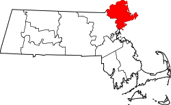
Hamilton is a town in the eastern central portion of Essex County in eastern Massachusetts, United States. At the 2020 census, it had a population of 7,561. [1] Currently the town has no manufacturing industry and no industrially zoned land.

Contents

Though Hamilton is a landlocked town in the North Shore region of Massachusetts, its proximity to it provides easy access to the Atlantic seashore with its reservations, beaches and boating. The town includes many historic houses, pastoral landscapes, and old stone walls that accompany winding tree-lined roads. It also has a rich equestrian heritage, which remains strong due to the influence of the many horse farms and of Myopia Hunt Club, which holds frequent equestrian events, including polo most Sunday afternoons. (Myopia also hosts a Thanksgiving Day fox hunt each year that the public may attend. [2] ) Thus, people visiting Hamilton may well share the secondary roads with horse and pony riders. Patton Park, one of the parks in downtown Hamilton, was named after General George S. Patton. The park is a center of activity for the town.

Hamilton-Wenham Public Library Hamilton-Wenham Public Library.jpg
Hamilton-Wenham Public Library

Hamilton is closely tied to neighboring Wenham, sharing a school system, library, recreation department, commuter rail station and newspaper. In 2010, the community of Hamilton-Wenham was listed among the "Best Places to Live" by Boston Magazine.

Hamilton includes South Hamilton, a part of Hamilton that the Postal Service has assigned the zip code 01982. "Hamilton" and "South Hamilton" differ only in zip code and are otherwise the same town.

History

View of First Congregational Church from Hamilton Cemetery View of First Congregational Church from Hamilton Cemetery.jpg
View of First Congregational Church from Hamilton Cemetery

In June 1638, John Winthrop the Younger, son of the founder of the Massachusetts Bay Colony, bought most of present-day Essex County from Masconomet, chief of the Agawam Indians, for the sum of twenty English pounds. A memorial stone on Sagamore Hill in southeastern Hamilton marks where Masconomet was buried with his gun and tomahawk around 1658.

Hamilton was first settled in 1638 and was originally a section of Ipswich known as "The Hamlet". The first recorded land grant in the Hamlet was Matthew Whipple's farm, dated 1638. Three years later the new stagecoach road from Boston to Newburyport (Bay Road) was laid out through the Whipple land. Other early settlers of the Hamlet, including the Appletons, Winthrops, Lamsons, and Dodges, were attracted by countryside similar to the English farms and estates they had left behind.

Hamilton Town Hall Hamilton, Massachusetts Hamilton Town Hall 1.jpg
Hamilton Town Hall Hamilton, Massachusetts

The town was incorporated on June 21, 1793, [3] and named for Alexander Hamilton, whose portrait became the town seal in 1903. With the arrival of the Boston and Maine Railroad in 1839, the population center moved gradually southward toward the depot.

The farm village proved to be an attractive location for Boston groups seeking land for recreation and renewal. A Methodist ministers' association first held a camp meeting at Asbury Grove in 1859. In the 1880s, the Myopia Hunt Club, which had been named in jest for its nearsighted founders, moved from Winchester, Massachusetts, to the Gibney Farm in Hamilton. Beginning as a lawn tennis and baseball club, it turned to polo, the hunt, and golf as members built large summer estates in the area. Myopia donated the site for the General George S. Patton Memorial Park to the town of Hamilton. The park continues to be a recreation center for the town.

In 1921, the Mandell family built the Community House in memory of the eight men in Hamilton and Wenham who died in military service during World War I, including their son, Sam. They commissioned Guy Lowell, a respected architect of Boston and New York, to design the building, and gave the Community House in trust for the use of the residents of both towns. Although in its early days the Community House offered activities such as bowling and a men's smoking room, it now features a wide range of classes and activities for all ages. [4] [5] [6]

In 2021, Hamilton became the first town in Massachusetts to mandate composting. [7] [8]

Geography

According to the United States Census Bureau, the town has a total area of 14.9 square miles (38.6 km2), of which 14.2 square miles (36.7 km2) is land and 0.73 square miles (1.9 km2), or 4.89%, is water. [9] Hamilton lies 5 miles (8 km) inland from Massachusetts Bay, and both the eastern and western portion of town are bordered by water, with the Ipswich River to the west and Chebacco Lake and several other small ponds to the east. The highest point in town is found on Blueberry Hill in Bradley Palmer State Park, with an elevation of at least 215 feet (66 m), according to the most recent (2011-2012) USGS 7.5-minute topographical map. [10] Several areas of town are protected, including Myopia Hunt Club and parts of Bradley Palmer State Park, Appleton Farm Grass Rides, and the Ipswich River Wildlife Sanctuary.

Hamilton is bordered by Ipswich to the north, Essex to the east, Manchester-by-the-Sea to the southeast, Wenham to the south, and Topsfield to the west. It is located 12 miles (19 km) south of Newburyport, 8 miles (13 km) north of Salem and 23 miles (37 km) northeast of Boston.

Transportation

Demographics

Historical population
YearPop.±%
1850 889    
1860 789−11.2%
1870 790+0.1%
1880 935+18.4%
1890 961+2.8%
1900 1,614+68.0%
1910 1,749+8.4%
1920 1,631−6.7%
1930 2,044+25.3%
1940 2,037−0.3%
1950 2,764+35.7%
1960 5,488+98.6%
1970 6,373+16.1%
1980 6,960+9.2%
1990 7,280+4.6%
2000 8,315+14.2%
2010 7,764−6.6%
2020 7,561−2.6%
2022*7,526−0.5%
* = population estimate.
Source: United States census records and Population Estimates Program data. [11] [12] [13] [14] [15] [16] [17] [18] [19] [20] [21]

As of the census [22] of 2000, there were 8,315 people, 2,668 households, and 2,142 families residing in the town. (Update: The population was 8251 in 2009, down less than 100 from the 8,315 of the 2000 census. Based on the total area, both land and water, the density is therefore 553.8 persons per square mile.) As of the 2000 census, there were 2,825 housing units at an average density of 193.5 per square mile (74.7/km2). The racial makeup of the town was 94.19% White, 0.47% African American, 0.17% Native American, 4.26% Asian, 0.05% Pacific Islander, 0.34% from other races, and 0.53% from two or more races. Hispanic or Latino of any race were 0.99% of the population.

There were 2,668 households, out of which 66.6% had children under the age of 18 living with them, 71.1% were married couples living together, 7.3% had a female householder with no husband present, and 19.7% were non-families. 15.7% of all households were made up of individuals, and 7.0% had someone living alone who was 65 years of age or older. The average household size was 2.87 and the average family size was 3.22.

In the town, the population was spread out, with 27.4% under the age of 18, 5.9% from 18 to 24, 33.3% from 25 to 44, 23.0% from 45 to 64, and 10.4% who were 65 years of age or older. The median age was 36 years. For every 100 females, there were 96.8 males. For every 100 females age 18 and over, there were 95.1 males.

The median income for a household in the town was $116,900. The per capita income for the town was $50,599. About 7.4% of the population were below the poverty line.

Education

Hamilton is esteemed for the regional school district it shares with neighboring Wenham, and Hamilton is where the majority of the schools in the Hamilton-Wenham Regional School District are located. The town serves two elementary schools; the Winthrop, and Cutler schools. The town only has one middle school; the Miles River Middle School. High School students attend Hamilton-Wenham Regional High School.

At Hamilton-Wenham Regional High School, students' average SAT scores are above the state average (According to numbers released by the state Dept of Education, Hamilton-Wenham Regional High School ranked 27th in the state based on combined total SAT scores for the 2006/2007 school year), and the school regularly sends top students to Ivy League schools. Boston Magazine's 2010 issue showcasing a list of the best public high schools ranked Hamilton-Wenham Regional High School 12th, placing Hamilton-Wenham's public high school in the top 10 percent of the state overall. Hamilton-Wenham also had one of the highest graduation rates, at 96.8 percent. By 2011, Hamilton-Wenham Regional High School had moved up to number nine in Boston Magazine's "Best Schools" list. More recently, Hamilton-Wenham Regional High School ranked 107th (out of 14,000) on Newsweek's 2014 list of "America's Top High Schools" [23] and Hamilton-Wenham Regional High School was ranked the 13th-best public high school in Massachusetts in the 2016 U.S. News & World Report rankings [24] (the same report ranked Hamilton-Wenham 344th nationally.)

According to a September 29, 2010, article in the Hamilton-Wenham Chronicle: "Of the 885 schools in Massachusetts, the Bessie Buker Elementary School ranked second in science on this year's MCAS. The fifth-grade class at the school had 93 percent of its students score advanced and proficient. In addition, all ninth-grade students passed the biology test, with 92 percent scoring advanced and proficient, ranking 20th state-wide. Cutler School scored 21st state-wide with 90 percent of third-graders scoring advanced and proficient in English language arts." [25]

The Pingree School, a private secondary school, is located on the historic Pingree Family Estate in Hamilton.

Hamilton is also home to Gordon-Conwell Theological Seminary, an interdenominational evangelical theological seminary.

Notable people

Historic places

Further reading

Hamilton, Massachusetts American Revolution Bicentennial Commission, "Hamilton, Massachusetts : Chronicle of a Country Town" (1976)

Notes

  1. Known for his exploits in World War II, Patton resided in Hamilton. This is the reason for Patton Park, a park made famous by the installation of an M4 Sherman full-sized World War II tank on which many children and young adults play. At one point, children were able to play inside the tank until the late 1960s when a fire was set inside. After this, the hatches were welded shut.
  2. In the years after his 1980 retirement from the Army with the rank of Major General, Patton turned a Hamilton estate owned by his late father into the 250 acres (1.0 km2) Green Meadows Farm, where he named the fields in honor of Vietnam soldiers who died under his command.

Related Research Articles

<span class="mw-page-title-main">Essex County, Massachusetts</span> County in Massachusetts, United States

<span class="mw-page-title-main">Beverly, Massachusetts</span> City in the United States

Beverly is a city in Essex County, Massachusetts, and a suburb of Boston. The population was 42,670 at the time of the 2020 United States Census. A resort, residential, and manufacturing community on the Massachusetts North Shore, Beverly includes Ryal Side, North Beverly, Montserrat, Beverly Farms and Prides Crossing. Beverly is a rival of Marblehead for the title of being the "birthplace of the U.S. Navy".

<span class="mw-page-title-main">Georgetown, Massachusetts</span> Town in Massachusetts, United States

Georgetown is a town in Essex County, Massachusetts, United States. The population was 8,470 at the 2020 census. It was incorporated in 1838 from part of Rowley.

<span class="mw-page-title-main">Groveland, Massachusetts</span> Town in Massachusetts, United States

Groveland is a town in Essex County, Massachusetts, United States. It is thirty-four miles north of Boston. At the 2020 census, it had a population of 6,752. The town is divided into two precincts, Groveland and South Groveland.

<span class="mw-page-title-main">Manchester-by-the-Sea, Massachusetts</span> Town in Massachusetts, United States

Manchester-by-the-Sea is a coastal town on Cape Ann, in Essex County, Massachusetts, United States. The town is known for scenic beaches and vista points. According to the 2020 population census, the population is 5,395.

<span class="mw-page-title-main">Middleton, Massachusetts</span> Town in Massachusetts, United States

Middleton is a town in Essex County, Massachusetts, United States. The population was 9,779 at the 2020 census.

<span class="mw-page-title-main">Newbury, Massachusetts</span> Town in Massachusetts, United States

Newbury is a town in Essex County, Massachusetts, USA. The population was 6,716 at the 2020 census. Newbury includes the villages of Old Town, Plum Island and Byfield. Each village is a precinct with its own voting district, various town offices, and business center.

<span class="mw-page-title-main">Newburyport, Massachusetts</span> City in Massachusetts, United States

Newburyport is a coastal city in Essex County, Massachusetts, United States, 35 miles (56 km) northeast of Boston. The population was 18,289 at the 2020 census. A historic seaport with a vibrant tourism industry, Newburyport includes part of Plum Island. The mooring, winter storage, and maintenance of recreational boats, motor and sail, still contribute a large part of the city's income. A Coast Guard station oversees boating activity, especially in the sometimes dangerous tidal currents of the Merrimack River.

<span class="mw-page-title-main">Peabody, Massachusetts</span> City in Massachusetts, United States

Peabody is a city in Essex County, Massachusetts, United States. The population was 54,481 at the time of the 2020 United States Census. Peabody is located in the North Shore region of Massachusetts, and is known for its rich industrial history.

<span class="mw-page-title-main">Wenham, Massachusetts</span> Town in Massachusetts, United States

Wenham is a town in Essex County, Massachusetts. The population was 4,979 at the time of the 2020 census.

<span class="mw-page-title-main">West Newbury, Massachusetts</span> Town in Massachusetts, United States

West Newbury is a town in Essex County, Massachusetts, United States. Situated on the Merrimack River, its population was 4,500 at the 2020 census.

<span class="mw-page-title-main">Essex, Massachusetts</span> Town in Massachusetts, United States

Essex is a coastal town in Essex County, Massachusetts, 26 miles (42 km) north of Boston and 13 miles (21 km) southeast of Newburyport. It is known for its former role as a center of shipbuilding. The population was 3,675 at the 2020 census.

<span class="mw-page-title-main">Amesbury, Massachusetts</span> City in Massachusetts, United States

Amesbury is a city in Essex County, Massachusetts, United States, located on the left bank of the Merrimack River near its mouth, upstream from Salisbury and across the river from Newburyport and West Newbury. The population was 17,366 at the 2020 United States Census. A former farming and mill town, Amesbury is today largely residential. It is one of the two northernmost towns in Massachusetts.

<span class="mw-page-title-main">Boxford, Massachusetts</span> Town in Massachusetts, United States

Boxford is a town in Essex County, Massachusetts, United States. According to the U.S. Census Bureau, the town's population was 8,203 in 2020.

<span class="mw-page-title-main">Ipswich, Massachusetts</span> Town in Massachusetts, United States

Ipswich is a coastal town in Essex County, Massachusetts, United States. The population was 13,785 at the 2020 census. Home to Willowdale State Forest and Sandy Point State Reservation, Ipswich includes the southern part of Plum Island. A residential community with a vibrant tourism industry, the town is famous for its clams, celebrated annually at the Ipswich Chowderfest, and for Crane Beach, a barrier beach near the Crane estate. Ipswich was incorporated as a town in 1634.

<span class="mw-page-title-main">Rowley, Massachusetts</span> Town in Massachusetts, United States

Rowley is a town in Essex County, Massachusetts, United States. The population was 6,161 at the 2020 census.

<span class="mw-page-title-main">Topsfield, Massachusetts</span> Town in Massachusetts, United States

Topsfield is a town in Essex County, Massachusetts, United States. The population was 6,569 at the 2020 census. Topsfield is located in the North Shore region of Massachusetts. Part of the town comprises the census-designated place of Topsfield.

<span class="mw-page-title-main">Massachusetts's 6th congressional district</span> U.S. House district for Massachusetts

Massachusetts's 6th congressional district is located in northeastern Massachusetts. It contains most of Essex County, including the North Shore and Cape Ann, as well as part of Middlesex County. It is represented by Seth Moulton, who has represented the district since January 2015. The shape of the district went through minor changes effective from the elections of 2012 after Massachusetts congressional redistricting to reflect the 2010 census. The towns of Tewksbury and Billerica were added, along with a small portion of the town of Andover.

<span class="mw-page-title-main">Bradley Palmer State Park</span>

Bradley Palmer State Park is a public recreation area covering 736 acres (298 ha) on the Ipswich River in the towns of Hamilton and Topsfield, Massachusetts. The state park was once the estate of noted attorney Bradley Palmer. In addition to an extensive system of multi-use trails, the park features Palmer's restored Willowdale Mansion. The mansion is now home to Willowdale Estate, a premier event venue. Bordered on the north by the Ipswich River and Willowdale State Forest, the park is managed by the Department of Conservation and Recreation.

<span class="mw-page-title-main">Hamilton/Wenham station</span>

Hamilton/Wenham station is an MBTA Commuter Rail station in Hamilton and Wenham, Massachusetts. It serves the Newburyport Branch of the Newburyport/Rockport Line. It is located just south of the intersection of Bay Road and Walnut Road, and straddles the Hamilton–Wenham town line, with the southern end of the platform geographically in Wenham.

References

  1. "Census - Geography Profile: Hamilton town, Essex County, Massachusetts". United States Census Bureau . Retrieved November 7, 2021.
  2. "Experience The Myopia Club Fox Hunt This Thanksgiving!". Nephotographyguild.com. Retrieved 2015-04-24.
  3. "The Massachusetts Register and United States Calendar for the Year of Our Lord ..." Richardson, Lord & Holbrook, and James Loring. 31 January 1848. Retrieved 31 January 2022 via Google Books.
  4. Beattie, Donald W., ed., Hamilton, Massachusetts: "Chronicle of a Country Town"; Hamilton, MA: Town of Hamilton, Massachusetts American Revolution Bicentennial Commission, 1976.
  5. Pulsifer, Janice P., Changing Town: Hamilton, Massachusetts 1850-1910; Hamilton, MA: Hamilton Historical Society, 1976.
  6. Safford, Daniel E., "Hamilton" in The History of Essex County, Volume II; Philadelphia: J.W. Lewis & Company, 1888.
  7. Nanos, Janelle (February 21, 2021). "Hamilton becomes first Mass. town to mandate composting". BostonGlobe.com. Retrieved 2023-06-19.
  8. "Here's what local climate action looks like in small-town USA". Canary Media. 2023-05-10. Retrieved 2023-06-19.
  9. "Geographic Identifiers: 2010 Demographic Profile Data (G001): Hamilton town, Essex County, Massachusetts". United States Census Bureau . Retrieved September 4, 2012.
  10. "Georgetown Map". Ims.er.usgs.gov. Archived from the original on 2016-01-14. Retrieved 2015-04-24.
  11. "Total Population (P1), 2010 Census Summary File 1". American FactFinder, All County Subdivisions within Massachusetts. United States Census Bureau. 2010.
  12. "Massachusetts by Place and County Subdivision - GCT-T1. Population Estimates". United States Census Bureau. Retrieved July 12, 2011.
  13. "1990 Census of Population, General Population Characteristics: Massachusetts" (PDF). US Census Bureau. December 1990. Table 76: General Characteristics of Persons, Households, and Families: 1990. 1990 CP-1-23. Retrieved July 12, 2011.
  14. "1980 Census of the Population, Number of Inhabitants: Massachusetts" (PDF). US Census Bureau. December 1981. Table 4. Populations of County Subdivisions: 1960 to 1980. PC80-1-A23. Retrieved July 12, 2011.
  15. "1950 Census of Population" (PDF). Bureau of the Census. 1952. Section 6, Pages 21-10 and 21-11, Massachusetts Table 6. Population of Counties by Minor Civil Divisions: 1930 to 1950. Retrieved July 12, 2011.
  16. "1920 Census of Population" (PDF). Bureau of the Census. Number of Inhabitants, by Counties and Minor Civil Divisions. Pages 21-5 through 21-7. Massachusetts Table 2. Population of Counties by Minor Civil Divisions: 1920, 1910, and 1920. Retrieved July 12, 2011.
  17. "1890 Census of the Population" (PDF). Department of the Interior, Census Office. Pages 179 through 182. Massachusetts Table 5. Population of States and Territories by Minor Civil Divisions: 1880 and 1890. Retrieved July 12, 2011.
  18. "1870 Census of the Population" (PDF). Department of the Interior, Census Office. 1872. Pages 217 through 220. Table IX. Population of Minor Civil Divisions, &c. Massachusetts. Retrieved July 12, 2011.
  19. "1860 Census" (PDF). Department of the Interior, Census Office. 1864. Pages 220 through 226. State of Massachusetts Table No. 3. Populations of Cities, Towns, &c. Retrieved July 12, 2011.
  20. "1850 Census" (PDF). Department of the Interior, Census Office. 1854. Pages 338 through 393. Populations of Cities, Towns, &c. Retrieved July 12, 2011.
  21. "City and Town Population Totals: 2020-2022". United States Census Bureau . Retrieved November 23, 2023.
  22. "U.S. Census website". United States Census Bureau . Retrieved 2008-01-31.
  23. "America's Top High Schools : 2014". Newsweek.com. 13 September 2014. Retrieved 2015-04-24.
  24. "Best Massachusetts High Schools". Usnews.com. Retrieved 2022-01-31.
  25. "Serving our students with excellence". Wicked Local Hamilton. Perinton, New York: GateHouse Media. Sep 29, 2010.

Bibliography