South Hamilton, Massachusetts

Last updated
South Hamilton, Massachusetts
Postal Address
Looking north on Bay Road, South Hamilton MA.jpg
Looking north on Bay Road
Hamilton ma highlight.png
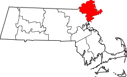
Location in Massachusetts
Coordinates: 42°37′10.95″N70°51′17.24″W / 42.6197083°N 70.8547889°W / 42.6197083; -70.8547889
Country United States
State Massachusetts
County Essex
Town Hamilton
Time zone UTC-5 (Eastern)
  Summer (DST) UTC-4 (Eastern)
ZIP code
01982
Area code 978

South Hamilton is a postal address assigned to ZIP code 01982 by the Postal Service and is part of the town of Hamilton, Essex County, Massachusetts, United States (ZIP code 01936). The designation arose in the 1960s when the Postal Service built a new modern post office in downtown Hamilton with the intention of closing the original post office 2 miles north on the same road. Due to public objection, the original post office was preserved and remains open to this day. To distinguish between the two post offices in an era when the use of ZIP code was not yet mandatory, the new post office was designated the "South Hamilton" post office.

Contents

The Postal Service followed through with moving most of their operations, including all delivery operations, to the new post office. Thus almost all mail delivered within the town of Hamilton carries the "South Hamilton" postal address and the 01982 ZIP code. Only mail destined for P.O. Boxes located within the old post office and a few nearby buildings still carries the "Hamilton" postal address and the 01936 zip code.
Bo Burnham's song "I'm Bo Yo" includes the lyric "I'm representing you/I'm representing the people from the 01982", a reference to Burnham's home town of Hamilton.

Related Research Articles

<span class="mw-page-title-main">United States Postal Service</span> Independent agency of the U.S. federal government

The United States Postal Service (USPS), also known as the Post Office, U.S. Mail, or Postal Service, is an independent agency of the executive branch of the United States federal government responsible for providing postal service in the United States, its insular areas, and its associated states. It is one of the few government agencies explicitly authorized by the Constitution of the United States. As of 2023, the USPS has 525,469 career employees and 114,623 non-career employees.

<span class="mw-page-title-main">Postal code</span> Series of letters and digits for sorting mail

A postal code is a series of letters or digits or both, sometimes including spaces or punctuation, included in a postal address for the purpose of sorting mail.

<span class="mw-page-title-main">ZIP Code</span> Numeric postal code used in the US and its territories

A ZIP Code is a system of postal codes used by the United States Postal Service (USPS). The term ZIP was chosen to suggest that the mail travels more efficiently and quickly when senders use the code in the postal address.

<span class="mw-page-title-main">Postcodes in the United Kingdom</span>

Postal codes used in the United Kingdom, British Overseas Territories and Crown dependencies are known as postcodes. They are alphanumeric and were adopted nationally between 11 October 1959 and 1974, having been devised by the General Post Office . The system uses alphanumeric codes to designate geographic areas. A full postcode, also known as a "postcode unit," identifies a group of addresses or a major delivery point. It consists of an outward code and inward code. The outward code indicates the area and district, while the inward code specifies the sector and delivery point, typically encompassing about 15 addresses.

<span class="mw-page-title-main">Hamilton, Massachusetts</span> Town in Massachusetts, United States

Hamilton is a town in the eastern central portion of Essex County in eastern Massachusetts, United States. At the 2020 census, it had a population of 7,561. Currently the town has no manufacturing industry and no industrially zoned land.

<span class="mw-page-title-main">Unincorporated area</span> Region of land not governed by own local government

An unincorporated area is a region that is not governed by a local municipal corporation. There are many unincorporated communities and areas in the United States and Canada.

<span class="mw-page-title-main">Postal codes in Canada</span>

A Canadian postal code is a six-character string that forms part of a postal address in Canada. Like British, Irish and Dutch postcodes, Canada's postal codes are alphanumeric. They are in the format A1A 1A1, where A is a letter and 1 is a digit, with a space separating the third and fourth characters. As of October 2019, there were 876,445 postal codes using Forward Sortation Areas from A0A in Newfoundland to Y1A in Yukon.

POSTNET is a barcode symbology used by the United States Postal Service to assist in directing mail. The ZIP Code or ZIP+4 code is encoded in half- and full-height bars. Most often, the delivery point is added, usually being the last two digits of the address or PO box number.

Poste restante, also known as general delivery in North American English, is a service where the post office holds the mail until the recipient calls for it. It is a common destination for mail for people who are visiting a particular location and have no need, or no way, of having mail delivered directly to their place of residence at that time.

<span class="mw-page-title-main">Post office box</span> Rented mailbox at a post office

A post office box is a uniquely addressable lockable box located on the premises of a post office.

<span class="mw-page-title-main">Address</span> Collection of information that describes the location of a building, apartment, or other structure

An address is a collection of information, presented in a mostly fixed format, used to give the location of a building, apartment, or other structure or a plot of land, generally using political boundaries and street names as references, along with other identifiers such as house or apartment numbers and organization name. Some addresses also contain special codes, such as a postal code, to make identification easier and aid in the routing of mail.

The RG postcode area, also known as the Reading postcode area, is a group of thirty postcode districts in England, within twelve post towns. These cover west and central Berkshire and north Hampshire, plus a small part of south-east Oxfordshire and very small parts of Buckinghamshire and Wiltshire.

<span class="mw-page-title-main">Postcodes in Australia</span>

Postcodes in Australia are used to more efficiently sort and route mail within the Australian postal system. Postcodes in Australia have four digits and are placed at the end of the Australian address, before the country. Postcodes were introduced in Australia in 1967 by the Postmaster-General's Department and are now managed by Australia Post, Australia's national postal service. Postcodes are published in booklets available from post offices or online from the Australia Post website.

<span class="mw-page-title-main">North Bridgton, Maine</span>

North Bridgton is a village in the town of Bridgton in Cumberland County, Maine, United States. It is located just west of Long Lake, and just south of the town of Harrison. In 1768, the undeveloped land was granted by the Massachusetts General Court to a group of proprietors led by a man named Moody Bridges. Settlement began in 1770, when a tavern was built.

Postal address verification is the process used to check the validity and deliverability of a physical mailing address. According to the United States Postal Service, an address is valid if it is CASS-certified, meaning that it exists within the comprehensive list of mailable addresses in their Address Management System. This is different from the credit card Address Verification System (AVS), which is the method used by credit card processors to authenticate ownership of a credit card by verifying that the account on the credit card matches the billing address on file. Credit card AVS does not determine deliverability of an address.

<span class="mw-page-title-main">Glasser, New Jersey</span> Populated place in Sussex County, New Jersey, US

Glasser is an area within the Northwood section of the Borough of Hopatcong, in Sussex County, in the U.S. state of New Jersey. While not officially a municipality, the area was granted its own post office in 1933 by the United States Postal Service that was later assigned ZIP Code 07837. Currently the area contains a small US Post Office, several residential apartments and bungalows, and a restaurant and bar overlooking Lake Hopatcong. Nearby residents get their mail delivered to PO boxes at the Glasser Post Office.

References