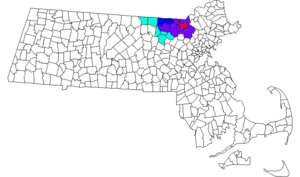
Middlesex County is located in the Commonwealth of Massachusetts, in the United States. As of the 2020 census, the population was 1,632,002, making it the 22nd most populous county in the United States, and the most populous county in both Massachusetts and New England. Middlesex County is one of two U.S. counties to be amongst the top 25 counties with the highest household income and the 25 most populated counties. As part of the 2010 national census, the Commonwealth's mean center of population for that year was geo-centered in Middlesex County, in the town of Natick at. Middlesex County is included in the Census Bureau's Boston–Cambridge–Newton, MA–NH Metropolitan Statistical Area.
Billerica is a town in Middlesex County, Massachusetts, United States. The population was 42,119 according to the 2020 census. It takes its name from the town of Billericay in Essex, England.

Chelmsford is a town in Middlesex County, Massachusetts in the United States. It is located 24 miles (39 km) northwest of Boston. Besides the city of Lowell on its northeast, it is surrounded by four towns: Tyngsborough to the north, Billerica to the east, Carlisle to the south, and Westford to the west. Chelmsford is bordered by the Merrimack River to the north and the Concord River to the east.

Dracut is a town in Middlesex County. At the 2020 census, the town's population was 32,617, making it the second most populous town in Massachusetts with an open town meeting system of governance. The town covers a total area of 21.36 square miles, 0.5 square miles of which is water.

Lowell is a city in Massachusetts, in the United States. With Cambridge, Lowell is one of two traditional seats of Middlesex County. With an estimated population of 115,554 in 2020, it was the fifth most populous city in Massachusetts as of the last census, and the second most populous in the Boston metropolitan statistical area. The city also is part of a smaller Massachusetts statistical area, called Greater Lowell, and of New England's Merrimack Valley region.

Tewksbury is a town in Middlesex County, Massachusetts, United States. Its population was 31,342 as of the 2020 United States Census.

Tyngsborough is a town in northern Middlesex County, Massachusetts, United States. Tyngsborough is 28 miles (45 km) from Boston along the Route 3 corridor, and located on the New Hampshire state line. At the 2020 census, the town population was 12,380. By its location, the town serves as a suburb of neighboring cities such as Nashua, New Hampshire and Lowell, Massachusetts.
Westford is a town in Middlesex County, Massachusetts, United States. The population was at 24,643 at the time of the 2020 Census.

Greater Boston is the metropolitan region of New England encompassing the municipality of Boston and its surrounding areas. The region forms the northern arc of the Northeast megalopolis, so Greater Boston means both a metropolitan statistical area (MSA) and a combined statistical area (CSA), which is broader. The MSA consists of most of the eastern third of Massachusetts, excluding the South Coast and Cape Cod; the CSA additionally includes the municipalities of Providence, Manchester, Worcester, the South Coast region, and Cape Cod. While the city of Boston covers 48.4 square miles (125 km2) and has 675,647 residents as of the 2020 census, the urbanization has extended well into surrounding areas and the CSA has a more than 8.4 million people, making it one of the most populous such regions in the U.S. The CSA is one of two in Massachusetts, the other being Greater Springfield. Greater Boston is the only CSA in New England that lies in three states.

The Middlesex Canal was a 27-mile (44-kilometer) barge canal connecting the Merrimack River with the port of Boston. When operational it was 30 feet wide, and 3 feet deep, with 20 locks, each 80 feet long and between 10 and 11 feet wide. It also had eight aqueducts.

Massachusetts's 5th congressional district is a congressional district in eastern Massachusetts. The district is represented by Katherine Clark. Massachusetts congressional redistricting after the 2010 census has changed the borders of the district starting with the elections of 2012, with the new 3rd district largely taking the place of the old 5th. The 5th district covers many of the communities represented in the old 7th district. As of 2010, the population of the 5th congressional district was 727,515. On July 15, 2013, Ed Markey resigned from the seat to become the junior Senator from Massachusetts. On December 10, 2013, Democrat Katherine Clark won a special election to fill the seat for the remainder of the 113th Congress. She was sworn into office on December 12, 2013 and serves as the Assistant Speaker of the United States House of Representatives for the 117th Congress.

Area code 978 was created as a split from area code 508 on September 1, 1997, and covers north central and most of northeastern Massachusetts. Use of 978 became mandatory on February 1, 1998. Prior to when this area was served by 508, it was served only by the 617 area code, along with the rest of the eastern two-thirds of the state. 351 has been sharing the service area since May 2, 2001. Since then, 10 digit local dialing is mandatory.

The Middlesex Turnpike was an early turnpike between Cambridge and Tyngsborough, Massachusetts and the New Hampshire border, where it connected with the Amherst Turnpike and thence Nashua and Claremont, New Hampshire.
Bay State Newspaper Company, based in Somerville, Massachusetts, United States, was a publisher of weekly newspapers in suburbs north of Boston. It was formed in 1991 by Fidelity Investments after it bought Dole Publishing from its longtime owner, William P. Dole.

The Lowell Regional Transit Authority (LRTA) is a public, non-profit organization in Massachusetts, charged with providing public transportation to the Greater Lowell area. This primarily includes the city of Lowell and the towns of Billerica, Burlington, Dracut, Chelmsford, Tewksbury, Tyngsborough, Westford and Wilmington. The LRTA provides fixed route bus services and paratransit services within this area, although some fixed lines do extend beyond these towns.

The Merrimack Valley is a bi-state region along the Merrimack River in the U.S. states of New Hampshire and Massachusetts. The Merrimack is one of the larger waterways in New England and has helped to define the livelihood and culture of those living along it for millennia.
The Spirit of Adventure Council is a regional council of the Boy Scouts of America. It serves the greater Boston, Massachusetts, area.
The Merrimack Valley Library Consortium (MVLC) is an American library consortium created by Nancy Jacobson and Evelyn Kuo in 1982. MVLC manages the resource sharing of 36 automated and partially automated libraries in Merrimack Valley region of northeastern Massachusetts, ensuring unified access to all of their catalogs, which represent almost three million items and more than six hundred thousand titles.

The Boston & Northern Street Railway Company (B&N) was a horse-drawn and electric streetcar railroad operated on the streets of Boston, Massachusetts, and communities to the north. Founded in 1859 as the Lynn and Boston Railroad (L&B), via lease and merger it became a primary mass transit provider for northeastern Massachusetts and New Hampshire. Its immediate successor was the Bay State Street Railway , and its modern successor is the state-run Massachusetts Bay Transportation Authority (MBTA).