Settled in 1778 and originally a part of Gilmanton, the town was first called Gunstock Parish. In 1812, Captain Lemuel B. Mason, who had fought in the 1781 Battle of Guilford Court House in North Carolina during the Revolutionary War and subsequently retired to Gunstock Parish, successfully proposed incorporation of a new town to be named Guilford after that battle. The name would later be contracted by clerical error. The original parish name is used by Gunstock Mountain and the ski resort located on it.[4]
Gilford was the destination of the first "snow train" from Boston in the 1930s. It also had New Hampshire’s first motorized ski lift, a gasoline-powered rope tow built in 1934 at what is now Gunstock Mountain Resort.[5]
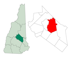
Geography
According to the United States Census Bureau, the town has a total area of 53.6 square miles (138.7km2), of which 38.8sqmi (100.5km2) are land and 14.7sqmi (38.2km2) are water, comprising 27.56% of the town.[1]Belknap Mountain, elevation 2,384 feet (727m) above sea level and the highest point in Gilford as well as Belknap County, is in the south. Much of the town is drained by the Gunstock River, a tributary of Lake Winnipesaukee. Gilford lies fully within the Merrimack Riverwatershed.[6]
New Hampshire Route 11 crosses the town from east to west, connecting Alton and Rochester to the east with Laconia to the west. NH 11 joins U.S. Route 3 near the western border of Gilford, and together they turn south on the Laconia Bypass, which is largely within the Gilford town limits, traveling southwest towards Tilton and Franklin. New Hampshire Route 11A is an alternate east–west route to NH 11, passing through the center of Gilford and by the entrance to Gunstock Mountain Resort. New Hampshire Route 11B leaves NH 11 near Sanders Bay on Lake Winnipesaukee and proceeds northwest to Weirs Beach in Laconia.
As of the 2000 census,[8] there were 6,803 people, 2,766 households, and 2,019 families residing in the town. The population density was 174.6 inhabitants per square mile (67.4/km2). There were 4,312 housing units at an average density of 110.6 per square mile (42.7/km2). The racial makeup of the town was 98.32% White, 0.19% African American, 0.15% Native American, 0.51% Asian, 0.07% from other races, and 0.75% from two or more races. Hispanic or Latino of any race were 0.57% of the population.
There were 2,766 households, out of which 30.8% had children under the age of 18 living with them, 61.9% were married couples living together, 8.1% had a female householder with no husband present, and 27.0% were non-families. 21.7% of all households were made up of individuals, and 9.0% had someone living alone who was 65 years of age or older. The average household size was 2.46 and the average family size was 2.85.
In the town, the population was spread out, with 23.7% under the age of 18, 4.4% from 18 to 24, 25.4% from 25 to 44, 29.6% from 45 to 64, and 16.8% who were 65 years of age or older. The median age was 43 years. For every 100 females, there were 92.0 males. For every 100 females age 18 and over, there were 89.8 males.
The median income for a household in the town was $48,658, and the median income for a family was $56,554. Males had a median income of $38,839 versus $27,325 for females. The per capita income for the town was $32,667. About 2.2% of families and 3.3% of the population were below the poverty line, including 1.2% of those under age 18 and 2.7% of those age 65 or over.
Government
Gilford city election results from state and federal races
↑ United States Census Bureau, American FactFinder, 2010 Census figures. Retrieved March 23, 2011.
↑ Coolidge, Austin J.; John B. Mansfield (1859). A History and Description of New England. Boston, Massachusetts: A.J. Coolidge. p.500. coolidge mansfield history description new england 1859.
This page is based on this Wikipedia article Text is available under the CC BY-SA 4.0 license; additional terms may apply. Images, videos and audio are available under their respective licenses.