Merrimack, New Hampshire

Last updated

Merrimack, New Hampshire
Town
First Church Merrimack NH.jpg
First Church of Merrimack
Merrimack Town Seal.png
Motto: 
One Town...Four Villages [1]
Hillsborough-Merrimack-NH.png
Coordinates: 42°51′59″N71°29′37″W / 42.86639°N 71.49361°W / 42.86639; -71.49361
CountryUnited States
State New Hampshire
County Hillsborough
Settled1673
Incorporated April 2, 1746
VillagesMerrimack
Reeds Ferry
South Merrimack
Thorntons Ferry
Government
   Town Council
   Town Manager Paul Micali
Area
[2]
  Total33.4 sq mi (86.6 km2)
  Land32.6 sq mi (84.4 km2)
  Water0.8 sq mi (2.2 km2)  2.55%
Elevation
180 ft (50 m)
Population
 (2020) [3]
  Total26,632
  Density817/sq mi (315.6/km2)
Time zone UTC−5 (Eastern)
  Summer (DST) UTC−4 (Eastern)
ZIP code
03054
Area code 603
FIPS code33-47540
GNIS feature ID0873663
Website www.merrimacknh.gov

Merrimack is a town in Hillsborough County, New Hampshire, United States. The population was 26,632 as of the 2020 census. [3]

Contents

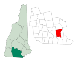
There are four villages in the town: Merrimack Village (formerly known as Souhegan Village), Thorntons Ferry, Reeds Ferry, and South Merrimack.

History

The first known settlers of the area appeared sometime after the last ice age. Merrimack is a Native American term meaning sturgeon, a type of fish. The Pennacook people named the Merrimack River after this fish because of the vast population that once existed there. The Pennacooks spelled it Monnomoke or Merramake. "When the town was incorporated, it took the name of the river and spelled it Merrymac," according to the Merrimack Historical Society. [4]

The first mention of the territory containing the current town of Merrimack among written records was the petition of Passaconaway to the General Court of Massachusetts for a grant of land to include a part of this region. This was in 1662, and in the autumn of that year the court acceded to the request, and the aged sachem and his associates were granted a strip of country a mile and a half wide on both banks of the Merrimack at this section of the river. Although the boundaries of this grant are not specifically known today, it is probable that the chieftain held at least a portion of the current town of Merrimack. European settlers first came to the area in the late 17th century when the area was still in dispute between the Province of New Hampshire and Massachusetts Bay Colony.

The town of Merrimack was originally part of the 1673 Dunstable grant. On June 25, 1734, Massachusetts granted the town organization as "Naticook", which was made up of Litchfield and part of Merrimack. In 1746 the boundary line between Massachusetts and New Hampshire was revised, and the land which was originally part of Massachusetts became part of New Hampshire. When it went back into New Hampshire, the province disincorporated the towns of Dunstable, Naticook, and Nottingham and formed it into one giant territory again, roughly the size of the old Dunstable Grant from the 1670s. [5]

On April 2, 1746, Governor Benning Wentworth signed a charter establishing that the land from Pennichuck Brook to the Souhegan River became the Town of Merrymac. At that time fewer than 50 families lived here. Pawtucket, Nashaway and Pennacook people camped along the banks of the Merrimack and Souhegan rivers. The Pennacooks were greatest in numbers, and their chief, Passaconaway, was the ruler of all the tribes in the Merrimack Valley. On June 5, 1750, the town's charter was ratified, giving the town an additional 3 miles (5 km) to the north. The new portion called "Souhegan East" was made up of the land north of the Souhegan River.

Matthew Thornton, a signer of the Declaration of Independence, lived and was buried in Merrimack. The Signer's House and Matthew Thornton Cemetery are still located in the town.

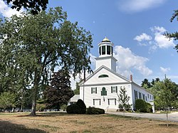
The original meetinghouse was built at the exact center of town. There were two cemeteries. Turkey Hill on Meetinghouse Road is the first mentioned in the town records, but Thornton Cemetery on Route 3 has the oldest gravestone.

The nineteenth century saw much growth in Merrimack. The meetinghouse was too small and too far from what had become the center of town. The church and government became separate and two new churches were built in more convenient locations, one in South Merrimack and one on Baboosic Lake Road. A new town hall was built to replace the meetinghouse. [6]

The Boston and Maine Railroad laid tracks through the town in the 19th century, with several stations operating until the mid-20th century, when the advent of the automobile transformed Merrimack from a largely agricultural community to a bedroom community of Boston and nearby cities in New Hampshire. Since 1970 the town has been the home of an Anheuser-Busch brewery, their easternmost, and one of their smallest plants in the United States. It is home to a brewery tour and one of the five stables for the Budweiser Clydesdales. [7]

The Merrimack School Board attracted national attention in 1995 when it passed a "prohibition of alternative lifestyle instruction" act, which resulted in the removal of a work by William Shakespeare from the school curriculum. [8] The board members who supported the act were voted out in the subsequent board election. [9]

Geography

The Souhegan River in Wildcat Falls Conservation Area Souhegan River Merrimack NH.jpg
The Souhegan River in Wildcat Falls Conservation Area

According to the United States Census Bureau, the town has a total area of 33.4 square miles (86.6 km2), of which 32.6 square miles (84.4 km2) are land and 0.85 square miles (2.2 km2) are water, comprising 2.55% of the town. [2] The highest point in Merrimack is an unnamed hill in the northwestern part of town that reaches 512 feet (156 m) above sea level.

Adjacent municipalities

Areas of Merrimack

Shadows of the former villages that now make Merrimack still exist. However, the boundaries and exact definitions are unclear due to the expansion of suburban development in the town during the latter half of the 20th century.

Thorntons Ferry

The area of town near Naticook Lake and Continental Boulevard, its name comes from Matthew Thornton, one of the signers of the Declaration of Independence who lived in Merrimack and is now buried in a cemetery near the intersection of Daniel Webster Highway (U.S. Route 3) and Greeley Street. Thorntons Ferry Elementary School is located on Camp Sargent Road.

Reeds Ferry

The northern portion of the town, Reeds Ferry is centered on the current intersection of Bedford Road and Daniel Webster Highway. The boundaries of the area are unclear, as the northwestern part of town near Baboosic Lake is not traditionally considered a portion of Reeds Ferry. While as a defined village it was located mostly near the Merrimack River, the area near Baboosic Lake may now possibly be seen as part of Reeds Ferry. Reeds Ferry Elementary School is located on Lyons Road.

South Merrimack

Centered on Pennichuck Square on Rte. 101A and Continental Boulevard, South Merrimack is usually considered to be the southwestern part of town near Rte. 101A and Boston Post Road. However, the southeastern portion of town near Harris Pond might also be considered part of South Merrimack or Thornton's Ferry.

Merrimack Village

The center of town is not known as "Merrimack Village" per se, but constitutes the area between the more defined Reeds Ferry and Thorntons Ferry areas. Largely considered to be located at the Public Library on the corner of Baboosic Lake Road and Daniel Webster Highway, Merrimack Village was built along the Souhegan River that roughly cuts the current town in half. The elementary school in this part of town is named after James Mastricola, [10] who deeded the land to the town upon his death. One of the three elementary schools, the upper elementary school, Merrimack High School, the library, and the current town hall, among other buildings, are all located on the land formerly owned by Mastricola.

The "village" is considered to extend westward to the Amherst border. This is due in large part to the former Town Meetinghouse, which was located on the corner of Turkey Hill Road and Meetinghouse Road.

Demographics

Historical population
CensusPop.Note
1790 819
1800 92613.1%
1810 1,04813.2%
1820 1,16210.9%
1830 1,1912.5%
1840 1,113−6.5%
1850 1,25012.3%
1860 1,119−10.5%
1870 1,066−4.7%
1880 1,042−2.3%
1890 951−8.7%
1900 1,23429.8%
1910 1,039−15.8%
1920 1,022−1.6%
1930 1,0846.1%
1940 1,25315.6%
1950 1,90852.3%
1960 2,98956.7%
1970 8,595187.6%
1980 15,40679.2%
1990 22,15643.8%
2000 25,11913.4%
2010 25,4941.5%
2020 26,6324.5%
U.S. Decennial Census [3] [11]

As of the 2010 census, there were 25,494 people, 9,503 households, and 7,150 families residing in the town. There were 9,818 housing units, of which 315, or 3.2%, were vacant. The racial makeup of the town was 95.0% White, 0.8% African American, 0.2% Native American, 2.0% Asian, <0.1% Native Hawaiian or Pacific Islander, 0.5% some other race, and 1.6% from two or more races. 2.1% of the population were Hispanic or Latino of any race. [12]

Of the 9,503 households, 36.7% had children under the age of 18 living with them, 62.6% were headed by married couples living together, 8.5% had a female householder with no husband present, and 24.8% were non-families. 18.8% of all households were made up of individuals, and 5.7% were someone living alone who was 65 years of age or older. The average household size was 2.67, and the average family size was 3.06. [12]

In the town, 24.5% of the population were under the age of 18, 6.7% were from 18 to 24, 25.7% from 25 to 44, 32.7% from 45 to 64, and 10.3% were 65 years of age or older. The median age was 40.7 years. For every 100 females, there were 99.0 males. For every 100 females age 18 and over, there were 96.4 males. [12]

For the period 2011–2015, the estimated median annual income for a household was $90,708, and the median income for a family was $101,786. Male full-time workers had a median income of $69,937 versus $50,184 for females. The per capita income for the town was $39,695. 4.0% of the population and 2.3% of families were below the poverty line. 4.7% of the population under the age of 18 and 4.4% of those 65 or older were living in poverty. [13]

Economy

PC Connection and Brookstone are based in Merrimack. Merrimack Canoe Company was started in Merrimack before being relocated to Tennessee. Other notable employers include Fidelity Investments, Anheuser-Busch, Campers Inn, and BAE Systems.

Merrimack's largest employers (2019)
BusinessProduct/serviceEmployeesEstablished
Fidelity Investments Financial services6,0001996
Connections, Inc. Computer resale1,0771998
Merrimack Premium Outlets Retail stores9002012
BAE Systems Defense systems8161988
Merrimack School District Education800
Atrium Maquet Getinge Group Sterile medical manufacturing7002013
Anheuser-Busch, Inc. Brewery, distribution5311970 [14]
Kollsman/Elbit Systems of America Electro-optics5001991
Brookstone, Inc Mail order marketer/retailer256
St. Gobain PTFE coated fabrics2531984

Opened in 2012, the Merrimack Premium Outlets are a 560,000-square-foot (52,000 m2) retail mall area with 12 buildings, parking lots, and other site improvements located off exit 10 of the Everett Turnpike. [15]

Education

Merrimack High School Merrimack High School, Merrimack NH.jpg
Merrimack High School

The six public schools in Merrimack are managed by the Merrimack School District and include Thorntons Ferry Elementary School, Reeds Ferry Elementary School, James Mastricola Elementary School, James Mastricola Upper Elementary School, Merrimack Middle School and Merrimack High School.

Merrimack High School has won one state championship in baseball (2007), three in softball (1980, 1988, 2001), one in football (1987), two in soccer (1998 girls, 2007 boys), three in indoor track (1999, 2007, 2008), four in outdoor track (2003, 2004, 2006, 2007), one in cross-country (2006), one in girls lacrosse (2012), one in skiing (1979), two in volleyball (2001, 2014), and four in basketball (1967, 2003, 2004, 2012). [16]

The Academy for Science and Design was a charter school established for the 2007–2008 academic year; it was New Hampshire's first charter school to concentrate on science, math, engineering, and design and is free of tuition fees. [17] The school has since moved to Nashua. [18] In 2014, the Gate City Charter School for the Arts opened its doors to students.

Also within the town lies the Thomas More College of Liberal Arts. The college is consistently ranked among the top liberal arts schools in the country.[ citation needed ]

Annual events

The Rock'N Ribfest, hosted by the Nashua West Rotary Club, was an annual event held from 2003 through 2018, the proceeds of which benefited many local charities. In 2019 the event was hosted by the Merrimack Rotary Club and renamed the Great American Ribfest and Food Truck Festival. [19] The ribfest is held on the Anheuser-Busch grounds in Merrimack and features BBQ, children's games and activities, music, and other entertainment.

Government

Merrimack town vote
by party in presidential elections [20]
Year Democratic Republican Third parties
2020 52.3%8,72345.9% 7,6691.8% 303
2016 42.9% 6,40549.6%7,3977.5% 1,121
2012 46.2% 6,83252.4%7,7501.4% 202
2008 48.5% 7,31650.1%7,5581.4% 216
2004 45.3% 6,68253.8%7,9270.9% 130
2000 45.4% 5,57150.8%6,2393.8% 472
1996 46.6%4,93442.5% 4,49910.9% 1,156
1992 34.1% 3,76439.9%4,41026.1% 2,880
1988 30.5% 2,57068.3%5,7651.2% 105
1984 24.4% 1,53275.3%4,7360.4% 22
1980 23.4% 1,33062.6%3,55514.0% 795
1976 42.0% 2,12656.5%2,8591.6% 79
1972 29.9% 1,14668.6%2,6291.6% 60
1968 42.6% 1,12350.7%1,3346.7% 177
1964 59.6%98940.4% 6700.0% 0
1960 43.3% 58256.7%7620.0% 0

The town government consists of a seven-member town council. This form of government was adopted by a ballot measure on May 25, 2006. More information on Merrimack's local government can be found at Charter commission website.

Each March, the town conducts two deliberative sessions (school and general) to decide what warrant articles will be on the Town General Election ballot in April, one of which is always election of town officers, and another is the budget. If the budget is not approved by the voters, the town's governing council either holds an emergency hearing regarding a new budget or goes forward with the priors years' budget, amended with any time-sensitive information pending upon the current year.

The Merrimack Village District administers the water system that serves the central area of the town.

As a large, suburban community located directly between the state's two largest cities (Manchester and Nashua), Merrimack plays a disproportionate role to its size every four years in the New Hampshire primary; in almost every Fourth of July preceding a presidential election, every presidential candidate will march or have a float in the town's Fourth of July parade.

In the New Hampshire Senate, Merrimack is in the 11th district and is currently represented by Democrat Shannon Chandley. On the New Hampshire Executive Council, Merrimack is in district 5 and is currently represented by Republican Dave Wheeler. In the U.S. House of Representatives, Merrimack is included in New Hampshire's 1st congressional district and is currently represented by Democrat Chris Pappas.

Merrimack leans Republican in presidential elections, but in recent years has shifted to become a battleground town. In 2020, Joe Biden was the first Democrat to carry the town with a majority of votes since Lyndon B. Johnson's landslide victory in 1964.

Republicans currently hold five of the town's eight seats in the General Court. The current General Court district of Merrimack is Hillsborough 12.

Notable people

Related Research Articles

<span class="mw-page-title-main">Hillsborough County, New Hampshire</span> County in New Hampshire, United States

Hillsborough County is the most populous county in the U.S. state of New Hampshire. As of the 2020 census, the population was 422,937, almost one-third the population of the entire state. Its county seats are Manchester and Nashua, the state's two biggest cities. Hillsborough is northern New England's most populous county as well as its most densely populated.

<span class="mw-page-title-main">Amherst, New Hampshire</span> Town in New Hampshire, United States

Amherst is a town in Hillsborough County in the state of New Hampshire, United States. The population was 11,753 at the 2020 census. Amherst is home to Ponemah Bog Wildlife Sanctuary, Hodgman State Forest, the Joe English Reservation and Baboosic Lake.

<span class="mw-page-title-main">Bedford, New Hampshire</span> Town in New Hampshire, United States

Bedford is a town in Hillsborough County, New Hampshire, United States. At the 2020 census, the population was 23,322, reflecting a growth of 10% from 2010. Bedford is a suburb of Manchester, New Hampshire's largest city.

<span class="mw-page-title-main">East Merrimack, New Hampshire</span> Census-designated place in New Hampshire, United States

East Merrimack is a census-designated place (CDP) in the town of Merrimack, Hillsborough County, New Hampshire, United States. There is no village center named "East Merrimack"; rather, the CDP refers to the region of the town of Merrimack lying east of the F. E. Everett Turnpike, overlapping portions of the villages of Reeds Ferry, Thornton's Ferry, and the center of Merrimack. The population was 5,176 at the 2020 census, up from 4,197 at the 2010 census.

<span class="mw-page-title-main">Hollis, New Hampshire</span> Town in New Hampshire, United States

Hollis is a town in Hillsborough County, New Hampshire, United States. The population was 8,342 at the 2020 census, having grown 9% from the 2010 population of 7,684. The town center village is listed on the National Register of Historic Places as Hollis Village Historic District.

<span class="mw-page-title-main">Litchfield, New Hampshire</span> Town in New Hampshire, United States

Litchfield is a town in Hillsborough County, New Hampshire, United States. The population was 8,478 at the 2020 census.

<span class="mw-page-title-main">Mason, New Hampshire</span> Town in New Hampshire, United States

Mason is a town in Hillsborough County, New Hampshire, United States. The population was 1,448 at the 2020 census. Mason, together with Wilton, is home to Russell-Abbott State Forest.

<span class="mw-page-title-main">Nashua, New Hampshire</span> City in New Hampshire, United States

Nashua is a city in southern New Hampshire, United States. As of the 2020 census, it had a population of 91,322, the second-largest in northern New England after nearby Manchester. Along with Manchester, it is a seat of New Hampshire's most populous county, Hillsborough.

<span class="mw-page-title-main">New Ipswich, New Hampshire</span> Town in New Hampshire, United States

New Ipswich is a town in Hillsborough County, New Hampshire, United States. The population was 5,204 at the 2020 census. New Ipswich, situated on the Massachusetts border, includes the villages of Bank, Davis, Gibson Four Corners, Highbridge, New Ipswich Center, Smithville, and Wilder, though these village designations no longer hold the importance they did in the past. The Wapack Trail passes through the community.

<span class="mw-page-title-main">Bow, New Hampshire</span> Town in New Hampshire, United States

Bow is a town in Merrimack County, New Hampshire, United States. The population was 8,229 at the 2020 census, up from 7,519 at the 2010 census, an increase of 9.4%.

<span class="mw-page-title-main">Matthew Thornton</span> Signatory of the United States Declaration of Independence

Matthew Thornton was an Irish-born Founding Father of the United States who signed the United States Declaration of Independence as a representative of New Hampshire.

<span class="mw-page-title-main">Wilton, New Hampshire</span> Town in New Hampshire, United States

Wilton is a town in Hillsborough County, New Hampshire, United States. The population was 3,896 at the 2020 census. Like many small New England towns, it grew up around water-powered textile mills, but is now a rural bedroom community with some manufacturing and service employment. Wilton is home to the High Mowing School, a private preparatory school.

<span class="mw-page-title-main">Hudson, New Hampshire</span> Town in New Hampshire, United States

Hudson is a town in Hillsborough County, New Hampshire, United States. It is located along the Massachusetts state line. The population was 25,394 at the 2020 census. It is the tenth-largest municipality in the state, by population.

<span class="mw-page-title-main">Milford, New Hampshire</span> Town in New Hampshire, United States

Milford is a town in Hillsborough County, New Hampshire, United States, on the Souhegan River. The population was 16,131 at the 2020 census, up from 15,115 at the 2010 census. It is the retail and manufacturing center of a multi-town area known informally as the Souhegan Valley.

<span class="mw-page-title-main">New Hampshire Route 101</span> East-west highway in southern New Hampshire, U.S.

New Hampshire Route 101 is a state-maintained highway in southern New Hampshire extending from Keene to Hampton Beach. It is the major east–west highway in the southern portion of the state. Most of its eastern portion is a major freeway linking the greater Manchester area to the Seacoast Region. At 95.189 miles (153.192 km) in length, NH 101 nearly spans the entire width of southern New Hampshire.

<span class="mw-page-title-main">Dunstable, New Hampshire</span>

Dunstable, New Hampshire was a town located in Hillsborough County, New Hampshire. It has been divided into several current cities and towns, including Nashua, Hollis, Hudson, Litchfield, and Merrimack.

The Pennacook, also known by the names Penacook and Pennacock, were an Algonquian-speaking Indigenous peoples of the Northeastern Woodlands who lived in Massachusetts, New Hampshire, and southern Maine. They were not a united tribe but a network of politically and culturally allied communities. Penacook was also the name of a specific Native village in what is now Concord, New Hampshire.

<span class="mw-page-title-main">Merrimack Valley</span> Region in the U.S. states of New Hampshire and Massachusetts

The Merrimack Valley is a bi-state region along the Merrimack River in the U.S. states of New Hampshire and Massachusetts. The Merrimack is one of the larger waterways in New England and has helped to define the livelihood and culture of those living along it for millennia.

<span class="mw-page-title-main">Signer's House and Matthew Thornton Cemetery</span> United States historic place in New Hampshire

The Signer's House and Matthew Thornton Cemetery are a pair of historic properties in Merrimack, New Hampshire, United States. It consists of a house, once owned by Matthew Thornton, a signer of the United States Declaration of Independence, and the adjacent cemetery in which he is buried. The house is a two-story Georgian style double house, and is the only surviving house of the period in Merrimack. It was owned by Thornton from 1780 to 1797, when he sold it to his son James. The cemetery, located across the Daniel Webster Highway from the house, is also Merrimack's first cemetery, with the oldest gravestone marked 1742.

<span class="mw-page-title-main">Reeds Ferry, New Hampshire</span> Unincorporated community in New Hampshire, United States

Reeds Ferry is the northern portion of the town of Merrimack, New Hampshire, in the United States. Reeds Ferry is centered on the current intersection of Bedford Road and Daniel Webster Highway and is named after William Reed's ferry landing site on the Merrimack River located at the bottom of what is now called Depot Street.

References

  1. "Town of Merrimack, New Hampshire". Town of Merrimack. Retrieved July 19, 2018.
  2. 1 2 "2021 U.S. Gazetteer Files – New Hampshire". United States Census Bureau. Retrieved December 8, 2021.
  3. 1 2 3 "Merrimack town, Hillsborough County, New Hampshire: 2020 DEC Redistricting Data (PL 94-171)". U.S. Census Bureau. Retrieved December 8, 2021.
  4. Merrimack Historical Society. History of Merrimack, New Hampshire. Merrimack Historical Society Inc, U.S.A. 1976. p. 9
  5. "A Brief History Of Merrimack New Hampshire".
  6. "Merrimack History".
  7. "Anheuser-Busch Factory Tour in Merrimack, NH". factorytour.com. Retrieved July 5, 2010.
  8. Mark Walsh (February 28, 1996). "Gay Students' Request Spurs Board to Cut Clubs". Education Week . Retrieved April 7, 2009.
  9. Rod Paul (May 15, 1996). "New England town rejects religious right; Gays, creationism were hot issues in widely watched school election". The San Francisco Examiner . Archived from the original on October 6, 2012. Retrieved April 7, 2009.
  10. "A History of James Mastricola Elementary School". Mastricola Elementary School. Archived from the original on September 30, 2007. Retrieved March 13, 2008.
  11. "Census of Population and Housing". Census.gov. Retrieved June 4, 2016.
  12. 1 2 3 "Profile of General Population and Housing Characteristics: 2010 Census Summary File 1 (DP-1): Merrimack town, Hillsborough County, New Hampshire". American Factfinder. U.S. Census Bureau. Archived from the original on February 13, 2020. Retrieved November 1, 2017.
  13. "Selected Economic Characteristics: 2011–2015 American Community Survey 5-Year Estimates (DP03): Merrimack town, Hillsborough County, New Hampshire". American Factfinder. U.S. Census Bureau. Archived from the original on February 13, 2020. Retrieved November 1, 2017.
  14. "MERRIMACK, NH". www.anheuser-busch.com. 2022.
  15. "Update on Merrimack Premium Outlets". Town of Merrimack. April 2008. Retrieved December 14, 2011.
  16. "NHIAA Champions" (PDF). New Hampshire Interscholastic Athletic Association. Retrieved February 25, 2010.[ dead link ]
  17. "New Hampshire May Soon Have a Science and Technology Charter School", Sheryl Rich-Kern, New Hampshire Public Radio, June 18, 2007.
  18. "Academy for Science and Design". asdnh.org. Retrieved April 8, 2016.
  19. "The Great American Ribfest is Coming!". Great American Ribfest and Food Truck Festival. Retrieved June 20, 2019.
  20. "Election Results". sos.nh.gov.
  21. "1892 Map of Merrimack, NH" . Retrieved April 18, 2019.
  22. "Tim Schaller". friars.com. Retrieved April 18, 2019.
  23. Reynolds, Alistair, "Matthew Thornton" Archived 2013-10-23 at the Wayback Machine Maine Ulsterscots Project, retrieved Oct. 8, 2014