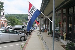
Peterborough (CDP), New Hampshire

Last updated

Peterborough, New Hampshire
Main St, Peterborough NH.jpg
Main Street
USA New Hampshire location map.svg
Red pog.svg
Peterborough
Usa edcp location map.svg
Red pog.svg
Peterborough
Coordinates: 42°52′36″N71°57′2″W / 42.87667°N 71.95056°W / 42.87667; -71.95056
Country United States
State New Hampshire
County Hillsborough
Town Peterborough
Area
[1]
  Total4.79 sq mi (12.41 km2)
  Land4.77 sq mi (12.35 km2)
  Water0.03 sq mi (0.06 km2)
Elevation
730 ft (220 m)
Population
 (2020)
  Total3,090
  Density648.21/sq mi (250.25/km2)
Time zone UTC-5 (Eastern (EST))
  Summer (DST) UTC-4 (EDT)
ZIP code
03458
Area code 603
FIPS code 33-60500
GNIS feature ID2378086

Peterborough is a census-designated place (CDP) and the main village in the town of Peterborough, Hillsborough County, New Hampshire, United States. The population of the CDP was 3,090 at the 2020 census, [2] out of 6,418 in the entire town.

Contents

Geography

The CDP occupies the central to west-central part of the town of Peterborough, along both sides of the Contoocook River where it is joined from the west by Nubanusit Brook. The CDP includes the Peterborough town center and extends west up Nubanusit Brook to encompass the village of West Peterborough. The CDP extends north, down the Contoocook River, as far as the area known as North Village, and it extends south, upriver, to the 19th-century factory complex known as Noone. [3] [4]

U.S. Route 202 runs through the eastern side of the CDP, following the Contoocook River. It leads north 19 miles (31 km) to Hillsborough and south 16 miles (26 km) to Winchendon, Massachusetts. New Hampshire Route 101 crosses US 202 south of the village center, leading east 17 miles (27 km) to Milford and west 19 miles (31 km) to Keene.

According to the U.S. Census Bureau, the Peterborough CDP has a total area of 4.8 square miles (12.4 km2), of which 0.02 square miles (0.06 km2), or 0.51%, are water. [5]

Demographics

Historical population
CensusPop.Note
1950 1,506
1960 1,93128.2%
1970 2,0787.6%
1980 2,56823.6%
1990 2,6854.6%
2000 2,9449.6%
2010 3,1035.4%
2020 3,090−0.4%
U.S. Decennial Census [6]

As of the census of 2010, there were 3,103 people, 1,442 households, and 750 families residing in the CDP. There were 1,577 housing units, of which 135, or 8.6%, were vacant. The racial makeup of the CDP was 96.3% white, 0.5% African American, 0.1% Native American, 1.8% Asian, 0.0% Pacific Islander, 0.5% some other race, and 0.8% from two or more races. 1.4% of the population were Hispanic or Latino of any race. [7]

Of the 1,442 households in the CDP, 24.0% had children under the age of 18 living with them, 37.0% were headed by married couples living together, 11.1% had a female householder with no husband present, and 48.0% were non-families. 41.2% of all households were made up of individuals, and 20.3% were someone living alone who was 65 years of age or older. The average household size was 2.06, and the average family size was 2.79. [7]

19.2% of residents in the CDP were under the age of 18, 6.9% were from age 18 to 24, 19.9% were from 25 to 44, 27.8% were from 45 to 64, and 26.1% were 65 years of age or older. The median age was 47.9 years. For every 100 females, there were 81.4 males. For every 100 females age 18 and over, there were 77.1 males. [7]

For the period 2011-15, the estimated median annual income for a household was $41,101, and the median income for a family was $82,558. The per capita income for the CDP was $40,090. [8]

Related Research Articles

<span class="mw-page-title-main">Bennington, New Hampshire</span> Town in New Hampshire, United States

Bennington is a town in Hillsborough County, New Hampshire, United States. The population was 1,501 at the 2020 census.

<span class="mw-page-title-main">East Merrimack, New Hampshire</span> Census-designated place in New Hampshire, United States

East Merrimack is a census-designated place (CDP) in the town of Merrimack, Hillsborough County, New Hampshire, United States. There is no village center named "East Merrimack"; rather, the CDP refers to the region of the town of Merrimack lying east of the F. E. Everett Turnpike, overlapping portions of the villages of Reeds Ferry, Thornton's Ferry, and the center of Merrimack. The population was 5,176 at the 2020 census, up from 4,197 at the 2010 census.

<span class="mw-page-title-main">Hancock, New Hampshire</span> Town in New Hampshire, United States

Hancock is a town in Hillsborough County, New Hampshire, United States. The population was 1,731 at the 2020 census. Hancock is home to the Welch Family Farm Forest.

<span class="mw-page-title-main">Contoocook, New Hampshire</span> Census-designated place in New Hampshire, United States

Contoocook is a village and census-designated place (CDP) within the town of Hopkinton in Merrimack County, New Hampshire, United States. The population was 1,427 at the 2020 census. Contoocook is well known for its growth of small businesses, preservation of historical landmarks, community involvement and recreational activities within the village.

<span class="mw-page-title-main">Jaffrey (CDP), New Hampshire</span> Census-designated place in New Hampshire, United States

Jaffrey is a census-designated place (CDP) and the main village in the town of Jaffrey in Cheshire County, New Hampshire, United States. The population of the CDP was 3,058 at the 2020 census, out of 5,320 in the entire town of Jaffrey.

<span class="mw-page-title-main">Antrim (CDP), New Hampshire</span> Census-designated place in New Hampshire, United States

Antrim is a census-designated place (CDP) and the main village in the town of Antrim in Hillsborough County, New Hampshire, United States. The population of the CDP was 1,395 at the 2020 census, out of 2,651 in the entire town.

<span class="mw-page-title-main">Antrim, New Hampshire</span> Town in New Hampshire, United States

Antrim is a town in Hillsborough County, New Hampshire, United States. The population was 2,651 at the 2020 census. The main village in the town, where 1,395 people lived at the 2020 census, is defined as the Antrim census-designated place (CDP) and is located at the intersection of U.S. Route 202 and New Hampshire Route 31. The town of Antrim also includes the villages of Antrim Center, North Branch, and Clinton Village.

<span class="mw-page-title-main">Greenville (CDP), New Hampshire</span> Census-designated place in New Hampshire, United States

Greenville is a census-designated place (CDP) and the main village in the town of Greenville in Hillsborough County, New Hampshire, United States. The population of the CDP was 1,074 at the 2020 census, out of 1,974 in the entire town.

<span class="mw-page-title-main">Hillsborough (CDP), New Hampshire</span> Census-designated place in New Hampshire, United States

Hillsborough is a census-designated place (CDP) and the main village in the town of Hillsborough in Hillsborough County, New Hampshire, United States. The population of the CDP was 2,156 at the 2020 census, out of 5,939 in the entire town.

<span class="mw-page-title-main">Milford (CDP), New Hampshire</span> Census-designated place in New Hampshire, United States

Milford is a census-designated place (CDP) and the main village in the town of Milford, Hillsborough County, New Hampshire, United States. The population of the CDP was 9,212 at the 2020 census, out of 16,131 in the entire town.

<span class="mw-page-title-main">Wilton (CDP), New Hampshire</span> Census-designated place in New Hampshire, United States

Wilton is a census-designated place (CDP) and the main village in the town of Wilton, Hillsborough County, New Hampshire, United States. The CDP extends east into the town of Milford as well. The population of the CDP was 1,324 at the 2020 census, up from 1,163 at the 2010 census.

<span class="mw-page-title-main">Henniker (CDP), New Hampshire</span> Census-designated place in New Hampshire, United States

Henniker is a census-designated place (CDP) and the main village in the town of Henniker in Merrimack County, New Hampshire, United States. The population of the CDP was 3,166 at the 2020 census, out of 6,185 in the entire town. The CDP is the home to New England College.

<span class="mw-page-title-main">Henniker, New Hampshire</span> Town in New Hampshire, United States

Henniker is a town in Merrimack County, New Hampshire, United States. As of the 2020 census, the reported total population of the town was 6,185, although the figure, 27.9% greater than the 2010 population, has been questioned by local officials. Henniker is home to New England College and Pats Peak Ski Area. Henniker is a college town and resort area, featuring both skiing and white-water kayaking.

<span class="mw-page-title-main">Peterborough, New Hampshire</span> Town in New Hampshire, United States

Peterborough is a town in Hillsborough County, New Hampshire, United States. The population was 6,418 at the 2020 census. The main village, with 3,090 people at the 2020 census, is defined as the Peterborough census-designated place (CDP) and is located along the Contoocook River at the junction of U.S. Route 202 and New Hampshire Route 101. Peterborough is 38 miles (61 km) west of Manchester and 72 miles (116 km) northwest of Boston.

<span class="mw-page-title-main">Hillsborough, New Hampshire</span> Town in New Hampshire, United States

Hillsborough, frequently spelled Hillsboro, is a town in Hillsborough County, New Hampshire, United States. The population was 5,939 at the 2020 census. The town is home to Fox State Forest and part of Low State Forest.

<span class="mw-page-title-main">Goffstown (CDP), New Hampshire</span> Census-designated place in New Hampshire, United States

Goffstown is a census-designated place (CDP) and the main village in the town of Goffstown in Hillsborough County, New Hampshire, United States. The population of the CDP was 3,366 at the 2020 census, out of 18,577 in the entire town.

<span class="mw-page-title-main">Amherst (CDP), New Hampshire</span> Census-designated place in New Hampshire, United States

Amherst is a census-designated place (CDP) and the main village in the town of Amherst in Hillsborough County, New Hampshire, United States. The population of the CDP was 697 at the 2020 census, out of 11,753 in the entire town. The village center is listed on the National Register of Historic Places as the Amherst Village Historic District.

<span class="mw-page-title-main">Bennington (CDP), New Hampshire</span> Census-designated place in New Hampshire, United States

Bennington is a census-designated place (CDP) and the main village in the town of Bennington in Hillsborough County, New Hampshire, United States. The population of the CDP was 338 at the 2020 census, out of 1,501 in the entire town.

<span class="mw-page-title-main">Hancock (CDP), New Hampshire</span> Census-designated place in New Hampshire, United States

Hancock is a census-designated place (CDP) and the main village in the town of Hancock in Hillsborough County, New Hampshire, United States. The population of the CDP was 213 at the 2020 census, out of 1,731 in the entire town.

<span class="mw-page-title-main">Warner (CDP), New Hampshire</span> Census-designated place in New Hampshire, United States

Warner is a census-designated place (CDP) and the main village in the town of Warner in Merrimack County, New Hampshire, United States. The population of the CDP was 453 at the 2020 census, out of 2,937 in the entire town.

References

  1. "ArcGIS REST Services Directory". United States Census Bureau. Retrieved September 20, 2022.
  2. "Peterborough CDP, New Hampshire: 2020 DEC Redistricting Data (PL 94-171)". U.S. Census Bureau. Retrieved December 10, 2021.
  3. "TIGERweb: Peterborough CDP, New Hampshire". Geography Division, U.S. Census Bureau. Retrieved September 26, 2017.
  4. "Peterborough, NH". 7.5-minute Topographic Map Series. U.S. Geological Survey at ACME Mapper. Retrieved September 26, 2017.
  5. "2021 U.S. Gazetteer Files – New Hampshire". United States Census Bureau. Retrieved December 10, 2021.
  6. "Decennial Census Official Publications". Census.gov. Retrieved March 4, 2024.
  7. 1 2 3 "Profile of General Population and Housing Characteristics: 2010 Census Summary File 1 (DP-1): Peterborough CDP, New Hampshire". U.S. Census Bureau, American Factfinder. Archived from the original on February 13, 2020. Retrieved September 26, 2017.
  8. "Selected Economic Characteristics: 2011-2015 American Community Survey 5-Year Estimates (DP03): Peterborough CDP, New Hampshire". U.S. Census Bureau, American Factfinder. Archived from the original on February 13, 2020. Retrieved September 26, 2017.