Hudson (CDP), New Hampshire

Last updated

Hudson, New Hampshire
Kimball Webster School, Hudson NH.jpg
Kimball Webster School
USA New Hampshire location map.svg
Red pog.svg
Hudson
Usa edcp location map.svg
Red pog.svg
Hudson
Coordinates: 42°45′53″N71°26′23″W / 42.76472°N 71.43972°W / 42.76472; -71.43972
Country United States
State New Hampshire
County Hillsborough
Town Hudson
Area
[1]
  Total3.26 sq mi (8.43 km2)
  Land3.08 sq mi (7.96 km2)
  Water0.18 sq mi (0.47 km2)
Elevation
150 ft (50 m)
Population
 (2020)
  Total7,534
  Density2,450.08/sq mi (945.99/km2)
Time zone UTC-5 (Eastern (EST))
  Summer (DST) UTC-4 (EDT)
ZIP code
03051
Area code 603
FIPS code 33-37860
GNIS feature ID2378074

Hudson is a census-designated place (CDP) and the urban center of the town of Hudson in Hillsborough County, New Hampshire, United States. The population of the CDP was 7,534 at the 2020 census, [2] out of 25,394 in the entire town.

Contents

Geography

The CDP occupies the center part of the west side of the town of Hudson, along the east side of the Merrimack River, which also forms the Nashua city line. The CDP includes all of Hudson village, as well as a small portion of Hudson Center. The CDP extends north to a line running between Federal Street and Garrison Farm Road, then runs east so that it passes north of Elmwood Drive and Megan Drive. The northern border then runs south of Wagner Way, Joel Path, and Bonnie Lane, and north of Monroe Drive and Jackson Drive, until it reaches Greeley Street, the eastern extent of the CDP. The border runs south on Greeley Street, then west on New Hampshire Route 111, then south on Belknap Road and Melendy Road. The border turns west to follow Pelham Road, then turns south on New Hampshire Route 3A (Lowell Road) to Third Brook, which it follows west to the Merrimack. [3]

Route 111 is the main east-west road through the CDP, leading west across the Merrimack River into Nashua and east 9 miles (14 km) to Interstate 93 in Windham. Route 3A runs north from Hudson 17 miles (27 km) to Manchester and southeast 14 miles (23 km) to Lowell, Massachusetts. New Hampshire Route 102 begins in Hudson and leads northeast 10 miles (16 km) to Derry.

According to the U.S. Census Bureau, the Hudson CDP has a total area of 3.2 square miles (8.4 km2), of which 3.1 square miles (8.0 km2) are land and 0.2 square miles (0.5 km2), or 5.57%, are water. [4] Besides the Merrimack River, the CDP contains Ottarnic Pond in the east.

Demographics

Historical population
CensusPop.Note
1950 2,382
1960 3,65153.3%
1980 6,248
1990 7,62622.1%
2000 7,8142.5%
2010 7,336−6.1%
2020 7,5342.7%
U.S. Decennial Census [5]

As of the census of 2010, there were 7,336 people, 2,924 households, and 1,968 families residing in the CDP. There were 3,055 housing units, of which 131, or 4.3%, were vacant. The racial makeup of the CDP was 93.8% white, 1.5% African American, 0.1% Native American, 1.6% Asian, 0.04% Pacific Islander, 1.3% some other race, and 1.6% from two or more races. 3.9% of the population were Hispanic or Latino of any race. [6]

Of the 2,924 households in the CDP, 32.1% had children under the age of 18 living with them, 49.0% were headed by married couples living together, 12.8% had a female householder with no husband present, and 32.7% were non-families. 25.3% of all households were made up of individuals, and 7.8% were someone living alone who was 65 years of age or older. The average household size was 2.51, and the average family size was 3.01. [6]

22.2% of residents in the CDP were under the age of 18, 8.1% were from age 18 to 24, 28.6% were from 25 to 44, 29.1% were from 45 to 64, and 12.1% were 65 years of age or older. The median age was 39.8 years. For every 100 females, there were 97.2 males. For every 100 females age 18 and over, there were 95.6 males. [6]

For the period 2011-15, the estimated median annual income for a household was $66,368, and the median income for a family was $72,879. Male full-time workers had a median income of $50,469 versus $39,980 for females. The per capita income for the CDP was $31,650. 8.2% of the population and 4.7% of families were below the poverty line, along with 15.8% of people under the age of 18 and 6.3% of people 65 or older. [7]

Related Research Articles

<span class="mw-page-title-main">East Merrimack, New Hampshire</span> Census-designated place in New Hampshire, United States

East Merrimack is a census-designated place (CDP) in the town of Merrimack, Hillsborough County, New Hampshire, United States. There is no village center named "East Merrimack"; rather, the CDP refers to the region of the town of Merrimack lying east of the F. E. Everett Turnpike, overlapping portions of the villages of Reeds Ferry, Thornton's Ferry, and the center of Merrimack. The population was 5,176 at the 2020 census, up from 4,197 at the 2010 census.

<span class="mw-page-title-main">Litchfield, New Hampshire</span> Town in New Hampshire, United States

Litchfield is a town in Hillsborough County, New Hampshire, United States. The population was 8,478 at the 2020 census.

<span class="mw-page-title-main">Pelham, New Hampshire</span> Town in New Hampshire, United States

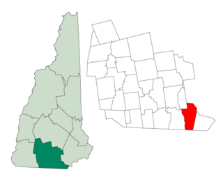
Pelham is a town in Hillsborough County, New Hampshire, United States. The population was 14,222 at the 2020 census, up from 12,897 at the 2010 census.

<span class="mw-page-title-main">South Hooksett, New Hampshire</span> Census-designated place in New Hampshire, United States

South Hooksett is a census-designated place (CDP) within the town of Hooksett in Merrimack County, New Hampshire, United States. The population was 5,888 at the 2020 census. It is a suburban area adjacent to the city of Manchester, New Hampshire's largest city, and includes a mix of housing developments and large retail stores.

<span class="mw-page-title-main">Suncook, New Hampshire</span> Census-designated place in New Hampshire, United States

Suncook is a census-designated place (CDP) in Merrimack County, New Hampshire, United States. The population was 5,501 at the 2020 census. Approximately two-thirds of Suncook is located in the town of Pembroke, with the remainder in Allenstown.

<span class="mw-page-title-main">Tilton Northfield, New Hampshire</span> Census-designated place in New Hampshire, United States

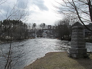
Tilton Northfield is a census-designated place (CDP) representing two adjacent villages in the towns of Tilton in Belknap County and Northfield in Merrimack County in the U.S. state of New Hampshire. The CDP encompasses the town centers of both Tilton and Northfield, located on either side of the Winnipesaukee River. The population was 3,324 at the 2020 census.

<span class="mw-page-title-main">Milford (CDP), New Hampshire</span> Census-designated place in New Hampshire, United States

Milford is a census-designated place (CDP) and the main village in the town of Milford, Hillsborough County, New Hampshire, United States. The population of the CDP was 9,212 at the 2020 census, out of 16,131 in the entire town.

<span class="mw-page-title-main">Wilton (CDP), New Hampshire</span> Census-designated place in New Hampshire, United States

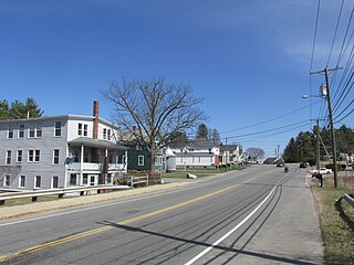
Wilton is a census-designated place (CDP) and the main village in the town of Wilton, Hillsborough County, New Hampshire, United States. The CDP extends east into the town of Milford as well. The population of the CDP was 1,324 at the 2020 census, up from 1,163 at the 2010 census.

<span class="mw-page-title-main">Henniker (CDP), New Hampshire</span> Census-designated place in New Hampshire, United States

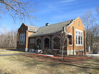
Henniker is a census-designated place (CDP) and the main village in the town of Henniker in Merrimack County, New Hampshire, United States. The population of the CDP was 3,166 at the 2020 census, out of 6,185 in the entire town. The CDP is the home to New England College.

<span class="mw-page-title-main">Hooksett (CDP), New Hampshire</span> Census-designated place in New Hampshire, United States

Hooksett is a census-designated place (CDP) in the town of Hooksett in Merrimack County, New Hampshire, United States. The CDP includes the historic central village of Hooksett as well as suburban and rural land surrounding it. The population of the CDP was 5,283 at the 2020 census, out of 14,871 in the entire town.

<span class="mw-page-title-main">Pittsfield (CDP), New Hampshire</span> Census-designated place in New Hampshire, United States

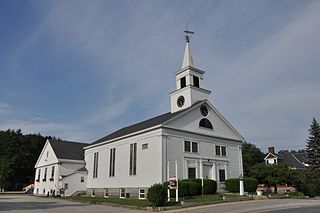
Pittsfield is a census-designated place (CDP) and the main village in the town of Pittsfield in Merrimack County, New Hampshire, United States. The population of the CDP was 1,570 at the 2020 census, out of 4,075 in the entire town.

<span class="mw-page-title-main">Derry (CDP), New Hampshire</span> Census-designated place in New Hampshire, United States

Derry is a census-designated place (CDP) in the town of Derry in Rockingham County, New Hampshire, United States. The CDP comprises the urban center of the town, as well as the village of East Derry and connected suburban areas. The population of the CDP was 22,879 at the 2020 census, out of 34,317 in the entire town.

<span class="mw-page-title-main">Londonderry (CDP), New Hampshire</span> Census-designated place in New Hampshire, United States

Londonderry is a census-designated place (CDP) within the town of Londonderry in Rockingham County, New Hampshire, United States. The population of the CDP was 11,645 at the 2020 census, out of 25,826 in the entire town.

<span class="mw-page-title-main">Raymond (CDP), New Hampshire</span> Census-designated place in New Hampshire, United States

Raymond is a census-designated place (CDP) and the main village in the town of Raymond, Rockingham County, New Hampshire, United States. The population of the CDP was 3,738 at the 2020 census, out of 10,684 in the entire town.

<span class="mw-page-title-main">Hudson, New Hampshire</span> Town in New Hampshire, United States

Hudson is a town in Hillsborough County, New Hampshire, United States. It is located along the Massachusetts state line. The population was 25,394 at the 2020 census. It is the tenth-largest municipality in the state, by population.

<span class="mw-page-title-main">Groton (CDP), Massachusetts</span> Census-designated place in Massachusetts, United States

Groton is a census-designated place (CDP) comprising the main village in the town of Groton in Middlesex County, Massachusetts, United States. The population of the CDP was 1,353 at the 2020 census, out of 11,315 in the entire town of Groton.

<span class="mw-page-title-main">Hudson (CDP), Massachusetts</span> Census-designated place in Massachusetts, United States

Hudson is a census-designated place (CDP) comprising the densely developed central part of the town of Hudson in Middlesex County, Massachusetts, United States. The population of the CDP was 15,749 at the 2020 census, out of 20,092 in the entire town.

<span class="mw-page-title-main">Pepperell (CDP), Massachusetts</span> Census-designated place in Massachusetts, United States

Pepperell is a census-designated place (CDP) comprising the main village in the town of Pepperell in Middlesex County, Massachusetts, United States. The population was 2,390 at the 2020 census, out of 11,604 in the entire town of Pepperell.

<span class="mw-page-title-main">Townsend (CDP), Massachusetts</span> Census-designated place in Massachusetts, United States

Townsend is a census-designated place (CDP) comprising the main village in the town of Townsend in Middlesex County, Massachusetts, United States. The population was 1,213 at the 2020 census, out of 9,127 in the entire town.

<span class="mw-page-title-main">Loudon (CDP), New Hampshire</span> Census-designated place in New Hampshire, United States

Loudon is a census-designated place (CDP) and the main village in the town of Loudon in Merrimack County, New Hampshire, United States. The population of the CDP was 711 at the 2020 census, out of 5,576 in the entire town.

References

  1. "ArcGIS REST Services Directory". United States Census Bureau. Retrieved September 20, 2022.
  2. "Hudson CDP, New Hampshire: 2020 DEC Redistricting Data (PL 94-171)". U.S. Census Bureau. Retrieved December 10, 2021.
  3. "TIGERweb: Hudson CDP, New Hampshire". Geography Division, U.S. Census Bureau. Retrieved September 14, 2017.
  4. "2021 U.S. Gazetteer Files – New Hampshire". United States Census Bureau. Retrieved December 10, 2021.
  5. "Decennial Census Official Publications". Census.gov. Retrieved March 4, 2024.
  6. 1 2 3 "Profile of General Population and Housing Characteristics: 2010 Census Summary File 1 (DP-1): Hudson CDP, New Hampshire". U.S. Census Bureau, American Factfinder. Archived from the original on February 13, 2020. Retrieved September 14, 2017.
  7. "Selected Economic Characteristics: 2011-2015 American Community Survey 5-Year Estimates (DP03): Hudson CDP, New Hampshire". U.S. Census Bureau, American Factfinder. Archived from the original on February 13, 2020. Retrieved September 14, 2017.