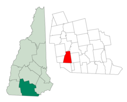
Temple, New Hampshire

Last updated

Temple, New Hampshire
Town
TempleNH TownHall.jpg
Town Hall
Hillsborough-Temple-NH.png
Coordinates: 42°49′05″N71°51′05″W / 42.81806°N 71.85139°W / 42.81806; -71.85139
Country United States
State New Hampshire
County Hillsborough
Incorporated 1768
Named for John Temple
Government
   Select Board Bill Ezell, Chair
Ken Caisse
George Willard
Area
[1]
  Total22.5 sq mi (58.2 km2)
  Land22.2 sq mi (57.6 km2)
  Water0.2 sq mi (0.6 km2)  0.98%
Elevation
1,024 ft (312 m)
Population
 (2020) [2]
  Total1,382
  Density62/sq mi (24.0/km2)
Time zone UTC-5 (Eastern)
  Summer (DST) UTC-4 (Eastern)
ZIP code
03084
Area code 603
FIPS code 33-76260
GNIS feature ID0873737
Website www.templenh.org

Temple is a town in Hillsborough County, New Hampshire, United States. The population was 1,382 at the 2020 census. [2] It is home to Temple Mountain State Reservation, formerly the Temple Mountain Ski Area.

Contents

History

The area was first called "Peterborough Slip", which included what is now the town of Sharon. In 1758, Maj. Ephraim Heald and his wife Sarah, along with his brother Deacon Peter Heald and Oliver Heald, a cousin, were among the first settlers. Peter Heald is generally considered to be the founder of Temple, and his child, Peter, was the first male child born in the town. [3] [4] In 1768, it was incorporated by colonial Governor John Wentworth, who named it after his lieutenant governor, John Temple. [5] Temple Glassworks was founded in 1780 by Robert Hewes of Boston. Although the company is long defunct, surviving examples of Temple glass are today rare and prized collectibles. By 1859 Temple had a population of 579, with two sawmills, one gristmill, and a tannery. [6] The town of Temple, Maine was named after Temple, NH. [7]

Terrain is generally uneven and rocky. It is also elevated, commanding distant views to the east and south. [6] As John Farmer and Jacob Bailey Moore wrote in 1823, "From the highest point of elevation, twenty meetinghouses may be seen when the atmosphere is clear." [8]

Geography

According to the United States Census Bureau, the town has a total area of 22.5 square miles (58.2 km2), of which 22.2 square miles (57.6 km2) are land and 0.2 square miles (0.6 km2) are water, comprising 0.98% of the town. [1] The town is drained to the east by Blood Brook and its tributary Temple Brook, part of the Souhegan River watershed. The highest point in Temple is 2,190 feet (670 m) above sea level, on an eastern spur of South Pack Monadnock Mountain. South of Route 101, 2,045-foot (623 m) Temple Mountain forms the town's western boundary for several miles.

Adjacent municipalities

Demographics

Historical population
CensusPop.Note
1790 747
1800 86716.1%
1810 9418.5%
1820 752−20.1%
1830 647−14.0%
1840 576−11.0%
1850 5790.5%
1860 501−13.5%
1870 421−16.0%
1880 49216.9%
1890 342−30.5%
1900 313−8.5%
1910 284−9.3%
1920 263−7.4%
1930 239−9.1%
1940 2587.9%
1950 33027.9%
1960 3619.4%
1970 44122.2%
1980 69256.9%
1990 1,19472.5%
2000 1,2978.6%
2010 1,3665.3%
2020 1,3821.2%
U.S. Decennial Census [2] [9]

As of the census [10] of 2000, there were 1,297 people, 440 households, and 347 families residing in the town. The population density was 55.8 inhabitants per square mile (21.5/km2). There were 465 housing units at an average density of 20.0 per square mile (7.7/km2). The racial makeup of the town was 98.00% White, 0.31% African American, 0.31% Native American, 0.31% Asian, 0.54% from other races, and 0.54% from two or more races. Hispanic or Latino of any race were 0.69% of the population.

There were 440 households, out of which 42.3% had children under the age of 18 living with them, 67.5% were married couples living together, 6.6% had a female householder with no husband present, and 21.1% were non-families. 16.4% of all households were made up of individuals, and 5.2% had someone living alone who was 65 years of age or older. The average household size was 2.91 and the average family size was 3.24.

In the town, the population was spread out, with 29.8% under the age of 18, 5.8% from 18 to 24, 30.7% from 25 to 44, 25.3% from 45 to 64, and 8.4% who were 65 years of age or older. The median age was 37 years. For every 100 females, there were 102.7 males. For every 100 females age 18 and over, there were 106.3 males.

The median income for a household in the town was $56,500, and the median income for a family was $64,297. Males had a median income of $36,563 versus $29,545 for females. The per capita income for the town was $21,897. About 2.8% of families and 6.4% of the population were below the poverty line, including 4.2% of those under age 18 and 4.5% of those age 65 or over.

Related Research Articles

<span class="mw-page-title-main">Weld, Maine</span> Town in the state of Maine, United States

Weld is a town in Franklin County, Maine, United States. The population was 376 at the 2020 census. Set beside Webb Lake and almost surrounded by mountains, Weld is noted for its scenery. It is home to Mount Blue State Park, Camp Kawanhee for Boys, and Camp Lawroweld.

<span class="mw-page-title-main">Surry, New Hampshire</span> Town in New Hampshire, United States

Surry is a town in Cheshire County, New Hampshire, United States. The population was 820 at the 2020 census, up from 732 at the 2010 census.

<span class="mw-page-title-main">Lyman, New Hampshire</span> Town in New Hampshire, United States

Lyman is a town in Grafton County, New Hampshire, United States. The population was 585 at the 2020 census.

<span class="mw-page-title-main">Thornton, New Hampshire</span> Town in New Hampshire, United States

Thornton is a town in Grafton County, New Hampshire, United States. The population was 2,708 at the 2020 census, up from 2,490 at the 2010 census.

<span class="mw-page-title-main">Bennington, New Hampshire</span> Town in New Hampshire, United States

Bennington is a town in Hillsborough County, New Hampshire, United States. The population was 1,501 at the 2020 census.

<span class="mw-page-title-main">Deering, New Hampshire</span> Town in New Hampshire, United States

Deering is a town in Hillsborough County, New Hampshire, United States. The population was 1,904 at the 2020 census.

<span class="mw-page-title-main">Francestown, New Hampshire</span> Town in New Hampshire, United States

Francestown is a town in Hillsborough County, New Hampshire, United States. The population was 1,610 at the 2020 census. The village of Francestown, population 201 in 2020, is in the center of the town.

<span class="mw-page-title-main">Greenfield, New Hampshire</span> Town in New Hampshire, United States

Greenfield is a town in Hillsborough County, New Hampshire, United States. The population was 1,716 at the 2020 census. Greenfield is home to the Crotched Mountain Rehabilitation Center, to Greenfield State Park, and to part of the Wapack Trail.

<span class="mw-page-title-main">Lyndeborough, New Hampshire</span> Town in New Hampshire, United States

Lyndeborough is a town in Hillsborough County, New Hampshire, United States. The population was 1,702 at the 2020 census.

<span class="mw-page-title-main">New Boston, New Hampshire</span> Town in New Hampshire, United States

New Boston is a town in Hillsborough County, New Hampshire, United States. The population was 6,108 at the 2020 census, up from 5,321 at the 2010 census. New Boston is home to the annual Hillsborough County Agricultural Fair and the Molly Stark Cannon. The 1743 cannon, which appears on the town seal, was given by General John Stark to the New Boston Artillery Company after the Battle of Bennington.

<span class="mw-page-title-main">New Ipswich, New Hampshire</span> Town in New Hampshire, United States

New Ipswich is a town in Hillsborough County, New Hampshire, United States. The population was 5,204 at the 2020 census. New Ipswich, situated on the Massachusetts border, includes the villages of Bank, Davis, Gibson Four Corners, Highbridge, New Ipswich Center, Smithville, and Wilder, though these village designations no longer hold the importance they did in the past. The Wapack Trail passes through the community.

<span class="mw-page-title-main">Sharon, New Hampshire</span> Town in New Hampshire, United States

Sharon is a town in Hillsborough County, New Hampshire, United States. The population was 359 at the 2020 census. It was the long-time home to the Sharon Arts Center, a nonprofit which has ceased operations.

<span class="mw-page-title-main">Windsor, New Hampshire</span> Town in New Hampshire, United States

Windsor is a town in Hillsborough County, New Hampshire, United States. The population was 262 at the 2020 census. It is the location of the Wediko Children's Services Summer Program and of Windsor Mountain International, a summer adventure and travel camp founded in 1961. It is also the home of Windsor Hills Camp and Retreat Center, a ministry of the Church of the Nazarene.

<span class="mw-page-title-main">Kensington, New Hampshire</span> Place in New Hampshire, United States

Kensington is a town in Rockingham County, New Hampshire, United States. The population was 2,095 at the 2020 census.

<span class="mw-page-title-main">Goshen, New Hampshire</span> Place in New Hampshire, United States

Goshen is a town in Sullivan County, New Hampshire, United States. The population was 796 at the 2020 census.

<span class="mw-page-title-main">Lunenburg, Vermont</span> Town in Vermont, United States

Lunenburg is a town in Essex County, Vermont, United States. The population was 1,246 at the 2020 census, the most populous in Essex County. Lunenburg contains the villages of Lunenburg and Gilman and hamlets of West Lunenburg, South Lunenburg, and Mill Village, and is part of the Berlin, NH–VT Micropolitan Statistical Area.

<span class="mw-page-title-main">Antrim, New Hampshire</span> Town in New Hampshire, United States

Antrim is a town in Hillsborough County, New Hampshire, United States. The population was 2,651 at the 2020 census. The main village in the town, where 1,395 people lived at the 2020 census, is defined as the Antrim census-designated place (CDP) and is located at the intersection of U.S. Route 202 and New Hampshire Route 31. The town of Antrim also includes the villages of Antrim Center, North Branch, and Clinton Village.

<span class="mw-page-title-main">Greenville (CDP), New Hampshire</span> Census-designated place in New Hampshire, United States

Greenville is a census-designated place (CDP) and the main village in the town of Greenville in Hillsborough County, New Hampshire, United States. The population of the CDP was 1,074 at the 2020 census, out of 1,974 in the entire town.

<span class="mw-page-title-main">Hillsborough (CDP), New Hampshire</span> Census-designated place in New Hampshire, United States

Hillsborough is a census-designated place (CDP) and the main village in the town of Hillsborough in Hillsborough County, New Hampshire, United States. The population of the CDP was 2,156 at the 2020 census, out of 5,939 in the entire town.

<span class="mw-page-title-main">Hillsborough, New Hampshire</span> Town in New Hampshire, United States

Hillsborough, frequently spelled Hillsboro, is a town in Hillsborough County, New Hampshire, United States. The population was 5,939 at the 2020 census. The town is home to Fox State Forest and part of Low State Forest.

References

  1. 1 2 "2021 U.S. Gazetteer Files – New Hampshire". United States Census Bureau. Retrieved December 9, 2021.
  2. 1 2 3 "Temple town, Hillsborough County, New Hampshire: 2020 DEC Redistricting Data (PL 94-171)". U.S. Census Bureau. Retrieved December 9, 2021.
  3. Blood, Henry Ames. The History of Temple, New Hampshire, p. 7, Geo. C. Rand & Avery, 1860.
  4. Stager, Helen, and Stager, Evelyn. A Family Odyssey, pp. 343-4, Nicollet Press, Inc., Pipestone, MN, 1983.
  5. New Hampshire Economic and Labor Market Information Bureau Profile
  6. 1 2 Coolidge, Austin J.; John B. Mansfield (1859). A History and Description of New England. Boston, Massachusetts. p. 664.{{cite book}}: CS1 maint: location missing publisher (link)
  7. "Profile for Temple, Maine". ePodunk . Retrieved April 18, 2010.
  8. John Farmer and Jacob Bailey Moore, editors; Collections, Topographical, Historical and Biographical, Relating Principally to New Hampshire; Volumes 1-3; 1823
  9. "Census of Population and Housing". Census.gov. Retrieved June 4, 2016.
  10. "U.S. Census website". United States Census Bureau . Retrieved January 31, 2008.