Temple, Maine

Last updated

Temple, Maine
Temple Historical Society.jpg
Temple Historical Society, formerly the historic No. 5 Schoolhouse
USA Maine location map.svg
Red pog.svg
Temple
Usa edcp location map.svg
Red pog.svg
Temple
Coordinates: 44°40′53″N70°15′35″W / 44.68139°N 70.25972°W / 44.68139; -70.25972
Country United States
State Maine
County Franklin
VillagesTemple
Temple Intervale
Area
[1]
  Total35.76 sq mi (92.62 km2)
  Land35.53 sq mi (92.02 km2)
  Water0.23 sq mi (0.60 km2)
Elevation
1,230 ft (375 m)
Population
 (2020)
  Total527
  Density15/sq mi (5.7/km2)
Time zone UTC-5 (Eastern (EST))
  Summer (DST) UTC-4 (EDT)
ZIP code
04984
Area code 207
FIPS code 23-75980
GNIS feature ID0582761
Website townoftemple.org

Temple is a town in Franklin County, Maine, United States. The town was named after Temple, New Hampshire. [2] It is located at the end of Maine State Route 43 (Temple Road), and is said to be one of only two towns in Maine to be situated at the end of a public highway. [3] The population was 527 at the 2020 census. [4]

Contents

History

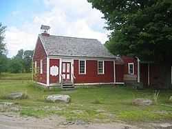
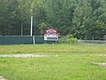
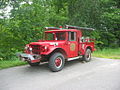
Hill-farmers from Temple, New Hampshire, Old North Yarmouth, Maine, and nearby Farmington settled the town beginning in 1796. It was incorporated in 1803. Commercial sawmills operated on Temple Stream in the village for many years in the 1800s and 1900s, providing the town a robust local economy. Logging is still vibrant in Temple, but its timber is now trucked to mills in nearby towns. The town contains a town hall (formerly an elementary school), a post office in the former general store (no longer has a post office), a theater (formerly the Congregational Church. The bell tower now sits in a semi-restored state at the town hall), a fire station, and a youth baseball field, established in 1957, commemorating the life of Larry Boyce, the former Temple Townies player and manager for whom the field is named.

What is now Maple Street was once called Cowturd Lane, due to "the smell of manure, fresh from cows walking in the road on their way to (pasture) and back, hanging in the air like swamp gas." [5]

Temple is a sanctuary for writers, poets, artists, and crafters, and the setting for several novels, biographies, and memoirs: Shawno (George Dennison), Temple (Dennison), Temple Stream: A Rural Odyssey (Bill Roorbach), Upcountry: Reflections from a Rural Life (Robert Kimber), A Soldier's Son: An American Boyhood During World War II (John E. Hodgkins), and The Town that Ends the Road (Theodore Enslin).

Besides the above, a number of well-known writers either lived or summered in Temple, including Denise Levertov, Mitchell Goodman, and C. J. Stevens.

Geography

According to the United States Census Bureau, the town has a total area of 35.76 square miles (92.62 km2), of which 35.53 square miles (92.02 km2) is land and 0.23 square miles (0.60 km2) is water. [1]

Demographics

Historical population
CensusPop.Note
1810 482
1820 61527.6%
1830 79529.3%
1840 95520.1%
1850 785−17.8%
1860 726−7.5%
1870 640−11.8%
1880 580−9.4%
1890 470−19.0%
1900 394−16.2%
1910 4032.3%
1920 4255.5%
1930 315−25.9%
1940 252−20.0%
1950 28412.7%
1960 31410.6%
1970 36716.9%
1980 51841.1%
1990 5608.1%
2000 5722.1%
2010 528−7.7%
2020 527−0.2%
U.S. Decennial Census [6]

2010 census

As of the census [7] of 2010, there were 528 people, 226 households, and 141 families residing in the town. The population density was 14.9 inhabitants per square mile (5.8/km2). There were 327 housing units at an average density of 9.2 per square mile (3.6/km2). The racial makeup of the town was 97.7% White, 1.1% Native American, 0.6% Asian, 0.2% from other races, and 0.4% from two or more races. Hispanic or Latino of any race were 0.8% of the population.

There were 226 households, of which 24.8% had children under the age of 18 living with them, 53.5% were married couples living together, 6.6% had a female householder with no husband present, 2.2% had a male householder with no wife present, and 37.6% were non-families. 30.5% of all households were made up of individuals, and 8.8% had someone living alone who was 65 years of age or older. The average household size was 2.34 and the average family size was 2.94.

The median age in the town was 45.6 years. 20.6% of residents were under the age of 18; 6.4% were between the ages of 18 and 24; 22.2% were from 25 to 44; 36% were from 45 to 64; and 15% were 65 years of age or older. The gender makeup of the town was 51.3% male and 48.7% female.

2000 census

As of the census [8] of 2000, there were 572 people, 228 households, and 165 families residing in the town. The population density was 16.1 people per square mile (6.2/km2). There were 316 housing units at an average density of 8.9 per square mile (3.4/km2). The racial makeup of the town was 98.60% White, 0.17% Native American, 0.52% Asian, and 0.70% from two or more races. Hispanic or Latino of any race were 0.52% of the population.

There were 228 households, out of which 35.1% had children under the age of 18 living with them, 57.5% were married couples living together, 7.9% had a female householder with no husband present, and 27.6% were non-families. 22.4% of all households were made up of individuals, and 7.0% had someone living alone who was 65 years of age or older. The average household size was 2.48 and the average family size was 2.79.

In the town, the population was spread out, with 25.7% under the age of 18, 4.9% from 18 to 24, 29.4% from 25 to 44, 27.1% from 45 to 64, and 12.9% who were 65 years of age or older. The median age was 40 years. For every 100 females, there were 107.2 males. For every 100 females age 18 and over, there were 105.3 males.

The median income for a household in the town was $33,750, and the median income for a family was $34,931. Males had a median income of $29,844 versus $24,688 for females. The per capita income for the town was $16,905. About 7.6% of families and 10.1% of the population were below the poverty line, including 10.1% of those under age 18 and 22.8% of those age 65 or over.

Notable people

See also

Related Research Articles

<span class="mw-page-title-main">Warren, Indiana</span> Town in Indiana, United States

Warren is a town in Salamonie Township, Huntington County, Indiana. The population of Warren was 1,182 at the time of the 2020 census.

<span class="mw-page-title-main">Durham, Maine</span> Town in the state of Maine, United States

Durham is a town in Androscoggin County, Maine, United States. The population was 4,173 at the 2020 census. It is included in both the Lewiston-Auburn, Maine Metropolitan Statistical Area and the Lewiston-Auburn, Maine Metropolitan New England City and Town Area.

<span class="mw-page-title-main">Wales, Maine</span> Town in the state of Maine, United States

Wales is a town in Androscoggin County, Maine, United States. The population was 1,608 at the 2020 census. It is included in both the Lewiston-Auburn, Maine Metropolitan Statistical Area and the Lewiston-Auburn, Maine Metropolitan New England City and Town Area.

<span class="mw-page-title-main">Portage Lake, Maine</span> Town in the state of Maine, United States

Portage Lake is a town in Aroostook County, Maine, United States. The population was 359 at the 2020 census.

<span class="mw-page-title-main">St. Francis, Maine</span> Town in the state of Maine, United States

St. Francis is a town in Aroostook County, Maine, United States on the Canada–United States border at the junction of the St. Francis River and the Saint John River. The population was 438 at the 2020 census. First settled by English speakers from southern Maine, the original population has been supplanted by French-speaking Acadians.

<span class="mw-page-title-main">Wade, Maine</span> Town in the state of Maine, United States

Wade is a town in Aroostook County, Maine, United States. The population was 229 at the 2020 census.

<span class="mw-page-title-main">Carthage, Maine</span> Town in the state of Maine, United States

Carthage is a town in Franklin County, Maine, United States. The population was 509 at the 2020 census.

<span class="mw-page-title-main">New Sharon, Maine</span> Town in the state of Maine, United States

New Sharon is a town in Franklin County, Maine, incorporated in 1794. The population was 1,458 at the 2020 census. The town is roughly bisected by the Sandy River, a tributary of the Kennebec River.

<span class="mw-page-title-main">Penobscot, Maine</span> Town in the state of Maine, United States

Penobscot is a town in Hancock County, Maine, United States. The Bagaduce River flows through the town. The population was 1,136 at the 2020 census.

<span class="mw-page-title-main">Sidney, Maine</span> Town in the state of Maine, United States

Sidney is a town in Kennebec County, Maine, United States. The population was 4,645 at the 2020 census. Sidney was incorporated as a town on January 30, 1792. The town was named for Sir Philip Sidney, an English author. Sidney is included in the Augusta, Maine micropolitan New England City and Town Area. Since 1937, the town has been the home of the New England Music Camp.

<span class="mw-page-title-main">Wayne, Maine</span> Town in the state of Maine, United States

Wayne is a town in Kennebec County, Maine, United States. The population was 1,129 at the 2020 census. The town was named after Revolutionary War General Anthony Wayne. During the summer, Wayne is home to Camp Androscoggin. A popular recreation spot in central Maine, Wayne is part of the Winthrop Lakes Region. The town is included in the Augusta, Maine micropolitan New England City and Town Area.

<span class="mw-page-title-main">Gilead, Maine</span> Town in the state of Maine, United States

Gilead is a town in Oxford County, Maine, United States. Upon incorporation in 1804, it was named for the large quantity of Balm of Gilead trees in the town center. The population was 195 at the 2020 census.

<span class="mw-page-title-main">Hanover, Maine</span> Town in the state of Maine, United States

Hanover is a town in Oxford County, Maine, United States. The population was 286 at the 2020 census. The town is a popular vacation and recreation area.

<span class="mw-page-title-main">Charleston, Maine</span> Town in the state of Maine, United States

Charleston is a town in Penobscot County, Maine, United States. It is part of the Bangor Metropolitan Statistical Area. The population was 1,558 at the 2020 census. Charleston includes the village of West Charleston and is home to the Higgins Classical Institute, a Christian school.

Kenduskeag is a town in Penobscot County, Maine, United States. The population was 1,346 at the 2020 census.

Lee is a town in Penobscot County, Maine, United States. It was incorporated in 1832. The town was originally called Mattekeunk, but changed it to Lee to give it an English name. Stephen Lee suggested the town be named Lee after Revolutionary general Henry "High Horse" Lee. To further convince the townsfolk, he brought a barrel of rum to the meeting. The population was 916 at the 2020 census. Lee has been home to Lee Academy since 1845.

Levant is a town in Penobscot County, Maine, United States. The population was 2,970 at the 2020 census.

Caratunk is a town in Somerset County, Maine, United States. The population was 81 at the 2020 census.

<span class="mw-page-title-main">Smithfield, Maine</span> Town in the state of Maine, United States

Smithfield is a town in Somerset County, Maine, United States. The population was 925 at the 2020 census. The town was incorporated on February 29, 1840 making it the only town in Maine incorporated on Leap Day. The town was named after the Rev. Henry Smith, an early settler.

<span class="mw-page-title-main">Popple River, Wisconsin</span> Town in Wisconsin, United States

Popple River is a town in Forest County, Wisconsin, United States. The population was 44 at the 2010 census.

References

  1. 1 2 "US Gazetteer files 2010". United States Census Bureau . Retrieved December 16, 2012.
  2. "Profile for Temple, Maine". ePodunk . Retrieved April 18, 2010.
  3. Maine Times, 1970s
  4. "Census - Geography Profile: Temple town, Franklin County, Maine" . Retrieved January 30, 2022.
  5. Hodgkins, John E., A Soldier's Son: An American Boyhood During World War II, Down East Books, 2006. ISBN   0-89272-716-0
  6. "Census of Population and Housing". Census.gov. Retrieved June 4, 2015.
  7. "U.S. Census website". United States Census Bureau . Retrieved December 16, 2012.
  8. "U.S. Census website". United States Census Bureau . Retrieved January 31, 2008.

44°41′06″N70°13′35″W / 44.68500°N 70.22639°W / 44.68500; -70.22639