
Franklin County is a county located in the state of Maine, United States. As of the 2020 census, the population was 29,456, making it the second-least populous county in Maine. Its county seat is Farmington. The county was established on May 9, 1838, and named for Benjamin Franklin.

Macwahoc Plantation is a plantation in Aroostook County, Maine, United States. The population was 62 at the 2020 census.

Moro Plantation is a plantation in Aroostook County, Maine, United States. The population was 44 at the 2020 census.

Westmanland is a town in Aroostook County, Maine, United States. The population was 79 at the 2020 census.

Carthage is a town in Franklin County, Maine, United States. The population was 509 at the 2020 census.

Coplin Plantation is a plantation in Franklin County, Maine, United States. The population was 131 at the 2020 census.

Dallas Plantation is a plantation in Franklin County, Maine, United States. The population was 304 at the 2020 census.

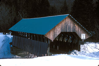
Eustis is a town in Franklin County, Maine, United States. The population was 641 at the 2020 census. Eustis, which includes the village of Stratton, is a popular recreation area.

Phillips is a town in Franklin County, Maine, United States. The population was 898 at the 2020 census. It is home to the Sandy River and Rangeley Lakes Railroad, a heritage railroad.

Sandy River Plantation is a plantation in Franklin County, Maine, United States. The population was 128 at the 2020 census. It is home to the popular Saddleback Mountain Ski Resort and the Rangeley Lakes Nordic Trail Center.

Roxbury is a town in Oxford County, Maine, United States. The population was 361 at the 2020 census. Ellis Pond is popular with recreational fishermen.
Seboeis Plantation is a plantation in Penobscot County, Maine, United States. The population was 40 at the 2020 census.
Webster Plantation is a plantation in Penobscot County, Maine, United States. The population was 68 at the 2020 census.
The Forks is a plantation in Somerset County, Maine, United States. The population was 48 at the 2020 census.
North Franklin is an unorganized territory in Franklin County, Maine, United States. The population was 41 at the 2020 census. The territory consists of 13 townships and three gores, namely Lang, Davis, Tim Pond, Stetsontown, Jim Pond, Alder Stream, Seven Ponds, Kibby, Chain of Ponds, Massachusetts Gore, Coburn Gore, Skinner, Merrill Strip, Lowelltown, Gorham Gore, and Beattie.
South Franklin is an unorganized territory in Franklin County, Maine, United States. The population was 60 at the 2020 census.
Milton is an unorganized territory (township) in Oxford County, Maine, United States. The population was 150 at the 2020 census. The township was formerly a plantation that surrendered its organization in 1939.
Lincoln Plantation is a plantation in Oxford County, Maine, United States. It contains the village of Wilson's Mills. The population was 41 at the 2020 census.

Farmington is a census-designated place (CDP) comprising the center of the town of Farmington, which is the county seat of Franklin County in Maine, United States. The population of the CDP was 4,288 at the 2010 census, out of 7,760 people in the town as a whole. The University of Maine at Farmington is located within the CDP.

Rangeley is a town in Franklin County, Maine, United States. The population was 1,222 at the 2020 census. Rangeley is the center of the Rangeley Lakes Region, a resort area. The town includes the villages of Rangeley and Oquossoc, as well as the communities of Mooselookmeguntic, Bald Mountain, Mountainview, and South Rangeley.


