Wilton (CDP), Maine

Last updated

Wilton, Maine
WiltonME Center.jpg
Downtown Wilton
USA Maine location map.svg
Red pog.svg
Wilton
Location within the state of Maine
Coordinates: 44°35′31″N70°13′50″W / 44.59194°N 70.23056°W / 44.59194; -70.23056
CountryUnited States
State Maine
County Franklin
Town Wilton
Area
[1]
  Total4.99 sq mi (12.92 km2)
  Land4.09 sq mi (10.60 km2)
  Water0.90 sq mi (2.33 km2)
Elevation
551 ft (168 m)
Population
 (2020)
  Total2,071
  Density506.11/sq mi (195.43/km2)
Time zone UTC-5 (Eastern (EST))
  Summer (DST) UTC-4 (EDT)
ZIP code
04294
Area code 207
FIPS code 23-85815
GNIS feature ID0578559

Wilton is a census-designated place (CDP) consisting of the main settlement within the town of Wilton in Franklin County, Maine, United States. The CDP population was 2,198 at the 2010 census, [2] out of a total town population of 4,116.

Contents

Geography

The Wilton CDP is located in the south-central part of the town of Wilton at 44°35′31″N70°13′49″W / 44.59194°N 70.23028°W / 44.59194; -70.23028 (44.591961, −70.230456). [3] The CDP extends south to the town line and is bordered by the town of Jay to the south. U.S. Route 2 passes through the southern part of the CDP, bypassing the densely settled town center; US 2 leads northeast 8 miles (13 km) to Farmington and west 22 miles (35 km) to Rumford. Maine State Route 4 runs northeast with US 2 to Farmington but branches off at Wilton, leading south 6 miles (10 km) to the center of Jay. Maine State Route 156 passes through the center of Wilton, leading northwest 13 miles (21 km) to Weld and east 10 miles (16 km) to US 2 beyond Farmington, near the town of New Sharon.

According to the United States Census Bureau, the CDP has a total area of 5.0 square miles (12.9 km2), of which 4.1 square miles (10.6 km2) is land and 0.89 square miles (2.3 km2), or 17.99%, is water. [2] Most of the water area is Wilson Pond, which occupies the western side of the CDP. The pond's outlet, Wilson Stream, descends 80 feet (24 m) in elevation through the CDP, which allowed for the development of a few water-powered factories in the 19th century.

Demographics

Historical population
CensusPop.Note
2020 2,071
U.S. Decennial Census [4]

As of the census [5] of 2000, there were 2,290 people, 958 households, and 614 families residing in the CDP. The population density was 560.9 inhabitants per square mile (216.6/km2). There were 1,078 housing units at an average density of 264.1 per square mile (102.0/km2). The racial makeup of the CDP was 96.77% White, 0.66% Black or African American, 0.61% Native American, 1.00% Asian, and 0.96% from two or more races. Hispanic or Latino of any race were 0.48% of the population.

There were 958 households, out of which 30.8% had children under the age of 18 living with them, 48.0% were married couples living together, 12.8% had a female householder with no husband present, and 35.9% were non-families. 28.9% of all households were made up of individuals, and 12.9% had someone living alone who was 65 years of age or older. The average household size was 2.39 and the average family size was 2.91.

In the CDP, the population was spread out, with 26.4% under the age of 18, 8.3% from 18 to 24, 27.3% from 25 to 44, 24.7% from 45 to 64, and 13.3% who were 65 years of age or older. The median age was 38 years. For every 100 females, there were 88.5 males. For every 100 females age 18 and over, there were 85.7 males.

The median income for a household in the CDP was $31,161, and the median income for a family was $40,000. Males had a median income of $32,383 versus $20,714 for females. The per capita income for the CDP was $17,804. About 7.4% of families and 14.6% of the population were below the poverty line, including 20.7% of those under age 18 and 12.8% of those age 65 or over.

Related Research Articles

<span class="mw-page-title-main">Franklin County, Maine</span> County in Maine, United States

Franklin County is a county located in the state of Maine, United States. As of the 2020 census, the population was 29,456, making it the second-least populous county in Maine. Its county seat is Farmington. The county was established on May 9, 1838, and named for Benjamin Franklin.

<span class="mw-page-title-main">Georgetown, Connecticut</span> Census-designated place in Connecticut, United States

Georgetown is a census-designated place in Fairfield County, Connecticut, United States. It is located in the area where the towns of Wilton, Redding, Weston, and Ridgefield meet.

<span class="mw-page-title-main">Falmouth Foreside, Maine</span> Census-designated place in Maine, United States

Falmouth Foreside is a census-designated place (CDP) within the town of Falmouth in Cumberland County, Maine, United States. As of the 2010 census, the CDP population was 1,511. It is part of the Portland–South Portland–Biddeford, Maine Metropolitan Statistical Area.

<span class="mw-page-title-main">North Windham, Maine</span> Census-designated place in Maine, United States

North Windham is a census-designated place (CDP) within the town of Windham in Cumberland County, Maine, United States. The population was 4,904 at the 2010 census. It is part of the Portland–South Portland–Biddeford, Maine Metropolitan Statistical Area.

Chisholm is a census-designated place (CDP) in the town of Jay in Franklin County, Maine, United States. The population was 1,380 at the 2010 census. It is an industrial village named for Hugh J. Chisholm, who built the Otis Falls Pulp & Paper Company here in 1888 to use Androscoggin River water power.

<span class="mw-page-title-main">South Paris, Maine</span> CDP in Maine, United States

South Paris is a census-designated place (CDP) located within the town of Paris in Oxford County, Maine, United States. The population was 2,237 at the 2000 census. While the CDP refers only to the densely settled area in the southern part of the town of Paris, the entire town, outside of Paris Hill, is located within the South Paris ZIP code, resulting in many residents referring to the entire town as South Paris.

<span class="mw-page-title-main">Van Buren (CDP), Maine</span> Census-designated place in Maine, United States

Van Buren is a census-designated place (CDP) comprising the main village within the town of Van Buren in Aroostook County, Maine, United States. The population of the CDP was 1,937 at the 2010 census, out of a population of 2,171 for the entire town.

<span class="mw-page-title-main">Oak Hill, Maine</span> Census-designated place in Maine, United States

Oak Hill is a census-designated place (CDP) in the town of Scarborough in Cumberland County, Maine, United States. Prior to the 2020 census, the CDP was known as Scarborough. The population was 4,403 at the 2010 census. It is part of the Portland–South Portland–Biddeford, Maine Metropolitan Statistical Area.

<span class="mw-page-title-main">Kennebunk (CDP), Maine</span> Census-designated place in Maine, United States

Kennebunk is a census-designated place (CDP) comprising the central village in the town of Kennebunk in York County, Maine, United States. The population was 5,214 at the 2010 census, out of a total town population of 10,798. It is part of the Portland–South Portland–Biddeford, Maine Metropolitan Statistical Area.

<span class="mw-page-title-main">Kittery (CDP), Maine</span> Census-designated place in Maine, United States

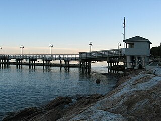
Kittery is a census-designated place (CDP) consisting of the main village in the town of Kittery in York County, Maine, United States. The village is also known as Kittery Foreside. The population of the CDP was 4,562 at the 2010 census. It is part of the Portland–South Portland–Biddeford, Maine Metropolitan Statistical Area.

<span class="mw-page-title-main">North Berwick (CDP), Maine</span> Census-designated place in Maine, United States

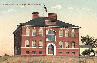
North Berwick is a census-designated place (CDP) consisting of the primary settlement in the town of North Berwick in York County, Maine, United States. The population was 1,615 at the 2010 census, out of a total town population of 4,576. It is part of the Portland–South Portland–Biddeford, Maine Metropolitan Statistical Area.

<span class="mw-page-title-main">Livermore Falls (CDP), Maine</span> Census-designated place in Maine, United States

Livermore Falls is a census-designated place (CDP) in the town of Livermore Falls in Androscoggin County, Maine, United States. The population of the CDP was 1,594 at the 2010 census, out of a population of 3,187 within the full town.

<span class="mw-page-title-main">Mechanic Falls (CDP), Maine</span> Census-designated place in Maine, United States

Mechanic Falls is a census-designated place (CDP) in the town of Mechanic Falls in Androscoggin County, Maine, United States. The population of the CDP was 2,237 at the 2010 census, out of a total town population of 3,031.

<span class="mw-page-title-main">Bridgton (CDP), Maine</span> Census-designated place in Maine, United States

Bridgton is a census-designated place (CDP) in the town of Bridgton in Cumberland County, Maine, United States. The population was 2,071 at the 2010 census. It is part of the Portland–South Portland–Biddeford, Maine Metropolitan Statistical Area.

<span class="mw-page-title-main">Gorham (CDP), Maine</span> Census-designated place in Maine, United States

Gorham is a census-designated place (CDP) in the town of Gorham, in Cumberland County, Maine, United States. The population was 6,882 at the 2010 census. It is part of the Portland–South Portland–Biddeford, Maine Metropolitan Statistical Area.

<span class="mw-page-title-main">Yarmouth (CDP), Maine</span> Census-designated place in Maine, United States

Yarmouth is a census-designated place (CDP) in the town of Yarmouth in Cumberland County, Maine, United States. The population was 6,125 at the 2020 census. It is part of the Portland–South Portland–Biddeford, Maine Metropolitan Statistical Area.

<span class="mw-page-title-main">Farmington (CDP), Maine</span> Census-designated place in Maine, United States

Farmington is a census-designated place (CDP) comprising the center of the town of Farmington, which is the county seat of Franklin County in Maine, United States. The population of the CDP was 4,288 at the 2010 census, out of 7,760 people in the town as a whole. The University of Maine at Farmington is located within the CDP.

<span class="mw-page-title-main">Wilton, Maine</span> Town in Maine, United States

Wilton is a town in Franklin County, Maine, United States. The population was 3,835 at the 2020 census. Situated beside Wilson Pond, the former mill town is today primarily a recreation area.

Fryeburg is a census-designated place (CDP) in the town of Fryeburg in Oxford County, Maine, United States. The population was 1,444 at the 2020 census.

<span class="mw-page-title-main">Skowhegan (CDP), Maine</span> CDP in Maine, United States

Skowhegan is a census-designated place (CDP) in the town of Skowhegan in Somerset County, Maine, United States. The population was 6,404 at the 2020 census.

References

  1. "2020 U.S. Gazetteer Files". United States Census Bureau. Retrieved April 8, 2022.
  2. 1 2 "Geographic Identifiers: 2010 Census Summary File 1 (G001), Wilton CDP, Maine". American FactFinder. U.S. Census Bureau. Archived from the original on February 13, 2020. Retrieved May 27, 2016.
  3. "US Gazetteer files: 2010, 2000, and 1990". United States Census Bureau. February 12, 2011. Retrieved April 23, 2011.
  4. "Census of Population and Housing". Census.gov. Retrieved June 4, 2016.
  5. "U.S. Census website". United States Census Bureau . Retrieved January 31, 2008.