Wilton (CDP), New Hampshire

Last updated

Wilton, New Hampshire
Wilton Station, Wilton NH.jpg
Wilton Station
USA New Hampshire location map.svg
Red pog.svg
Wilton
Usa edcp location map.svg
Red pog.svg
Wilton
Coordinates: 42°50′36″N71°44′6″W / 42.84333°N 71.73500°W / 42.84333; -71.73500
Country United States
State New Hampshire
County Hillsborough
Towns Wilton, Milford
Area
[1]
  Total2.11 sq mi (5.46 km2)
  Land2.11 sq mi (5.46 km2)
  Water0.00 sq mi (0.00 km2)
Elevation
380 ft (120 m)
Population
 (2020)
  Total1,324
  Density628.08/sq mi (242.54/km2)
Time zone UTC-5 (Eastern (EST))
  Summer (DST) UTC-4 (EDT)
ZIP codes
03086 (Wilton)
03055 (Milford)
Area code 603
FIPS code 33-85140
GNIS feature ID2378096

Wilton is a census-designated place (CDP) and the main village in the town of Wilton, Hillsborough County, New Hampshire, United States. The CDP extends east into the town of Milford as well. The population of the CDP was 1,324 at the 2020 census, [2] up from 1,163 at the 2010 census.

Contents

Geography

The CDP occupies the northeastern part of the town of Wilton, along the Souhegan River, where it is joined from the northwest by Stony Brook. It extends west out Sand Hill Road as far as Holt Road and is bordered to the north in Wilton by Curtis Farm Road, Dale Street, and Pead Hill Road. The CDP extends east into the northwestern corner of the town of Milford, where it is bordered to the north by the town of Lyndeborough and to the south by the Souhegan River. It extends east as far as the former bridge across the Souhegan near Jones Road. [3]

New Hampshire Route 101 runs along the southern edge of the CDP, leading east and northeast 18 miles (29 km) to Bedford and west 13 miles (21 km) to Peterborough. New Hampshire Route 31 passes through the center of the village, leading northwest up the Stony Creek valley 10 miles (16 km) to Greenfield, and southwest up the Souhegan River valley 7 miles (11 km) to Greenville. The city of Nashua is 15 miles (24 km) to the east via Routes 101 and 101A.

According to the U.S. Census Bureau, the Wilton CDP has a total area of 2.1 square miles (5.5 km2), all of it recorded as land. [4]

Demographics

Historical population
CensusPop.Note
1950 1,615
1960 1,425−11.8%
1970 1,161−18.5%
1980 1,31012.8%
1990 1,165−11.1%
2000 1,2366.1%
2010 1,163−5.9%
2020 1,32413.8%
U.S. Decennial Census [5]

As of the census of 2010, there were 1,163 people, 455 households, and 293 families residing in the CDP. There were 498 housing units, of which 43, or 8.6%, were vacant. The racial makeup of the CDP was 96.4% white, 0.6% African American, 0.2% Native American, 1.1% Asian, 0.0% Pacific Islander, 0.6% some other race, and 1.1% from two or more races. 2.2% of the population were Hispanic or Latino of any race. [6]

Of the 455 households in the CDP, 38.2% had children under the age of 18 living with them, 46.4% were headed by married couples living together, 15.8% had a female householder with no husband present, and 35.6% were non-families. 29.5% of all households were made up of individuals, and 11.2% were someone living alone who was 65 years of age or older. The average household size was 2.56, and the average family size was 3.18. [6]

27.1% of residents in the CDP were under the age of 18, 7.4% were from age 18 to 24, 28.6% were from 25 to 44, 26.2% were from 45 to 64, and 10.6% were 65 years of age or older. The median age was 36.5 years. For every 100 females, there were 97.1 males. For every 100 females age 18 and over, there were 96.8 males. [6]

For the period 2011-15, the estimated median annual income for a household was $50,565, and the median income for a family was $71,458. The per capita income for the CDP was $32,559. [7]

Related Research Articles

<span class="mw-page-title-main">Amherst, New Hampshire</span> Town in New Hampshire, United States

Amherst is a town in Hillsborough County in the state of New Hampshire, United States. The population was 11,753 at the 2020 census. Amherst is home to Ponemah Bog Wildlife Sanctuary, Hodgman State Forest, the Joe English Reservation and Baboosic Lake.

<span class="mw-page-title-main">East Merrimack, New Hampshire</span> Census-designated place in New Hampshire, United States

East Merrimack is a census-designated place (CDP) in the town of Merrimack, Hillsborough County, New Hampshire, United States. There is no village center named "East Merrimack"; rather, the CDP refers to the region of the town of Merrimack lying east of the F. E. Everett Turnpike, overlapping portions of the villages of Reeds Ferry, Thornton's Ferry, and the center of Merrimack. The population was 5,176 at the 2020 census, up from 4,197 at the 2010 census.

<span class="mw-page-title-main">Winchester (CDP), New Hampshire</span> Census-designated place in New Hampshire, United States

Winchester is a census-designated place (CDP) and the main village in the town of Winchester in Cheshire County, New Hampshire, United States. The population of the CDP was 1,606 at the 2020 census, compared to 4,150 in the entire town.

Gorham is a census-designated place (CDP) and the main village in the town of Gorham in Coos County, New Hampshire, United States. The population of the CDP was 1,851 at the 2020 census, out of 2,698 people in the entire town of Gorham.

Whitefield is a census-designated place (CDP) and the main village in the town of Whitefield in Coos County, New Hampshire, United States. The population of the CDP was 1,460 at the 2020 census, out of 2,490 people in the entire town of Whitefield.

<span class="mw-page-title-main">Bristol (CDP), New Hampshire</span> Census-designated place in New Hampshire, United States

Bristol is a census-designated place (CDP) and the main village in the town of Bristol in Grafton County, New Hampshire, United States. The population of the CDP was 1,911 at the 2020 census, out of 3,244 in the entire town.

Hanover is a census-designated place (CDP) and the main village in the town of Hanover in Grafton County, New Hampshire, United States. The population of the CDP was 9,078 at the 2020 census, out of 11,870 in the entire town. The CDP includes the campus of Dartmouth College.

Littleton is a census-designated place (CDP) and the main village in the town of Littleton in Grafton County, New Hampshire, United States. The population of the CDP was 4,467 at the 2020 census, out of 6,005 in the entire town.

<span class="mw-page-title-main">Greenville (CDP), New Hampshire</span> Census-designated place in New Hampshire, United States

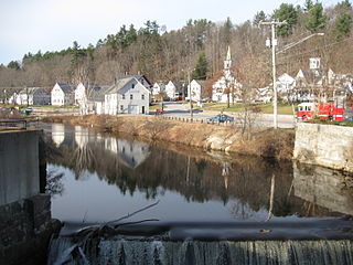
Greenville is a census-designated place (CDP) and the main village in the town of Greenville in Hillsborough County, New Hampshire, United States. The population of the CDP was 1,074 at the 2020 census, out of 1,974 in the entire town.

<span class="mw-page-title-main">Hudson (CDP), New Hampshire</span> Census-designated place in New Hampshire, United States

Hudson is a census-designated place (CDP) and the urban center of the town of Hudson in Hillsborough County, New Hampshire, United States. The population of the CDP was 7,534 at the 2020 census, out of 25,394 in the entire town.

<span class="mw-page-title-main">Milford (CDP), New Hampshire</span> Census-designated place in New Hampshire, United States

Milford is a census-designated place (CDP) and the main village in the town of Milford, Hillsborough County, New Hampshire, United States. The population of the CDP was 9,212 at the 2020 census, out of 16,131 in the entire town.

<span class="mw-page-title-main">Peterborough (CDP), New Hampshire</span> Census-designated place in New Hampshire, United States

Peterborough is a census-designated place (CDP) and the main village in the town of Peterborough, Hillsborough County, New Hampshire, United States. The population of the CDP was 3,090 at the 2020 census, out of 6,418 in the entire town.

<span class="mw-page-title-main">Wilton, New Hampshire</span> Town in New Hampshire, United States

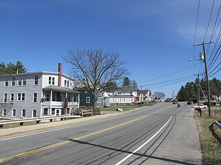
Wilton is a town in Hillsborough County, New Hampshire, United States. The population was 3,896 at the 2020 census. Like many small New England towns, it grew up around water-powered textile mills, but is now a rural bedroom community with some manufacturing and service employment. Wilton is home to the High Mowing School, a private preparatory school.

<span class="mw-page-title-main">Milford, New Hampshire</span> Town in New Hampshire, United States

Milford is a town in Hillsborough County, New Hampshire, United States, on the Souhegan River. The population was 16,131 at the 2020 census, up from 15,115 at the 2010 census. It is the retail and manufacturing center of a multi-town area known informally as the Souhegan Valley.

<span class="mw-page-title-main">Belmont (CDP), New Hampshire</span> Census-designated place in New Hampshire, United States

Belmont is a census-designated place (CDP) and the main village in the town of Belmont in Belknap County, New Hampshire, United States. The population was 1,285 at the 2020 census, out of 7,314 in the entire town of Belmont.

<span class="mw-page-title-main">Goffstown (CDP), New Hampshire</span> Census-designated place in New Hampshire, United States

Goffstown is a census-designated place (CDP) and the main village in the town of Goffstown in Hillsborough County, New Hampshire, United States. The population of the CDP was 3,366 at the 2020 census, out of 18,577 in the entire town.

<span class="mw-page-title-main">Newfields (CDP), New Hampshire</span> Census-designated place in New Hampshire, United States

Newfields is a census-designated place (CDP) and the main village within the town of Newfields, Rockingham County, New Hampshire, United States. The population of the CDP was 378 at the 2020 census, out of 1,769 in the entire town.

<span class="mw-page-title-main">Amherst (CDP), New Hampshire</span> Census-designated place in New Hampshire, United States

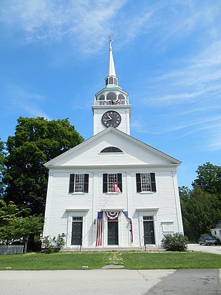
Amherst is a census-designated place (CDP) and the main village in the town of Amherst in Hillsborough County, New Hampshire, United States. The population of the CDP was 697 at the 2020 census, out of 11,753 in the entire town. The village center is listed on the National Register of Historic Places as the Amherst Village Historic District.

Canaan is a census-designated place (CDP) and the main village in the town of Canaan in Grafton County, New Hampshire, United States. The population of the CDP was 442 at the 2020 census, out of 3,794 in the entire town.

<span class="mw-page-title-main">Colebrook (CDP), New Hampshire</span> Census-designated place in New Hampshire, United States

Colebrook is a census-designated place (CDP) and the main village in the town of Colebrook, Coös County, New Hampshire, United States. The population of the CDP was 1,201 at the 2020 census, out of 2,084 in the entire town. The CDP population had dropped from 1,394 at the 2010 census.

References

  1. "ArcGIS REST Services Directory". United States Census Bureau. Retrieved September 20, 2022.
  2. "Wilton CDP, New Hampshire: 2020 DEC Redistricting Data (PL 94-171)". U.S. Census Bureau. Retrieved December 10, 2021.
  3. "TIGERweb: Wilton CDP, New Hampshire". Geography Division, U.S. Census Bureau. Retrieved September 26, 2017.
  4. "2021 U.S. Gazetteer Files – New Hampshire". United States Census Bureau. Retrieved December 10, 2021.
  5. "Decennial Census Official Publications". Census.gov. Retrieved March 4, 2024.
  6. 1 2 3 "Profile of General Population and Housing Characteristics: 2010 Census Summary File 1 (DP-1): Wilton CDP, New Hampshire". U.S. Census Bureau, American Factfinder. Archived from the original on February 13, 2020. Retrieved September 26, 2017.
  7. "Selected Economic Characteristics: 2011-2015 American Community Survey 5-Year Estimates (DP03): Wilton CDP, New Hampshire". U.S. Census Bureau, American Factfinder. Archived from the original on February 13, 2020. Retrieved September 26, 2017.