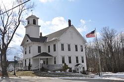
Greenfield, New Hampshire

Last updated

Greenfield, New Hampshire
GreenfieldNH TownHall.jpg
The former elementary school, listed on the New Hampshire State Register of Historic Places, now serves as the Town Office.
Greenfield Town Seal.png
Hillsborough-Greenfield-NH.png
Coordinates: 42°57′02″N71°52′20″W / 42.95056°N 71.87222°W / 42.95056; -71.87222
Country United States
State New Hampshire
County Hillsborough
Incorporated 1791
Government
   Board of Selectmen
  • Mason Parker
  • Michael Borden
  • Thomas Bascom
  Town AdministratorAaron K. Patt
Area
[1]
  Total26.8 sq mi (69.3 km2)
  Land26.2 sq mi (67.9 km2)
  Water0.5 sq mi (1.4 km2)  2.04%
Elevation
840 ft (260 m)
Population
 (2020) [2]
  Total1,716
  Density66/sq mi (25.3/km2)
Time zone UTC-5 (Eastern)
  Summer (DST) UTC-4 (Eastern)
ZIP code
03047
Area code 603
FIPS code 33-31540
GNIS feature ID0873611
Website www.greenfield-nh.gov

Greenfield is a town in Hillsborough County, New Hampshire, United States. The population was 1,716 at the 2020 census. [2] Greenfield is home to the Crotched Mountain Rehabilitation Center, to Greenfield State Park, and to part of the Wapack Trail.

Contents

History

Originally known as "Lyndeborough Addition", the area was first settled by the Lynde family in 1753. Separated from the nearest church and school by the Monadnock hills, the residents successfully petitioned to form a new town in 1791, using the name "Greenfield" to highlight the area's level, fertile ground. [3]

In 1953, the Crotched Mountain Rehabilitation Center began operation in Greenfield. Established by Harry Gregg, the facility on Crotched Mountain originally treated for polio, cerebral palsy, spina bifida and other physical and neurological disabilities. A center for adult rehabilitation opened in 1961, and a rehabilitation center for adults with brain injuries in 1986. The complex today provides service to over 2,000 children and adults. In 2004, it unveiled the first wheelchair-accessible tree house in New Hampshire.

Greenfield is home to the Yankee Siege, considered the most powerful (current) trebuchet in the world, which has participated in the annual World Championship Punkin' Chunkin' Contest in Sussex County, Delaware, since 2004. The farthest official toss is 1,897 feet (578 m) as of 2008, although there are unofficial reports of 2,000-to-2,300-foot (610 to 700 m) throws as of 2009.

Geography

According to the United States Census Bureau, the town has a total area of 26.8 square miles (69.3 km2), of which 26.2 square miles (67.9 km2) are land and 0.54 square miles (1.4 km2) are water, comprising 2.04% of the town. [1] The southeastern part of Greenfield is drained by Stony Brook, flowing southeast to the Souhegan River in Wilton, while the western part, including the town center, is drained by the Contoocook River and its tributary Otter Brook; the Contoocook forms the northwestern border of the town, where it passes through Powder Mill Pond. The northeastern corner of the town is drained by Rand Brook, a tributary of the South Branch of the Piscataquog River. Greenfield lies fully within the Merrimack River watershed. [4] North Pack Monadnock, elevation 2,276 feet (694 m) above sea level, is the northernmost summit of the Wapack Range and the highest point in Greenfield, located in the extreme southern part of the town.

Adjacent municipalities

Demographics

Historical population
CensusPop.Note
1800 934
1810 9804.9%
1820 974−0.6%
1830 946−2.9%
1840 834−11.8%
1850 716−14.1%
1860 692−3.4%
1870 527−23.8%
1880 64923.1%
1890 607−6.5%
1900 605−0.3%
1910 574−5.1%
1920 417−27.4%
1930 394−5.5%
1940 4073.3%
1950 4305.7%
1960 53825.1%
1970 1,05896.7%
1980 972−8.1%
1990 1,51956.3%
2000 1,6579.1%
2010 1,7495.6%
2020 1,716−1.9%
U.S. Decennial Census [5]

As of the census [6] of 2000, there were 1,657 people, 563 households, and 405 families residing in the town. The population density was 65.1 inhabitants per square mile (25.1/km2). There were 640 housing units at an average density of 25.1 per square mile (9.7/km2). The racial makeup of the town was 97.28% White, 0.72% African American, 0.84% Native American, 0.24% Asian, 0.48% from other races, and 0.42% from two or more races. Hispanic or Latino of any race were 0.60% of the population.

There were 563 households, out of which 38.9% had children under the age of 18 living with them, 60.0% were married couples living together, 8.0% had a female householder with no husband present, and 27.9% were non-families. 19.5% of all households were made up of individuals, and 4.3% had someone living alone who was 65 years of age or older. The average household size was 2.69 and the average family size was 3.12.

In the town, the population was spread out, with 30.8% under the age of 18, 7.3% from 18 to 24, 32.1% from 25 to 44, 22.8% from 45 to 64, and 7.1% who were 65 years of age or older. The median age was 34 years. For every 100 females, there were 104.1 males. For every 100 females age 18 and over, there were 105.9 males.

The median income for a household in the town was $48,833, and the median income for a family was $56,250. Males had a median income of $36,250 versus $24,438 for females. The per capita income for the town was $19,895. About 2.4% of families and 5.4% of the population were below the poverty line, including 6.9% of those under age 18 and 8.5% of those age 65 or over.

Related Research Articles

<span class="mw-page-title-main">Hillsborough County, New Hampshire</span> County in New Hampshire, United States

Hillsborough County is the most populous county in the U.S. state of New Hampshire. As of the 2020 census, the population was 422,937, almost one-third the population of the entire state. Its county seats are Manchester and Nashua, the state's two biggest cities. Hillsborough is northern New England's most populous county as well as its most densely populated.

<span class="mw-page-title-main">Fitzwilliam, New Hampshire</span> Town in New Hampshire, United States

Fitzwilliam is a town in Cheshire County, New Hampshire, United States. The population was 2,351 at the 2020 census. Fitzwilliam is home to Rhododendron State Park, a 16-acre (6.5 ha) grove of native rhododendrons that bloom in mid-July.

<span class="mw-page-title-main">Harrisville, New Hampshire</span> Town in New Hampshire, United States

Harrisville is a town in Cheshire County, New Hampshire, United States. Besides the town center, it also includes the villages of Chesham and Eastview. The population of the town was 984 at the 2020 census.

<span class="mw-page-title-main">Nelson, New Hampshire</span> Town in New Hampshire, United States

Nelson is a town in Cheshire County, New Hampshire, United States. The population was 629 at the 2020 census, down from 729 at the 2010 census. Nelson includes the village of Munsonville.

<span class="mw-page-title-main">Rindge, New Hampshire</span> Town in New Hampshire, United States

Rindge is a town in Cheshire County, New Hampshire, United States. The population was 6,476 at the 2020 census, up from 6,014 at the 2010 census. Rindge is home to Franklin Pierce University, the Cathedral of the Pines and part of Annett State Forest.

<span class="mw-page-title-main">Troy, New Hampshire</span> Town in New Hampshire, United States

Troy is a town in Cheshire County, New Hampshire, United States. The population was 2,130 at the 2020 census. It is situated west of Mount Monadnock.

<span class="mw-page-title-main">Bennington, New Hampshire</span> Town in New Hampshire, United States

Bennington is a town in Hillsborough County, New Hampshire, United States. The population was 1,501 at the 2020 census.

<span class="mw-page-title-main">Deering, New Hampshire</span> Town in New Hampshire, United States

Deering is a town in Hillsborough County, New Hampshire, United States. The population was 1,904 at the 2020 census.

<span class="mw-page-title-main">Hancock, New Hampshire</span> Town in New Hampshire, United States

Hancock is a town in Hillsborough County, New Hampshire, United States. The population was 1,731 at the 2020 census. Hancock is home to the Welch Family Farm Forest.

<span class="mw-page-title-main">Lyndeborough, New Hampshire</span> Town in New Hampshire, United States

Lyndeborough is a town in Hillsborough County, New Hampshire, United States. The population was 1,702 at the 2020 census.

<span class="mw-page-title-main">Sharon, New Hampshire</span> Town in New Hampshire, United States

Sharon is a town in Hillsborough County, New Hampshire, United States. The population was 359 at the 2020 census. It was the long-time home to the Sharon Arts Center, a nonprofit which has ceased operations.

<span class="mw-page-title-main">Temple, New Hampshire</span> Town in New Hampshire, United States

Temple is a town in Hillsborough County, New Hampshire, United States. The population was 1,382 at the 2020 census. It is home to Temple Mountain State Reservation, formerly the Temple Mountain Ski Area.

<span class="mw-page-title-main">Boscawen, New Hampshire</span> Town in New Hampshire, United States

Boscawen is a town in Merrimack County, New Hampshire, United States. The population was 3,998 at the 2020 census.

<span class="mw-page-title-main">Salisbury, New Hampshire</span> Town in New Hampshire, United States

Salisbury is a town in Merrimack County, New Hampshire, United States. The population was 1,422 at the 2020 census.

<span class="mw-page-title-main">Sutton, New Hampshire</span> Town in New Hampshire, United States

Sutton is a town in Merrimack County, New Hampshire, United States. The population was 1,978 at the 2020 census. Sutton includes the villages of Sutton Mills, North Sutton, South Sutton and East Sutton. North Sutton is home to Wadleigh State Park on Kezar Lake.

<span class="mw-page-title-main">Washington, New Hampshire</span> Place in New Hampshire, United States

Washington is a town in Sullivan County, New Hampshire, United States. The population was 1,192 at the 2020 census. Situated in a hilly, rocky, forested area, and with 26 lakes and ponds, Washington is a picturesque resort area. It is home to Pillsbury State Park.

<span class="mw-page-title-main">Jaffrey, New Hampshire</span> Town in New Hampshire, United States

Jaffrey is a town in Cheshire County, New Hampshire, United States. The population was 5,320 at the 2020 census.

<span class="mw-page-title-main">Marlborough, New Hampshire</span> Town in New Hampshire, United States

Marlborough is a town in Cheshire County, New Hampshire, United States. The population was 2,096 at the 2020 census. The town is home to the Kensan-Devan Wildlife Sanctuary at Meetinghouse Pond.

<span class="mw-page-title-main">Antrim, New Hampshire</span> Town in New Hampshire, United States

Antrim is a town in Hillsborough County, New Hampshire, United States. The population was 2,651 at the 2020 census. The main village in the town, where 1,395 people lived at the 2020 census, is defined as the Antrim census-designated place (CDP) and is located at the intersection of U.S. Route 202 and New Hampshire Route 31. The town of Antrim also includes the villages of Antrim Center, North Branch, and Clinton Village.

<span class="mw-page-title-main">Peterborough, New Hampshire</span> Town in New Hampshire, United States

Peterborough is a town in Hillsborough County, New Hampshire, United States. The population was 6,418 at the 2020 census. The main village, with 3,090 people at the 2020 census, is defined as the Peterborough census-designated place (CDP) and is located along the Contoocook River at the junction of U.S. Route 202 and New Hampshire Route 101. Peterborough is 38 miles (61 km) west of Manchester and 72 miles (116 km) northwest of Boston.

References

  1. 1 2 "2021 U.S. Gazetteer Files – New Hampshire". United States Census Bureau. Retrieved December 7, 2021.
  2. 1 2 "Greenfield town, Hillsborough County, New Hampshire: 2020 DEC Redistricting Data (PL 94-171)". U.S. Census Bureau. Retrieved December 7, 2021.
  3. Coolidge, Austin J.; John B. Mansfield (1859). A History and Description of New England. Boston, Massachusetts: A.J. Coolidge. pp.  509. coolidge mansfield history description new england 1859.
  4. Foster, Debra H.; Batorfalvy, Tatianna N.; Medalie, Laura (1995). Water Use in New Hampshire: An Activities Guide for Teachers. U.S. Department of the Interior and U.S. Geological Survey.
  5. "Census of Population and Housing". Census.gov. Retrieved June 4, 2016.
  6. "U.S. Census website". United States Census Bureau . Retrieved January 31, 2008.