Hillsborough (CDP), New Hampshire

Last updated

Hillsborough, New Hampshire
Gov John Butler Smith House, Hillsborough NH.jpg
Gov. John Butler Smith House
USA New Hampshire location map.svg
Red pog.svg
Hillsborough
Usa edcp location map.svg
Red pog.svg
Hillsborough
Coordinates: 43°6′50″N71°53′44″W / 43.11389°N 71.89556°W / 43.11389; -71.89556
Country United States
State New Hampshire
County Hillsborough
Town Hillsborough
Area
[1]
  Total1.95 sq mi (5.04 km2)
  Land1.95 sq mi (5.04 km2)
  Water0.00 sq mi (0.00 km2)
Elevation
640 ft (200 m)
Population
 (2020)
  Total2,156
  Density1,107.91/sq mi (427.75/km2)
Time zone UTC-5 (Eastern (EST))
  Summer (DST) UTC-4 (EDT)
ZIP code
03244
Area code 603
FIPS code 33-36020
GNIS feature ID2378071

Hillsborough (frequently spelled Hillsboro) is a census-designated place (CDP) and the main village in the town of Hillsborough in Hillsborough County, New Hampshire, United States. The population of the CDP was 2,156 at the 2020 census, [2] out of 5,939 in the entire town.

Contents

Geography

The CDP is in the southeastern part of the town of Hillsborough, along the Contoocook River. The southern border of the CDP follows the town line with Deering. Parts of the eastern and southern borders follow the Contoocook River. The northern border is the Route 202/9 bypass, and the western border follows Route 202 and a power line in the valley of the North Branch of the Contoocook. [3]

Routes 202 and 9 lead east from Hillsborough 22 miles (35 km) to Concord, the state capital. US 202 leads south 20 miles (32 km) to Peterborough, while NH 9 leads southwest 28 miles (45 km) to Keene. New Hampshire Route 149 passes through the center of the CDP, leading southeast 12 miles (19 km) to Weare.

According to the U.S. Census Bureau, the Hillsborough CDP has a total area of 1.9 square miles (5.0 km2), all of it recorded as land. [4]

Demographics

Historical population
CensusPop.Note
1950 1,670
1960 1,645−1.5%
1970 1,7848.4%
1980 1,7970.7%
1990 1,8261.6%
2000 1,8420.9%
2010 1,9767.3%
2020 2,1569.1%
U.S. Decennial Census [5]

As of the census of 2010, there were 1,976 people, 823 households, and 492 families residing in the CDP. There were 933 housing units, of which 110, or 11.8%, were vacant. The racial makeup of the CDP was 95.2% white, 0.7% African American, 0.3% Native American, 0.8% Asian, 0.1% Pacific Islander, 0.4% some other race, and 2.5% from two or more races. 1.7% of the population were Hispanic or Latino of any race. [6]

Of the 823 households in the CDP, 33.8% had children under the age of 18 living with them, 36.3% were headed by married couples living together, 16.9% had a female householder with no husband present, and 40.2% were non-families. 31.3% of all households were made up of individuals, and 11.3% were someone living alone who was 65 years of age or older. The average household size was 2.40, and the average family size was 3.00. [6]

25.5% of residents in the CDP were under the age of 18, 11.1% were from age 18 to 24, 25.3% were from 25 to 44, 25.9% were from 45 to 64, and 12.2% were 65 years of age or older. The median age was 35.0 years. For every 100 females, there were 94.1 males. For every 100 females age 18 and over, there were 92.3 males. [6]

For the period 2011-15, the estimated median annual income for a household was $41,750, and the median income for a family was $75,526. Male full-time workers had a median income of $55,194 versus $33,203 for females. The per capita income for the CDP was $25,379. [7]

Related Research Articles

<span class="mw-page-title-main">Bennington, New Hampshire</span> Town in New Hampshire, United States

Bennington is a town in Hillsborough County, New Hampshire, United States. The population was 1,501 at the 2020 census.

<span class="mw-page-title-main">East Merrimack, New Hampshire</span> Census-designated place in New Hampshire, United States

East Merrimack is a census-designated place (CDP) in the town of Merrimack, Hillsborough County, New Hampshire, United States. There is no village center named "East Merrimack"; rather, the CDP refers to the region of the town of Merrimack lying east of the F. E. Everett Turnpike, overlapping portions of the villages of Reeds Ferry, Thornton's Ferry, and the center of Merrimack. The population was 5,176 at the 2020 census, up from 4,197 at the 2010 census.

<span class="mw-page-title-main">Hancock, New Hampshire</span> Town in New Hampshire, United States

Hancock is a town in Hillsborough County, New Hampshire, United States. The population was 1,731 at the 2020 census. Hancock is home to the Welch Family Farm Forest.

<span class="mw-page-title-main">Pinardville, New Hampshire</span> Census-designated place in New Hampshire, United States

Pinardville is a census-designated place (CDP) in the town of Goffstown, Hillsborough County, New Hampshire, United States. It is a suburban neighborhood adjacent to the city of Manchester. The population was 5,034 at the 2020 census. Pinardville has existed since 1906.

<span class="mw-page-title-main">Contoocook, New Hampshire</span> Census-designated place in New Hampshire, United States

Contoocook is a village and census-designated place (CDP) within the town of Hopkinton in Merrimack County, New Hampshire, United States. The population was 1,427 at the 2020 census. Contoocook is well known for its growth of small businesses, preservation of historical landmarks, community involvement and recreational activities within the village.

<span class="mw-page-title-main">Jaffrey (CDP), New Hampshire</span> Census-designated place in New Hampshire, United States

Jaffrey is a census-designated place (CDP) and the main village in the town of Jaffrey in Cheshire County, New Hampshire, United States. The population of the CDP was 3,058 at the 2020 census, out of 5,320 in the entire town of Jaffrey.

<span class="mw-page-title-main">Antrim (CDP), New Hampshire</span> Census-designated place in New Hampshire, United States

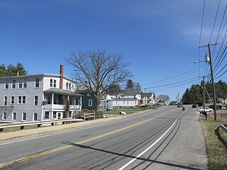
Antrim is a census-designated place (CDP) and the main village in the town of Antrim in Hillsborough County, New Hampshire, United States. The population of the CDP was 1,395 at the 2020 census, out of 2,651 in the entire town.

<span class="mw-page-title-main">Antrim, New Hampshire</span> Town in New Hampshire, United States

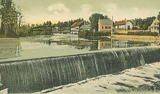
Antrim is a town in Hillsborough County, New Hampshire, United States. The population was 2,651 at the 2020 census. The main village in the town, where 1,395 people lived at the 2020 census, is defined as the Antrim census-designated place (CDP) and is located at the intersection of U.S. Route 202 and New Hampshire Route 31. The town of Antrim also includes the villages of Antrim Center, North Branch, and Clinton Village.

<span class="mw-page-title-main">Greenville (CDP), New Hampshire</span> Census-designated place in New Hampshire, United States

Greenville is a census-designated place (CDP) and the main village in the town of Greenville in Hillsborough County, New Hampshire, United States. The population of the CDP was 1,074 at the 2020 census, out of 1,974 in the entire town.

<span class="mw-page-title-main">Hudson (CDP), New Hampshire</span> Census-designated place in New Hampshire, United States

Hudson is a census-designated place (CDP) and the urban center of the town of Hudson in Hillsborough County, New Hampshire, United States. The population of the CDP was 7,534 at the 2020 census, out of 25,394 in the entire town.

<span class="mw-page-title-main">Milford (CDP), New Hampshire</span> Census-designated place in New Hampshire, United States

Milford is a census-designated place (CDP) and the main village in the town of Milford, Hillsborough County, New Hampshire, United States. The population of the CDP was 9,212 at the 2020 census, out of 16,131 in the entire town.

<span class="mw-page-title-main">Peterborough (CDP), New Hampshire</span> Census-designated place in New Hampshire, United States

Peterborough is a census-designated place (CDP) and the main village in the town of Peterborough, Hillsborough County, New Hampshire, United States. The population of the CDP was 3,090 at the 2020 census, out of 6,418 in the entire town.

<span class="mw-page-title-main">Henniker (CDP), New Hampshire</span> Census-designated place in New Hampshire, United States

Henniker is a census-designated place (CDP) and the main village in the town of Henniker in Merrimack County, New Hampshire, United States. The population of the CDP was 3,166 at the 2020 census, out of 6,185 in the entire town. The CDP is the home to New England College.

<span class="mw-page-title-main">Hampton (CDP), New Hampshire</span> Census-designated place in New Hampshire, United States

Hampton is a census-designated place (CDP) comprising the town center and surrounding developed areas of the town of Hampton, Rockingham County, New Hampshire, United States. The population of the CDP was 9,597 at the 2020 census, out of 16,214 in the entire town.

<span class="mw-page-title-main">Hillsborough, New Hampshire</span> Town in New Hampshire, United States

Hillsborough, frequently spelled Hillsboro, is a town in Hillsborough County, New Hampshire, United States. The population was 5,939 at the 2020 census. The town is home to Fox State Forest and part of Low State Forest.

<span class="mw-page-title-main">Amherst (CDP), New Hampshire</span> Census-designated place in New Hampshire, United States

Amherst is a census-designated place (CDP) and the main village in the town of Amherst in Hillsborough County, New Hampshire, United States. The population of the CDP was 697 at the 2020 census, out of 11,753 in the entire town. The village center is listed on the National Register of Historic Places as the Amherst Village Historic District.

<span class="mw-page-title-main">Bennington (CDP), New Hampshire</span> Census-designated place in New Hampshire, United States

Bennington is a census-designated place (CDP) and the main village in the town of Bennington in Hillsborough County, New Hampshire, United States. The population of the CDP was 338 at the 2020 census, out of 1,501 in the entire town.

<span class="mw-page-title-main">Colebrook (CDP), New Hampshire</span> Census-designated place in New Hampshire, United States

Colebrook is a census-designated place (CDP) and the main village in the town of Colebrook, Coös County, New Hampshire, United States. The population of the CDP was 1,201 at the 2020 census, out of 2,084 in the entire town. The CDP population had dropped from 1,394 at the 2010 census.

<span class="mw-page-title-main">Hancock (CDP), New Hampshire</span> Census-designated place in New Hampshire, United States

Hancock is a census-designated place (CDP) and the main village in the town of Hancock in Hillsborough County, New Hampshire, United States. The population of the CDP was 213 at the 2020 census, out of 1,731 in the entire town.

<span class="mw-page-title-main">Warner (CDP), New Hampshire</span> Census-designated place in New Hampshire, United States

Warner is a census-designated place (CDP) and the main village in the town of Warner in Merrimack County, New Hampshire, United States. The population of the CDP was 453 at the 2020 census, out of 2,937 in the entire town.

References

  1. "ArcGIS REST Services Directory". United States Census Bureau. Retrieved September 20, 2022.
  2. "Hillsborough CDP, New Hampshire: 2020 DEC Redistricting Data (PL 94-171)". U.S. Census Bureau. Retrieved December 10, 2021.
  3. "TIGERweb: Hillsborough CDP, New Hampshire". Geography Division, U.S. Census Bureau. Retrieved September 14, 2017.
  4. "2021 U.S. Gazetteer Files – New Hampshire". United States Census Bureau. Retrieved December 10, 2021.
  5. "Decennial Census Official Publications". Census.gov. Retrieved March 4, 2024.
  6. 1 2 3 "Profile of General Population and Housing Characteristics: 2010 Census Summary File 1 (DP-1): Hillsborough CDP, New Hampshire". U.S. Census Bureau, American Factfinder. Archived from the original on February 13, 2020. Retrieved September 14, 2017.
  7. "Selected Economic Characteristics: 2011-2015 American Community Survey 5-Year Estimates (DP03): Hillsborough CDP, New Hampshire". U.S. Census Bureau, American Factfinder. Archived from the original on February 13, 2020. Retrieved September 14, 2017.