Derry (CDP), New Hampshire

Last updated

Derry, New Hampshire
NH Route 102, Derry NH.jpg
West/East Broadway
USA New Hampshire location map.svg
Red pog.svg
Derry
Usa edcp location map.svg
Red pog.svg
Derry
Coordinates: 42°52′50″N71°19′38″W / 42.88056°N 71.32722°W / 42.88056; -71.32722
Country United States
State New Hampshire
County Rockingham
Town Derry
Area
[1]
  Total16.27 sq mi (42.14 km2)
  Land16.02 sq mi (41.50 km2)
  Water0.25 sq mi (0.64 km2)
Elevation
280 ft (90 m)
Population
 (2020)
  Total22,879
  Density1,427.80/sq mi (551.27/km2)
Time zone UTC-5 (Eastern (EST))
  Summer (DST) UTC-4 (EDT)
ZIP codes
03038 (Derry),
03041 (East Derry)
Area code 603
FIPS code 33-17860
GNIS feature ID2378058

Derry is a census-designated place (CDP) in the town of Derry in Rockingham County, New Hampshire, United States. The CDP comprises the urban center of the town, as well as the village of East Derry and connected suburban areas. The population of the CDP was 22,879 at the 2020 census, [2] out of 34,317 in the entire town.

Contents

Geography

The CDP occupies the central section of the town of Derry, extending from the western border of town to the eastern border. The main urban area of Derry, centered on the intersection of New Hampshire Routes 102 and 28, is in the western part of the CDP, and the village of East Derry is near the geographic center of the CDP. The town line with Londonderry forms the western border of the CDP, and the eastern border is the town line with Hampstead and Sandown. A portion of the northeastern edge of the CDP follows the town line with Chester. [3]

Route 28 passes through the center of Derry, leading northwest 4 miles (6 km) to Interstate 93 Exit 5 in North Londonderry and 11 miles (18 km) to Manchester. Route 28 leads southeast 10 miles (16 km) to Salem. Route 102 crosses Route 28 in the center of Derry, leading southwest 1 mile (1.6 km) to Interstate 93 Exit 4 in Londonderry and 12 miles (19 km) to Nashua. To the northeast Route 102 leads 15 miles (24 km) to Raymond. New Hampshire Route 28 Bypass crosses the CDP east of Derry's central urban area, leading northwest 8 miles (13 km) to New Hampshire Route 101 east of Manchester. Interstate 93 forms part of the southwest border of the CDP and leads northwest 11 miles (18 km) to Manchester and southeast 40 miles (64 km) to Boston, Massachusetts.

According to the U.S. Census Bureau, the Derry CDP has a total area of 16.3 square miles (42.1 km2), of which 16.0 square miles (41.5 km2) are land and 0.2 square miles (0.6 km2), or 1.52%, are water. [4] Beaver Lake is near the center of the CDP, northeast of Derry village and northwest of East Derry. Its outlet, Beaver Brook, flows southwest through Derry and eventually to the Merrimack River.

Demographics

Historical population
CensusPop.Note
1960 4,468
1970 6,09036.3%
1980 12,248101.1%
1990 20,44666.9%
2000 22,66110.8%
2010 22,015−2.9%
2020 22,8793.9%
U.S. Decennial Census [5]

As of the census of 2010, there were 22,015 people, 8,806 households, and 5,704 families residing in the CDP. There were 9,339 housing units, of which 533, or 5.7%, were vacant. The racial makeup of the CDP was 94.2% white, 1.0% African American, 0.3% Native American, 1.6% Asian, 0.05% Pacific Islander, 1.1% some other race, and 1.8% from two or more races. 3.6% of the population were Hispanic or Latino of any race. [6]

Of the 8,806 households in the CDP, 35.4% had children under the age of 18 living with them, 45.6% were headed by married couples living together, 13.5% had a female householder with no husband present, and 35.2% were non-families. 27.3% of all households were made up of individuals, and 7.6% were someone living alone who was 65 years of age or older. The average household size was 2.48, and the average family size was 3.03. [6]

23.6% of residents in the CDP were under the age of 18, 9.8% were from age 18 to 24, 28.2% were from 25 to 44, 28.9% were from 45 to 64, and 9.6% were 65 years of age or older. The median age was 37.5 years. For every 100 females, there were 98.6 males. For every 100 females age 18 and over, there were 94.2 males. [6]

For the period 2011-15, the estimated median annual income for a household was $63,526, and the median income for a family was $81,867. Male full-time workers had a median income of $50,189 versus $38,107 for females. The per capita income for the CDP was $28,048. 10.0% of the population and 7.3% of families were below the poverty line, along with 16.7% of people under the age of 18 and 7.1% of people 65 or older. [7]

Related Research Articles

<span class="mw-page-title-main">Bristol (CDP), New Hampshire</span> Census-designated place in New Hampshire, United States

Bristol is a census-designated place (CDP) and the main village in the town of Bristol in Grafton County, New Hampshire, United States. The population of the CDP was 1,911 at the 2020 census, out of 3,244 in the entire town.

Hanover is a census-designated place (CDP) and the main village in the town of Hanover in Grafton County, New Hampshire, United States. The population of the CDP was 9,078 at the 2020 census, out of 11,870 in the entire town. The CDP includes the campus of Dartmouth College.

Littleton is a census-designated place (CDP) and the main village in the town of Littleton in Grafton County, New Hampshire, United States. The population of the CDP was 4,467 at the 2020 census, out of 6,005 in the entire town.

<span class="mw-page-title-main">Antrim (CDP), New Hampshire</span> Census-designated place in New Hampshire, United States

Antrim is a census-designated place (CDP) and the main village in the town of Antrim in Hillsborough County, New Hampshire, United States. The population of the CDP was 1,395 at the 2020 census, out of 2,651 in the entire town.

<span class="mw-page-title-main">Greenville (CDP), New Hampshire</span> Census-designated place in New Hampshire, United States

Greenville is a census-designated place (CDP) and the main village in the town of Greenville in Hillsborough County, New Hampshire, United States. The population of the CDP was 1,074 at the 2020 census, out of 1,974 in the entire town.

<span class="mw-page-title-main">Hudson (CDP), New Hampshire</span> Census-designated place in New Hampshire, United States

Hudson is a census-designated place (CDP) and the urban center of the town of Hudson in Hillsborough County, New Hampshire, United States. The population of the CDP was 7,534 at the 2020 census, out of 25,394 in the entire town.

<span class="mw-page-title-main">Hooksett (CDP), New Hampshire</span> Census-designated place in New Hampshire, United States

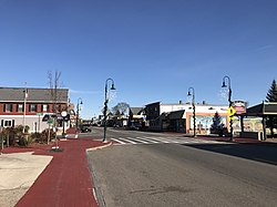
Hooksett is a census-designated place (CDP) in the town of Hooksett in Merrimack County, New Hampshire, United States. The CDP includes the historic central village of Hooksett as well as suburban and rural land surrounding it. The population of the CDP was 5,283 at the 2020 census, out of 14,871 in the entire town.

<span class="mw-page-title-main">Hooksett, New Hampshire</span> Town in New Hampshire, United States

Hooksett is a town in Merrimack County, New Hampshire, United States. The population was 14,871 at the 2020 census, up from 13,451 at the 2010 census. The town is located between Manchester, the state's largest city, and Concord, the state capital. A prominent landmark is Robie's Country Store, a National Historic Landmark and a frequent stop for presidential candidates during the New Hampshire primary.

<span class="mw-page-title-main">Pittsfield (CDP), New Hampshire</span> Census-designated place in New Hampshire, United States

Pittsfield is a census-designated place (CDP) and the main village in the town of Pittsfield in Merrimack County, New Hampshire, United States. The population of the CDP was 1,570 at the 2020 census, out of 4,075 in the entire town.

<span class="mw-page-title-main">Exeter (CDP), New Hampshire</span> Census-designated place in New Hampshire, United States

Exeter is a census-designated place (CDP) and the main village in the town of Exeter, Rockingham County, New Hampshire, United States. The population of the CDP was 10,109 at the 2020 census, out of 16,049 in the entire town.

<span class="mw-page-title-main">Hampton (CDP), New Hampshire</span> Census-designated place in New Hampshire, United States

Hampton is a census-designated place (CDP) comprising the town center and surrounding developed areas of the town of Hampton, Rockingham County, New Hampshire, United States. The population of the CDP was 9,597 at the 2020 census, out of 16,214 in the entire town.

<span class="mw-page-title-main">Londonderry (CDP), New Hampshire</span> Census-designated place in New Hampshire, United States

Londonderry is a census-designated place (CDP) within the town of Londonderry in Rockingham County, New Hampshire, United States. The population of the CDP was 11,645 at the 2020 census, out of 25,826 in the entire town.

<span class="mw-page-title-main">Londonderry, New Hampshire</span> Town in Rockingham County, New Hampshire, United States of America

Londonderry is a town in western Rockingham County, New Hampshire, United States. It sits between Manchester and Derry, the largest and fourth-largest communities in the state. The population was 25,826 at the 2020 census. Londonderry is known for its apple orchards and is home to the headquarters of Stonyfield Farm and part of Manchester–Boston Regional Airport.

<span class="mw-page-title-main">Raymond (CDP), New Hampshire</span> Census-designated place in New Hampshire, United States

Raymond is a census-designated place (CDP) and the main village in the town of Raymond, Rockingham County, New Hampshire, United States. The population of the CDP was 3,738 at the 2020 census, out of 10,684 in the entire town.

<span class="mw-page-title-main">Charlestown (CDP), New Hampshire</span> Census-designated place in New Hampshire, United States

Charlestown is a census-designated place (CDP) and the main village in the town of Charlestown, Sullivan County, New Hampshire, United States. The population of the CDP was 1,078 at the 2020 census, out of 4,806 in the entire town.

<span class="mw-page-title-main">Derry, New Hampshire</span> Town in New Hampshire, United States

Derry is a town in Rockingham County, New Hampshire, United States. The population was 34,317 at the 2020 census. Although it is a town and not a city, Derry is the most populous community in Rockingham County and the 4th most populous in the state. The town's nickname, "Spacetown", derives from the fact that Derry is the birthplace of Alan Shepard, the first astronaut from the United States in space. Derry was also for a time the home of the poet Robert Frost and his family.

<span class="mw-page-title-main">Ashland (CDP), New Hampshire</span> Census-designated place in New Hampshire, United States

Ashland is a census-designated place (CDP) and the main village in the town of Ashland in Grafton County, New Hampshire, United States. The population of the CDP was 1,082 at the 2020 census, out of 1,938 in the entire town.

<span class="mw-page-title-main">Bradford (CDP), New Hampshire</span> Census-designated place in New Hampshire, United States

Bradford is a census-designated place (CDP) and the main village in the town of Bradford in Merrimack County, New Hampshire, United States. The population of the CDP was 372 at the 2020 census, out of 1,662 in the entire town.

<span class="mw-page-title-main">Loudon (CDP), New Hampshire</span> Census-designated place in New Hampshire, United States

Loudon is a census-designated place (CDP) and the main village in the town of Loudon in Merrimack County, New Hampshire, United States. The population of the CDP was 711 at the 2020 census, out of 5,576 in the entire town.

<span class="mw-page-title-main">Warner (CDP), New Hampshire</span> Census-designated place in New Hampshire, United States

Warner is a census-designated place (CDP) and the main village in the town of Warner in Merrimack County, New Hampshire, United States. The population of the CDP was 453 at the 2020 census, out of 2,937 in the entire town.

References

  1. "ArcGIS REST Services Directory". United States Census Bureau. Retrieved September 20, 2022.
  2. "Derry CDP, New Hampshire: 2020 DEC Redistricting Data (PL 94-171)". U.S. Census Bureau. Retrieved January 3, 2022.
  3. "TIGERweb: Derry CDP, New Hampshire". Geography Division, U.S. Census Bureau. Retrieved January 26, 2021.
  4. "2021 U.S. Gazetteer Files – New Hampshire". United States Census Bureau. Retrieved January 3, 2022.
  5. "Decennial Census Official Publications". Census.gov. Retrieved March 4, 2024.
  6. 1 2 3 "Profile of General Population and Housing Characteristics: 2010 Census Summary File 1 (DP-1): Derry CDP, New Hampshire". U.S. Census Bureau, American Factfinder. Archived from the original on February 13, 2020. Retrieved September 29, 2017.
  7. "Selected Economic Characteristics: 2011-2015 American Community Survey 5-Year Estimates (DP03): Derry CDP, New Hampshire". U.S. Census Bureau, American Factfinder. Archived from the original on February 13, 2020. Retrieved September 29, 2017.