Canton, Massachusetts

Last updated

Canton, Massachusetts
Canton Town Hall, MA.jpg
Town Hall
Canton MA Town Seal.png
Norfolk County Massachusetts incorporated and unincorporated areas Canton highlighted.svg
Location in Norfolk County in Massachusetts
Coordinates: 42°09′30″N71°08′43″W / 42.15833°N 71.14528°W / 42.15833; -71.14528
Country Flag of the United States.svg United States
State Flag of Massachusetts.svg  Massachusetts
County Flag of Norfolk County, Massachusetts.gif Norfolk
Settled1630
Incorporated1797
Government
  Type Open town meeting
Area
  Total50.7 km2 (19.6 sq mi)
  Land49.0 km2 (18.9 sq mi)
  Water1.7 km2 (0.6 sq mi)
Elevation
30 m (100 ft)
Population
 (2020) [1]
  Total24,370
  Density497.3/km2 (1,289.4/sq mi)
Time zone UTC−5 (Eastern)
  Summer (DST) UTC−4 (Eastern)
ZIP Code
02021
Area code 781/339
FIPS code 25-11315
GNIS feature ID0619457
Website www.town.canton.ma.us

Canton is a town in Norfolk County, Massachusetts, United States. The population was 24,370 at the 2020 census. Canton is part of Greater Boston, about 15 miles (24 kilometers) southwest of Downtown Boston.

Contents

History

The area that would become Canton was inhabited for tens of thousands of years prior to European colonization. The Paleo-Indian site Wamsutta, radiocarbon dated to 12,140 years before present, [2] is located within the bounds of modern day Canton at Signal Hill. At the time of the Puritan migration to New England in the early 1600s, Canton was seasonally inhabited by the Neponset band of Massachusett under the leadership of sachem Chickatawbut.

From the 1630s to the 1670s, increasing encroachment by year-round English settlers on lands traditionally inhabited only part of the year, devastating virgin soil epidemics, and English colonial policy pushed native people in to Praying Towns, a precursor to modern day Indian reservations. The modern town of Canton was the site of Ponkapoag, the second Praying Town in the Massachusetts Bay Colony, which was set off from Dorchester in 1657, three years after English colonists resettled a group of Nemasket there from Cohannet, modern day Taunton. The so-called Praying Indians that settled in Ponkapoag are known today as the Massachusett Tribe at Ponkapoag.

In 1674, King Philip's War led to significant depopulation of Ponkapoag, which found itself on the fault lines of one of the bloodiest conflicts in North American history, [3] and in October 1675 those Praying Indians that remained were forcibly removed to Deer Island by order of the Massachusetts General Court. After the war, in part because of the loss of life and the fleeing of native refugees north to join the Wabanaki Confederacy, the General Court disbanded 10 of the original 14 towns in 1677 and placed the remaining four, including Ponkapoag, under the supervision of colonists. Over the next hundred years although Ponkapoag remained an official entity, loss of self-determination and privatization of collective lands led to the gradual intermixing of native and settler populations in the area. [4]

In 1726, Stoughton, Massachusetts split from the large original territory of Dorchester; then on February 23, 1797, Canton was officially incorporated from the territory of Stoughton. The name "Canton" was suggested by Elijah Dunbar and comes from a belief that Canton, China was antipodal to it. [5] This is not possible, since they are both well north of the Equator; they are, however, about 2 degrees from being antipodal in longitude , ignoring latitude. In addition to being a prominent Canton citizen, Elijah Dunbar was the first president of the Stoughton Musical Society from 1786 to 1808. [6] Now named the Old Stoughton Music Society, it is the oldest choral society in the United States. [7]

Paul Revere built the nation's first copper rolling mill in Canton in 1801. His poem entitled Canton Dale expresses his affection for the town. Canton was the location of the Rising Sun Stove Polish Company, founded by Elijah Morse, a wealthy merchant and creator of the pot-belly stove.[ citation needed ]

Commerce

Canton is the headquarters of Dunkin' Donuts and is the headquarters of Computershare (North American HQ), Organogenesis, Inc., Boston Mutual Life Insurance Company, Interpolymer Corporation, Casual Male Retail Group, and formerly, Tweeter. It is also home to the Massachusetts Division headquarters of the Salvation Army.

Top employers

According to the Town's 2022 Annual Comprehensive Financial Report, [8] the top employers in the city are:

#Employer# of Employees
1 Dunkin' Brands 633
2 Computershare 540
3 Meditech 504
4 Destination XL Group 446
5 FIS Global 350
6Stoneridge Control Devices (Pollak)255
7Boston Mutual Insurance229
8Pappas Rehablitation Hospital220
9Gray, Gray and Gray LLP107
10Bank of Canton104

Geography

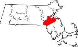
According to the United States Census Bureau, the town has a total area of 19.6 square miles (51 km2), of which, 18.9 square miles (49 km2) of it is land and 0.6 square miles (1.6 km2) of it (3.27%) is water.

Canton lies at the foot of Great Blue Hill. The Canton River flows through the center of the town, linking a chain of small lakes including Bolivar and Forge Ponds and flowing into the Neponset River. The Neponset River forms the boundary between Canton and its western neighbors: Norwood, Westwood, and Dedham. In addition to wooded land, the area includes wetlands, particularly in the eastern part along Route 138 near the Randolph and Stoughton borders, and in the western part along I-95.

Canton borders the towns of Dedham, Milton, Norwood, Randolph, Sharon, Stoughton, Westwood and the Hyde Park neighborhood in the city of Boston.

MonthJanFebMarAprMayJunJulAugSepOctNovDecYear
Record high °F (°C)68
(20)
71
(22)
89
(32)
94
(34)
96
(36)
99
(37)
100
(38)
101
(38)
99
(37)
88
(31)
81
(27)
74
(23)
101
(38)
Mean maximum °F (°C)56.6
(13.7)
56.9
(13.8)
65.6
(18.7)
79.4
(26.3)
87.3
(30.7)
90.0
(32.2)
92.9
(33.8)
91.3
(32.9)
86.9
(30.5)
77.6
(25.3)
68.4
(20.2)
60.0
(15.6)
94.7
(34.8)
Mean daily maximum °F (°C)34.7
(1.5)
37.0
(2.8)
44.1
(6.7)
56.3
(13.5)
66.8
(19.3)
75.4
(24.1)
81.7
(27.6)
80.2
(26.8)
72.7
(22.6)
61.0
(16.1)
50.1
(10.1)
40.2
(4.6)
58.4
(14.6)
Daily mean °F (°C)26.5
(−3.1)
28.2
(−2.1)
35.5
(1.9)
47.1
(8.4)
58.5
(14.7)
66.5
(19.2)
72.7
(22.6)
71.4
(21.9)
64.2
(17.9)
52.5
(11.4)
42.0
(5.6)
32.5
(0.3)
49.8
(9.9)
Mean daily minimum °F (°C)18.3
(−7.6)
19.5
(−6.9)
26.9
(−2.8)
37.9
(3.3)
48.2
(9.0)
57.6
(14.2)
63.8
(17.7)
62.6
(17.0)
55.6
(13.1)
44.0
(6.7)
33.8
(1.0)
24.9
(−3.9)
41.1
(5.1)
Mean minimum °F (°C)0.0
(−17.8)
3.1
(−16.1)
10.1
(−12.2)
26.7
(−2.9)
37.5
(3.1)
45.9
(7.7)
54.9
(12.7)
53.4
(11.9)
42.3
(5.7)
30.5
(−0.8)
19.6
(−6.9)
8.7
(−12.9)
−2.5
(−19.2)
Record low °F (°C)−14
(−26)
−21
(−29)
−5
(−21)
6
(−14)
27
(−3)
36
(2)
44
(7)
39
(4)
28
(−2)
21
(−6)
5
(−15)
−19
(−28)
−21
(−29)
Average precipitation inches (mm)4.50
(114)
4.00
(102)
5.52
(140)
4.76
(121)
3.82
(97)
4.63
(118)
3.47
(88)
3.91
(99)
4.06
(103)
5.49
(139)
4.31
(109)
5.39
(137)
53.86
(1,367)
Average snowfall inches (cm)18.6
(47)
18.2
(46)
15.0
(38)
2.8
(7.1)
0.0
(0.0)
0.0
(0.0)
0.0
(0.0)
0.0
(0.0)
0.0
(0.0)
0.7
(1.8)
1.8
(4.6)
12.6
(32)
69.7
(176.5)
Average extreme snow depth inches (cm)10.6
(27)
11.5
(29)
9.8
(25)
2.6
(6.6)
0.0
(0.0)
0.0
(0.0)
0.0
(0.0)
0.0
(0.0)
0.0
(0.0)
0.3
(0.76)
1.3
(3.3)
7.7
(20)
17.1
(43)
Average precipitation days (≥ 0.01 in)13.211.312.512.513.012.110.510.29.211.510.912.6139.5
Average snowy days (≥ 0.1 in)8.17.15.71.30.00.00.00.00.00.41.35.329.2
Mean monthly sunshine hours 132.1146.7174.0185.6220.2231.8258.1242.5204.1182.1133.3125.92,236.4
Percent possible sunshine 46.350.948.547.950.452.758.058.756.755.147.045.951.5
Source: NOAA, BHO [9] [10]

Demographics

Historical population
YearPop.±%
1850 2,598    
1860 3,242+24.8%
1870 3,879+19.6%
1880 4,516+16.4%
1890 4,538+0.5%
1900 4,584+1.0%
1910 4,797+4.6%
1920 5,945+23.9%
1930 5,816−2.2%
1940 6,381+9.7%
1950 7,465+17.0%
1960 12,771+71.1%
1970 17,100+33.9%
1980 18,182+6.3%
1990 18,530+1.9%
2000 20,775+12.1%
2010 21,561+3.8%
2020 24,370+13.0%
202224,609+1.0%
* = population estimate.
Source: United States census records and Population Estimates Program data. [11] [12] [13] [14] [15] [16] [17] [18] [19] [20] [21]

As of the 2010 [22] census, there were 21,561 people, 7,952 households, and 5,550 families residing in the town. The population density was 1,097.3 inhabitants per square mile (423.7/km2). There were 8,163 housing units at an average density of 431.1 per square mile (166.4/km2). The racial makeup of the town was 81.6% White, 6.6% African American, 0.1% Native American, 7.5% Asian, 0.02% Pacific Islander, 0.51% from other races, and 2.1% from two or more races. [23] Hispanic or Latino of any race were 3.9% of the population. 79.7% of the population was non-Hispanic white in 2010, down from 98.0% in 1980.

There were 7,952 households, out of which 30.9% had children under the age of 18 living with them, 58.4% were married couples living together, 8.9% had a female householder with no husband present, and 30.2% were non-families. Of all households, 25.4% were made up of individuals, and 12.3% had someone living alone who was 65 years of age or older. The average household size was 2.56 and the average family size was 3.12.

In the town, the population was spread out, with 23.6% under the age of 18, 5.6% from 18 to 24, 29.9% from 25 to 44, 24.0% from 45 to 64, and 16.9% who were 65 years of age or older. The median age was 40 years. For every 100 females, there were 89.4 males. For every 100 females age 18 and over, there were 85.2 males.

The median income for a household in the town was $109,260, and the median income for a family was $132,904. Males had a median income of $52,216 versus $40,755 for females. The per capita income for the town was $43,510. About 5.2% of families and 7.2% of the population were below the poverty line, including 4.7% of those under age 18 and 9.5% of those age 65 or over.

Education

The town of Canton has three public elementary schools: the John F. Kennedy School, Lt. Peter M. Hansen School, and Dean S. Luce School. The area in which one lives determines which elementary school one's children attend.

Canton has one public middle school, the William H. Galvin Middle School, where all of the three elementary schools combine. It provides grades 6–8 and is located next to the Lt. Peter M. Hansen Elementary School. Canton also has a public high school, Canton High School, that provides grades 9–12. There is one private school, St. John the Evangelist, which has been open since 1883 and serves students in grades Preschool–8. In addition, the state's Pappas Rehabilitation Hospital for Children, formerly known as the Massachusetts Hospital School, is in Canton. [24] In addition, the Marilyn G. Rodman Educational and Administrative Center is located next to Canton High School, housing administrative buildings as well as a preschool.

The Blue Hills Regional Technical School and the Canton campus of Massasoit Community College are located within the town as well. [25] Additionally, Porter and Chester Institute also has a campus in Canton.

Clarke Schools for Hearing and Speech, formerly Clarke School for the Deaf, operates a satellite school, "Clarke Boston", in Canton for children who are diagnosed with deafness at an early age and then are mainstreamed to a public school. Clarke is the oldest school for the deaf in the country that teaches children to lip-read and speak orally, rather than use sign language; its main campus is located 80 miles to the west in Northampton, Massachusetts.

The Judge Rotenberg Educational Center is housed in Canton as well.

CHS Awards

Government

Canton has the open town meeting form of government. Annually each spring, and as necessary, the voters gather to discuss matters such as zoning, schools, public works, recreational facilities, the budget, taxes and bond issues.

Property taxes on residential and other land, buildings and improvements, and transfers from the state government, are two important sources of revenue for the town.

Boards and Committees

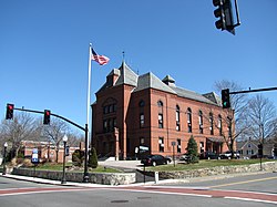
The Select Board oversees the day-to-day operations of the town government. There are five positions on the Canton Board of Selectmen currently filled by Thomas W. Theodore (Chair), John J. Connolly (Vice-Chair), Michael C. Loughran (Clerk), Christopher M. Albert (Member) and John R. McCourt (Member). [26]

The Town Administrator follows rules set by the Select Board and oversees all town services and responsibilities controlled by the board. They act as the key liaison between elected officials, municipal departments, and the community. The current Town Administrator is Charles E. Doody. [27]

The Planning Board approves new town subdivisions, reviews site plans for commercial development, oversees the towns scenic ways, drafts and approves a town wide master plan, and statutorily provides recommendations to Town Meeting regarding zoning and development.

The Finance Committee studies the financial affairs of the town, advises and makes recommendations to the Town Meeting on the budget and other areas with fiscal implications and serves as the fiscal watchdog for the voters.

Canton maintains an Executive Office, responsible for maintenance and implementation of all policies and procedures, updating the administrative code and all legal, personal and town wide planning matters. The Executive Office consists of: Town Administrator, Human Resources, Town Counsel and Town Planner. [28]

Public Safety

For public safety needs, the Town of Canton is protected by the Canton Fire Department and Canton Police Department. [29] The Norfolk District Attorney, Michael W. Morrissey and the Norfolk State Police Detective Unit are located in Canton. [30]

Fire Department

There are two fire stations in Canton: Headquarters Station 1 and Ponkapoag Station 2. [31]

Police Department

The Canton Police Department was officially formed in 1875, with four men working limited part-time hours. In 1900, the first Chief of Police was appointed and served in the role for 11 years. A motorcycle officer was added in 1928. [32]

In 1978, Elizabeth A. Galvin became the town's first female police officer. [32]

In May 2004, a new police station was opened in the former Eliott School building on Washington Street. [32] The original reconstruction project cost $5.9M to renovate the 150-year-old building and then required additional repairs shortly after the grand opening, when the floor began to buckle due to weight. [33]

In June 2022, Helena Rafferty, was sworn in as the town's 14th Chief of Police and first female Chief of Police. Rafferty previously served as the Deputy under retiring Chief Ken Berkowitz, who had been in the role since 2005. [34]

In November 2023, residents voted for an independent audit of the Canton Police Department due to the ongoing investigation into the Karen Read Case involving the 2022 death of Boston Police Officer John O'Keefe. The vote was passed by a 903-800 margin during a Special Town Meeting held on November 20th, 2023. [35] [36]

Transportation

Interstates 93, 95, US Route 1 and Massachusetts Route 128 diverge in Canton. I-93 goes east, then north into Boston, from which it continues north into New Hampshire. I-95 is locally a beltway that skirts Boston to the west, continues circling Boston until it is north of the city, then goes north through New Hampshire and ends in Maine. South of Canton, it leads to Providence, Rhode Island, Connecticut, New York City, Washington, D.C. and ultimately to Miami, Florida.

Route 138 has a cloverleaf interchange with Route 93 in Canton near Great Blue Hill. From Canton, it goes north into Milton, then enters Boston in the Mattapan section. South of Canton, it travels to Stoughton, continuing into Rhode Island, through Newport and ending in southwest RI.

Route 24 is a divided, limited-access highway that originates at Route 93 in Randolph, just east of Canton. From there, it goes south through the easternmost corner of Canton, running roughly parallel to Route 138 as far as Portsmouth, Rhode Island.

MBTA commuter rail trains on the Providence/Stoughton Line pass through Canton. Some stop at Canton Junction. This line crosses the Neponset River on the Canton Viaduct, a prominent local landmark. Route 128 Station in neighboring Westwood also carries many Canton commuters into Boston. Amtrak trains (including the Acela Express high-speed trains) also stop at Route 128, but pass through Canton without stopping. Of note, on March 25, 2008 a runaway box car crashed into a MBTA train at Canton Junction station injuring 150 people on board. [37] [38]

Another line branches into Stoughton, stopping at Canton Center.

Bus service is available to Mattapan Station in the MBTA system. [39]

Canton once had an airfield, [40] but it closed down in 1970. Norwood Memorial Airport is the closest airport to Canton. For scheduled air service, residents go to Boston's Logan International Airport or to T. F. Green Airport in Rhode Island.

Points of interest

A west side view of the Canton Viaduct looking south with the former Revere Copper Mill in the background, April 1977. Canton Viaduct.jpg
A west side view of the Canton Viaduct looking south with the former Revere Copper Mill in the background, April 1977.

Notable people

International relations

A German American Partnership high school exchange program has been operated between Canton and Bocholt, Germany since 1977. [43] [44]

Related Research Articles

<span class="mw-page-title-main">Easton, Massachusetts</span> Town in Massachusetts, United States

Easton is a town in Bristol County, Massachusetts, United States. The population was 25,058 at the 2020 census. It is part of the Greater Boston area.

<span class="mw-page-title-main">Raynham, Massachusetts</span> Town in Massachusetts, United States

Raynham is a town in Bristol County, Massachusetts, United States, located approximately 32 miles (51 km) south of Boston and 22 miles (35 km) northeast of Providence, Rhode Island. The population was 15,082 at the 2020 census. It has one village, Raynham Center.

<span class="mw-page-title-main">Billerica, Massachusetts</span> Town in Massachusetts, United States

Billerica is a town in Middlesex County, Massachusetts, United States. The population was 42,119 according to the 2020 census. It takes its name from the town of Billericay in Essex, England.

<span class="mw-page-title-main">Weston, Massachusetts</span> Town in Massachusetts, United States

Weston is a town in Middlesex County, Massachusetts, about 15 miles west of Boston. At the time of the 2020 United States Census, the population of Weston was 11,851.

<span class="mw-page-title-main">Quincy, Massachusetts</span> City in Massachusetts, United States

Quincy is a coastal U.S. city in Norfolk County, Massachusetts, United States. It is the largest city in the county and a part of Metropolitan Boston as one of Boston's immediate southern suburbs. Its population in 2020 was 101,636, making it the seventh-largest city in the state. Known as the "City of Presidents", Quincy is the birthplace of two U.S. presidents—John Adams and his son John Quincy Adams—as well as John Hancock, the first signer of the Declaration of Independence and the first and third governor of Massachusetts.

<span class="mw-page-title-main">Stoughton, Massachusetts</span> Town in Massachusetts, United States

Stoughton is a town in Norfolk County, Massachusetts, United States. The population was 29,281 at the 2020 census. The town is located approximately 17 miles (27 km) from Boston, 31 miles (50 km) from Providence, Rhode Island, and 35 miles (56 km) from Cape Cod.

<span class="mw-page-title-main">Westwood, Massachusetts</span> Town in Massachusetts, United States

Westwood is a town in Norfolk County, Massachusetts, United States. The population was 16,266 at the 2020 United States Census.

<span class="mw-page-title-main">East Bridgewater, Massachusetts</span> Town in Massachusetts, United States

East Bridgewater is a town in Plymouth County, Massachusetts, United States. The population was 14,440 at the 2020 census. It is also a part of Massachusetts' 8th congressional district, of which it is represented by Stephen Lynch.

<span class="mw-page-title-main">West Bridgewater, Massachusetts</span> Town in Massachusetts, United States

West Bridgewater is a town in Plymouth County, Massachusetts, United States. The population was 7,707 at the 2020 census.

<span class="mw-page-title-main">Burlington, Massachusetts</span> Town in Massachusetts, United States

Burlington is a town in Middlesex County, Massachusetts, United States. The population was 26,377 at the 2020 census.

<span class="mw-page-title-main">Wilmington, Massachusetts</span> Town in Massachusetts, United States

Wilmington is a town in Middlesex County, Massachusetts, United States. Its population was 23,349 at the 2020 United States census.

<span class="mw-page-title-main">Randolph, Massachusetts</span> City in Massachusetts, United States

The Town of Randolph is a suburban city in Norfolk County, Massachusetts, United States. At the 2020 census, the city population was 34,984. Randolph adopted a charter effective January 2010 providing for a council-manager form of government instead of the traditional town meeting. Randolph is one of thirteen Massachusetts municipalities that have applied for, and been granted, city forms of government but wish to retain "The town of" in their official names.

<span class="mw-page-title-main">Sharon, Massachusetts</span> Town in Massachusetts, United States

Sharon is a New England town in Norfolk County, Massachusetts, United States. The population was 18,575 at the 2020 census. Sharon is part of Greater Boston, about 17 miles (27 km) southwest of downtown Boston, and is connected to both Boston and Providence by the Providence/Stoughton Line.

<span class="mw-page-title-main">Walpole, Massachusetts</span> Town in Massachusetts, United States

Walpole is a town in Norfolk County, Massachusetts, United States. Walpole Town, as the Census refers to it, is located about 18 miles (29 km) south of downtown Boston, Massachusetts, and 30 miles (48 km) north of Providence, Rhode Island. The population of Walpole was 26,383 at the 2020 census. Walpole was first settled in 1659 and was considered a part of Dedham until officially incorporated in 1724. The town was named after Sir Robert Walpole, de facto first Prime Minister of Great Britain. It also encompasses the entirely distinct entity of Walpole (CDP), with its much smaller area of 2.9 square miles.

<span class="mw-page-title-main">Milton, Massachusetts</span> Town in Massachusetts, United States

Milton is a town in Norfolk County, Massachusetts, United States and a suburb of Boston. The population was 28,630 at the 2020 census. Milton is the birthplace of former U.S. President George H. W. Bush, and architect Buckminster Fuller. Milton was ranked by Money as the 2nd, 7th, 8th, and 17th best place to live in the United States in 2011, 2009, 2019, 2021, and 2022 respectively.

<span class="mw-page-title-main">Ashmont–Mattapan High-Speed Line</span> Light rail line in Boston and Milton, Massachusetts

The Ashmont–Mattapan High-Speed Line, commonly referred to as the Mattapan Trolley, is a partially grade-separated light rail line which forms part of the MBTA's Red Line rapid transit line. The line, which runs through Boston and Milton, Massachusetts, opened on August 26, 1929, as a conversion of a former commuter rail line. It exclusively uses PCC streetcars built in the 1940s. Passengers must transfer at Ashmont to access the rest of the Red Line, which uses heavy rail metro rolling stock.

<span class="mw-page-title-main">Greater Boston</span> Metropolitan area in the United States

Greater Boston is the metropolitan region of New England encompassing the municipality of Boston, the capital of the U.S. state of Massachusetts and the most populous city in New England, and its surrounding areas. The region forms the northern arc of the Northeast megalopolis, making Greater Boston both a metropolitan statistical area (MSA) and a combined statistical area (CSA). The most stringent definition of the region consists of most of the eastern third of mainland Massachusetts, excluding the Merrimack Valley and South Coast; while the most expansive definition includes these plus Cape Cod, Central Massachusetts, Rhode Island, southeastern New Hampshire, and Windham County, Connecticut.

<span class="mw-page-title-main">Mattapan</span> Neighborhood of Boston in Suffolk, Massachusetts, United States

Mattapan is a neighborhood in Boston, Massachusetts. Historically and for legal processes a section of Dorchester, Mattapan became a part of Boston when Dorchester was annexed in 1870. Mattapan is the original Native American name for the Dorchester area, possibly meaning "a place to sit." At the 2010 census, it had a population of 36,480, with the majority of its population immigrants.

<span class="mw-page-title-main">Mattapan station</span> Light rail station in Boston, Massachusetts, US

Mattapan station is an MBTA light rail station in Boston, Massachusetts. It is the southern terminus of the Ashmont–Mattapan High-Speed Line, part of the Red Line, and is also an important MBTA bus transfer station, with eight routes terminating there. It is located at Mattapan Square in the Mattapan neighborhood. At the station, streetcars use a balloon loop to reverse direction back to Ashmont station. Mattapan station is fully accessible, with mini-high platforms.

<span class="mw-page-title-main">Norton, Massachusetts</span> Town in Massachusetts, United States

Norton is a town in Bristol County, Massachusetts, United States, and contains the villages of Norton Center and Chartley. The population was 19,202 at the 2020 census. Home of Wheaton College, Norton hosts the Dell Technologies Championship, a tournament of the PGA Tour held annually on the Labor Day holiday weekend at the TPC Boston golf club.

References

  1. "Census - Geography Profile: Canton town, Norfolk County, Massachusetts". U.S. Census Bureau. Retrieved November 3, 2021.
  2. Chandler, Jim (Fall 2001). "On the Shore of a Pleistocene Lake: the Wamsutta Site (19-NF-70)". Bulletin of the Massachusetts Archaeological Society. 62 (2): 57–58.
  3. Lepore, Jill (September 23, 2009). The Name of War: King Philip's War and the Origins of American Identity. Knopf Doubleday Publishing Group. ISBN   978-0-307-48857-2.
  4. "Praying Towns | Encyclopedia.com". www.encyclopedia.com. Retrieved July 12, 2022.
  5. Canton (Massachusetts, United States) – Britannica Online Encyclopedia (Retrieved on April 21, 2009)
  6. Standish, Lemuel (1929). The Old Stoughton musical society: an historical and informative record of the oldest choral society in America, together with interesting data of its organization, meetings, reunions and outings, and a complete list of past and present officers and members. Stoughton, MA: [Stoughton Print Co.]
  7. Ph.D, Jacqueline Edmondson (October 3, 2013). Music in American Life: An Encyclopedia of the Songs, Styles, Stars, and Stories that Shaped our Culture [4 volumes]: An Encyclopedia of the Songs, Styles, Stars, and Stories That Shaped Our Culture. ABC-CLIO. ISBN   9780313393488.
  8. ACFR
  9. "U.S. Climate Normals Quick Access – Station: Blue Hill COOP, MA". National Oceanic and Atmospheric Administration. Retrieved February 10, 2023.
  10. "Blue Hill Observatory daily sunshine data". Blue Hill Meteorological Observatory. Retrieved October 11, 2015.
  11. "Total Population (P1), 2010 Census Summary File 1". American FactFinder, All County Subdivisions within Massachusetts. United States Census Bureau. 2010.
  12. "Massachusetts by Place and County Subdivision - GCT-T1. Population Estimates". United States Census Bureau. Retrieved July 12, 2011.
  13. "1990 Census of Population, General Population Characteristics: Massachusetts" (PDF). US Census Bureau. December 1990. Table 76: General Characteristics of Persons, Households, and Families: 1990. 1990 CP-1-23. Retrieved July 12, 2011.
  14. "1980 Census of the Population, Number of Inhabitants: Massachusetts" (PDF). US Census Bureau. December 1981. Table 4. Populations of County Subdivisions: 1960 to 1980. PC80-1-A23. Retrieved July 12, 2011.
  15. "1950 Census of Population" (PDF). Bureau of the Census. 1952. Section 6, Pages 21-10 and 21-11, Massachusetts Table 6. Population of Counties by Minor Civil Divisions: 1930 to 1950. Retrieved July 12, 2011.
  16. "1920 Census of Population" (PDF). Bureau of the Census. Number of Inhabitants, by Counties and Minor Civil Divisions. Pages 21-5 through 21-7. Massachusetts Table 2. Population of Counties by Minor Civil Divisions: 1920, 1910, and 1920. Retrieved July 12, 2011.
  17. "1890 Census of the Population" (PDF). Department of the Interior, Census Office. Pages 179 through 182. Massachusetts Table 5. Population of States and Territories by Minor Civil Divisions: 1880 and 1890. Retrieved July 12, 2011.
  18. "1870 Census of the Population" (PDF). Department of the Interior, Census Office. 1872. Pages 217 through 220. Table IX. Population of Minor Civil Divisions, &c. Massachusetts. Retrieved July 12, 2011.
  19. "1860 Census" (PDF). Department of the Interior, Census Office. 1864. Pages 220 through 226. State of Massachusetts Table No. 3. Populations of Cities, Towns, &c. Retrieved July 12, 2011.
  20. "1850 Census" (PDF). Department of the Interior, Census Office. 1854. Pages 338 through 393. Populations of Cities, Towns, &c. Retrieved July 12, 2011.
  21. "City and Town Population Totals: 2020-2022". United States Census Bureau . Retrieved October 29, 2023.
  22. "ZIP Code 02021, Canton MA, U.S. ZIP Codes, Database - Canton Massachusetts Map".
  23. https://www.census.gov/quickfacts/fact/table/cantontownnorfolkcountymassachusetts/PST045219 [ dead link ]
  24. Pappas Rehabilitation Hospital for Children Bureau of Hospitals, Commonwealth of Massachusetts (Retrieved on April 7, 2018)
  25. Massasoit – Directions to our Campuses Archived March 25, 2009, at the Wayback Machine Massasoit Community College (Retrieved on March 15, 2009)
  26. "Select Board | Canton, MA - Official Website". www.town.canton.ma.us. Retrieved January 21, 2024.
  27. "Town Administrator | Canton, MA - Official Website". www.town.canton.ma.us. Retrieved January 21, 2024.
  28. "Executive Office | Canton, MA - Official Website". www.town.canton.ma.us. Retrieved January 21, 2024.
  29. "Canton, MA - Official Website | Official Website". www.town.canton.ma.us. Retrieved January 21, 2024.
  30. "MASSACHUSETTS STATE POLICE UNIT". www.nfkda.com. Retrieved January 22, 2024.
  31. "Canton Police Department, MA | Official Website". www.cantonpolice.com. Retrieved January 21, 2024.
  32. 1 2 3 "Department History | Canton Police Department, MA". www.cantonpolice.com. Retrieved January 22, 2024.
  33. Campenella, L. E. "Canton police shuffle headquarters for repairs". The Patriot Ledger. Retrieved January 22, 2024.
  34. "Massachusetts town swears in its first female police chief". WCVB. June 15, 2022. Retrieved January 22, 2024.
  35. Staff, WBZ-News (November 21, 2023). "Canton votes to audit police department amid Karen Read investigation - CBS Boston". www.cbsnews.com. Retrieved January 21, 2024.
  36. Beltrán, Bianca; Glavin, Kirsten; Kwangwari • •, Munashe (November 22, 2023). "Vote to audit Canton police over murder case brings out hundreds of passionate residents". NBC Boston. Retrieved January 21, 2024.
  37. Scores injured in Canton commuter rail crash – BostonHerald.com Archived April 16, 2009, at the Wayback Machine Retrieved September 14, 2008
  38. Equipment, Personnel Eyed In Train, Boxcar Crash – Boston News Story – WCVB Boston Archived May 28, 2008, at the Wayback Machine Retrieved September 14, 2008
  39. "716 Cobbs Corner-Mattapan Station" (Schedule). MBTA. Winter 2014. Accessed May 25, 2008.
  40. Boston Metropolitan Airfield-Abandoned & Little-Known Airfields: Massachusetts, Southwestern Boston area
  41. "Museum of American Bird Art". MassAudubon.org. Retrieved June 12, 2021.
  42. Thomas, Linda. "PROFILES: Canton's Bobby Witt looks back at Major League career". Wicked Local. Retrieved September 8, 2023.
  43. "German exchange founder honored by State Dept". patriotledger.com. Patriot Ledger. July 19, 2019. Retrieved May 31, 2020.
  44. "At 85, Canton teacher leads 42nd German exchange program". thecantoncitizen.com. Canton Citizen. July 19, 2019. Retrieved May 31, 2020.