Auburn, Massachusetts

Last updated

Auburn, Massachusetts
Auburn Town Offices and Merriam Library, Auburn MA.jpg
Auburn Town Offices and Merriam Library
Seal of Auburn, Massachusetts.png
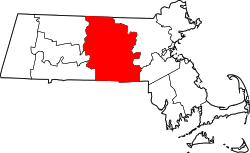
Worcester County Massachusetts incorporated and unincorporated areas Auburn highlighted.svg
Location in Worcester County and the state of Massachusetts.
Coordinates: 42°12′N71°50′W / 42.200°N 71.833°W / 42.200; -71.833
Country United States
State Massachusetts
County Worcester
Settled1714
IncorporatedApril 10, 1778
Government
  Type Representative town meeting
  Town ManagerEdward Kazanovicz
  Board of
Selectmen
Chair Scott Wrenn
Vice-Chair Sara Rufli
Dan Carpenter
Lionel Berthiaume
  School
Committee
Chair Jessica Harrington
Vice-Chair Meghan McCrillis
Gail Halloway
Samantha Raphael
Brooke Wrenn
Area
  Total16.4 sq mi (42.5 km2)
  Land15.4 sq mi (39.8 km2)
  Water1.0 sq mi (2.7 km2)
Elevation
603 ft (184 m)
Population
 (2020)
  Total16,889
  Density1,000/sq mi (400/km2)
Time zone UTC-5 (Eastern)
  Summer (DST) UTC-4 (Eastern)
ZIP code
01501
Area code 508 / 774
FIPS code 25-02760
GNIS feature ID0619474
Website www.auburnguide.com

Auburn is a town in Worcester County, Massachusetts, United States. The population was 16,889 at the 2020 census. [1]

Contents

History

The Auburn area was first settled in 1714 as of today outer parts of Worcester, Sutton, Leicester and Oxford, Massachusetts, and the town was officially incorporated on April 10, 1778, as the town of Ward, [2] in honor of American Revolution General Artemas Ward (second in command to George Washington). In 1837, the town changed its name to Auburn after the Post Office complained that the name was too similar to the nearby town of Ware.

Before incorporation, most of Auburn was known as the South Parish of Worcester; other portions fell within the town limits of Leicester and Millbury.

Today, Auburn is bordered by Worcester to the north, Leicester to the west, Millbury to the east, and Oxford to the south.

Robert H. Goddard launched the first liquid-fueled rocket from Pakachoag Hill, on his aunt Effe Ward's farm, in Auburn on March 16, 1926. Goddard is commemorated in Goddard Memorial Park, located downtown next to the Auburn Fire Department Headquarters. The park features a model of Goddard's prototype liquid-fueled rocket and a Polaris missile (Type A-1). A second replica of Goddard's prototype stands at Auburn High School.

Goddard's launch is also commemorated with a small monument, the Goddard Rocket Launching Site, between the first and ninth holes of Pakachoag Golf Course. [3]

Geography

Government

The form of government is representative town meeting. There are 24 town-meeting members from each of the five precincts of the town, for a total of 120 who represent the people at the annual town meeting each May. The town also has a Board of Selectmen which consists of five elected members, each serving for a term of three years. As of 2009, the town adopted a new charter which allowed for the creation of a Town Manager.

State government
State Representative(s):Paul K. Frost (R)
State Senator(s):Michael O. Moore (D)
Governor's Councilor(s):Paul DePaulo (D)
Federal government
U.S. Representative(s): 2nd District
U.S. Senators: Elizabeth Warren (D), Ed Markey (D)

Demographics

Historical population
YearPop.±%
1850 879    
1860 914+4.0%
1870 1,178+28.9%
1880 1,317+11.8%
1890 1,532+16.3%
1900 2,446+59.7%
1910 2,797+14.3%
1920 3,052+9.1%
1930 6,147+101.4%
1940 6,629+7.8%
1950 8,840+33.4%
1960 14,047+58.9%
1970 15,347+9.3%
1980 14,845−3.3%
1990 15,005+1.1%
2000 15,901+6.0%
2010 16,188+1.8%
2020 16,889+4.3%
202216,762−0.8%

Source: United States census records and Population Estimates Program data. [4] [5] [6] [7] [8] [9] [10] [11] [12] [13] [14]

The 2010 Auburn, MA, population was 16,188. There are 1,053 people per square mile.

The median age is 40.8. The US median is 37.6. 61.86% of people in Auburn, MA, are married. 8.00% are divorced. The average household size is 2.41 people. 22.71% of people are married, with children. 5.08% have children, but are single.

According to the 2000 census, 97.21% of people are white, 0.81% are black or African American, 1.19% are Asian, 0.10% are Native American, and 1.00% are "other". 1.24% of the people in Auburn, MA, are of Hispanic ethnicity.

Highways

I-90: The 138 mile Massachusetts Turnpike was commissioned in 1957 and is a part of the 3,099 mile long I-90, the longest Interstate in the country. Almost 5 miles of I-90 runs from the west-southwest to east-northeast through Auburn and is six lanes wide (three each direction) through the town. The right of way is nominally about 300 feet wide. Auburn also contains Exit 90. The total land utilized in Auburn for the interstate is about 200 acres.

I-290: The first three miles of the 20 mile long eastbound (heads north in Auburn) Interstate 290 is in Auburn along with exits 7 (I-90), 8 (Rt. 12), and 9 (Swanson Rd EB, Auburn St. WB).

I-395: Two miles of Interstate 395 are in Auburn which becomes I-290 after Exit 6 (US 20).

Route 12: Five miles of Rt. 12 (Southbridge St.) traverses generally north/south through Auburn and its intersection with Auburn St. is named Drury Square.

US 20: Five miles of US 20 runs through Auburn. At 3,365 miles, US 20 is the longest road in the United States. In Auburn it is also known as Southbridge St. (concurrent section with RT 12), Washington St. and the SW Cutoff.

Education

Auburn has two elementary schools, Bryn Mawr School (grades K–2) and Pakachoag School (grades K–2). All Auburn public school students attend Swanson Road Intermediate School (grades 3–5) and Auburn Middle School (grades 6–8). Some students attend Auburn High School (grades 9–12), [15] while others are given the option to attend Bay Path Regional Vocational Technical High School in nearby Charlton.

A new Auburn High School opened on Drury Square in the center of town directly next to the old high school in the fall of 2006, equipped with turfed fields, to include (Memorial Field) all-purpose field for soccer, football, track & field, lacrosse, a turf baseball field, and a grass softball field (Rebecca J. Colokaithis Field), as well three new tennis courts and a basketball court (Holstrom Corner). Auburn High School participates in the Massachusetts Comprehensive Assessment System.

In 2006 a group called "Save the '35" protested demolition of the oldest (1935) wing of the former high school. The old high school has now been completely demolished, except the dome on top of the high school, which is now located as a monument outside of right center field of the baseball field. A few of the bricks of the old building were sold within the town, and there are some located at the Auburn Historical Museum. In 1997, the Eastern Nazarene College started a learning annex in Auburn. [16]

Points of interest

Notable people

See also

Related Research Articles

<span class="mw-page-title-main">Worcester County, Massachusetts</span> County in Massachusetts, United States

Worcester County is a county in the U.S. state of Massachusetts. At the 2020 census, the population was 862,111, making it the second-most populous county in Massachusetts. It is also the largest county in Massachusetts by geographic area. The largest city and traditional shire town is Worcester. Worcester County is part of the Worcester, MA–CT metropolitan statistical area and as the Boston–Worcester–Providence, MA–RI–NH–CT combined statistical area.

<span class="mw-page-title-main">Mansfield, Massachusetts</span> Town in Massachusetts, United States

Mansfield is a town in Bristol County, Massachusetts, United States. As of the United States 2020 Census, the town population is 23,860. Mansfield is in the south-southwest suburbs of Boston and is also close to Providence, Rhode Island. The village of Mansfield Center is located in the town. The town is twinned with Mansfield in Nottinghamshire, England.

<span class="mw-page-title-main">Leverett, Massachusetts</span> Town in Massachusetts, United States

Leverett is a town in Franklin County, Massachusetts, United States. The population was 1,865 as of the 2020 census. It is part of the Springfield, Massachusetts Metropolitan Statistical Area.

<span class="mw-page-title-main">Medway, Massachusetts</span> Town in Massachusetts, United States

Medway is a town in Norfolk County, Massachusetts, United States. The town had a population of 13,115 at the 2020 census.

<span class="mw-page-title-main">Rochester, Massachusetts</span> Town in Massachusetts

Rochester is a town in Plymouth County, Massachusetts, United States. The population was 5,717 at the 2020 census.

<span class="mw-page-title-main">Douglas, Massachusetts</span> Town in Massachusetts, United States

Douglas is a town in Southern Worcester County, Massachusetts, United States. The population was 8,983 at the 2020 census. It includes the sizable Douglas State Forest, managed by the Department of Conservation and Recreation (DCR).

<span class="mw-page-title-main">Dudley, Massachusetts</span> Town in Massachusetts, United States

Dudley is a town in Worcester County, Massachusetts, United States. The population was 11,921 at the 2020 census.

<span class="mw-page-title-main">Grafton, Massachusetts</span> Town in Massachusetts, United States

Grafton is a town in Worcester County, Massachusetts, United States. The population was 19,664 at the 2020 census. The town consists of the North Grafton, Grafton, and South Grafton geographic areas, each with a separate ZIP Code. Incorporated in 1735, the town is home to a Nipmuc village known as Hassanamisco Reservation, the Willard House and Clock Museum, Community Harvest Project, and the Tufts University Cummings School of Veterinary Medicine. Grafton operates the state's largest on-call fire department, with 74 members.

<span class="mw-page-title-main">Hardwick, Massachusetts</span> Town in Massachusetts, United States

Hardwick is a town in Worcester County, Massachusetts, United States, about 20 miles (32 km) northwest of the city of Worcester. It had a population of 2,667 at the 2020 census. It includes the villages of Hardwick, Gilbertville, Wheelwright and Old Furnace.

<span class="mw-page-title-main">Holden, Massachusetts</span> Town in Massachusetts, United States

Holden is a town in Worcester County, Massachusetts, United States. The town was founded in 1741, and the Town Square was donated by John Hancock, former Governor of Massachusetts. The population was 19,905 at the 2020 census.

<span class="mw-page-title-main">Oakham, Massachusetts</span> Town in Massachusetts, United States

Oakham is a town in Worcester County, Massachusetts, United States. The population was 1,851 at the 2020 census.

<span class="mw-page-title-main">Royalston, Massachusetts</span> Town in Massachusetts, United States

Royalston is a town in Worcester County, Massachusetts, United States. The population was 1,250 at the 2020 census.

<span class="mw-page-title-main">Shrewsbury, Massachusetts</span> Town in Massachusetts, United States

Shrewsbury is a town in Worcester County, Massachusetts, United States. The population was 38,325 according to the 2020 United States Census, in nearly 15,000 households.

<span class="mw-page-title-main">Southborough, Massachusetts</span> Town in Massachusetts, United States

Southborough is a town in Worcester County, Massachusetts, United States. It incorporates the villages of Cordaville, Fayville, and Southville. Its name is often informally shortened to Southboro, a usage seen on many area signs and maps, though officially rejected by town ordinance. At the 2020 census, its population was 10,450 in 3,542 households.

<span class="mw-page-title-main">Holland, Massachusetts</span> Town in Massachusetts, United States

Holland is a town in Hampden County, Massachusetts, United States. The population was 2,603 at the 2020 census. It is part of the Springfield, Massachusetts Metropolitan Statistical Area.

<span class="mw-page-title-main">Barre, Massachusetts</span> Town in Massachusetts, United States

Barre is a town in Worcester County, Massachusetts, United States. The population was 5,530 at the 2020 census.

<span class="mw-page-title-main">Oxford, Massachusetts</span> Town in Massachusetts, United States

Oxford is a town in Worcester County, Massachusetts, United States. The population was 13,347 as of the 2020 United States Census.

<span class="mw-page-title-main">Sturbridge, Massachusetts</span> Town in Massachusetts, United States

Sturbridge is a town in Worcester County, Massachusetts, United States. It is home to Old Sturbridge Village living history museum and other sites of historical interest such as Tantiusques.

<span class="mw-page-title-main">Westborough, Massachusetts</span> Town in Worcester County, Massachusetts, US

Westborough is a town in Worcester County, Massachusetts, United States. The population was 21,567 at the 2020 Census, in over 7,000 households. Incorporated in 1717, the town is governed under the New England open town meeting system, headed by a five-member elected Board of Selectmen whose duties include licensing, appointing various administrative positions, and calling a town meeting of citizens annually or whenever the need arises.

<span class="mw-page-title-main">Northborough, Massachusetts</span> Town in Massachusetts, United States

Northborough is a town in Worcester County, Massachusetts, United States. The official spelling of the town's name is "Northborough," but the alternative spelling "Northboro" is also used. The population was 15,741 at the 2020 census.

References

  1. "Census - Geography Profile: Auburn town, Worcester County, Massachusetts". United States Census Bureau . Retrieved November 12, 2021.
  2. "Town of Auburn, MA - Auburn History", Auburn, MA, 2013, webpage: AG-docs Archived December 29, 2012, at the Wayback Machine .
  3. National Historic Landmarks Survey, by State - Massachusetts, page 8, accessed Oct. 19, 2007.
  4. "Total Population (P1), 2010 Census Summary File 1". American FactFinder, All County Subdivisions within Massachusetts. United States Census Bureau. 2010.
  5. "Massachusetts by Place and County Subdivision - GCT-T1. Population Estimates". United States Census Bureau. Retrieved July 12, 2011.
  6. "1990 Census of Population, General Population Characteristics: Massachusetts" (PDF). US Census Bureau. December 1990. Table 76: General Characteristics of Persons, Households, and Families: 1990. 1990 CP-1-23. Retrieved July 12, 2011.
  7. "1980 Census of the Population, Number of Inhabitants: Massachusetts" (PDF). US Census Bureau. December 1981. Table 4. Populations of County Subdivisions: 1960 to 1980. PC80-1-A23. Retrieved July 12, 2011.
  8. "1950 Census of Population" (PDF). Bureau of the Census. 1952. Section 6, Pages 21-10 and 21-11, Massachusetts Table 6. Population of Counties by Minor Civil Divisions: 1930 to 1950. Retrieved July 12, 2011.
  9. "1920 Census of Population" (PDF). Bureau of the Census. Number of Inhabitants, by Counties and Minor Civil Divisions. Pages 21-5 through 21-7. Massachusetts Table 2. Population of Counties by Minor Civil Divisions: 1920, 1910, and 1920. Retrieved July 12, 2011.
  10. "1890 Census of the Population" (PDF). Department of the Interior, Census Office. Pages 179 through 182. Massachusetts Table 5. Population of States and Territories by Minor Civil Divisions: 1880 and 1890. Retrieved July 12, 2011.
  11. "1870 Census of the Population" (PDF). Department of the Interior, Census Office. 1872. Pages 217 through 220. Table IX. Population of Minor Civil Divisions, &c. Massachusetts. Retrieved July 12, 2011.
  12. "1860 Census" (PDF). Department of the Interior, Census Office. 1864. Pages 220 through 226. State of Massachusetts Table No. 3. Populations of Cities, Towns, &c. Retrieved July 12, 2011.
  13. "1850 Census" (PDF). Department of the Interior, Census Office. 1854. Pages 338 through 393. Populations of Cities, Towns, &c. Retrieved July 12, 2011.
  14. "City and Town Population Totals: 2020-2022". United States Census Bureau . Retrieved November 23, 2023.
  15. "Auburn Public Schools". Archived from the original on March 4, 2017. Retrieved November 3, 2016.
  16. Salter, Sue (Summer 1997). "New Learning Center Launched at ENC" (PDF). News Vol. 7 No. 2. Consortium for the Advancement of Adult Higher Education. Archived from the original (PDF) on July 25, 2011. Retrieved May 29, 2009.
  17. Horgan Skating Rink Archived July 11, 2011, at the Wayback Machine
  18. Who Was Who in America, Historical Volume, 1607–1896. Chicago: Marquis Who's Who. 1967.