Lunenburg (CDP), Massachusetts

Last updated
Lunenburg, Massachusetts
CDP
United Parish of Lunenburg, Lunenburg MA.jpg
United Parish of Lunenburg
Worcester County Massachusetts incorporated and unincorporated areas Lunenburg (CDP) highlighted.svg
Location in Worcester County and the state of Massachusetts.
Coordinates: 42°35′42″N71°43′29″W / 42.59500°N 71.72472°W / 42.59500; -71.72472 Coordinates: 42°35′42″N71°43′29″W / 42.59500°N 71.72472°W / 42.59500; -71.72472
Country United States
State Massachusetts
County Worcester
Area
[1]
  Total3.80 sq mi (9.84 km2)
  Land3.80 sq mi (9.84 km2)
  Water0.00 sq mi (0.00 km2)
Elevation
571 ft (174 m)
Population
 (2020)
  Total1,789
  Density471.16/sq mi (181.90/km2)
Time zone UTC-5 (Eastern (EST))
  Summer (DST) UTC-4 (EDT)
ZIP code
01462
Area code(s) 978
FIPS code 25-37385
GNIS feature ID0610772

Lunenburg is a census-designated place (CDP) in the town of Lunenburg in Worcester County, Massachusetts, United States. The population was 1,760 at the 2010 census.

Contents

Geography

Lunenburg is located at 42°35′42″N71°43′28″W / 42.59500°N 71.72444°W / 42.59500; -71.72444 (42.595056, -71.724654). [2]

According to the United States Census Bureau, the CDP has a total area of 9.9 km2 (3.8 mi2), all land.

Demographics

Historical population
CensusPop.
2020 1,789
U.S. Decennial Census [3]

As of the census [4] of 2000, there were 1,695 people, 632 households, and 489 families residing in the CDP. The population density was 171.3/km2 (443.6/mi2). There were 644 housing units at an average density of 65.1/km2 (168.5/mi2). The racial makeup of the CDP was 96.81% White, 0.35% Black or African American, 0.24% Native American, 1.06% Asian, 0.12% from other races, and 1.42% from two or more races. Hispanic or Latino of any race were 1.06% of the population.

There were 632 households, out of which 35.3% had children under the age of 18 living with them, 66.5% were married couples living together, 8.9% had a female householder with no husband present, and 22.5% were non-families. 19.1% of all households were made up of individuals, and 10.0% had someone living alone who was 65 years of age or older. The average household size was 2.68 and the average family size was 3.06.

In the CDP, the population was spread out, with 26.3% under the age of 18, 5.4% from 18 to 24, 26.1% from 25 to 44, 27.3% from 45 to 64, and 15.0% who were 65 years of age or older. The median age was 41 years. For every 100 females, there were 96.9 males. For every 100 females age 18 and over, there were 95.5 males.

The median income for a household in the CDP was $54,429, and the median income for a family was $58,203. Males had a median income of $52,026 versus $32,139 for females. The per capita income for the CDP was $31,759. About 1.9% of families and 0.8% of the population were below the poverty line, including 1.0% of those under age 18 and none of those age 65 or over.

Related Research Articles

East Pepperell, Massachusetts Census-designated place in Massachusetts, United States

East Pepperell is a census-designated place (CDP) in the town of Pepperell in Middlesex County, Massachusetts, United States. The population was 2,059 at the 2010 census.

Littleton Common, Massachusetts Census-designated place in Massachusetts, United States

Littleton Common is a census-designated place (CDP) in the town of Littleton in Middlesex County, Massachusetts, United States. The population was 2,789 at the 2010 census.

West Concord, Massachusetts CDP in Massachusetts, United States

West Concord is an unincorporated village and census-designated place (CDP) in the town of Concord in Middlesex County, Massachusetts, United States. The population was 6,028 at the 2010 census.

East Douglas, Massachusetts CDP in Massachusetts, United States

East Douglas is a census-designated place (CDP) in the town of Douglas in Worcester County, Massachusetts, United States. The population was 2,557 at the 2010 census.

South Ashburnham, Massachusetts CDP in Massachusetts, United States

South Ashburnham is a census-designated place (CDP) in the town of Ashburnham in Worcester County, Massachusetts, United States. The population was 1,062 at the 2010 census.

Ayer (CDP), Massachusetts Census-designated place in Massachusetts, United States

Ayer is a census-designated place (CDP) in the town of Ayer in Middlesex County, Massachusetts, United States. The population was 2,868 at the 2010 census.

Medfield (CDP), Massachusetts CDP in Massachusetts, United States

Medfield is a census-designated place (CDP) in the town of Medfield in Norfolk County, Massachusetts, United States. The population was 6,483 at the 2010 census.

Marshfield (CDP), Massachusetts Census-designated place in Massachusetts, United States

Marshfield is a census-designated place (CDP) in the town of Marshfield in Plymouth County, Massachusetts, United States. The population was 4,335 at the 2010 census.

Clinton (CDP), Massachusetts CDP in Massachusetts, United States

Clinton is a census-designated place (CDP) in the town of Clinton in Worcester County, Massachusetts, United States. The population was 7,389 at the 2010 census.

Milford (CDP), Massachusetts CDP in Massachusetts, United States

Milford is a census-designated place (CDP) in the town of Milford in Worcester County, Massachusetts, United States. The population was 25,055 at the 2010 census.

Oxford (CDP), Massachusetts CDP in Massachusetts, United States

Oxford is a census-designated place (CDP) in the town of Oxford in Worcester County, Massachusetts, United States. The population was 6,103 at the 2010 census.

Rutland (CDP), Massachusetts CDP in Massachusetts, United States

Rutland is a census-designated place (CDP) in the town of Rutland in Worcester County, Massachusetts, United States. The population was 2,111 at the 2010 census.

Webster (CDP), Massachusetts CDP in Massachusetts, United States

Webster is a census-designated place (CDP) in the town of Webster in Worcester County, Massachusetts, United States. The population was 11,412 at the 2010 census.

Groton (CDP), Massachusetts Census-designated place in Massachusetts, United States

Groton is a census-designated place (CDP) in the town of Groton in Middlesex County, Massachusetts, United States. The population was 1,124 at the 2010 census.

Hudson (CDP), Massachusetts Census-designated place in Massachusetts, United States

Hudson is a census-designated place (CDP) in the town of Hudson in Middlesex County, Massachusetts, United States. The population was 14,907 at the 2010 census.

Pepperell (CDP), Massachusetts Census-designated place in Massachusetts, United States

Pepperell is a census-designated place (CDP) in the town of Pepperell in Middlesex County, Massachusetts, United States. The population was 2,504 at the 2010 census.

Shirley (CDP), Massachusetts Census-designated place in Massachusetts, United States

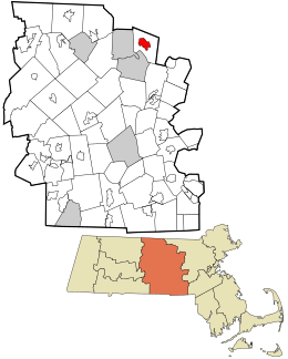
Shirley is a census-designated place (CDP) in the town of Shirley in Middlesex County, Massachusetts, United States. The population was 1,441 at the 2010 census.

Townsend (CDP), Massachusetts Census-designated place in Massachusetts, United States

Townsend is a census-designated place (CDP) in the town of Townsend in Middlesex County, Massachusetts, United States. The population was 1,128 at the 2010 census.

Bellingham (CDP), Massachusetts CDP in Massachusetts, United States

Bellingham is a census-designated place (CDP) in the town of Bellingham in Norfolk County, Massachusetts, United States. The population was 4,854 at the 2010 census.

Dover (CDP), Massachusetts CDP in Massachusetts, United States

Dover is a census-designated place (CDP) in the town of Dover in Norfolk County, Massachusetts, United States. The population was 2,265 at the 2010 census.

References

  1. "2020 U.S. Gazetteer Files". United States Census Bureau. Retrieved May 21, 2022.
  2. "US Gazetteer files: 2010, 2000, and 1990". United States Census Bureau. 2011-02-12. Retrieved 2011-04-23.
  3. "Census of Population and Housing". Census.gov. Retrieved June 4, 2016.
  4. "U.S. Census website". United States Census Bureau . Retrieved 2008-01-31.