Upton (CDP), Massachusetts

Last updated

Upton, Massachusetts
Upton House of Pizza, Upton MA.jpg
Upton House of Pizza
Worcester County Massachusetts incorporated and unincorporated areas Upton (CDP) highlighted.svg
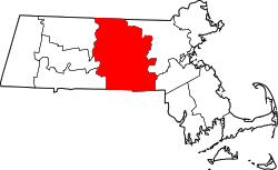
Location in Worcester County and the state of Massachusetts
Coordinates: 42°10′30″N71°36′44″W / 42.17500°N 71.61222°W / 42.17500; -71.61222
Country United States
State Massachusetts
County Worcester
Town Upton
Area
[1]
  Total2.55 sq mi (6.60 km2)
  Land2.47 sq mi (6.40 km2)
  Water0.08 sq mi (0.21 km2)
Elevation
381 ft (116 m)
Population
 (2020)
  Total3,090
  Density1,251.52/sq mi (483.14/km2)
Time zone UTC-5 (Eastern (EST))
  Summer (DST) UTC-4 (EDT)
ZIP Code
01568
Area code(s) 508/774
FIPS code 25-71445
GNIS feature ID2378243

Upton is a census-designated place (CDP) in the town of Upton in Worcester County, Massachusetts, United States. The population was 3,013 at the 2010 census, out of 7,542 in the entire town. The CDP includes the villages of Upton and West Upton.

Contents

Geography

Upton and West Upton are located in the central and western part of the town of Upton. Massachusetts Route 140 passes through the CDP, leading northwest 12 miles (19 km) to Shrewsbury and southeast 14 miles (23 km) to Franklin.

According to the United States Census Bureau, the CDP has a total area of 6.6 km2 (2.6 mi2), of which 6.4 km2 (2.5 mi2) is land and 0.2 km2 (0.1 mi2) (2.73%) is water.

Notable areas

The community is home to a number of notable town of Upton landmarks, including the town's police department, fire department, town library, and the town hall. It is also home to the town's historic Knowlton Hat Factory, now repurposed as the Millhaus Apartments.

Demographics

Historical population
CensusPop.Note
2020 3,090
U.S. Decennial Census [2]

As of the census [3] of 2000, there were 2,326 people, 914 households, and 617 families residing in the CDP, at the time listed as "Upton-West Upton". The population density was 360.7/km2 (935.4/mi2). There were 940 housing units at an average density of 145.8/km2 (378.0/mi2). The racial makeup of the CDP was 97.12% White, 0.43% Black or African American, 0.04% Native American, 1.03% Asian, 0.39% from other races, and 0.99% from two or more races. Hispanic or Latino of any race were 0.69% of the population.

There were 914 households, out of which 36.9% had children under the age of 18 living with them, 56.9% were married couples living together, 8.1% had a female householder with no husband present, and 32.4% were non-families. 27.9% of all households were made up of individuals, and 13.0% had someone living alone who was 65 years of age or older. The average household size was 2.50 and the average family size was 3.11.

In the CDP, the population was spread out, with 27.9% under the age of 18, 3.9% from 18 to 24, 34.5% from 25 to 44, 20.4% from 45 to 64, and 13.4% who were 65 years of age or older. The median age was 37 years. For every 100 females, there were 87.4 males. For every 100 females age 18 and over, there were 85.6 males.

The median income for a household in the CDP was $62,578, and the median income for a family was $75,937. Males had a median income of $51,071 versus $35,351 for females. The per capita income for the CDP was $26,502. About 3.0% of families and 5.3% of the population were below the poverty line, including 7.1% of those under age 18 and 8.7% of those age 65 or over.

Related Research Articles

<span class="mw-page-title-main">Conning Towers Nautilus Park, Connecticut</span> Census-designated place in Connecticut, United States

Conning Towers Nautilus Park is a census-designated place (CDP) in the town of Groton in New London County, Connecticut, United States. The population was 9,828 at the 2010 census. The statistical area consists of the portion of the town in the vicinity of Route 12 and includes Naval Submarine Base New London.

<span class="mw-page-title-main">Coventry Lake, Connecticut</span> Census-designated place in Connecticut, United States

Coventry Lake is a village and census-designated place in the town of Coventry, Connecticut in Tolland County, Connecticut, United States. The population was 2,990 at the 2010 census. The CDP includes the residential areas around Wangumbaug Lake.

<span class="mw-page-title-main">North Lakeville, Massachusetts</span> Census-designated place in Massachusetts, United States

North Lakeville is a census-designated place (CDP) in the town of Lakeville in Plymouth County, Massachusetts, United States. The population was 2,630 at the 2010 census.

<span class="mw-page-title-main">West Wareham, Massachusetts</span> Census-designated place in Massachusetts, United States

West Wareham is a census-designated place (CDP) in the town of Wareham in Plymouth County, Massachusetts, United States. The population was 2,064 at the 2010 census.

<span class="mw-page-title-main">East Douglas, Massachusetts</span> CDP in Massachusetts, United States

East Douglas is a census-designated place (CDP) in the town of Douglas in Worcester County, Massachusetts, United States. The population was 2,557 at the 2010 census.

<span class="mw-page-title-main">Fiskdale, Massachusetts</span> CDP in Sturbridge, Massachusetts, United States

Fiskdale is a census-designated place (CDP) in the town of Sturbridge in Worcester County, Massachusetts, United States. The population was 2,583 at the 2010 census.

<span class="mw-page-title-main">Crystal Lake, Polk County, Florida</span> Census-designated place in Florida, United States

Crystal Lake is a census-designated place (CDP) in Polk County, Florida, United States. The population was 5,341 at the 2000 census, an increase from 5,300 in 1990. The 2010 Census reported a population of 5,514. It is part of the Lakeland–Winter Haven Metropolitan Statistical Area.

<span class="mw-page-title-main">Duxbury (CDP), Massachusetts</span> Census-designated place in Massachusetts, United States

Duxbury is a census-designated place (CDP) in the town of Duxbury in Plymouth County, Massachusetts, United States. The population was 1,802 at the 2010 census.

<span class="mw-page-title-main">Kingston (CDP), Massachusetts</span> Census-designated place in Massachusetts, United States

Kingston is a census-designated place (CDP) in the town of Kingston in Plymouth County, Massachusetts, United States. The population was 5,591 at the 2010 census.

<span class="mw-page-title-main">Marshfield (CDP), Massachusetts</span> Census-designated place in Massachusetts, United States

Marshfield is a census-designated place (CDP) in the town of Marshfield in Plymouth County, Massachusetts, United States. The population was 4,335 at the 2010 census.

<span class="mw-page-title-main">East Brookfield (CDP), Massachusetts</span> CDP in Massachusetts, United States

East Brookfield is a census-designated place (CDP) in the town of East Brookfield in Worcester County, Massachusetts, United States. The population was 1,323 at the 2010 census.

<span class="mw-page-title-main">Milford (CDP), Massachusetts</span> CDP in Massachusetts, United States

Milford is a census-designated place (CDP) in the town of Milford in Worcester County, Massachusetts, United States. The population was 25,055 at the 2010 census.

<span class="mw-page-title-main">North Brookfield (CDP), Massachusetts</span> CDP in Massachusetts, United States

North Brookfield is a census-designated place (CDP) in the town of North Brookfield in Worcester County, Massachusetts, United States. The population was 2,265 at the 2010 census.

<span class="mw-page-title-main">Rutland (CDP), Massachusetts</span> CDP in Massachusetts, United States

Rutland is a census-designated place (CDP) in the town of Rutland in Worcester County, Massachusetts, United States. The population was 2,111 at the 2010 census.

<span class="mw-page-title-main">Warren (CDP), Massachusetts</span> CDP in Massachusetts, United States

Warren is a census-designated place (CDP) in the town of Warren in Worcester County, Massachusetts, United States. The population was 1,405 at the 2010 census.

<span class="mw-page-title-main">Webster (CDP), Massachusetts</span> CDP in Massachusetts, United States

Webster is a census-designated place (CDP) in the town of Webster in Worcester County, Massachusetts, United States. The population was 11,412 at the 2010 census.

<span class="mw-page-title-main">Winchendon (CDP), Massachusetts</span> Census-designated place in Massachusetts, United States

Winchendon is a census-designated place (CDP) in the town of Winchendon in Worcester County, Massachusetts, United States. The population was 4,160 at the 2020 census.

<span class="mw-page-title-main">Brattleboro (CDP), Vermont</span> CDP in Vermont, United States

Brattleboro is a census-designated place (CDP) corresponding to the densely populated core of the town of Brattleboro in Windham County, Vermont, United States. The population was 8,289 at the 2000 census.

Seymour is a census-designated place (CDP) in Eau Claire County, Wisconsin, United States. The population was 1,418 at the 2010 census. It is located within the town of Seymour and is part of the Eau Claire urban area.

<span class="mw-page-title-main">Rib Mountain (CDP), Wisconsin</span> CDP in Wisconsin, United States

Rib Mountain is a census-designated place (CDP) in the town of Rib Mountain in Marathon County, Wisconsin, United States. The population was 6,061 at the 2020 census.

References

  1. "2020 U.S. Gazetteer Files". United States Census Bureau. Retrieved May 21, 2022.
  2. "Census of Population and Housing". Census.gov. Retrieved June 4, 2016.
  3. "U.S. Census website". United States Census Bureau . Retrieved January 31, 2008.