Still River, Massachusetts

Last updated
Post Office Post Office, Still River MA.jpg
Post Office

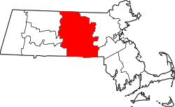
Still River is a village located on the west side of the town of Harvard, Worcester County, Massachusetts, United States, just north of the Still River in Bolton where it converges with the Nashua River.

Noted for its views of Mount Wachusett, Still River is home to Saint Benedict Abbey, St. Benedict Center, Harvard Historical Society, Willard Farm Stand, various hills, meadows, and wetlands.

The zip code is 01467.
Related Research Articles

<span class="mw-page-title-main">The Rowland Institute at Harvard</span> Nonprofit, privately endowed basic research organization

The Rowland Institute at Harvard, formerly the Rowland Institute for Science, was founded by Edwin H. Land as a nonprofit, privately endowed basic research organization in 1980. The institute merged with Harvard University on July 1, 2002. The Rowland Institute is dedicated to experimental science across a wide range of disciplines. Research subjects at the institute includes chemistry, physics and biology, and focus on interdisciplinary work and the development of new experimental tools. It is located on the Charles River near Kendall Square in Cambridge, Massachusetts, and is a few miles away from the main campus of Harvard.

<span class="mw-page-title-main">Harvard University Press</span> American university publishing house

Harvard University Press (HUP) is a publishing house established on January 13, 1913, as a division of Harvard University, and focused on academic publishing. It is a member of the Association of University Presses. After the retirement of William P. Sisler in 2017, the university appointed as George Andreou as director.

<span class="mw-page-title-main">Great Bridge (Cambridge)</span>

The Great Bridge over the Charles River connected Cambridge, Massachusetts, to what is now known as Allston, Boston, Massachusetts. The Great Bridge was built in 1660–1662 at what was then called Brighton Street, and was the first bridge to span the Charles. A toll was authorized in 1670. The bridge was rebuilt in 1862.

<span class="mw-page-title-main">Longwood Medical and Academic Area</span> Medical campus in Boston, Massachusetts

The Longwood Medical and Academic Area is a medical campus in Boston, Massachusetts. Flanking Longwood Avenue, LMA is adjacent to the Fenway–Kenmore, Audubon Circle, and Mission Hill neighborhoods, as well as the town of Brookline.

<span class="mw-page-title-main">Bright-Landry Hockey Center</span> Ice-hockey arena in Boston, Massachusetts

The Bright-Landry Hockey Center is a 3,095-seat ice-hockey arena in the Allston neighborhood of Boston, Massachusetts, United States. It is home to the Harvard University Crimson men's and women's ice hockey teams. It is named for Alec Bright, class of 1919, a former hockey and baseball player.

<span class="mw-page-title-main">Charles River Esplanade</span> State-owned park in Boston, Massachusetts, U.S.

The Charles River Esplanade of Boston, Massachusetts, is a state-owned park situated in the Back Bay area of the city, on the south bank of the Charles River Basin.

<span class="mw-page-title-main">Monatiquot River</span> River in the United States

The Monatiquot River is a 4.9-mile-long (7.9 km) river in Braintree, Massachusetts, formed by the confluence of the Farm River and Cochato River in the Braintree Municipal Golf Course, flowing in swampy meanders to the northeast, and emptying into the tidal Weymouth Fore River estuary. The name roughly translates to either “at the deep tidal place” or “lookout place”. Its drainage area is 28.7 square miles (74 km2).

<span class="mw-page-title-main">Johnston Gate</span> A gate to Harvard Yard

The Johnston Gate is one of the several entrances to Harvard Yard in Cambridge, Massachusetts. Completed in 1889 after a Georgian Revival design by McKim, Mead, and White, it opens onto Peabody Street just north of Harvard Square. Costing some $10,000, it was the gift of Samuel Johnston.

<span class="mw-page-title-main">Old Connecticut Path</span> Native American trail

The Old Connecticut Path was the Native American trail that led westward from the area of Massachusetts Bay to the Connecticut River Valley, the first of the North American trails that led west from the settlements close to the Atlantic seacoast, towards the interior. The earliest colonists of Massachusetts Bay Colony used it, and rendered it wider by driving cattle along it. The old route is still followed, for part of its length, by Massachusetts Route 9 and Massachusetts Route 126.

<span class="mw-page-title-main">Community Charter School of Cambridge</span> Public charter school in Cambridge, Massachusetts, United States

Community Charter School of Cambridge is a charter school located in Cambridge, Massachusetts, United States. Located in the Kendall Square area near MIT, the school serves 360 students in grades 6-12. CCSC opened in September 2005.

<span class="mw-page-title-main">Malkin Athletic Center</span> Athletic building at Harvard in Cambridge, Massachusetts

The Malkin Athletic Center (MAC) is a 1,000-seat multi-purpose arena and athletic facility at Harvard University in Cambridge, Massachusetts.

<span class="mw-page-title-main">Boylston Hall (Harvard University)</span> Classroom and academic office building in Harvard Yard, Harvard University

Boylston Hall is a Harvard University classroom and academic office building lecture hall near the southwest corner of Harvard Yard, Cambridge, Massachusetts.

<span class="mw-page-title-main">Harvard Hall</span>

Harvard Hall is a Harvard University classroom building in Harvard Yard, Cambridge, Massachusetts.

<span class="mw-page-title-main">Peabody Terrace</span> Housing complex at Harvard University

Peabody Terrace, on the north bank of the Charles River in Cambridge, Massachusetts, is a Harvard University housing complex primarily serving graduate students, particularly married students and their families. Designed in the brutalist style and constructed in 1964, its three-story perimeter grows to five and seven stories within, with three interior 22-story towers.

<span class="mw-page-title-main">South Nashua River</span> River in the U.S. state of Massachusetts

The South Nashua River is a river in Massachusetts that flows 5.1 miles (8.2 km) through Clinton and Lancaster. It starts at the Wachusett Dam on the Wachusett Reservoir and ends by joining the North Nashua River to form the Nashua River.

The Whitman River is an 8.4-mile-long (13.5 km) river in Massachusetts that flows through Ashburnham, Westminster and Fitchburg. It arises from Lake Wampanoag in Ashburnham, travels through a couple of ponds in Westminster, and ultimately joins Phillips Brook in Fitchburg to form the North Nashua River, a principal tributary of the Nashua River.

<span class="mw-page-title-main">Phillips Brook (Massachusetts)</span> River in the United States of America

Phillips Brook is an 8-mile-long (13 km) river in Massachusetts. The river rises from Lake Winnikeag in Ashburnham, flows through Westminster, and meets the Whitman River in Fitchburg to form the North Nashua River.

<span class="mw-page-title-main">Newell Boathouse</span> Harvard University boat storage facility

Newell Boathouse, named for a popular Harvard athlete killed just a few years after graduation, is the primary boathouse used by Harvard University's varsity men's rowing teams. It stands on land subject to an unusual peppercorn lease agreement between Harvard and the Commonwealth of Massachusetts.

<span class="mw-page-title-main">Stony Brook (Merrimack River tributary)</span> River in northeastern Massachusetts

Stony Brook is a tributary of the Merrimack River in northeastern Massachusetts, joining the Merrimack at Chelmsford.

<span class="mw-page-title-main">Still River (Nashua River)</span>

The Still River is a 5-mile-long (8.0 km) tributary of the Nashua River in Bolton, Massachusetts and Harvard, Massachusetts. The river is located near Lancaster, Massachusetts in eastern Worcester County, Massachusetts. The village of Still River, Massachusetts is located in Harvard, Massachusetts, where the river merges with the Nashua in the Bolton Flats.

References

    42°29′31.1″N71°37′2.4″W / 42.491972°N 71.617333°W / 42.491972; -71.617333