Warren, Rhode Island

Last updated

Warren, Rhode Island
Town
Warren RI Street.jpg
Main Street, Warren, Rhode Island
Bristol County Rhode Island incorporated and unincorporated areas Warren highlighted.svg
Location in Bristol County and the state of Rhode Island
Coordinates: 41°43′50″N71°16′57″W / 41.73056°N 71.28250°W / 41.73056; -71.28250
CountryUnited States
StateRhode Island
CountyBristol
Settled1680
IncorporatedJanuary 27, 1747
Government
  TypeRepresentative town meeting
  Town CouncilJoseph A. DePasquale (I)
John W. Hanley (I)
Steven P. Calenda (I)
P. Brandt Heckert (D)
Keri M. Cronin (D)
  Town ModeratorPasquale T. Annarummo (D)
Area
  Total8.7 sq mi (22.4 km2)
  Land6.2 sq mi (15.9 km2)
  Water2.5 sq mi (6.5 km2)
Elevation
7 ft (2 m)
Population
 (2020)
  Total11,147
  Density1,816/sq mi (701.1/km2)
Time zone UTC−5 (Eastern (EST))
  Summer (DST) UTC−4 (EDT)
ZIP Code
02885
Area code 401
FIPS code25-37175
GNIS feature ID1220057 [1]
Website www.townofwarren-ri.gov

Warren is a town in Bristol County, Rhode Island, United States. The population was 11,147 at the 2020 census.

Contents

History

Church at Warren, middle- to late-19th century Church at Barrington, by A. G. Eldridge.jpg
Church at Warren, middle- to late-19th century

Warren was the site of the Pokanoket Indian settlement of Sowams located on a peninsula within the Pokanoket region. The region consisted of over 60 settlements under the authority of Chief Massasoit (sometimes called Osamequin) who controlled the land from Plymouth to the eastern shores of Narragansett Bay. English colonists Edward Winslow and Stephen Hopkins from Plymouth Colony first visited there in July, 1621. [2] Winslow and John Hampden saved Massasoit's life two years later and gained an important ally and lifelong friend. The colonists set up a trading post by 1632 on the banks of the Kickamuit River where they traded English goods for furs and other items. Roger Williams was banished from Salem, Massachusetts, in January, 1636, and fled to Sowams, becoming ill on the way. He was sheltered by Massasoit in Sowams until he recovered over the winter months; he later established Providence Plantations.

Permanent English settlement began east of the Indian village in 1653. Massasoit and his oldest son Wamsutta sold to Plymouth Colony settlers what is now Warren and parts of Barrington, Rhode Island, Swansea, Massachusetts, and Rehoboth, Massachusetts. [3] The land was part of the Massachusetts Bay Colony and was first incorporated as part of Swansea. After the death of Massasoit, however, relations became strained between the Indians and the settlers, leading to King Philip's War in 1675 when the Indians destroyed the settlement at Sowams. In 1668, the township was officially incorporated with the name Sowams; in 1691, the Plymouth Colony merged with the Massachusetts Bay Colony.

Warren was ceded to Rhode Island from Massachusetts in 1747 along with the Attleborough Gore (now Cumberland), Barrington, Bristol, Tiverton, and Little Compton, Rhode Island. [4] The town was named "Warren" after British naval hero Admiral Sir Peter Warren after a victory at Louisburg in 1745. Barrington was unified with Warren at the time, until it was separated again in 1770.

Warren was the original home of Brown University, founded in 1764 as the College in the English Colony of Rhode Island and Providence Plantations. The school registered its first students in 1765 and was the Baptist answer to Congregationalist Yale and Harvard, Presbyterian Princeton, and Episcopalian Penn and Columbia. It was the only one of these schools that welcomed students of all religious persuasions, following the example of Roger Williams, who founded Rhode Island in 1636 on the same principle.

In the mid-18th century, the town was well known as a whaling port, and ship building became an important industry. The American Revolutionary War seriously affected Warren's commercial prosperity, and the town was subject to British raids in 1778 along with the rest of the region. Commerce revived within the decade after the Revolution until the middle of the 19th century, and Warren was famous for the fine vessels launched from its yards. These vessels were largely commanded and operated by Warren crews, and they engaged in whaling, merchant service, and the West India trade. Three notable ships were built in Warren by Chase & Davis: the 1853 clipper Lookout , the 1853 clipper bark Gem of the Sea, and the 1854 clipper bark Mary Ogden.

1886 engraving of Warren Warren Rhode Island 1886 engraving.jpg
1886 engraving of Warren

With the decline of the whaling industry and related seafaring commerce toward the middle of the 19th century, business attention turned to textile manufacturing. Warren's first cotton mill was erected by the Warren Manufacturing Company in 1847. Further mills and factories developed during and after the Civil War, attracting an immigrant work force. Today, Warren is home to several waterfront businesses such as Blount Marine, Blount Seafood, and Dyer Boats.

Geography

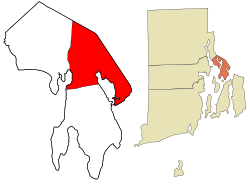
According to the United States Census Bureau, the town has a total area of 8.6 square miles (22 km2), of which 6.2 square miles (16 km2) is land and 2.5 square miles (6.5 km2) (28.90%) is water. Warren is located on the east bank of the Warren River (opposite Barrington, Rhode Island).

Demographics

Historical population
CensusPop.Note
1790 1,122
1800 1,47331.3%
1810 1,77520.5%
1820 1,8061.7%
1830 1,800−0.3%
1840 2,43735.4%
1850 3,10327.3%
1860 2,636−15.0%
1870 3,00814.1%
1880 4,00733.2%
1890 4,48912.0%
1900 5,10813.8%
1910 6,58528.9%
1920 7,84119.1%
1930 7,9741.7%
1940 8,1582.3%
1950 8,5134.4%
1960 8,7502.8%
1970 10,52320.3%
1980 10,6401.1%
1990 11,3857.0%
2000 11,360−0.2%
2010 10,611−6.6%
2020 11,1475.1%
U.S. Decennial Census [5] [6]

As of the census [7] of 2000, there were 11,360 people, 4,708 households, and 2,994 families residing in the town. The population density was 1,845.8 inhabitants per square mile (712.7/km2). There were 4,977 housing units at an average density of 808.7 per square mile (312.2/km2). The racial makeup of the town was 96.82% White, 0.83% African American, 0.23% Native American, 0.50% Asian, 0.04% Pacific Islander, 0.29% from other races, and 1.29% from two or more races. Hispanic or Latino of any race were 0.93% of the population.

There were 4,708 households, out of which 27.4% had children under the age of 18 living with them, 47.3% were married couples living together, 12.6% had a female householder with no husband present, and 36.4% were non-families. Of all households, 30.8% were made up of individuals, and 11.7% had someone living alone who was 65 years of age or older. The average household size was 2.36 and the average family size was 2.96.

In the town, the population was spread out, with 21.6% under the age of 18, 7.6% from 18 to 24, 30.0% from 25 to 44, 23.0% from 45 to 64, and 17.9% who were 65 years of age or older. The median age was 40 years. For every 100 females, there were 90.4 males. For every 100 females age 18 and over, there were 86.0 males.

The median income for a household in the town was $41,285, and the median income for a family was $52,824. Males had a median income of $35,472 versus $27,023 for females. The per capita income for the town was $22,448. About 5.2% of families and 7.3% of the population were below the poverty line, including 8.1% of those under age 18 and 10.4% of those age 65 or over.

Government

Warren town vote
by party in presidential elections
[8]
Year GOP DEM Others
2016 39.33% 1,98753.15%2,6857.52% 380
2012 34.78% 1,68863.01%3,0582.20% 107
2008 34.54% 1,76063.85%3,2541.61% 82
2004 38.17% 1,83559.93%2,8811.89% 91
2000 31.02% 1,44662.74%2,9256.24% 291
1996 25.95% 1,17760.79%2,75713.25% 601
1992 29.27% 1,54446.03%2,42824.70% 1,303
1988 45.57% 2,12054.02%2,5130.41% 19

Warren is a part of the 10th District in the Rhode Island Senate and is currently represented by Democrat Walter Felag Jr. The town is a part of Rhode Island's 1st congressional district at the federal level and is presently represented by Democrat David Cicilline. It is a reliably Democratic stronghold in presidential elections, as no Republican has carried the town in over four decades.

Notable places

Notable people

See also

Related Research Articles

<span class="mw-page-title-main">Bristol County, Massachusetts</span> County in Massachusetts, United States

Bristol County is a county in the Commonwealth of Massachusetts. As of the 2020 census, the population was 579,200. The shire town is Taunton. Some governmental functions are performed by the Commonwealth of Massachusetts, others by the county, and others by local towns and cities.

<span class="mw-page-title-main">Plymouth County, Massachusetts</span> County in Massachusetts, United States

Plymouth County is a county in the U.S. state of Massachusetts, south of Boston. As of the 2020 census, the population was 530,819. Its county seats are Plymouth and Brockton. In 1685, the county was created by the Plymouth General Court, the legislature of Plymouth Colony, predating its annexation by the Massachusetts Bay Colony.

<span class="mw-page-title-main">Bristol County, Rhode Island</span> County in Rhode Island, United States

Bristol County is a county located in the U.S. state of Rhode Island. As of the 2020 census, the population was 50,793, making it the least populous county in Rhode Island. In terms of land area, it is the third-smallest county in the United States, at only 25 square miles (65 km2). The county was created in 1747 when it was separated from Bristol County, Massachusetts. Bristol County is included in the Providence-Warwick, RI-MA Metropolitan Statistical Area, which in turn constitutes a portion of the greater Boston-Worcester-Providence, MA-RI-NH-CT Combined Statistical Area.

<span class="mw-page-title-main">Raynham, Massachusetts</span> Town in Massachusetts, United States

Raynham is a town in Bristol County, Massachusetts, United States, located approximately 32 miles (51 km) south of Boston and 22 miles (35 km) northeast of Providence, Rhode Island. The population was 15,082 at the 2020 census. It has one village, Raynham Center.

<span class="mw-page-title-main">Rehoboth, Massachusetts</span> Town in Massachusetts, United States

Rehoboth is a historic town in Bristol County, Massachusetts. Established in 1643, Rehoboth is one of the oldest towns in Massachusetts. The population was 12,502 at the 2020 census. Rehoboth is a mostly rural community with many historic sites, including 53 historic cemeteries.

<span class="mw-page-title-main">Seekonk, Massachusetts</span> Town in Massachusetts, United States

Seekonk is a town in Bristol County, Massachusetts, United States, on the Massachusetts border with Rhode Island. It was incorporated in 1812 from the western half of Rehoboth. The population was 15,531 at the 2020 census. In 1862, under a U.S. Supreme Court decision resolving a longstanding border dispute between Massachusetts and Rhode Island, a portion of Tiverton Rhode Island was awarded to Massachusetts to become part of Fall River, while 2/3 of Seekonk was awarded to Rhode Island.

<span class="mw-page-title-main">Swansea, Massachusetts</span> Town in Massachusetts, United States

Swansea is a town in Bristol County in southeastern Massachusetts. It is located at the mouth of the Taunton River, just west of Fall River, 47 miles (76 km) south of Boston, and 12 miles (19 km) southeast of Providence, Rhode Island. The population was 17,144 at the 2020 census. The villages of Hortonville, Barneyville and Ocean Grove are located in the town.

<span class="mw-page-title-main">Warwick, Rhode Island</span> City in Rhode Island, United States

Warwick is a city in Kent County, Rhode Island, United States, and is the third largest city in the state with a population of 82,823 at the 2020 census. Warwick is located approximately 12 miles (19 km) south of downtown Providence, Rhode Island, 63 miles (101 km) southwest of Boston, Massachusetts, and 171 miles (275 km) northeast of New York City.

<span class="mw-page-title-main">Portsmouth, Rhode Island</span> Town in Rhode Island, United States

Portsmouth is a town in Newport County, Rhode Island, United States. The population was 17,871 at the 2020 U.S. census. Portsmouth is the second-oldest municipality in Rhode Island, after Providence; it was one of the four colonies which merged to form the Colony of Rhode Island and Providence Plantations, the others being Providence, Newport, and Warwick.

<span class="mw-page-title-main">Glocester, Rhode Island</span> Town in Rhode Island, United States

Glocester is a town in Providence County, Rhode Island, United States. The population was 9,974 as of the 2020 census. The villages of Chepachet and Harmony are in Glocester. Putnam Pike runs west through the town center of Glocester into Putnam, Connecticut.

<span class="mw-page-title-main">Pawtucket, Rhode Island</span> City in Rhode Island

Pawtucket is a city in Providence County, Rhode Island. The population was 75,604 at the 2020 census, making the city the fourth-largest in the state. Pawtucket borders Providence and East Providence to the south, Central Falls and Lincoln to the north, and North Providence to the west. The city also borders the Massachusetts municipalities of Seekonk and Attleboro.

<span class="mw-page-title-main">Exeter, Rhode Island</span> Town in Rhode Island, United States

Exeter is a town in Washington County, Rhode Island, United States. Exeter extends east from the Connecticut border to the town of North Kingstown. It is bordered to the north by West Greenwich and East Greenwich, and to the south by Hopkinton, Richmond, and South Kingstown. Exeter's postal code is 02822, although small parts of the town have the mailing address West Kingston (02892) or Saunderstown (02874). The population was 6,460 at the 2020 census.

<span class="mw-page-title-main">Richmond, Rhode Island</span> Town in Rhode Island, United States

Richmond is a town in Washington County, Rhode Island. The population was 8,020 at the 2020 census. It contains the villages of Alton, Arcadia, Barberville, Carolina, Hillsdale, Kenyon, Shannock, Tug Hollow, Usquepaug, Wood River Junction, Woodville, and Wyoming. Students in Richmond are part of the Chariho Regional School District.

<span class="mw-page-title-main">Bristol, Rhode Island</span> Town in Rhode Island, United States

Bristol is a town in Bristol County, Rhode Island, United States, as well as the county seat. The population of Bristol was 22,493 at the 2020 census. It is a deep water seaport named after Bristol, England. Major industries include boat building and related marine industries, manufacturing, and tourism. The town's school system is united with that of the neighboring town of Warren. Prominent communities include Portuguese-Americans, mostly Azoreans, and Italian-Americans.

<span class="mw-page-title-main">Barrington, Rhode Island</span> Town in Rhode Island, United States

Barrington is a suburban, residential town in Bristol County, Rhode Island, United States, approximately 7 miles (11 km) southeast of Providence. It was founded by Congregationalist separatists from Swansea, Massachusetts, and incorporated in 1717.

<span class="mw-page-title-main">Warren, Massachusetts</span> Town in Massachusetts, United States

Warren is a town in Worcester County, Massachusetts, United States. The population was 4,975 at the 2020 census. The town contains the villages of Warren and West Warren.

<span class="mw-page-title-main">King Philip's War</span> 1675–78 war in New England

King Philip's War was an armed conflict in 1675–1676 between a group of indigenous peoples of the Northeastern Woodlands and the English New England Colonies and their indigenous allies. The war is named for Metacomet, the Pokanoket chief and sachem of the Wampanoag who adopted the English name Philip because of the friendly relations between his father Massasoit and the Plymouth Colony. The war continued in the most northern reaches of New England until the signing of the Treaty of Casco Bay on April 12, 1678.

<span class="mw-page-title-main">Massasoit</span> Leader of the Wampanoag confederacy

Massasoit Sachem or Ousamequin was the sachem or leader of the Wampanoag confederacy. Massasoit means Great Sachem. Massasoit was not his name but a title. English colonists mistook Massasoit as his name and it stuck.

<span class="mw-page-title-main">Pokanoket</span> Native American village and 17th c. Native American political division

The Pokanoket was the village governed by Massasoit. The term broadened to refer to all peoples and lands governed by Massasoit and his successors, which were part of the Wampanoag people in what is now Rhode Island and Massachusetts.

The Warren River, historically called the Sowams River, is a tidal extension of the Palmer River in the U.S. state of Rhode Island. It flows approximately 6.5 km (4 mi). There are no dams along the river's length.

References

  1. "US Board on Geographic Names". United States Geological Survey. October 25, 2007. Retrieved January 31, 2008.
  2. Baker, Virginia (1904). Massasoit's Town: Sowams in Pokanoket, Its History, Legends and Traditions. Warren, RI: By the author. pp. 9–11. ISBN   9789333322287.
  3. Bicknell, Thomas (1908). Sowams, with Ancient Records of Sowams and Parts Adjacent; Illustrated. London: Forgotten Books. p. 161. ISBN   978-1-333-57061-3.
  4. "Rhode Island History: Chapter 2". State of Rhode Island. Archived from the original on September 19, 2008. Retrieved June 17, 2016.
  5. "Census of Population and Housing". Census.gov. Retrieved June 4, 2016.
  6. Snow, Edwin M. (1867). Report upon the Census of Rhode Island 1865. Providence, RI: Providence Press Company.
  7. "U.S. Census website". United States Census Bureau . Retrieved January 31, 2008.
  8. http://www.elections.state.ri.us/elections/preresults/ [ dead link ]