Avon, Massachusetts

Last updated

Avon, Massachusetts
Avon Baptist Church, Avon MA.jpg
Avon Baptist Church
Seal of Avon, Massachusetts.png
Norfolk County Massachusetts incorporated and unincorporated areas Avon highlighted.svg
Location in Norfolk County in Massachusetts
Coordinates: 42°07′50″N71°02′30″W / 42.13056°N 71.04167°W / 42.13056; -71.04167
Country Flag of the United States.svg United States
State Flag of Massachusetts.svg  Massachusetts
County Flag of Norfolk County, Massachusetts.gif Norfolk
Settled1700
Incorporated1888
Government
  Type Open town meeting
   Town
   Administrator
Jonathan Beder
  Board of
   Selectmen
Eric S. Beckerman, Chair
Shannon M. Coffey
Jason L. Suzor
Area
  Total11.8 km2 (4.6 sq mi)
  Land11.3 km2 (4.4 sq mi)
  Water0.5 km2 (0.2 sq mi)
Elevation
67 m (219 ft)
Population
 (2020) [1]
  Total4,777
  Density422.7/km2 (1,085.7/sq mi)
Time zone UTC−5 (Eastern)
  Summer (DST) UTC−4 (Eastern)
ZIP Code
02322
Area code 508 / 774
FIPS code 25-02935
GNIS feature ID0618314
Website www.avon-ma.gov

Avon is a town in Norfolk County, Massachusetts, United States. The population was 4,777 at the 2020 census. [2]

Contents

History

The first settler in the land that would become Avon was Moses Curtis (c.1720), a blacksmith from Braintree, Massachusetts. [3] With most of his surviving children living near him, by 1749 the locale was called Curtis Corners. [3]

Avon's story begins deep in the forest of the Massachusetts Bay Colony, in the territory of the ancient town of Dorchester. In 1630 the Indian chief Chicataubut, in return for a sum of money, gave the English the right to settle Dorchester, south to the top of Blue Hill. After the chief's death, his brother Kitchamakin extended the boundary line farther southward, all the way to the Plymouth Colony line. This "New Grant" as it was called, gave the town of Dorchester title over 40,000 acres, making it the largest town in New England.

In 1726 Dorchester's South Precinct, holding the present-day towns of Stoughton, Avon, Sharon, Canton, and Foxborough, as well as parts of Wrenthham (Plainville) and Dedham, was set aside and incorporated under the name Stoughton. Its neighbor to the east, also resting on the Plymouth Colony line, was the town of Braintree, which at the time included present-day Quincy, Holbrook, and Randolph.

The road through the southeasternmost corner of "Old Stoughton" was little more than a cart trail when Moses Curtis arrived from Braintree in 1720. Known simply as the "Old Beaten Path", it arched its back in a southwesterly direction after crossing the present-day Randolph line, and then gradually turned southeasterly as it approached the Bay Colony line, about two miles away. What attracted Curtis to this location is unknown, but it is fair to say that he had chosen one of the most isolated spots possible for settlement.

By 1720 only five houses preceded the Curtis homested in all of the present Stoughton-Avon area, and his stood virtually alone in the far southeastern corner of the "New Grant"...

A History of Avon, Massachusetts 1720–1988, by William F. Hanna [4]

The Third Baptist Meeting House was erected in East Stoughton on 30 March 1848. [3]

Following a petition sent through the Massachusetts House of Representatives and the Massachusetts Senate, the new town of Avon was separated from Stoughton and incorporated on February 21st, 1888. The town was named after Stratford-upon-Avon, Warwickshire, England. The town's seal features a portrait of William Shakespeare, who was born in Stratford-upon-Avon. [5]

Geography

According to the United States Census Bureau, the town has a total area of 4.6 square miles (12 km2), of which, 4.4 square miles (11 km2) of it is land and 0.2 square miles (0.52 km2) of it (4.16%) is water. Avon is bordered by the City of Brockton on the south, Stoughton on the west, Randolph on the northeast, and Holbrook on the east. Avon is 17 miles (27 km) south of Boston.

Demographics

At the 2000 census, [14] there were 4,443 people, 1,705 households and 1,220 families residing in the town. The population density was 1,014.7 inhabitants per square mile (391.8/km2). There were 1,740 housing units at an average density of 397.4 per square mile (153.4/km2). The racial makeup of the town was 93.45% White, 3.74% African American, 0.27% Native American, 0.92% Asian, 0.77% from other races, and 0.86% from two or more races. Hispanic or Latino of any race were 1.44% of the population.

There were 1,705 households, of which 26.7% had children under the age of 18 living with them, 55.5% were married couples living together, 12.0% had a female householder with no husband present, and 28.4% were non-families. Of all households 23.5% were made up of individuals, and 12.3% had someone living alone who was 65 years of age or older. The average household size was 2.61 and the average family size was 3.13.

Age distribution was 22.5% under the age of 18, 7.0% from 18 to 24, 28.8% from 25 to 44, 24.2% from 45 to 64, and 17.6% who were 65 years of age or older. The median age was 40 years. For every 100 females, there were 91.8 males. For every 100 females age 18 and over, there were 88.0 males.

The median household income was $50,305, and the median family income was $60,625. Males had a median income of $41,582 versus $32,837 for females. The per capita income for the town was $24,410. About 4.3% of families and 6.6% of the population were below the poverty line, including 12.5% of those under age 18 and 4.2% of those age 65 or over.

Government

Avon is governed by a three-person Board of Selectmen who appoint a Town Administrator to carry out the day to day executive functions of the Board. Legislation is enacted in an Open Town Meeting.

Education

The Avon School District serves Avon.

Transportation

The town is served by the Brockton Area Transit Authority and the Massachusetts Bay Transportation Authority (MBTA), which provide public transit service to Brockton and Boston.

Related Research Articles

<span class="mw-page-title-main">Norfolk County, Massachusetts</span> County in Massachusetts, United States

Norfolk County is located in the U.S. state of Massachusetts. At the 2020 census, the population was 725,981. Its county seat is Dedham. It is the fourth most populous county in the United States whose county seat is neither a city nor a borough, and it is the second most populous county that has a county seat at a town. The county was named after the English county of the same name. Two towns, Cohasset and Brookline, are exclaves.

<span class="mw-page-title-main">Plymouth County, Massachusetts</span> County in Massachusetts, United States

Plymouth County is a county in the U.S. state of Massachusetts, south of Boston. As of the 2020 census, the population was 530,819. Its county seats are Plymouth and Brockton. In 1685, the county was created by the Plymouth General Court, the legislature of Plymouth Colony, predating its annexation by the Massachusetts Bay Colony.

<span class="mw-page-title-main">Easton, Massachusetts</span> Town in Massachusetts, United States

Easton is a town in Bristol County, Massachusetts, United States. The population was 25,058 at the 2020 census. It is part of the Greater Boston area.

<span class="mw-page-title-main">Stoughton, Massachusetts</span> Town in Massachusetts, United States

Stoughton is a town in Norfolk County, Massachusetts, United States. The population was 29,281 at the 2020 census. The town is located approximately 17 miles (27 km) from Boston, 31 miles (50 km) from Providence, Rhode Island, and 35 miles (56 km) from Cape Cod.

<span class="mw-page-title-main">Brockton, Massachusetts</span> City in Massachusetts, United States

Brockton is a city in Plymouth County, Massachusetts, United States; the population was 105,643 at the 2020 United States census. Along with Plymouth, it is one of the two county seats of Plymouth County. It is the sixth-largest city in Massachusetts and is sometimes referred to as the "City of Champions", due to the success of native boxers Rocky Marciano and Marvin Hagler, as well as its successful Brockton High School sports programs. Two villages within it are Montello and Campello, both of which have MBTA Commuter Rail Stations and post offices. Campello is the smallest neighborhood, but also the most populous. Brockton hosts a baseball team, the Brockton Rox. It is the second-windiest city in the United States, with an average wind speed of 14.3 mph (23.0 km/h).

<span class="mw-page-title-main">East Bridgewater, Massachusetts</span> Town in Massachusetts, United States

East Bridgewater is a town in Plymouth County, Massachusetts, United States. The population was 14,440 at the 2020 census. It is also a part of Massachusetts' 8th congressional district, of which it is represented by Stephen Lynch.

<span class="mw-page-title-main">Halifax, Massachusetts</span> Town in Massachusetts, United States

Halifax is a town in Plymouth County, Massachusetts, United States. The population was 7,749 at the 2020 census.

<span class="mw-page-title-main">Rockland, Massachusetts</span> Town in Massachusetts, United States

Rockland is a town in Plymouth County, Massachusetts, United States. The population was 17,803 at the 2020 census. As of December 31, 2009, there were 11,809 registered voters in the community.

<span class="mw-page-title-main">West Bridgewater, Massachusetts</span> Town in Massachusetts, United States

West Bridgewater is a town in Plymouth County, Massachusetts, United States. The population was 7,707 at the 2020 census.

<span class="mw-page-title-main">Whitman, Massachusetts</span> Town in Massachusetts, United States

Whitman is a town in Plymouth County, Massachusetts, United States. The population was 15,121 at the 2020 census. It is notable as being the place where the chocolate chip cookie was invented.

<span class="mw-page-title-main">Hardwick, Massachusetts</span> Town in Massachusetts, United States

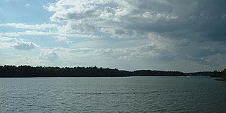
Hardwick is a town in Worcester County, Massachusetts, United States, about 20 miles (32 km) west of the city of Worcester. It had a population of 2,667 at the 2020 census. It includes the villages of Hardwick, Gilbertville, Wheelwright and Old Furnace.

<span class="mw-page-title-main">New Braintree, Massachusetts</span> Town in Massachusetts, United States

New Braintree is a town in Worcester County, Massachusetts, United States. The population was 996 at the 2020 census.

<span class="mw-page-title-main">Oakham, Massachusetts</span> Town in Massachusetts, United States

Oakham is a town in Worcester County, Massachusetts, United States. The population was 1,851 at the 2020 census.

<span class="mw-page-title-main">Holbrook, Massachusetts</span> Town in Massachusetts, United States

Holbrook is a town in Norfolk County, Massachusetts, United States. As of 2023, the town's population was 12,284.

<span class="mw-page-title-main">Randolph, Massachusetts</span> City in Massachusetts, United States

The Town of Randolph is a suburban city in Norfolk County, Massachusetts, United States. At the 2020 census, the city population was 34,984. Randolph adopted a charter effective January 2010 providing for a council-manager form of government instead of the traditional town meeting. Randolph is one of thirteen Massachusetts municipalities that have applied for, and been granted, city forms of government but wish to retain "The town of" in their official names.

<span class="mw-page-title-main">Abington, Massachusetts</span> Town in Massachusetts, United States

Abington is a town in Plymouth County, Massachusetts, United States, 20 miles (32 km) southeast of Boston. The population was 17,062 at the 2020 census.

<span class="mw-page-title-main">Marshfield, Massachusetts</span> Town in Massachusetts, United States

Marshfield is a town in Plymouth County, Massachusetts, United States, on Massachusetts's South Shore. The population was 25,825 at the 2020 census.

<span class="mw-page-title-main">Barre, Massachusetts</span> Town in Massachusetts, United States

Barre is a town in Worcester County, Massachusetts, United States. The population was 5,530 at the 2020 census.

<span class="mw-page-title-main">Warren, Massachusetts</span> Town in Massachusetts, United States

Warren is a town in Worcester County, Massachusetts, United States. The population was 4,975 at the 2020 census. The town contains the villages of Warren and West Warren.

<span class="mw-page-title-main">North Brookfield, Massachusetts</span> Town in Massachusetts, United States

North Brookfield is a town in Worcester County, Massachusetts, United States. The population was 4,735 at the 2020 census.

References

  1. "Census - Geography Profile: Avon town, Norfolk County, Massachusetts". U.S. Census Bureau. Retrieved September 29, 2021.
  2. "Explore Census Data". data.census.gov. Retrieved September 29, 2023.
  3. 1 2 3 Avon 75th Anniversary 1888-1963 Diamond Jubilee, accessed June 2021.
  4. Hanna, William F. (1989). A History of Avon, Massachusetts 1720–1988. Avon, Mass.: The Avon Centennial Committee. OCLC   750986399.
  5. "AVON". stoughtonhistory.com. Retrieved September 29, 2023.
  6. "TOTAL POPULATION (P1), 2010 Census Summary File 1, All County Subdivisions within Massachusetts". United States Census Bureau. Archived from the original on February 12, 2020. Retrieved September 13, 2011.
  7. "Massachusetts by Place and County Subdivision - GCT-T1. Population Estimates". United States Census Bureau. Archived from the original on January 6, 2012. Retrieved July 12, 2011.
  8. "1990 Census of Population, General Population Characteristics: Massachusetts" (PDF). US Census Bureau. December 1990. Table 76: General Characteristics of Persons, Households, and Families: 1990. 1990 CP-1-23. Archived from the original (PDF) on December 7, 2013. Retrieved July 12, 2011.
  9. "1980 Census of the Population, Number of Inhabitants: Massachusetts" (PDF). US Census Bureau. December 1981. Table 4. Populations of County Subdivisions: 1960 to 1980. PC80-1-A23. Archived from the original on August 5, 2010. Retrieved July 12, 2011.
  10. "1950 Census of Population" (PDF). 1: Number of Inhabitants. Bureau of the Census. 1952. Section 6, Pages 21-10 and 21-11, Massachusetts Table 6. Population of Counties by Minor Civil Divisions: 1930 to 1950. Archived (PDF) from the original on June 9, 2011. Retrieved July 12, 2011.{{cite journal}}: Cite journal requires |journal= (help)
  11. "1920 Census of Population" (PDF). Bureau of the Census. Number of Inhabitants, by Counties and Minor Civil Divisions. Pages 21-5 through 21-7. Massachusetts Table 2. Population of Counties by Minor Civil Divisions: 1920, 1910, and 1920. Retrieved July 12, 2011.
  12. "1890 Census of the Population" (PDF). Department of the Interior, Census Office. Pages 179 through 182. Massachusetts Table 5. Population of States and Territories by Minor Civil Divisions: 1880 and 1890. Retrieved July 12, 2011.
  13. "City and Town Population Totals: 2020-2022". United States Census Bureau . Retrieved November 10, 2023.
  14. "U.S. Census website". United States Census Bureau . Retrieved January 31, 2008.