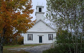
New Durham is a town in Strafford County, New Hampshire, United States. The population was 2,693 at the 2020 census. It is drained by the Merrymeeting, Cocheco and Ela rivers, and is known for Merrymeeting Lake. New Durham is home to the Powder Mill Fish Hatchery, located on Merrymeeting Road. Also located here is the Lions Club's Camp Pride, a camp for children and adults with special needs.

The Connecticut Lakes are a group of lakes in Coos County, northern New Hampshire, United States, situated along the headwaters of the Connecticut River. They are accessed via the northernmost segment of U.S. Route 3, between the village of Pittsburg and the Canada port of entry south of Chartierville, Quebec. The lakes are located within the boundaries of Pittsburg, but are far from the town center. Connecticut Lakes State Forest adjoins them.

Silver Lake, formerly known as Long Pond, is a small lake in the town of Hollis, New Hampshire, United States. The lake was formerly surrounded by summer vacation cottages and camps, but most of these buildings have now been converted for use as year-round homes. Silver Lake State Park occupies the northern end of the lakeshore.
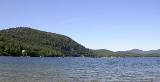
Newfound Lake is located in Grafton County, New Hampshire, United States. It is situated in the Lakes Region of central New Hampshire, in the towns of Alexandria, Bridgewater, Bristol, and Hebron. Its area of 4,451 acres (18.0 km2) places it behind only Lake Winnipesaukee and Squam Lake among lakes located entirely within New Hampshire, and fourth in the state overall, when Umbagog Lake on the Maine border is included.

The Lamprey River is a 50.2-mile-long (80.8 km) river in southeastern New Hampshire, the United States. It rises in Meadow Lake in Northwood, and flows south, then generally east through Raymond, Epping, Lee, Durham and finally Newmarket. Here, it meets Great Bay, a tidal inlet of the Atlantic Ocean, to which it is connected by a tidal estuary, the Piscataqua River. The river from the Bunker Pond Dam in Epping to the confluence with the Piscassic River is part of the designated National Wild and Scenic River System.

Goose Pond is a 625-acre (2.5 km2) water body located in Grafton County in western New Hampshire, United States, in the towns of Canaan and Hanover. It is considered a great pond by the state of New Hampshire. The lake has 6.3 miles (10.1 km) of shoreline, and is approximately 3 miles (5 km) long by 0.5 miles (0.8 km) wide. All but the northernmost end of the pond is in the town of Canaan. The average depth of the pond is approximately 10 feet (3.0 m), with the deepest part approximately 35 feet (11 m). The lake is part of the Mascoma River watershed, flowing to the Connecticut River.

Island Pond is a 532-acre (215 ha) water body located in Rockingham County in southern New Hampshire, in the towns of Derry, Hampstead and Atkinson. The pond is at the head of the Spicket River watershed, which feeds into the Merrimack River in Lawrence, Massachusetts. The pond was formed from the merger of Perch Pond in Hampstead and Lake Wentworth in Derry in 1878, when a new dam raised the water level by 8.5 feet (2.6 m).

Pawtuckaway Lake is a 784-acre (3.17 km2) reservoir in Rockingham County in southeastern New Hampshire, United States, in the town of Nottingham. The lake is located in the Piscataqua River drainage basin.
Silver Lake is a 969-acre (3.92 km2) water body located in Carroll County in eastern New Hampshire, United States, in the town of Madison. The village of Silver Lake within Madison lies at the north end of the lake. Water from Silver Lake flows via the West Branch, through the Ossipee Pine Barrens to Ossipee Lake and ultimately to the Saco River in Maine.
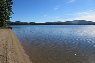
Stinson Lake is a 342-acre (1.38 km2) water body located in the town of Rumney in Grafton County, New Hampshire, United States. The lake is in the southern part of the White Mountains and is the largest lake in the White Mountain National Forest. Water from Stinson Lake flows via Stinson Brook, the Baker River, and the Pemigewasset River to the Merrimack River.

Lake Almanor is a large reservoir in northwestern Plumas County, northeastern California, United States. The reservoir has a capacity of 1,308,000 acre-feet (1.613×10⁹ m3) and a maximum depth of about 90 feet (27 meters). It is formed by Canyon Dam on the North Fork of the Feather River, as well as Benner and Last Chance Creeks, Hamilton Branch, and various natural springs.
Rushford Lake is a small reservoir in the western part of New York, United States. The lake is in the northwest part of Allegany County, mostly in the Town of Rushford, but the eastern part of the lake is in the Town of Caneadea.
Lake Perris is an artificial lake completed in 1973. It is the southern terminus of the California State Water Project, situated in a mountain-rimmed valley between Moreno Valley and Perris, in what is now the Lake Perris State Recreation Area. The park offers a variety of recreational activities. Because of this and the lake's proximity to major population centers, it is very crowded during the summer months.

Dublin Pond or Dublin Lake is a 236-acre (0.96 km2) water body located in Cheshire County in southwestern New Hampshire, United States, in the town of Dublin. The pond lies at an elevation of 1,480 feet (451 m) above sea level, near the height of land between the Connecticut River/Long Island Sound watershed to the west and the Merrimack River/Gulf of Maine watershed to the east.

Lake Sunapee is located within Sullivan County and Merrimack County in western New Hampshire, the United States. It is the fifth-largest lake located entirely in New Hampshire.

Chocorua Lake is a picturesque lake in northeast New Hampshire with commanding views of the summit of Mount Chocorua. It is approximately 1.1 miles (1.8 km) long (north-south) with a maximum width of 3,500 ft (1.1 km) (east-west), covering 222 acres, and a maximum depth of 27 feet.
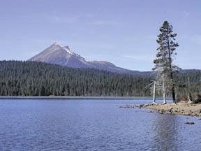
Lake of the Woods is a natural lake near the crest of the Cascade Range in the Fremont–Winema National Forest in southern Oregon in the United States. The lake covers 1,146 acres (4.64 km2). It was named by Oliver C. Applegate in 1870. Today, the Oregon Department of Fish and Wildlife manages the lake's fishery. The small unincorporated community of Lake of the Woods is located on the east shore of the lake. Lake of the Woods is one of southern Oregon's most popular outdoor recreation sites.
Androscoggin Lake is a body of water located in the towns of Wayne and Leeds, Maine. The surface area of the lake is 3,826 acres (1,548 ha). Its greatest length is 4.5 mi (7.2 km) and its greatest width is 2.8 mi (4.5 km). The lake is very shallow with a mean depth of 15 ft (4.6 m) and maximum depth of 38 ft (12 m). The lake temperature is therefore quite warm during summer, and the temperature is the same on the bottom as it is on the top, making it a homothermous body of water. There are 4 islands on the lake: Androscoggin Island, Blodgett Island, Lothrop Island and Norris Island. Norris Island has a cabin that can be reserved for free on tklt.org. The islands support a diverse assemblage of rare species and natural communities. The most extensive areas are along and around the Dead River, which connects the lake to the Androscoggin River. The islands also provide important nesting habitat for bald eagles, ospreys and great blue herons. Lothrop Island's black sand beaches are of geological interest and are also home to several rare plants.
Granite Lake is a 233-acre (0.9 km2) lake located in Cheshire County in southwestern New Hampshire, United States, in the towns of Nelson and Stoddard. The village of Munsonville, within the town of Nelson, is located at the outlet. The lake flows into a tributary of Otter Brook, which flows southwest to the Ashuelot River in Keene and thence to the Connecticut River. Granite Lake Dam regulates the lake's water level.

Nequasset Lake, or Nequasset Pond, is a 392-acre (159 ha), largely undeveloped lake located entirely in the town of Woolwich, Maine.


