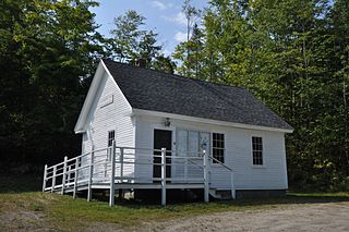
Ellsworth is a town in Grafton County, New Hampshire, United States. The population was 93 at the 2020 census.
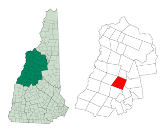
Rumney is a town in Grafton County, New Hampshire, United States. The population was 1,498 at the 2020 census. The town is located at the southern edge of the White Mountain National Forest.

Lake Winnipesaukee is the largest lake in the U.S. state of New Hampshire, located in the Lakes Region at the foothills of the White Mountains. It is approximately 21 miles (34 km) long (northwest-southeast) and from 1 to 9 miles wide (northeast-southwest), covering 69 square miles (179 km2)—71 square miles (184 km2) when Paugus Bay is included—with a maximum depth of 180 feet (55 m). The center area of the lake is called The Broads.

The Connecticut Lakes are a group of lakes in Coos County, northern New Hampshire, United States, situated along the headwaters of the Connecticut River. They are accessed via the northernmost segment of U.S. Route 3, between the village of Pittsburg and the Canada port of entry south of Chartierville, Quebec. The lakes are located within the boundaries of Pittsburg, but are far from the town center. Connecticut Lakes State Forest adjoins them.
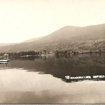
Mascoma Lake is a 1,158-acre (469 ha) lake in western New Hampshire, United States. Most of the lake is within the town of Enfield, while a small portion is within the city of Lebanon, where it drains into the Mascoma River, a tributary of the Connecticut River.
New Hampshire Route 25 is a 96.62-mile (155.49 km) long east–west state highway in New Hampshire. It runs completely across the state from Vermont to Maine.

The Baker River, or Asquamchumauke, is a 36.4-mile-long (58.6 km) river in the White Mountains region of New Hampshire in the United States. It rises on the south side of Mount Moosilauke and runs south and east to empty into the Pemigewasset River in Plymouth. The river traverses the towns of Warren, Wentworth, and Rumney. It is part of the Merrimack River watershed.
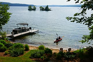
Lake Winnisquam is in Belknap County in the Lakes Region of central New Hampshire, United States, in the communities of Meredith, Laconia, Sanbornton, Belmont, and Tilton. At 4,214 acres (1,705 ha), it is the fourth-largest lake entirely in New Hampshire. The lake is roughly triangular in shape, with the vertexes pointing north, east, and south. The lake lies along the path of the Winnipesaukee River, which enters the lake from its eastern corner and carries water from Lake Winnipesaukee via Paugus Bay and Opechee Bay. The river also flows south out of Winnisquam's southern corner, eventually joining the Merrimack River. The lake extends several miles north from the course of the Winnipesaukee River, which forms the lake's southeastern side, with the northern point being formed by the confluence of several smaller creeks near the village of Meredith Center. The lake has a maximum depth of 155 feet (47 m).

Conway Lake is a 1,316-acre (5 km2) water body with a maximum depth of 45 feet (14 m), located in Carroll County in eastern New Hampshire, in the United States. The lake is located in the towns of Conway and Eaton, just to the east of the White Mountains, and is part of the Saco River watershed.
Dan Hole Pond is a 443-acre (1.8 km2) water body located in Carroll County in eastern New Hampshire, United States, in the towns of Ossipee and Tuftonboro. The pond is situated on the south side of the Ossipee Mountains. Water exits Dan Hole Pond via the Dan Hole River, part of the Ossipee Lake watershed and ultimately that of the Saco River in Maine.

Goose Pond is a 625-acre (2.5 km2) water body located in Grafton County in western New Hampshire, United States, in the towns of Canaan and Hanover. It is considered a great pond by the state of New Hampshire. The lake has 6.3 miles (10.1 km) of shoreline, and is approximately 3 miles (5 km) long by 0.5 miles (0.8 km) wide. All but the northernmost end of the pond is in the town of Canaan. The average depth of the pond is approximately 10 feet (3.0 m), with the deepest part approximately 35 feet (11 m). The lake is part of the Mascoma River watershed, flowing to the Connecticut River.
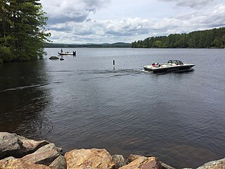
The Suncook Lakes are a pair of lakes located in Belknap County in central New Hampshire, United States, in the town of Barnstead. Upper Suncook Lake encompasses 402 acres (1.63 km2), while Lower Suncook Lake covers 295 acres (1.19 km2). The lakes are connected by a 1,000-foot-long (300 m) channel, spanned by a road bridge. A dam at the outlet of Lower Suncook Lake controls the water level of both lakes. The lakes are located along the Suncook River, a tributary of the Merrimack River. There are three islands on Lower Lake.
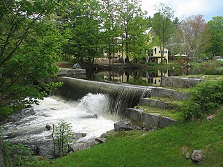
The Chocorua River is a 15.2-mile (24.5 km) river located in eastern New Hampshire in the United States. It is a tributary of the Bearcamp River, part of the Ossipee Lake / Saco River watershed leading to the Atlantic Ocean.
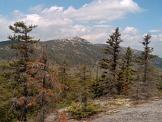
Mount Cardigan is a prominent bare-rock summit in the towns of Orange and Alexandria in western New Hampshire, USA. While its peak is only 3,155 feet (962 m) above sea level, it has extensive areas of bare granite ledges and alpine scrub, giving it the feel to hikers of a much higher mountain. Most of the summit area was denuded by devastating forest fires in 1855.
Stinson Lake is an unincorporated community in the town of Rumney in Grafton County, New Hampshire, United States. It is located at the south end of Stinson Lake, around the lake's outlet. The village is 4 miles (6 km) north of the village of Rumney, via Stinson Lake Road.

Lake Sunapee is located within Sullivan County and Merrimack County in western New Hampshire, the United States. It is the fifth-largest lake located entirely in New Hampshire.

Chocorua Lake is a picturesque lake in northeast New Hampshire with commanding views of the summit of Mount Chocorua. It is approximately 1.1 miles (1.8 km) long (north-south) with a maximum width of 3,500 ft (1.1 km) (east-west), covering 222 acres, and a maximum depth of 27 feet.

Willard Pond is a small, protected lake in Antrim, New Hampshire, United States. The lake, located in southwestern New Hampshire, is about 108 acres (44 ha) in size with an average depth of 25 feet (7.6 m) and a maximum depth of 58 feet (18 m). No petroleum motors are allowed, and fly fishing is the only form of fishing allowed. It is part of the dePierrefeu Wildlife Sanctuary, which is owned by the New Hampshire Audubon Society. Because the pond and the land around it are part of the sanctuary, the shore is unable to be developed. Therefore, there are no buildings around the pond and there won't be in the foreseeable future. Willard is instead surrounded by extensive amounts of wilderness and hiking trails that lead around the pond and to the summits of Bald Mountain and Goodhue Hill. Willard is a popular fishing, boating and hiking destination, and it has become more popular with its mention in numerous magazines and newspapers.

Independence Lake is a natural glacial lake in California, in the Sierra Nevada mountains. At an elevation of 6,949 feet (2,118 m) in the upper reaches of the Truckee River basin, it has been less affected by development than most lakes in the area. The Nature Conservancy owns a 2,325 acres (9.41 km2) parcel of land around it, which it manages privately as the Independence Lake Preserve for the purposes of conservation and low-impact recreation.


