Belknap County is a county in the U.S. state of New Hampshire. As of the 2020 census, the population was 63,705. The county seat is Laconia. It is located in New Hampshire's Lakes Region, slightly southeast of the state's geographic center. Belknap County comprises the Laconia, NH Micropolitan Statistical Area, which in turn constitutes a portion of the Boston-Worcester-Providence, MA-RI-NH-CT Combined Statistical Area.

Alton is a town in Belknap County, New Hampshire, United States. The population was 5,894 at the 2020 census, up from 5,250 at the 2010 census. It is home to Alton Bay State Forest and Mount Major State Forest.

Gilford is a town in Belknap County, New Hampshire, United States. The population was 7,699 at the 2020 census, up from 7,126 at the 2010 census. Situated on Lake Winnipesaukee, Gilford is home to Governors Island, Ellacoya State Beach, Belknap Mountain State Forest, Gunstock Mountain Resort, and the Bank of New Hampshire Pavilion, a seasonal outdoor concert venue. The lakeside village of Glendale lies within Gilford's borders.

Gilmanton is a town in Belknap County, New Hampshire, United States. The population was 3,945 at the 2020 census. Gilmanton includes the villages of Gilmanton Corners and Gilmanton Ironworks. The town became well known in the 1950s after it was rumored that the popular novel Peyton Place, written by resident Grace Metalious, was based on the town.

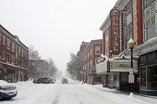
Laconia is a city in Belknap County, New Hampshire, United States. The population was 16,871 at the 2020 census, up from 15,951 at the 2010 census. It is the county seat of Belknap County. Laconia, situated between Lake Winnipesaukee and Lake Winnisquam, includes the villages of Lakeport and Weirs Beach. Each June, the city hosts Laconia Motorcycle Week, also more simply known as "Bike Week", one of the country's largest rallies.

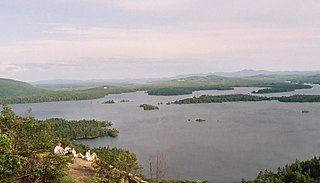
Lake Winnipesaukee is the largest lake in the U.S. state of New Hampshire, located in the Lakes Region at the foothills of the White Mountains. It is approximately 21 miles (34 km) long (northwest-southeast) and from 1 to 9 miles wide (northeast-southwest), covering 69 square miles (179 km2)—71 square miles (184 km2) when Paugus Bay is included—with a maximum depth of 180 feet (55 m). The center area of the lake is called The Broads.

The Lakes Region of New Hampshire is located in the east-central part of the state, south of the White Mountains Region and extending to the Maine border. It is named for the numerous lakes in the region, the largest of which are Lake Winnipesaukee, Lake Winnisquam, Squam Lake, and Newfound Lake. The area comprises all of Belknap County, the southern portion of Carroll County, the eastern portion of Grafton County, and the northern portions of Strafford County and Merrimack County. The largest municipality is the city of Laconia.

New Hampshire Route 11 is a 108.223-mile-long (174.168 km) east–west state highway in New Hampshire, running completely across the central part of the state. Its western terminus is at the Vermont state line in Charlestown, where it continues west as Vermont Route 11. The eastern terminus is at the Maine state line in Rochester, where it crosses the border with U.S. Route 202 and continues as Maine State Route 11.

Loon Mountain is a mountain in Lincoln and Livermore, New Hampshire, in Grafton County. It is in the White Mountain National Forest.

Crystal Lake is a 455-acre (1.8 km2) water body located in Belknap County in the Lakes Region of central New Hampshire, United States, in the town of Gilmanton. Crystal Lake is at the head of the Suncook River watershed. Water flows into Crystal Lake from the Belknap Range through Manning and Sunset lakes to the north. Water from Manning Lake enters Crystal Lake via Nelson Brook. Other waterways flowing into Crystal Lake include Wasson Brook and Mill Brook. Water flows out of a dam from the southern end of Crystal Lake via the Suncook Lakes and Suncook River to the Merrimack River. Shoreline development along Crystal Lake consists primarily of summer cottages, with a few year-round residents. Belknap Mountain and Mount Major can be seen from the shoreline.

The Tioga River is a 12.8-mile-long (20.6 km) river located in the Lakes Region of central New Hampshire in the United States. It is a tributary of the Winnipesaukee River, part of the Merrimack River watershed.

Mount Sunapee is a 5-mile-long (8.0 km) mountain ridge in the towns of Newbury and Goshen in western New Hampshire, United States. Its highest peak, at the north end of the mountain, is 2,726 feet (831 m) above sea level. The mountain has three secondary peaks, White Ledges at 2,716 ft (828 m); North Peak at 2,280 ft (695 m); and South Peak at 2,608 ft (795 m). The north end of the mountain, including the summit, is within Mount Sunapee State Park, which encompasses 3.85 square miles (10.0 km2) and is home to the popular Mount Sunapee Resort. The mountain extends south to Pillsbury State Park in the towns of Goshen and Washington.

Mount Shaw is a mountain located in the towns of Moultonborough and Tuftonboro in Carroll County, New Hampshire, United States. It is part of the remains of an ancient volcanic ring dike. With a summit elevation of 2,990 feet (911 m), it is the highest of the Ossipee Mountains.

The Sandwich Range is located in the White Mountains of New Hampshire in the United States, north of the Lakes Region and south of the Kancamagus Highway. Although the range is not outstanding for its elevation, it is very rugged and has excellent views of the surrounding lakes, mountains, and forests.
The Gunstock River is a 6.4-mile-long (10.3 km) river in the Lakes Region of central New Hampshire in the United States. It is a tributary of Lake Winnipesaukee, part of the Merrimack River watershed.

Belknap Mountain is a mountain located in Belknap County, New Hampshire, United States, south of Lake Winnipesaukee. Like the county, the mountain and the associated surrounding Belknap Mountains are named after Jeremy Belknap (1744–1798), a renowned preacher, historian, and author of The History of New Hampshire. The mountain is within Belknap Mountain State Forest.
Sunset Lake is a 253-acre (1.02 km2) water body located in Belknap County in the Lakes Region of New Hampshire, United States, in the towns of Gilmanton and Alton. Water from Sunset Lake flows south to Crystal Lake, the head of the Suncook River, which flows to the Merrimack River and ultimately the Gulf of Maine.

Mount Major is a mountain located in Alton, New Hampshire, south of Lake Winnipesaukee and northeast of Straightback Mountain in the Belknap Range.

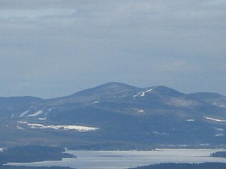
Gunstock Mountain is the second highest peak in the Belknap Mountains of central New Hampshire with an elevation greater than 2240 feet. It is located 1 mile (1.6 km) north of Belknap Mountain, the highest point in the range. It is home to the Gunstock Mountain Resort ski area. The ski resort has been written up in national ski magazines for its views of Lake Winnipesaukee.


