
New Hampshire is a state in the New England region of the Northeastern United States. It borders Massachusetts to the south, Vermont to the west, Maine and the Gulf of Maine to the east, and the Canadian province of Quebec to the north. Of the 50 U.S. states, New Hampshire is the seventh-smallest by land area and the tenth-least populous, with a population of 1,377,529 residents as of the 2020 census. Concord is the state capital and Manchester is the most populous city. New Hampshire's motto, "Live Free or Die", reflects its role in the American Revolutionary War; its nickname, "The Granite State", refers to its extensive granite formations and quarries. It is well known nationwide for holding the first primary in the U.S. presidential election cycle, and for its resulting influence on American electoral politics.

Gilmanton is a town in Belknap County, New Hampshire, United States. The population was 3,945 at the 2020 census. Gilmanton includes the villages of Gilmanton Corners and Gilmanton Ironworks. The town became well known in the 1950s after it was rumored that the popular novel Peyton Place, written by resident Grace Metalious, was based on the town.

Troy is a town in Cheshire County, New Hampshire, United States. The population was 2,130 at the 2020 census. It is situated in southwestern New Hampshire, west of Mount Monadnock.

Thornton is a town in Grafton County, New Hampshire, United States. The population was 2,708 at the 2020 census, up from 2,490 at the 2010 census.

Grantham is a town in Sullivan County, New Hampshire, United States. The population was 3,404 at the 2020 census, an increase over the figure of 2,985 tabulated in 2010. The planned community of Eastman is in the eastern part of the town.

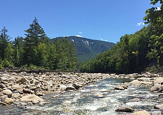
The Baker River, or Asquamchumauke, is a 36.4-mile-long (58.6 km) river in the White Mountains region of New Hampshire in the United States. It rises on the south side of Mount Moosilauke and runs south and east to empty into the Pemigewasset River in Plymouth. The river traverses the towns of Warren, Wentworth, and Rumney. It is part of the Merrimack River watershed.

Carter Dome, or simply The Dome, is a mountain located in Coös County, New Hampshire, U.S. It has a maximum elevation of 4,826 feet (1,471 m), placing it on the list of the state's four-thousand footers.

Loon Mountain is a mountain in Lincoln and Livermore, New Hampshire, in Grafton County. It is in the White Mountain National Forest.

The Conway Scenic Railroad is a heritage railroad located in North Conway, New Hampshire, owned by Profile Mountain Holdings Corp. The railroad operates over two historic railway routes: a line from North Conway to Conway that was formerly part of the Conway Branch of the Boston and Maine Railroad, and a line from North Conway through Crawford Notch to Fabyan that was once part of the Mountain Division of the Maine Central Railroad. The Conway line is owned by Conway Scenic, and the Mountain Division is owned by the State of New Hampshire.

Eastman Pond is a 320-acre (1.3 km2) water body located in Sullivan and Grafton counties in western New Hampshire, United States, in the towns of Grantham and Enfield. Water from Eastman Pond flows via Eastman Brook and Stocker Brook to the North Branch of the Sugar River, then the Sugar River, and finally the Connecticut River.
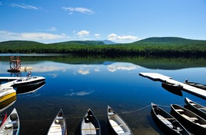
Lake Tarleton is a 334-acre (1.35 km2) water body located in Grafton County on the western edge of the White Mountains in New Hampshire, United States. The lake is located in the towns of Piermont and Warren. Water from Lake Tarleton flows via Eastman Brook west to the Connecticut River.

Imp Mountain is a mountain located in Coos County, New Hampshire. The mountain is part of the Carter-Moriah Range of the White Mountains, which runs along the northern east side of Pinkham Notch. Imp Mountain is flanked to the northeast by Mount Moriah, and to the southwest by North Carter Mountain.
Nehemiah Eastman was an American lawyer, banker and politician from New Hampshire. He served as a member of the United States House of Representatives, the New Hampshire Senate and the New Hampshire House of Representatives in the early 1800s.
Scar Ridge, also known as Scar Ridge , is a mountain located in Grafton County, New Hampshire. It is part of the White Mountains. It is officially trailless and several different routes are possible. Scar Ridge is flanked to the west by Loon Mountain, to the northwest by Black Mountain, and to the east by Mount Osceola.
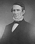
Ira Allen Eastman was an American manufacturer and Democratic politician in the U.S. state of New Hampshire. He served as a member of the United States House of Representatives and as a member of the New Hampshire House of Representatives in the 1800s.
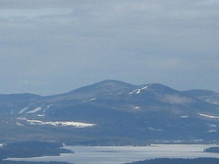
Gunstock Mountain is the second highest peak in the Belknap Mountains of central New Hampshire with an elevation greater than 2240 feet. It is located 1 mile (1.6 km) north of Belknap Mountain, the highest point in the range. It is home to the Gunstock Mountain Resort ski area. The ski resort has been written up in national ski magazines for its views of Lake Winnipesaukee.
Barrett Mountain is a mountain located in south-central New Hampshire within the Wapack Range of mountains. It lies within the town of New Ipswich and is traversed by the 22-mile (35 km) Wapack Trail. Kidder Mountain is located directly to the north along the Wapack ridgeline; New Ipswich Mountain to the south. The summit of the mountain is mostly wooded. A cross-country ski area occupies the north side of Barrett Mountain.
New Ipswich Mountain is a summit within the Wapack Range of mountains in south-central New Hampshire, United States. It lies within the town of New Ipswich and is traversed by the 22-mile (35 km) Wapack Trail. Barrett Mountain is located directly to the north along the Wapack ridgeline; Stony Top, a subordinate peak of Pratt Mountain, lies to the south. The summit of the mountain is mostly wooded, but a number of rocky ledges below the summit offer views of the surrounding countryside.

The Baldface-Royce Range is a range of mountains in western Maine and eastern New Hampshire, in the United States. They are located in the town of Chatham, New Hampshire, and the townships of Bean's Purchase, New Hampshire, and Batchelders Grant, Maine, in the eastern part of the White Mountains.
The 1863 New Hampshire gubernatorial election was held on March 10, 1863.

