
The White Mountains Region is a tourism region designated by the New Hampshire Division of Travel and Tourism. It is located in northern New Hampshire in the United States and is named for the White Mountains, which cover most of the region. The southern boundary of the region begins at Piermont on the west, and runs to Plymouth, then to Conway, and east to the Maine border. The northern boundary begins at Cushman, runs to Berlin and then east to the Maine border. The region to the north is known as the Great North Woods Region, which should not be confused with the larger and more general Great North Woods.

The High Huts of the White Mountains are eight mountain huts in the White Mountains, in the U.S. state of New Hampshire, owned and maintained by the Appalachian Mountain Club. Modeled after similar huts in the Alps, they are positioned at intervals along the Appalachian Trail, allowing "thru-hikers" to benefit from their services. They are generally separated by six to eight miles, about a day's hike.
Moose Brook is a 4.7-mile (7.6 km) long stream in northern New Hampshire in the United States. It is a tributary of the Androscoggin River, which flows south and east into Maine, joining the Kennebec River near the Atlantic Ocean.

The Moose River is an 11.7 miles (18.8 km) long stream in northern New Hampshire in the United States. It is a tributary of the Androscoggin River, which flows south and east into Maine, joining the Kennebec River near the Atlantic Ocean.

The East Branch of the Pemigewasset River is a 15.8-mile-long (25.4 km) river located in the White Mountains of New Hampshire in the United States. It is a tributary of the Pemigewasset River, part of the Merrimack River watershed.
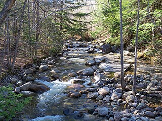
The Rattle River is a 4.1-mile (6.6 km) river in the White Mountains of New Hampshire in the United States. It is a tributary of the Androscoggin River, which flows east into Maine, joining the Kennebec River near the Atlantic Ocean.

The North Branch of the Gale River is a 5.8-mile (9.3 km) long river in the White Mountains of New Hampshire in the United States. Via the Gale River, it is a tributary of the Ammonoosuc River and part of the Connecticut River watershed.

The South Branch of the Gale River is a 5.1-mile (8.2 km) long river in the White Mountains of New Hampshire in the United States. Via the Gale River, it is a tributary of the Ammonoosuc River and part of the Connecticut River watershed.

The Little River is a 7.4 mile long river in the White Mountains of New Hampshire in the United States. It is a tributary of the Ammonoosuc River and part of the Connecticut River watershed.

The Zealand River is a 6.3-mile (10.1 km) long river in the White Mountains of New Hampshire in the United States. It is a tributary of the Ammonoosuc River and part of the Connecticut River watershed.
The South Branch of the Israel River is a 6.8-mile-long (10.9 km) river in the White Mountains of New Hampshire in the United States. It is a tributary of the Israel River and part of the Connecticut River watershed. For most of its length, it is within the White Mountain National Forest.
The North Fork of the East Branch of the Pemigewasset River is a 6.9-mile-long (11.1 km) river located in the White Mountains of New Hampshire in the United States. It is a tributary of the East Branch of the Pemigewasset River, part of the Merrimack River watershed.
The East Fork of the East Branch of the Saco River is a 2.2-mile (3.5 km) long stream in the White Mountains of New Hampshire in the United States. It is a tributary of the East Branch of the Saco River, with its waters ultimately flowing to the Atlantic Ocean in Maine.
The Sawyer River is a 9.1-mile (14.6 km) long river in the White Mountains of New Hampshire in the United States. It is a tributary of the Saco River, which flows to the Atlantic Ocean in Maine.

North Moat Mountain is a mountain located in Carroll County, New Hampshire.
North Moat is flanked to the south by Middle Moat Mountain, and to the west by Big Attitash Mountain.

North Baldface is a 3,606-foot (1,099 m) mountain in the township of Bean's Purchase, New Hampshire in the eastern White Mountains. It gets its name from its steep barren southeast face. Along with the neighboring summit South Baldface, it is a popular hiking destination, especially in the summer. The two mountains are ascended by the Slippery Brook, Baldface Knob, Baldface Circle, Meader Ridge, and Bicknell Ridge trails.

South Baldface is a 3,547-foot (1,081 m) mountain in the town of Chatham, New Hampshire in the eastern White Mountains. It gets its name from its steep barren eastern face. Along with the neighboring summit North Baldface, it is a popular hiking destination, especially in the summer. The two mountains are ascended by the Slippery Brook, Baldface Knob, Baldface Circle, Meader Ridge, and Bicknell Ridge trails.
The Nulhegan River is a 15.1-mile-long (24.3 km) tributary of the Connecticut River in Essex County, Vermont.

North Bald Cap, formerly known as Mount Success, is a mountain located in Coos County, New Hampshire. The mountain has an elevation of 2,893 feet (882 m) and is a part of the Mahoosuc Range of the White Mountains.
The Crescent Range, sometimes referred to as the Randolph Mountains, is located in the White Mountains of New Hampshire in the United States. The highest peak in the range is Black Crescent Mountain, with an elevation of 3,264 feet (995 m).


