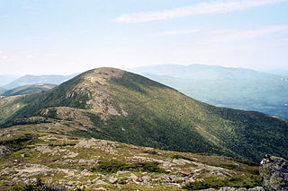
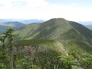
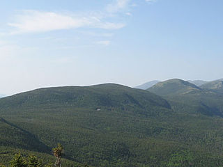
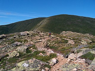
The below list of mountains in New Hampshire is an incomplete list of mountains in the U.S. state of New Hampshire, with elevation. This list includes many mountains in the White Mountains range that covers about a quarter of the state, as well as mountains outside of that range. Several of the mountains are sites of major alpine ski resorts.
Some of the peaks are included in specific lists of mountains, as denoted in the table:
- 4000 footers – listed on the four-thousand footers, peaks with an elevation of over 4,000 feet (1,200 m), per the Appalachian Mountain Club (AMC)
- 50 Finest – listed on the New England Fifty Finest
- AT – mountain is on the Appalachian Trail, a 2,170-mile (3,490 km) National Scenic Trail from Georgia to Maine
- 100 highest – listed on the New England Hundred Highest, a superset of the four-thousand footers
Note that some peaks with sufficient elevation to be considered four-thousand footers are excluded from the AMC lists because the peak's topographic prominence does not meet AMC's prominence criterion. An example is the 5,532-foot (1,686 m) Mount Clay, located 1.1 miles (1.8 km) north-northwest along the ridge joining the peak of Mount Washington with that of Mount Jefferson, rising less than 200 feet (61 m) above the general trend of that ridge.
| Mountain | County | Location | Height (ft. / m) | 4000 footers | 50 Finest | AT | 100 highest | Subpeak of | Notes | Sources |
|---|---|---|---|---|---|---|---|---|---|---|
| Mount Washington | Coös | Sargent's Purchase | 6,288 feet (1,917 m) | |||||||
| Mount Adams | Coös | Thompson and Meserve's Purchase | 5,774 feet (1,760 m) | |||||||
| Mount Jefferson | Coös | Thompson and Meserve's Purchase | 5,712 feet (1,741 m) | |||||||
| Mount Sam Adams | Coös | Low and Burbank's Grant | 5,584 feet (1,702 m) | Mount Adams | ||||||
| Mount Clay (or Reagan) | Coös | Thompson and Meserve's Purchase | 5,532 feet (1,686 m) | Mount Washington | ||||||
| Boott Spur | Coös | Sargent's Purchase | 5,492 feet (1,674 m) | Mount Washington | ||||||
| Mount Quincy Adams | Coös | Low and Burbank's Grant | 5,394 feet (1,644 m) | Mount Adams | ||||||
| Mount Monroe | Coös | Sargent's Purchase | 5,384 feet (1,641 m) | |||||||
| Mount Madison | Coös | Low and Burbank's Grant | 5,367 feet (1,636 m) | |||||||
| Mount Abigail Adams | Coös | Low and Burbank's Grant | 5,348 feet (1,630 m) | Mount Adams | ||||||
| Mount Adams "5" | Coös | Thompson and Meserve's Purchase | 5,266 feet (1,605 m) | Mount Adams | ||||||
| Mount Lafayette | Grafton | Franconia | 5,249 feet (1,600 m) | |||||||
| Mount Lincoln | Grafton | Franconia | 5,089 feet (1,551 m) | |||||||
| Mount Franklin | Coös | Sargent's Purchase | 5,004 feet (1,525 m) | Mount Monroe | ||||||
| South Twin Mountain | Grafton | Franconia | 4,902 feet (1,494 m) | |||||||
| Carter Dome | Coös | Bean's Purchase | 4,832 feet (1,473 m) | |||||||
| Mount Moosilauke | Grafton | Benton | 4,802 feet (1,464 m) | |||||||
| Mount Eisenhower | Coös | Chandler's Purchase | 4,780 feet (1,460 m) | |||||||
| Little Haystack Mountain | Grafton | Franconia | 4,774 feet (1,455 m) | Mount Lincoln | [1] | |||||
| North Twin Mountain | Grafton | Franconia | 4,761 feet (1,451 m) | |||||||
| Mount Carrigain | Grafton | Lincoln, Livermore | 4,700 feet (1,400 m) | |||||||
| Mount Bond | Grafton | Lincoln | 4,698 feet (1,432 m) | |||||||
| Gulf Peak | Coös | Cutt's Grant | 4,692 feet (1,430 m) | Boott Spur | ||||||
| Mount Hight | Coös | Bean's Purchase | 4,675 feet (1,425 m) | Carter Dome | ||||||
| Middle Carter Mountain | Coös | Bean's Purchase | 4,610 feet (1,410 m) | |||||||
| North Carter Mountain | Coös | Bean's Purchase | 4,589 feet (1,399 m) | Middle Carter Mountain | ||||||
| Mount Guyot | Grafton | Lincoln, Livermore | 4,580 feet (1,400 m) | South Twin Mountain | ||||||
| West Bond Mountain | Grafton | Lincoln | 4,540 feet (1,380 m) | |||||||
| Mount Blue | Grafton | Benton | 4,529 feet (1,380 m) | Mount Moosilauke | ||||||
| South Peak Mount Moosilauke | Grafton | Benton | 4,523 feet (1,379 m) | Mount Moosilauke | ||||||
| Mount Garfield | Grafton | Franconia | 4,500 feet (1,400 m) | |||||||
| Mount Liberty | Grafton | Lincoln | 4,459 feet (1,359 m) | |||||||
| South Carter Mountain | Coös | Bean's Purchase | 4,430 feet (1,350 m) | |||||||
| Wildcat Mountain | Coös | Bean's Purchase | 4,422 feet (1,348 m) | |||||||
| Mount Hancock | Grafton | Lincoln | 4,420 feet (1,350 m) | |||||||
| South Peak Kinsman Mountain | Grafton | Lincoln | 4,358 feet (1,328 m) | |||||||
| Mount Field | Grafton | Bethlehem | 4,340 feet (1,320 m) | |||||||
| Mount Osceola | Grafton | Lincoln, Livermore | 4,340 feet (1,320 m) | |||||||
| Mount Flume | Grafton | Lincoln | 4,328 feet (1,319 m) | |||||||
| South Hancock Mountain | Grafton | Lincoln | 4,319 feet (1,316 m) | |||||||
| Mount Pierce (or Clinton) | Coös | Bean's Grant | 4,310 feet (1,310 m) | |||||||
| Wildcat B | Coös | Bean's Purchase | 4,305 feet (1,312 m) | Wildcat Mountain | ||||||
| North Peak Kinsman Mountain | Grafton | Lincoln | 4,293 feet (1,309 m) | |||||||
| Mount Willey | Grafton | Bethlehem | 4,285 feet (1,306 m) | |||||||
| Wildcat C | Coös | Bean's Purchase | 4,285 feet (1,306 m) | Wildcat Mountain | ||||||
| Bondcliff | Grafton | Lincoln | 4,265 feet (1,300 m) | |||||||
| Mount Zealand | Grafton | Lincoln | 4,260 feet (1,300 m) | |||||||
| North Peak Mount Tripyramid | Grafton | Waterville Valley | 4,180 feet (1,270 m) | |||||||
| Mount Jim | Grafton | Woodstock | 4,172 feet (1,272 m) | Mount Moosilauke | ||||||
| Mount Cabot | Coös | Kilkenny | 4,170 feet (1,270 m) | |||||||
| East Peak Mount Osceola | Grafton | Lincoln, Livermore | 4,156 feet (1,267 m) | |||||||
| Middle Peak Mount Tripyramid | Grafton | Waterville Valley | 4,140 feet (1,260 m) | |||||||
| West Peak Mount Osceola | Grafton | Livermore | 4,114 feet (1,254 m) | Mount Osceola | ||||||
| Cannon Mountain | Grafton | Franconia | 4,100 feet (1,200 m) | Cannon Mountain Ski Area | ||||||
| South Peak Mount Tripyramid | Grafton | Waterville Valley | 4,090 feet (1,250 m) | Middle Peak Mount Tripyramid | ||||||
| Mount Hale | Grafton | Bethlehem | 4,054 feet (1,236 m) | |||||||
| Mount Jackson | Coös | Bean's Grant | 4,052 feet (1,235 m) | |||||||
| Mount Tom | Grafton | Bethlehem | 4,051 feet (1,235 m) | |||||||
| Wildcat D Mountain | Coös | Bean's Purchase | 4,050 feet (1,230 m) | Wildcat Mountain Ski Area | ||||||
| Mount Moriah | Coös | Bean's Purchase | 4,049 feet (1,234 m) | |||||||
| Wildcat E | Coös | Bean's Purchase | 4,046 feet (1,233 m) | Wildcat D | ||||||
| Mount Passaconaway | Grafton | Waterville Valley | 4,043 feet (1,232 m) | |||||||
| Owl's Head (Franconia) | Grafton | Franconia | 4,025 feet (1,227 m) | |||||||
| Galehead | Grafton | Franconia | 4,024 feet (1,227 m) | |||||||
| Mount Whiteface | Grafton | Waterville Valley | 4,020 feet (1,230 m) | |||||||
| Mount Waumbek | Coös | Kilkenny | 4,006 feet (1,221 m) | |||||||
| Mount Isolation | Coös | Sargent's Purchase | 4,004 feet (1,220 m) | |||||||
| Mount Tecumseh | Grafton | Waterville Valley | 4,003 feet (1,220 m) | Waterville Valley Resort | ||||||
| Sandwich Mountain | Carroll | Sandwich | 3,993 feet (1,217 m) | |||||||
| The Bulge | Coös | Kilkenny | 3,950 feet (1,200 m) | |||||||
| Mount Waternomee | Grafton | Woodstock | 3,934 feet (1,199 m) | |||||||
| Mount Nancy | Grafton | Lincoln, Livermore | 3,926 feet (1,197 m) | |||||||
| Mount Webster | Coös | Bean's Grant | 3,910 feet (1,190 m) | |||||||
| The Horn | Coös | Kilkenny | 3,905 feet (1,190 m) | |||||||
| Mount Weeks | Coös | Berlin | 3,901 feet (1,189 m) | |||||||
| Mount Starr King | Coös | Jefferson | 3,898 feet (1,188 m) | |||||||
| South Weeks | Coös | Randolph | 3,885 feet (1,184 m) | |||||||
| Vose Spur | Grafton | Lincoln, Livermore | 3,862 feet (1,177 m) | |||||||
| The Sleepers, East Peak | Grafton | Waterville Valley | 3,840 feet (1,170 m) | |||||||
| Mount Davis | Coös | Sargent's Purchase | 3,819 feet (1,164 m) | |||||||
| Nubble Peak | Grafton | Bethlehem | 3,813 feet (1,162 m) | |||||||
| Scar Ridge | Grafton | Lincoln, Livermore | 3,774 feet (1,150 m) | |||||||
| The Cannon Balls, NE Peak | Grafton | Lincoln | 3,769 feet (1,149 m) | |||||||
| Mount Kancamagus | Grafton | Livermore | 3,763 feet (1,147 m) | |||||||
| Middle Moriah Mountain | Coös | Shelburne | 3,755 feet (1,145 m) | |||||||
| Hutchins Mountain | Coös | Stark | 3,739 feet (1,140 m) | |||||||
| Shelburne Moriah Mountain | Coös | Shelburne | 3,734 feet (1,138 m) | |||||||
| Mount Dartmouth | Coös | Low and Burbank's Grant | 3,727 feet (1,136 m) | |||||||
| Mount Bemis | Grafton | Livermore | 3,725 feet (1,135 m) | |||||||
| Bunnell Mountain | Coös | Columbia | 3,724 feet (1,135 m) | Formerly Blue Mountain | [2] | |||||
| Imp Mountain | Coös | Bean's Purchase | 3,720 feet (1,130 m) | |||||||
| Sugarloaf | Coös | Stratford | 3,710 feet (1,130 m) | |||||||
| Mount Huntington | Grafton | Lincoln, Livermore | 3,684 feet (1,123 m) | |||||||
| Mount Deception | Coös | Carroll | 3,671 feet (1,119 m) | |||||||
| Terrace Mountain | Coös | Kilkenny | 3,655 feet (1,114 m) | |||||||
| Mount Mittersill | Grafton | Franconia | 3,650 feet (1,110 m) | Cannon Mountain | Cannon Mountain Ski Area | |||||
| Zeacliff | Grafton | Lincoln | 3,640 feet (1,110 m) | Mount Zealand | [3] | |||||
| Stub Hill | Coös | Pittsburg | 3,626 feet (1,105 m) | |||||||
| Gore Mountain | Coös | Stratford | 3,619 feet (1,103 m) | |||||||
| North Baldface | Coös | Bean's Purchase | 3,606 feet (1,099 m) | |||||||
| Pliny Mountain | Coös | Kilkenny | 3,606 feet (1,099 m) | |||||||
| Scaur Peak | Grafton | Waterville Valley | 3,605 feet (1,099 m) | Mount Tripyramid | ||||||
| Whaleback Mountain | Grafton | Lincoln | 3,586 feet (1,093 m) | |||||||
| Cherry Mountain (Mount Martha) | Coös | Carroll | 3,573 feet (1,089 m) | |||||||
| Castle Mountain | Coös | Stratford | 3,567 feet (1,087 m) | |||||||
| Mount Success | Coös | Success | 3,565 feet (1,087 m) | |||||||
| Mount Clough | Grafton | Benton | 3,561 feet (1,085 m) | |||||||
| The Fool Killer | Grafton | Waterville Valley | 3,548 feet (1,081 m) | Mount Tripyramid | ||||||
| South Baldface | Carroll | Chatham | 3,547 feet (1,081 m) | |||||||
| Sable Mountain | Carroll | Chatham | 3,519 feet (1,073 m) | |||||||
| Savage Mountain | Coös | Stratford | 3,510 feet (1,070 m) | |||||||
| Mount Wolf | Grafton | Lincoln | 3,480 feet (1,060 m) | [4] | ||||||
| Mount Chocorua | Carroll | Albany | 3,475 feet (1,059 m) | |||||||
| Mount Kelsey | Coös | Millsfield | 3,472 feet (1,058 m) | |||||||
| Dixville Peak | Coös | Dixville | 3,471 feet (1,058 m) | |||||||
| Goback Mountain | Coös | Stratford | 3,461 feet (1,055 m) | |||||||
| Stairs Mountain | Coös | Sargent's Purchase | 3,455 feet (1,053 m) | |||||||
| Carr Mountain | Grafton | Wentworth | 3,453 feet (1,052 m) | |||||||
| Mount Bowman | Coös | Low and Burbank's Grant | 3,445 feet (1,050 m) | Mount Jefferson | ||||||
| Mount Avalon | Grafton | Bethlehem | 3,442 feet (1,049 m) | |||||||
| Jennings Peak | Grafton | Waterville Valley | 3,440 feet (1,050 m) | Sandwich Mountain | ||||||
| North Percy Peak | Coös | Stratford | 3,430 feet (1,050 m) | |||||||
| Salmon Mountain | Coös | Pittsburg | 3,425 feet (1,044 m) | |||||||
| Mount Resolution | Coös | Sargent's Purchase | 3,415 feet (1,041 m) | |||||||
| Whitewall Mountain | Grafton | Bethlehem | 3,405 feet (1,038 m) | |||||||
| Notch Mountain | Coös | Stratford | 3,402 feet (1,037 m) | Gore Mountain | ||||||
| Mount Magalloway | Coös | Pittsburg | 3,383 feet (1,031 m) | |||||||
| Rice Mountain | Coös | Dixville | 3,383 feet (1,031 m) | |||||||
| Teapot Mountain | Coös | Stratford | 3,380 feet (1,030 m) | |||||||
| Mount Tremont | Carroll | Bartlett | 3,371 feet (1,027 m) | |||||||
| Chandler Mountain | Carroll | Jackson | 3,335 feet (1,017 m) | |||||||
| Black Mountain | Carroll | Jackson | 3,304 feet (1,007 m) | Black Mountain Ski Area | ||||||
| Big Coolidge Mountain | Grafton | Lincoln | 3,294 feet (1,004 m) | |||||||
| Crystal Mountain | Coös | Dix's Grant | 3,270 feet (1,000 m) | |||||||
| Kearsarge North | Carroll | Chatham | 3,268 feet (996 m) | |||||||
| Owl's Head (Carroll) | Coös | Carroll | 3,258 feet (993 m) | |||||||
| Black Crescent Mountain | Coös | Randolph | 3,255 feet (992 m) | |||||||
| Mount Crescent | Coös | Randolph | 3,251 feet (991 m) | |||||||
| Smarts Mountain | Grafton | Lyme | 3,238 feet (987 m) | |||||||
| Flat Top Mountain | Grafton | Franconia | 3,238 feet (987 m) | |||||||
| South Percy Peak | Coös | Stratford | 3,234 feet (986 m) | |||||||
| Mount Cushman | Grafton | Woodstock | 3,221 feet (982 m) | |||||||
| Mount Paugus | Carroll | Albany | 3,198 feet (975 m) | |||||||
| North Moat Mountain | Carroll | Bartlett | 3,195 feet (974 m) | |||||||
| North Blue Mountain | Coös | Columbia | 3,190 feet (970 m) | |||||||
| Mount Monadnock | Cheshire | Jaffrey | 3,165 feet (965 m) | Monadnock-Sunapee Greenway | ||||||
| Mount Cardigan | Grafton | Orange | 3,155 feet (962 m) | |||||||
| Mount Crawford | Coös | Hadley's Purchase | 3,118 feet (950 m) | |||||||
| West Royce Mountain | Coös | Bean's Purchase | 3,116 feet (950 m) | |||||||
| Mount Echo | Grafton | Bethlehem | 3,084 feet (940 m) | |||||||
| Mount Pisgah | Coös | Clarksville | 3,081 feet (939 m) | [5] | ||||||
| Mount Randolph | Coös | Randolph | 3,081 feet (939 m) | |||||||
| Loon Mountain | Grafton | Lincoln, Livermore | 3,065 feet (934 m) | Loon Mountain Ski Resort | ||||||
| Wolf Cub | Grafton | Lincoln | 3,063 feet (934 m) | Mount Wolf | [6] | |||||
| South Whaleback | Grafton | Lincoln | 3,060 feet (930 m) | Whaleback Mountain | ||||||
| Mount Mitten | Coös | Low and Burbank's Grant | 3,058 feet (932 m) | |||||||
| Mount Doublehead | Carroll | Jackson | 3,053 feet (931 m) | |||||||
| Mount Stickney | Grafton | Bethlehem | 3,043 feet (928 m) | Mount Echo | Bretton Woods Mountain Resort | |||||
| Firescrew | Grafton | Orange | 3,040 feet (930 m) | Mount Cardigan | ||||||
| East Spruce Mountain | Coös | Stratford | 3,010 feet (920 m) | |||||||
| Mount Parker | Carroll | Bartlett | 3,004 feet (916 m) | |||||||
| South Sugarloaf | Grafton | Bethlehem | 3,002 feet (915 m) | |||||||
| Bear Mountain | Carroll | Bartlett | 2,995 feet (913 m) | |||||||
| Jeffers Mountain | Grafton | Benton | 2,994 feet (913 m) | |||||||
| Mount Shaw | Carroll | Moultonborough | 2,990 feet (910 m) | |||||||
| Bartlett Haystack | Carroll | Bartlett | 2,980 feet (910 m) | |||||||
| Noon Peak | Grafton | Waterville Valley | 2,976 feet (907 m) | Sandwich Mountain | ||||||
| Mount Rosebrook | Grafton | Bethlehem | 2,976 feet (907 m) | Bretton Woods Mountain Resort | ||||||
| Howe Peak | Coös | Shelburne | 2,966 feet (904 m) | |||||||
| Flume Peak | Grafton | Waterville Valley | 2,952 feet (900 m) | |||||||
| Perry Ponds Peak | Coös | Pittsburg | 2,948 feet (899 m) | [7] | ||||||
| West Peak Mount Magalloway | Coös | Pittsburg | 2,946 feet (898 m) | [8] | ||||||
| Northwest Peak Black Mountain | Coös | Wentworth Location | 2,944 feet (897 m) | [9] | ||||||
| West Peak Baldface Mountain | Coös | Bean's Purchase | 2,941 feet (896 m) | [10] | ||||||
| Hibbard Mountain | Grafton | Waterville Valley | 2,940 feet (900 m) | Mount Passaconaway | ||||||
| Eastman Mountain | Carroll | Chatham | 2,939 feet (896 m) | |||||||
| Black Mountain | Grafton | Lincoln | 2,937 feet (895 m) | |||||||
| Mount Kearsarge (Merrimack County) | Merrimack | Warner, Wilmot | 2,937 feet (895 m) | |||||||
| Attitash Mountain | Carroll | Bartlett | 2,910 feet (890 m) | Attitash Mountain Resort | ||||||
| Mount Cube | Grafton | Orford | 2,909 feet (887 m) | |||||||
| Spruce Mountain | Coös | Stratford | 2,904 feet (885 m) | |||||||
| Stinson Mountain | Grafton | Rumney | 2,900 feet (880 m)84 | |||||||
| Tumble Dick Mountain | Coös | Dixville | 2,900 feet (880 m) | |||||||
| North Bald Cap | Coös | Success | 2,893 feet (882 m) | |||||||
| Millsfield Mountain | Coös | Millsfield | 2,889 feet (881 m) | [11] | ||||||
| Lowes Bald Spot | Coös | Thompson and Meserve's Purchase | 2,884 feet (879 m) | [12] | ||||||
| Mount Dustan | Coös | Wentworth Location | 2,878 feet (877 m) | [13] | ||||||
| Mount Willard | Carroll | Hart's Location | 2,865 feet (873 m) | |||||||
| South Peak Mount Cardigan | Grafton | Orange | 2,864 feet (873 m) | Mount Cardigan | ||||||
| West Peak Whitcomb Mountain | Coös | Odell | 2,840 feet (870 m) | [14] | ||||||
| Moran Notch Mountain | Coös | Columbia | 2,830 feet (860 m) | [15] | ||||||
| Mount Tucker | Coös | Second College Grant | 2,821 feet (860 m) | |||||||
| Black Mountain | Grafton | Benton | 2,820 feet (860 m) | |||||||
| South Peak Loon Mountain | Grafton | Lincoln | 2,807 feet (856 m) | Loon Mountain | Loon Mountain Ski Resort | |||||
| North Peak | Coös | Stark | 2,804 feet (855 m) | [16] | ||||||
| Black Snout Mountain | Carroll | Moultonborough, Tamworth | 2,803 feet (854 m) | |||||||
| Deer Ridge | Coös | Milan | 2,802 feet (854 m) | |||||||
| Norton Pool Mountain | Coös | Pittsburg | 2,792 feet (851 m) | [17] | ||||||
| Currier Mountain | Coös | Low and Burbank's Grant | 2,790 feet (850 m) | |||||||
| Sachem Peak | Grafton | Waterville Valley | 2,784 feet (849 m) | |||||||
| West Peak Mount Randolph | Coös | Randolph | 2,782 feet (848 m) | Mount Randolph | [18] | |||||
| Mount Meader | Coös | Bean's Purchase | 2,782 feet (848 m) | |||||||
| Faraway Mountain | Carroll | Moultonborough | 2,782 feet (848 m) | [19] | ||||||
| Hogback Mountain | Grafton | Waterville Valley | 2,770 feet (840 m) | |||||||
| Croydon Peak | Sullivan | Croydon | 2,766 feet (843 m) | |||||||
| Mount Wonalancet | Grafton | Waterville Valley | 2,760 feet (840 m) | |||||||
| Lilly Ledge | Coös | Sargent's Purchase | 2,756 feet (840 m) | [20] | ||||||
| Mount Patience | Coös | Millsfield | 2,750 feet (840 m) | [21] | ||||||
| Scott Bog Mountain | Coös | Pittsburg | 2,749 feet (838 m) | [22] | ||||||
| Camp Seven Mountain | Coös | Pittsburg | 2,745 feet (837 m) | [23] | ||||||
| Mount Gloriette | Coös | Dixville | 2,740 feet (840 m) | [24] | ||||||
| Square Mountain | Coös | Kilkenny | 2,735 feet (834 m) | [25] | ||||||
| Dickey Mountain | Grafton | Waterville Valley | 2,734 feet (833 m) | |||||||
| Baldhead Mountain | Coös | Columbia | 2,729 feet (832 m) | [26] | ||||||
| Mount Sunapee | Merrimack | Newbury | 2,726 feet (831 m) | Mount Sunapee Resort, Monadnock-Sunapee Greenway | ||||||
| Piermont Mountain | Grafton | Piermont | 2,717 feet (828 m) | |||||||
| Potash Mountain | Grafton | Waterville Valley | 2,700 feet (820 m) | |||||||
| Mount Oscar | Grafton | Bethlehem | 2,700 feet (820 m) | Bretton Woods Mountain Resort | ||||||
| Black Mountain | Coös | Cambridge | 2,694 feet (821 m) | |||||||
| Potash Knob | Grafton | Lincoln | 2,684 feet (818 m) | |||||||
| Orange Mountain | Grafton | Orange | 2,684 feet (818 m) | |||||||
| Blueberry Mountain | Grafton | Benton | 2,662 feet (811 m) | |||||||
| Bartlett Mountain | Carroll | Bartlett | 2,661 feet (811 m) | [27] | ||||||
| Mount Israel | Carroll | Sandwich | 2,620 feet (800 m) | |||||||
| Welch Mountain | Grafton | Waterville Valley | 2,605 feet (794 m) | |||||||
| Mount Roberts | Carroll | Moultonborough | 2,582 feet (787 m) | |||||||
| Mount Pemigewasset (Indian Head) | Grafton | Lincoln | 2,557 feet (779 m) | [28] | ||||||
| Mill Mountain | Coös | Stark | 2,517 feet (767 m) | |||||||
| Mount Rosa | Cheshire | Jaffrey | 2,510 feet (770 m) | Mount Monadnock | ||||||
| Little Attitash Mountain | Carroll | Bartlett | 2,504 feet (763 m) | Attitash Mountain | ||||||
| Middle Sugarloaf | Grafton | Bethlehem | 2,503 feet (763 m) | |||||||
| Lovewell Mountain | Sullivan | Washington | 2,473 feet (754 m) | |||||||
| Jericho Mountain (or Black Mountain) | Coös | Berlin | 2,454 feet (748 m) | |||||||
| Russell Mountain | Grafton | Woodstock | 2,424 feet (739 m) | |||||||
| Little Coolidge Mountain | Grafton | Lincoln | 2,421 feet (738 m) | Big Coolidge Mountain | [29] | |||||
| Hedgehog Nubble | Coös | Pittsburg | 2,421 feet (738 m) | |||||||
| Pine Mountain | Coös | Gorham | 2,405 feet (733 m) | |||||||
| Mount Langdon | Carroll | Bartlett | 2,390 feet (730 m) | |||||||
| Campton Mountain | Grafton | Campton | 2,387 feet (728 m) | |||||||
| Crane Mountain | Grafton | Orange | 2,385 feet (727 m) | |||||||
| Belknap Mountain | Belknap | Gilford | 2,382 feet (726 m) | |||||||
| Mount Agassiz | Grafton | Bethlehem | 2,378 feet (725 m) | [30] | ||||||
| Mowglis Mountain | Grafton | Alexandria | 2,370 feet (720 m) | |||||||
| Black Cap | Carroll | Conway | 2,369 feet (722 m) | |||||||
| Tenney Mountain | Grafton | Groton | 2,350 feet (720 m) | Tenney Mountain Ski Resort | ||||||
| Bald Mountain | Grafton | Franconia | 2,340 feet (710 m) | |||||||
| Willoughby Mountain | Grafton | Rumney | 2,336 feet (712 m) | Carr Mountain | ||||||
| Artists Bluff | Grafton | Franconia | 2,320 feet (710 m) | [31] | ||||||
| Moose Mountain | Grafton | Hanover | 2,313 feet (705 m) | |||||||
| Pack Monadnock | Hillsborough | Peterborough | 2,290 feet (700 m) | Miller State Park | ||||||
| Cow Mountain | Coös | Dummer | 2,289 feet (698 m) | |||||||
| Ragged Mountain | Merrimack | Andover | 2,286 feet (697 m) | Ragged Mountain Resort | ||||||
| Thorn Mountain | Carroll | Jackson | 2,282 feet (696 m) | Thorn Mountain Ski Area (closed 1956) [32] | ||||||
| North Pack Monadnock | Hillsborough | Greenfield | 2,276 feet (694 m) | Wapack Trail | ||||||
| Brown Mountain | Grafton | Alexandria | 2,270 feet (690 m) | |||||||
| Gunstock Mountain | Belknap | Gilford | 2,245 feet (684 m) | |||||||
| Mount Ingalls | Coös | Shelburne | 2,242 feet (683 m) | [33] | ||||||
| Oregon Mountain | Grafton | Alexandria | 2,239 feet (682 m) | |||||||
| Mount Crosby | Grafton | Groton | 2,238 feet (682 m) | |||||||
| Mount Cilley | Grafton | Woodstock | 2,227 feet (679 m) | |||||||
| North Sugarloaf | Grafton | Bethlehem | 2,221 feet (677 m) | |||||||
| Mount Morgan | Grafton | Campton | 2,220 feet (680 m) | |||||||
| Mount Percival | Grafton | Campton | 2,212 feet (674 m) | |||||||
| Mount Whittier | Carroll | Tamworth | 2,205 feet (672 m) | |||||||
| Turtleback Mountain | Carroll | Moultonborough | 2,203 feet (671 m) | |||||||
| Grafton Knob | Grafton | Orange | 2,201 feet (671 m) | [34] | ||||||
| Hix Mountain | Grafton | Thornton | 2,198 feet (670 m) | |||||||
| Mount Surprise | Coös | Shelburne | 2,194 feet (669 m) | Mount Moriah | ||||||
| Plymouth Mountain | Grafton | Plymouth | 2,193 feet (668 m) | |||||||
| Silver Mountain | Sullivan | Lempster | 2,190 feet (670 m) | |||||||
| Melvin Mountain | Grafton | Grafton | 2,177 feet (664 m) | |||||||
| Barber Mountain | Grafton | Grafton | 2,166 feet (660 m) | |||||||
| Pitcher Mountain | Cheshire | Stoddard | 2,153 feet (656 m) | |||||||
| Round Mountain | Coös | Milan | 2,150 feet (660 m) | |||||||
| Cone Mountain | Grafton | Thornton | 2,132 feet (650 m) | |||||||
| Upper Rattlesnake Mountain | Grafton | Rumney | 2,126 feet (648 m) | |||||||
| Hurricane Mountain | Carroll | Conway | 2,100 feet (640 m) | |||||||
| Larcom Mountain | Carroll | Tamworth | 2,093 feet (638 m) | |||||||
| Prospect Mountain | Coös | Lancaster | 2,077 feet (633 m) | |||||||
| Canaan Mountain | Carroll | Tuftonboro | 2,073 feet (632 m) | |||||||
| Ames Mountain | Grafton | Wentworth | 2,070 feet (630 m) | |||||||
| Crotched Mountain | Hillsborough | Francestown | 2,066 feet (630 m) | |||||||
| Tate Mountain (Big Ball Mountain) | Carroll | Tuftonboro | 2,060 feet (630 m) | [35] | ||||||
| Piper Mountain | Belknap | Gilford | 2,044 feet (623 m) | |||||||
| Temple Mountain | Hillsborough | Temple, Sharon | 2,045 feet (623 m) | |||||||
| Mount Forest (Mount Forist) | Coös | Berlin | 2,031 feet (619 m) | |||||||
| Tin Mountain | Carroll | Jackson | 2,031 feet (619 m) | |||||||
| Red Hill | Carroll | Moultonborough | 2,030 feet (620 m) | |||||||
| Mount Mexico | Carroll | Albany | 2,020 feet (620 m) | |||||||
| Grandview Mountain | Grafton | Woodstock | 2,012 feet (613 m) | |||||||
| Burton Peak | Hillsborough | Temple, Sharon | 2,010 feet (610 m) | |||||||
| Mount Klem | Belknap | Gilford | 2,001 feet (610 m) | [36] | ||||||
| Skatutakee Mountain | Hillsborough | Hancock | 1,998 feet (609 m) | |||||||
| Thumb Mountain | Hillsborough | Hancock | 1,978 feet (603 m) | |||||||
| Mount Mack | Belknap | Gilford | 1,945 feet (593 m) | [36] | ||||||
| Mount Pickering | Carroll | Bartlett | 1,930 feet (590 m) | |||||||
| Little Roundtop Mountain | Coös | Cambridge | 1,930 feet (590 m) | [37] | ||||||
| Straightback Mountain | Belknap | Alton | 1,910 feet (580 m) | |||||||
| Gap Mountain | Cheshire | Troy | 1,900 feet (580 m) | |||||||
| Little Monadnock Mountain | Cheshire | Fitzwilliam | 1,900 feet (580 m) | |||||||
| West Quarry Mountain | Belknap | Alton | 1,894 feet (577 m) | East Quarry Mountain | [36] | |||||
| South Straightback Mountain | Belknap | Alton | 1,890 feet (580 m) | Straightback Mountain | ||||||
| Green Mountain | Carroll | Effingham | 1,884 feet (574 m) | |||||||
| Mount Rand | Belknap | Gilford | 1,883 feet (574 m) | Mount Klem | [36] | |||||
| New Ipswich Mountain | Hillsborough | New Ipswich | 1,881 feet (573 m) | |||||||
| Copple Crown Mountain | Carroll | Brookfield | 1,868 feet (569 m) | [38] | ||||||
| Middle Mountain | Carroll | Conway | 1,857 feet (566 m) | |||||||
| Barrett Mountain | Hillsborough | New Ipswich | 1,853 feet (565 m) | |||||||
| Bayle Mountain | Carroll | Ossipee | 1,853 feet (565 m) | |||||||
| Suncook Mountain | Belknap | Gilford | 1,851 feet (564 m) | [39] | ||||||
| Sunday Mountain | Grafton | Orford | 1,823 feet (556 m) | |||||||
| Pratt Mountain | Hillsborough | New Ipswich | 1,817 feet (554 m) | |||||||
| Heator Mountain | Belknap | Gilford | 1,806 feet (550 m) | [40] | ||||||
| Kidder Mountain | Hillsborough | New Ipswich | 1,805 feet (550 m) | |||||||
| Bald Knob | Carroll | Moultonborough | 1,801 feet (549 m) | |||||||
| Bog Mountain | Merrimack | Wilmot | 1,787 feet (545 m) | |||||||
| Mount Major | Belknap | Alton | 1,786 feet (544 m) | |||||||
| Grant Peak | Belknap | Ossipee | 1,783 feet (543 m) | |||||||
| Little Black Mountain | Grafton | Haverhill | 1,782 feet (543 m) | Black Mountain (Benton) | ||||||
| Wanosha Mountain | Grafton | Thornton | 1,777 feet (542 m) | |||||||
| Rollstone Mountain | Cheshire | Nelson | 1,772 feet (540 m) | |||||||
| Peaked Mountain | Carroll | Conway | 1,739 feet (530 m) | |||||||
| Mount Stanton | Carroll | Bartlett | 1,716 feet (523 m) | |||||||
| Whitcomb Peak | Hillsborough | Temple | 1,710 feet (520 m) | |||||||
| Little Ball Mountain | Carroll | Tuftonboro | 1,706 feet (520 m) | Tate Mountain | [41] | |||||
| Nickerson Mountain | Carroll | Ossipee | 1,700 feet (520 m) | |||||||
| Mount Rowe | Belknap | Gilford | 1,680 feet (510 m) | Gunstock Mountain | ||||||
| Sentinel Mountain | Carroll | Tuftonboro | 1,680 feet (510 m) | |||||||
| Cranmore Mountain | Carroll | Conway | 1,667 feet (508 m) | |||||||
| Mount Anna | Belknap | Gilmanton | 1,660 feet (510 m) | Straightback Mountain | [42] | |||||
| Foss Mountain | Carroll | Eaton | 1,657 feet (505 m) | |||||||
| Barron Mountain | Grafton | Woodstock, Thornton | 1,650 feet (500 m) | |||||||
| Mount Tug | Grafton | Lebanon | 1,644 feet (501 m) | |||||||
| Rattlesnake Mountain | Carroll | Conway | 1,580 feet (480 m) | |||||||
| Mount Swett | Belknap | Gilmanton | 1,535 feet (468 m) | [43] | ||||||
| Rockhouse Mountain | Carroll | Madison | 1,505 feet (459 m) | [44] | ||||||
| Burleigh Mountain | Belknap | New Hampton | 1,462 feet (446 m) | [45] | ||||||
| Mount Evans | Coös | Shelburne | 1,443 feet (440 m) | [46] | ||||||
| Cave Mountain | Carroll | Bartlett | 1,439 feet (439 m) | |||||||
| Knox Mountain | Carroll | Ossipee | 1,424 feet (434 m) | |||||||
| Mount Crag | Coös | Shelburne | 1,412 feet (430 m) | |||||||
| Mount Katherine | Carroll | Sandwich | 1,371 feet (418 m) | |||||||
| Wantastiquet Mountain | Cheshire | Hinsdale | 1,384 feet (422 m) | [47] | ||||||
| Blue Job Mountain | Strafford | Farmington | 1,356 feet (413 m) | |||||||
| North Peak Uncanoonuc Mountains | Hillsborough | Goffstown | 1,324 feet (404 m) | |||||||
| South Peak Uncanoonuc Mountains | Hillsborough | Goffstown | 1,321 feet (403 m) | |||||||
| Mount Pisgah | Cheshire | Winchester | 1,319 feet (402 m) | [48] | ||||||
| East Rattlesnake | Carroll | Sandwich | 1,289 feet (393 m) | |||||||
| Mount Shannon | Belknap | Gilmanton | 1,265 feet (386 m) | [49] | ||||||
| West Rattlesnake | Grafton | Holderness | 1,243 feet (379 m) | |||||||
| Daniels Mountain | Cheshire | Hinsdale | 1,230 feet (370 m) | |||||||
| Mount Dearborn | Hillsborough | Weare | 1,211 feet (369 m) | |||||||
| Mount Long Stack | Carroll | Wolfeboro | 1,204 feet (367 m) | |||||||
| Hussey Mountain | Strafford | Farmington | 1,204 feet (367 m) | [50] | ||||||
| Phoebe's Nable Mountain | Strafford | Middleton | 1,185 feet (361 m) | [51] | ||||||
| Stone Mountain | Cheshire | Winchester | 1,168 feet (356 m) | |||||||
| Cedar Mountain | Belknap | Alton | 1,082 feet (330 m) | |||||||
| Chesley Mountain | Strafford | Farmington | 1,020 feet (310 m) | [52] | ||||||
| Mount Caesar | Cheshire | Swanzey | 965 feet (294 m) | [53] | ||||||
| Hall Mountain | Rockingham | Candia | 941 feet (287 m) | [54] | ||||||
| Mount Pisgah | Rockingham | Auburn | 550 feet (170 m) | [55] |