Tamworth is a town in Carroll County, New Hampshire, United States. The population was 2,812 at the 2020 census. Tamworth includes the villages of Chocorua, South Tamworth, Wonalancet, and Whittier. The White Mountain National Forest is to the north. The town is home to Hemenway State Forest in the north and White Lake State Park in the southeast.

The White Mountain National Forest (WMNF) is a federally managed forest contained within the White Mountains in the northeastern United States. It was established in 1918 as a result of the Weeks Act of 1911; federal acquisition of land had already begun in 1914. It has a total area of 750,852 acres (303,859 ha). Most of the WMNF is in New Hampshire; a small part is in the neighboring state of Maine. Conservationist and community activist Katherine Sleeper Walden was instrumental in securing at-risk land for the forest, including thousands of acres in the region surrounding the locally famous Bowl near Wonalancet.

Mount Carrigain is a mountain located in Grafton County, New Hampshire. The mountain is named after Phillip Carrigain, NH Secretary of State (1805–10), and is on the south side of the Pemigewasset Wilderness, the source of the East Branch of the Pemigewasset River in the heart of the White Mountains, between Franconia Notch and Crawford Notch. Carrigain is flanked to the northeast beyond Carrigain's Vose Spur by Mount Anderson and Mount Lowell across Carrigain Notch, and to the southwest by Mount Hancock. It has a fire tower at the summit, providing 360 degree views of the surrounding wilderness.
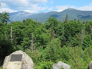
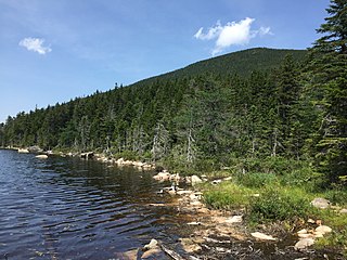
The Sandwich Range is located in the White Mountains of New Hampshire in the United States, north of the Lakes Region and south of the Kancamagus Highway. Although the range is not outstanding for its elevation, it is very rugged and has excellent views of the surrounding lakes, mountains, and forests.
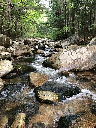
The Whiteface River is a 5.9-mile-long (9.5 km) river rising in the White Mountains of New Hampshire in the United States. Its waters flow by way of the Cold River, Bearcamp River, Ossipee Lake, the Ossipee River and the Saco River into the Gulf of Maine, an arm of the Atlantic Ocean.

The East Branch of the Whiteface River is a 1.9-mile-long (3.1 km) stream in the White Mountains of New Hampshire in the United States. It is a tributary of the Whiteface River, part of the Saco River watershed.
Mount Franklin is a mountain in Coös County, New Hampshire, United States. The mountain is named after Benjamin Franklin and is part of the Presidential Range of the White Mountains. Note that Ben Franklin was not a president. Mount Franklin is flanked to the northeast by Mount Monroe, and to the southwest by Mount Eisenhower.

Mount Field is a mountain located in Grafton County, New Hampshire. The mountain is named after Darby Field (1610–1649), who in 1642 made the first known ascent of Mount Washington. Mount Field is the highest peak of the Willey Range of the White Mountains. Mt. Field is flanked to the northwest by Mount Tom, and to the southwest by Mount Willey.

Mount Passaconaway is a 4,043 ft (1,232 m) mountain in the Sandwich Range Wilderness of the White Mountain National Forest in Grafton County, New Hampshire, near Waterville Valley. It is named after Passaconaway, a 16th-century sachem of the Pennacook tribe, whose name was also attached to a small village in Albany, where the northern trailhead is now located.

Mount Willey is a mountain located in Grafton County, New Hampshire. The mountain is named after Samuel Willey, Jr. (1766–1826) and his family, who in 1825 moved into a house in Crawford Notch. The family was killed a year later in August 1826 during a landslide.
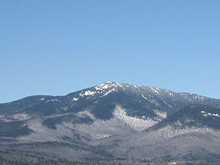
Mount Whiteface is a 4,019 ft (1,225 m) mountain located in Grafton County, New Hampshire. The mountain is part of the Sandwich Range of the White Mountains. Whiteface is flanked to the northwest by Mount Tripyramid, and to the northeast by Mount Passaconaway. Whiteface is on the eastern border of the Sandwich Range Wilderness. To the east, between Whiteface, Passaconaway, and Mt. Wonalancet, lies The Bowl natural area, an unlogged cirque.

Mount Tripyramid is a mountain located in Grafton County, New Hampshire. Part of the Sandwich Range of the White Mountains, it has three distinct peaks – North, Middle, and South – along its mile-long summit ridge. North, at 4,160 ft (1,270 m), is the highest. Scaur Peak and The Fool Killer are subsidiary peaks to the northwest and northeast. To the southeast, Tripyramid is flanked by The Sleepers.

Sandwich Mountain is a 3,983 ft (1,214 m) mountain located on the border between Carroll and Grafton counties, New Hampshire spanning parts of the towns of Sandwich and Waterville Valley, respectively. The mountain is part of the Sandwich Range of the White Mountains.

Mount Webster is a mountain located on the border between Coos County and Carroll County, New Hampshire. The mountain, formerly called Notch Mountain, is named after Daniel Webster (1782–1852), and is the south-westernmost of the Presidential Range of the White Mountains. Mount Webster is flanked to the northeast by Mount Jackson; to the southwest it faces Mount Willey across Crawford Notch.

Mount Doublehead is a twin-peaked mountain in eastern New Hampshire, United States. It is located in the town of Jackson, Carroll County, in the eastern White Mountains. North Doublehead has an elevation of 3,053 feet (930.5 m) above sea level, while South Doublehead has an elevation of 2,939 ft (895.8 m).
Mount Nancy, formerly Mount Amorisgelu, is a mountain located in Grafton County, New Hampshire, on the eastern boundary of the Pemigewasset Wilderness of the White Mountains. The mountain is the highest point and namesake of the Nancy Range. Mt. Nancy is flanked to the northeast by Mount Bemis, to the southwest by Mount Anderson, and to the southeast by Duck Pond Mountain. Although Mount Nancy is officially trailless, a visible path climbs to the summit from Norcross Pond. With a summit elevation of 3,926 feet (1,197 m), it is one of the New England Hundred Highest peaks.

Bartlett Haystack is a mountain located in Bartlett, New Hampshire. Like the town, the mountain is named after Josiah Bartlett (1729–1795), one of the signers of the Declaration of Independence and sixth Governor of New Hampshire. Bartlett Haystack is flanked to the west by Mount Tremont, and to the southeast across Bear Notch by Bear Mountain.

North Moat Mountain is a mountain located in Carroll County, New Hampshire. North Moat is flanked to the south by Middle Moat Mountain, and to the west by Big Attitash Mountain.
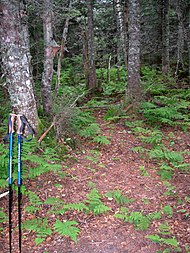
Ferncroft is an unincorporated community lying mostly in the town of Albany in Carroll County, New Hampshire, United States. Some of the roads and houses in Ferncroft stretch into the towns of Sandwich and Waterville Valley. The hamlet is a widely spaced cluster of houses centered on several fields lying along the Wonalancet River on Ferncroft Road.

Katherine Sleeper Walden was an American environmental conservationist and community activist in Wonalancet, New Hampshire. Prior to moving to New Hampshire in 1890, Katherine was an active member of the community and was among the first female journalists in Massachusetts.