
Carroll is a town in Coös County, New Hampshire, United States. The population was 820 at the 2020 census. The two largest villages are Twin Mountain and Bretton Woods. Carroll is an important access point for recreational areas in the White Mountains, including many 4,000-footers, the Zealand River area, the Presidential Range, and the Presidential Dry River Wilderness. The town is home to the Mount Washington Hotel at Bretton Woods and to the Highland Center at Crawford Notch, the Appalachian Mountain Club's four-season lodge.
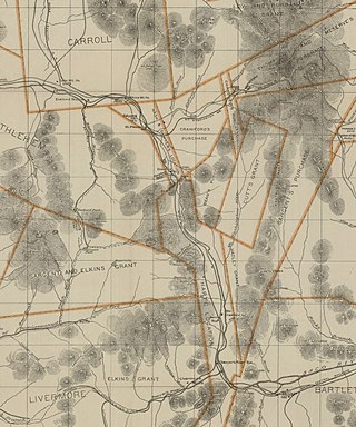
Bean's Grant is a township in southern Coös County, New Hampshire, United States, north of Crawford Notch State Park. The grant lies entirely within the White Mountain National Forest. The population was zero as of the 2020 census.

The Rocky Branch is a 13.1-mile-long (21.1 km) river in the White Mountains of New Hampshire in the United States. It is a tributary of the Saco River, which flows to the Atlantic Ocean in Maine.

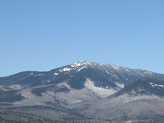
Mount Carrigain is a mountain located in Grafton County, New Hampshire. The mountain is named after Phillip Carrigain, NH Secretary of State (1805–10), and is on the south side of the Pemigewasset Wilderness, the source of the East Branch of the Pemigewasset River in the heart of the White Mountains, between Franconia Notch and Crawford Notch. Carrigain is flanked to the northeast beyond Carrigain's Vose Spur by Mount Anderson and Mount Lowell across Carrigain Notch, and to the southwest by Mount Hancock. It has a fire tower at the summit, providing 360 degree views of the surrounding wilderness.

Boott Spur is a minor peak located in Coos County, New Hampshire, United States. The mountain is named after Francis Boott (1792–1863), and is part of the Presidential Range of the White Mountains. Boott Spur stands on the shoulder of Mount Washington, above the south side of the headwall of Tuckerman Ravine.
Mount Franklin is a mountain in Coös County, New Hampshire, United States. The mountain is named after Benjamin Franklin and is part of the Presidential Range of the White Mountains. Note that Ben Franklin was not a president. Mount Franklin is flanked to the northeast by Mount Monroe, and to the southwest by Mount Eisenhower.

The Dry River is a 9.0-mile-long (14.5 km) river in the White Mountains of New Hampshire in the United States. It is a tributary of the Saco River, which flows to the Atlantic Ocean in Maine. For nearly its entire length, it is within the Presidential Range-Dry River Wilderness of the White Mountain National Forest.

Mount Willey is a mountain located in Grafton County, New Hampshire. The mountain is named after Samuel Willey, Jr. (1766–1826) and his family, who in 1825 moved into a house in Crawford Notch. The family was killed a year later in August 1826 during a landslide.

Mount Tom is a mountain located in Grafton County, New Hampshire, about 1.5 miles (2.4 km) southwest of the height of land of Crawford Notch.
Mount Whiteface is a 4,019 ft (1,225 m) mountain located in Grafton County, New Hampshire. The mountain is part of the Sandwich Range of the White Mountains. Whiteface is flanked to the northwest by Mount Tripyramid, and to the northeast by Mount Passaconaway. Whiteface is on the eastern border of the Sandwich Range Wilderness. To the east, between Whiteface, Passaconaway, and Mt. Wonalancet, lies The Bowl natural area, an unlogged cirque.

Sandwich Mountain is a 3,983 ft (1,214 m) mountain located on the border between Carroll and Grafton counties, New Hampshire spanning parts of the towns of Sandwich and Waterville Valley, respectively. The mountain is part of the Sandwich Range of the White Mountains.

Mount Webster is a mountain located on the border between Coos County and Carroll County, New Hampshire. The mountain, formerly called Notch Mountain, is named after Daniel Webster (1782–1852), and is the south-westernmost of the Presidential Range of the White Mountains. Mount Webster is flanked to the northeast by Mount Jackson; to the southwest it faces Mount Willey across Crawford Notch.

Mount Doublehead is a twin-peaked mountain in eastern New Hampshire, United States. It is located in the town of Jackson, Carroll County, in the eastern White Mountains. North Doublehead has an elevation of 3,053 feet (930.5 m) above sea level, while South Doublehead has an elevation of 2,939 ft (895.8 m).

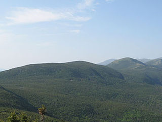
The Pemigewasset Wilderness is a 45,000-acre (182 km2) federally designated Wilderness Area in the heart of New Hampshire's White Mountains. It is a part of the White Mountain National Forest. It is New Hampshire's largest wilderness area.
Mount Nancy, formerly Mount Amorisgelu, is a mountain located in Grafton County, New Hampshire, on the eastern boundary of the Pemigewasset Wilderness of the White Mountains. The mountain is the highest point and namesake of the Nancy Range. Mt. Nancy is flanked to the northeast by Mount Bemis, to the southwest by Mount Anderson, and to the southeast by Duck Pond Mountain. Although Mount Nancy is officially trailless, a visible path climbs to the summit from Norcross Pond. With a summit elevation of 3,926 feet (1,197 m), it is one of the New England Hundred Highest peaks.
The Sleepers are two mountain peaks, East Sleeper 3,855 ft (1,175 m) and West Sleeper 3,881 ft (1,183 m), located within the Sandwich Range Wilderness in Grafton County, New Hampshire. Part of the Sandwich Range of the White Mountains, they are flanked to the northwest by Mount Tripyramid, to the northeast by Mount Passaconaway, and to the southeast by Mount Whiteface. The Kate Sleeper Trail passes close by both peaks.

Bartlett Haystack is a mountain located in Bartlett, New Hampshire. Like the town, the mountain is named after Josiah Bartlett (1729–1795), one of the signers of the Declaration of Independence and sixth Governor of New Hampshire. Bartlett Haystack is flanked to the west by Mount Tremont, and to the southeast across Bear Notch by Bear Mountain.
Bear Mountain is a 3,219-foot (981 m) mountain located in Bartlett, New Hampshire, USA. Bear Mountain is flanked to the northwest, across Bear Notch, by Bartlett Haystack. To the east is Table Mountain, followed by Big Attitash Mountain. The north side of Bear Mountain drains via Louisville Brook and Albany Brook to the Saco River in Bartlett. The southern slopes of the mountain drain to the Swift River, on the southwest via Douglas Brook and on the southeast via Cilley Brook, which joins the Swift River at Rocky Gorge.
Mount Avalon is a 3,442-foot-high (1,049 m) mountain located in Grafton County, New Hampshire, United States. It is a small, rocky spur of Mount Field, overlooking Crawford Notch in the White Mountains. Avalon's summit is reached by a spur from the Mount Avalon Trail, which climbs to the summit of Mount Field.
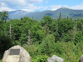
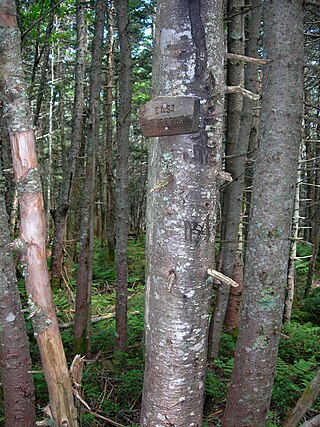
The Crawford family of the White Mountains were a family who moved to New Hampshire's White Mountains in the 1790s from Guildhall, Vermont, and were pioneers in establishing a tourist industry in that area. Abel Crawford and his father-in-law, Eleazar Rosebrook, began the effort, and one of Abel's sons, Ethan Allen Crawford, made significant contributions. Another son, Thomas Jefferson Crawford, continued the work; and Ethan's wife, Lucy, also contributed. Their work was in the area then known as White Mountain Notch, subsequently called Crawford Notch.
