
Chatham is a town in Carroll County, New Hampshire, United States. The population was 341 at the 2020 census. It is located in the White Mountains, and except for the southeastern corner, all of Chatham is in the White Mountain National Forest. The town is home to the Cold River national forest campgrounds.

North Conway is a census-designated place (CDP) and village in eastern Carroll County, New Hampshire, United States. The population was 2,116 at the 2020 census. A year-round resort area, North Conway is the second-largest village within the town of Conway, after the village of Conway proper. North Conway maintains its own fire station, post office and public library, sharing its other services with Conway. The White Mountain National Forest is to the west and north. The area is home to Cathedral Ledge, Echo Lake State Park, and Cranmore Mountain Resort. North Conway is known for its large number of outlet shops.

Conway is a town in Carroll County, New Hampshire, United States. It is the most populous community in the county, with a population of 9,822 at the 2020 census, down from 10,115 at the 2010 census. The town is on the southeastern edge of the White Mountain National Forest. There are five villages in the town: Conway, North Conway, Center Conway, Redstone and Kearsarge. Additionally, it shares a portion of the village of Intervale with the neighboring town of Bartlett.

Mount Kearsarge is a mountain located in Wilmot, New Hampshire, and Warner, New Hampshire. Two state parks are located at the northern and southern bases of the mountain—Winslow State Park and Rollins State Park, respectively—and the entire mountain is within Kearsarge Mountain State Forest. On a very clear day, skyscrapers in the city of Boston 80 miles (130 km) away are visible from the fire tower on the summit. The summit has remained bare since a 1796 forest fire.

Loon Mountain is a mountain in Lincoln and Livermore, New Hampshire, in Grafton County. It is in the White Mountain National Forest.

Mount Sunapee is a 5-mile-long (8.0 km) mountain ridge in the towns of Newbury and Goshen in western New Hampshire, United States. Its highest peak, at the north end of the mountain, is 2,726 feet (831 m) above sea level. The mountain has three secondary peaks, White Ledges at 2,716 ft (828 m); North Peak at 2,280 ft (695 m); and South Peak at 2,608 ft (795 m). The north end of the mountain, including the summit, is within Mount Sunapee State Park, which encompasses 3.85 square miles (10.0 km2) and is home to the popular Mount Sunapee Resort. The mountain extends south to Pillsbury State Park in the towns of Goshen and Washington.
Mount Cardigan is a prominent bare-rock summit in the towns of Orange and Alexandria in western New Hampshire, USA. While its peak is only 3,155 feet (962 m) above sea level, it has extensive areas of bare granite ledges and alpine scrub, giving it the feel to hikers of a much higher mountain. Most of the summit area was denuded by devastating forest fires in 1855.

Ragged Mountain is a low mountain with numerous knobby summits in the towns of Danbury and Andover in central New Hampshire. It is home to the Ragged Mountain ski resort.

Mount Willey is a mountain located in Grafton County, New Hampshire. The mountain is named after Samuel Willey, Jr. (1766–1826) and his family, who in 1825 moved into a house in Crawford Notch. The family was killed a year later in August 1826 during a landslide.

Kearsarge North is a mountain located about 4 miles (6 km) northeast of North Conway, Carroll County, New Hampshire, United States. The U.S. Board on Geographic Names accepted the name "Pequawket Mountain" in 1915 but it was renamed Kearsarge North in 1957. The Pequawket are a subdivision of the Abenaki people who formerly lived in the area. It is sometimes referred to as Mount Kearsarge, a name officially assigned to a mountain in Merrimack County.
Mount Whiteface is a 4,019 ft (1,225 m) mountain located in Grafton County, New Hampshire. The mountain is part of the Sandwich Range of the White Mountains. Whiteface is flanked to the northwest by Mount Tripyramid, and to the northeast by Mount Passaconaway. Whiteface is on the eastern border of the Sandwich Range Wilderness. To the east, between Whiteface, Passaconaway, and Mt. Wonalancet, lies The Bowl natural area, an unlogged cirque.

Mount Tripyramid is a mountain located in Grafton County, New Hampshire. Part of the Sandwich Range of the White Mountains, it has three distinct peaks – North, Middle, and South – along its mile-long summit ridge. North, at 4,160 ft (1,270 m), is the highest. Scaur Peak and The Fool Killer are subsidiary peaks to the northwest and northeast. To the southeast, Tripyramid is flanked by The Sleepers.

The Monadnock-Sunapee Greenway (MSG) is a 50-mile (80 km) hiking trail that traverses the highlands of southern New Hampshire from Mount Monadnock in Jaffrey to Mount Sunapee in Newbury. Located approximately 27 miles (43 km) from the city of Concord, New Hampshire, the trail traverses a rural, heavily glaciated and metamorphic upland studded with lakes, heath barrens, the rocky summits of several monadnocks, and dense woodland of the northern hardwood forest type. The trail is maintained primarily through the efforts of the Monadnock-Sunapee Greenway Trail Club.

Mount Webster is a mountain located on the border between Coos County and Carroll County, New Hampshire. The mountain, formerly called Notch Mountain, is named after Daniel Webster (1782–1852), and is the south-westernmost of the Presidential Range of the White Mountains. Mount Webster is flanked to the northeast by Mount Jackson; to the southwest it faces Mount Willey across Crawford Notch.
The Sleepers are two mountain peaks, East Sleeper 3,855 ft (1,175 m) and West Sleeper 3,881 ft (1,183 m), located within the Sandwich Range Wilderness in Grafton County, New Hampshire. Part of the Sandwich Range of the White Mountains, they are flanked to the northwest by Mount Tripyramid, to the northeast by Mount Passaconaway, and to the southeast by Mount Whiteface. The Kate Sleeper Trail passes close by both peaks.

Sugarloaf Mountain or Mount Sugarloaf, is a butte-like mountain located in South Deerfield, Massachusetts, United States, with two summits, North Sugarloaf Mountain 791 ft (241 m) and its more popular knee, South Sugarloaf Mountain 652 ft (199 m). Its cliffs, made of arkose sandstone, are a very prominent landscape feature visible for miles. Despite low elevations relative to the Berkshire Mountains to the west, dramatic cliff faces and a rise of 500 feet (150 m) to 600 feet (180 m) from the nearby Connecticut River make the mountain a popular tourist and hiking destination. Sugarloaf Mountain is the southern terminus of the Pocumtuck Range.

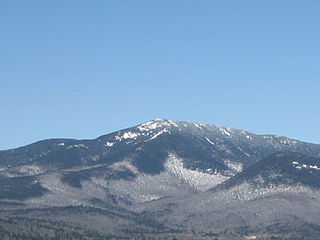
North Baldface is a 3,606-foot (1,099 m) mountain in the township of Bean's Purchase, New Hampshire in the eastern White Mountains. It gets its name from its steep barren southeast face. Along with the neighboring summit South Baldface, it is a popular hiking destination, especially in the summer. The two mountains are ascended by the Slippery Brook, Baldface Knob, Baldface Circle, Meader Ridge, and Bicknell Ridge trails.

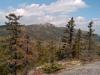
South Baldface is a 3,547-foot (1,081 m) mountain in the town of Chatham, New Hampshire in the eastern White Mountains. It gets its name from its steep barren eastern face. Along with the neighboring summit North Baldface, it is a popular hiking destination, especially in the summer. The two mountains are ascended by the Slippery Brook, Baldface Knob, Baldface Circle, Meader Ridge, and Bicknell Ridge trails.

Moose Mountain is an 8-mile (13 km)-long ridge located in the eastern part of the town of Hanover in Grafton County, New Hampshire. The mountain is flanked to the north by Holts Ledge, at 2,110 feet (640 m), and to the south by Shaker Mountain, at 1,690 feet (520 m). It is traversed by the Appalachian Trail, a 2,170-mile (3,490 km) National Scenic Trail from Georgia to Maine. Moose Mountain is outside the White Mountain National Forest, but the trail runs through a narrow corridor along the ridge which is administered by the U.S. Forest Service. The trail can be accessed from the south along Three Mile Road in Hanover, and from the north along Goose Pond Road in Lyme, New Hampshire.

Evans Notch is a mountain pass located in the White Mountains in Maine, United States, about 1 mile (1.6 km) east of the New Hampshire border. It is the easternmost notch through the White Mountains. To the south, the notch is drained by the Cold River, which leads via the Charles River to the Saco River, which in turn flows into the Gulf of Maine east of Saco and Biddeford. The Mad River is a small mountain stream that joins the Cold River from the west about 2 miles (3 km) south of the height of land, after dropping over Mad River Falls. The notch is drained to the north by Evans Brook, a tributary of the Wild River, which flows north to the Androscoggin River. The Androscoggin leads east and south to the Kennebec River at Merrymeeting Bay north of Bath, Maine.

