Langdon, New Hampshire | |
---|---|
Coordinates: 43°10′00″N72°22′49″W / 43.16667°N 72.38028°W | |
Country | United States |
State | New Hampshire |
County | Sullivan |
Incorporated | 1787 |
Government | |
• Selectboard |
|
Area | |
• Total | 16.3 sq mi (42.3 km2) |
• Land | 16.3 sq mi (42.1 km2) |
• Water | 0.08 sq mi (0.2 km2) 0.45% |
Elevation | 676 ft (206 m) |
Population (2020) | |
• Total | 651 |
• Density | 40/sq mi (15.5/km2) |
Time zone | UTC-5 (Eastern) |
• Summer (DST) | UTC-4 (Eastern) |
ZIP code | 03602 |
Area code | 603 |
FIPS code | 33-40900 |
GNIS feature ID | 0873642 |
Website | langdonnh |
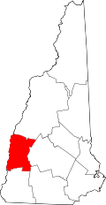
Langdon is a town in Sullivan County, New Hampshire, United States. The population was 651 at the 2020 census. [2]
First settled in 1773 by Seth Walker, Langdon was incorporated on January 11, 1787, when it was named after Governor John Langdon. [3] The town is home to the Prentiss Bridge, the shortest covered bridge in New Hampshire. Built across Great Brook in 1874, the lattice truss span has a length of 34 feet 6 inches (10.52 m).
According to the United States Census Bureau, the town has a total area of 16.3 square miles (42.3 km2), of which 0.1 square miles (0.2 km2) are water, comprising 0.45% of the town. [1] Drained by the Cold River and its tributary Great Brook, Langdon lies within the Connecticut River watershed. [4] The highest point in town is the summit of Holden Hill, at 1,348 feet (411 m) above sea level.
Census | Pop. | Note | %± |
---|---|---|---|
1790 | 244 | — | |
1800 | 484 | 98.4% | |
1810 | 632 | 30.6% | |
1820 | 654 | 3.5% | |
1830 | 667 | 2.0% | |
1840 | 615 | −7.8% | |
1850 | 575 | −6.5% | |
1860 | 478 | −16.9% | |
1870 | 411 | −14.0% | |
1880 | 364 | −11.4% | |
1890 | 305 | −16.2% | |
1900 | 339 | 11.1% | |
1910 | 340 | 0.3% | |
1920 | 279 | −17.9% | |
1930 | 267 | −4.3% | |
1940 | 276 | 3.4% | |
1950 | 378 | 37.0% | |
1960 | 338 | −10.6% | |
1970 | 337 | −0.3% | |
1980 | 437 | 29.7% | |
1990 | 580 | 32.7% | |
2000 | 586 | 1.0% | |
2010 | 688 | 17.4% | |
2020 | 651 | −5.4% | |
U.S. Decennial Census [5] |
As of the census [6] of 2000, there were 586 people, 237 households, and 174 families residing in the town. The population density was 36.0 inhabitants per square mile (13.9/km2). There were 269 housing units at an average density of 16.5 per square mile (6.4/km2). The racial makeup of the town was 99.66% White, 0.17% from other races, and 0.17% from two or more races. Hispanic or Latino of any race were 0.17% of the population.
There were 237 households, out of which 29.5% had children under the age of 18 living with them, 65.4% were married couples living together, 5.5% had a female householder with no husband present, and 26.2% were non-families. 21.1% of all households were made up of individuals, and 8.4% had someone living alone who was 65 years of age or older. The average household size was 2.47 and the average family size was 2.85.
In the town, the population was spread out, with 21.3% under the age of 18, 5.3% from 18 to 24, 30.2% from 25 to 44, 31.2% from 45 to 64, and 11.9% who were 65 years of age or older. The median age was 41 years. For every 100 females, there were 113.1 males. For every 100 females age 18 and over, there were 105.8 males.
The median income for a household in the town was $42,083, and the median income for a family was $43,125. Males had a median income of $33,750 versus $24,444 for females. The per capita income for the town was $24,572. About 3.3% of families and 3.8% of the population were below the poverty line, including none of those under age 18 and 12.3% of those age 65 or over.
Sullivan County is a county in the U.S. state of New Hampshire. As of the 2020 census, the population was 43,063, making it the second-least populous county in New Hampshire. Its county seat is Newport.
Prentiss County is a county located in the U.S. state of Mississippi. As of the 2020 census, the population was 25,008. Its county seat is Booneville. The county is named for Seargent Smith Prentiss, a noted speaker and US Congressman from Natchez.
Albany is a town in Carroll County, New Hampshire, United States. The population was 759 at the 2020 census.
Chatham is a town in Carroll County, New Hampshire, United States. The population was 341 at the 2020 census. It is located in the White Mountains, and except for the southeastern corner, all of Chatham is in the White Mountain National Forest. The town is home to the Cold River national forest campgrounds.
Alstead is a town in Cheshire County, New Hampshire, United States. The population was 1,864 at the 2020 census. Alstead is home to Feuer State Forest.
Gilsum is a town in Cheshire County, New Hampshire, United States. The population was 752 at the 2020 census. Home to Bear's Den Natural Area, Gilsum includes Gilsum Lower Village.
Walpole is a town in Cheshire County, New Hampshire, United States. The population was 3,633 at the 2020 census.
Columbia is a town in Coös County, New Hampshire, United States. The population was 659 at the 2020 census, down from 757 at the 2010 census. It is part of the Berlin, NH-VT micropolitan statistical area.
Northumberland is a town located in western Coös County, New Hampshire, United States, north of Lancaster. It is part of the Berlin, NH–VT micropolitan statistical area. As of the 2020 census, the town population was 2,126, of whom 1,068 lived in the village of Groveton.
Stark is a town in Coös County, New Hampshire, United States. The population was 478 at the 2020 census, a decline from the figure of 556 tabulated in 2010. It has a famous covered bridge. The town includes the villages of Percy and Crystal as well as the village of Stark, located on the Upper Ammonoosuc River. New Hampshire Route 110 runs through Stark, east from U.S. Highway 3 in Groveton and northwest from Route 16 in Berlin. Much of the town is within the boundaries of the White Mountain National Forest.
Stewartstown is a town in Coös County, New Hampshire, United States. The population was 813 at the 2020 census, down from 1,004 at the 2010 census. It includes the village of West Stewartstown and is part of the Berlin, NH-VT Micropolitan Statistical Area.
Stratford is a town located on the Connecticut River in Coös County, New Hampshire, United States. The population was 662 at the 2020 census, a decline from the figure of 746 tabulated in 2010. Within the town are the villages of North Stratford, Stratford Hollow, and Beatties. U.S. Route 3 passes through the center of town, as does the St. Lawrence and Atlantic Railroad, formerly a part of the Grand Trunk Railway.
Campton is a town in Grafton County, New Hampshire, United States. The population was 3,343 at the 2020 census. Campton, which includes the villages of Blair, Campton Hollow, Lower Campton and West Campton, is home to Blair State Forest and Livermore Falls State Forest. It is located in the foothills of the White Mountains, and parts of the White Mountain National Forest are in the northeast and northwest.
Greenfield is a town in Hillsborough County, New Hampshire, United States. The population was 1,716 at the 2020 census. Greenfield is home to the Crotched Mountain Rehabilitation Center, to Greenfield State Park, and to part of the Wapack Trail.
Webster is a town in Merrimack County, New Hampshire, United States. The population was 1,913 at the 2020 census.
Newington is a town in Rockingham County, New Hampshire, United States. The population was 811 at the 2020 census. It is bounded to the west by Great Bay, to the northwest by Little Bay and to the northeast by the Piscataqua River.
Acworth is a town in Sullivan County, New Hampshire, United States. At the 2020 census, the town had a total population of 853.
Lemington is a town in Essex County, Vermont, United States. The population was 87 as of the 2020 census. It is part of the Berlin, NH–VT Micropolitan Statistical Area.
Capon Bridge is a town in eastern Hampshire County, West Virginia, United States, along the Northwestern Turnpike, approximately 20 miles (32 km) west of Winchester, Virginia. The population was 418 at the 2020 census. Originally known as "Glencoe", Capon Bridge was incorporated in 1902 by the Hampshire County Circuit Court. It is named because of the construction of the bridge over the Cacapon River at that place, the name of the river being derived from the Shawnee Cape-cape-de-hon, meaning "river of medicine water".
Plymouth is a rural town in Grafton County, New Hampshire, United States, in the White Mountains Region. It has a unique role as the economic, medical, commercial, and cultural center for the predominantly rural Plymouth, NH Labor Market Area. Plymouth is located at the confluence of the Pemigewasset and Baker rivers and sits at the foot of the White Mountains. The town's population was 6,682 at the 2020 census. It is home to Plymouth State University, Speare Memorial Hospital, and Plymouth Regional High School.