Interstate 89 (I-89) is an Interstate Highway in the Northeastern United States traveling from Bow, New Hampshire, to the Canadian border between Highgate Springs, Vermont, and Saint-Armand, Quebec. As with all odd-numbered primary interstates, I-89 is signed as a north–south highway. However, it follows a primarily northwest-to-southeast path. The route forms a substantial part of the main connection between the cities of Montreal and Boston. In Quebec the route continues as Quebec Route 133. The eventual completion of Autoroute 35 from Montreal will lead to a non-stop limited access highway route between the two cities, following I-93 south from I-89's terminus. The largest cities directly served by I-89 are Concord, the state capital of New Hampshire, Montpelier, the state capital of Vermont, and Burlington, Vermont. I-89 is one of three main Interstate highways whose route is located entirely within New England, along with I-91 and I-93.

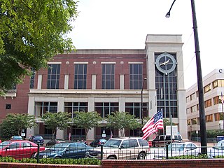
Cobb County is a suburban county in the U.S. state of Georgia. As of 2017, the population was 755,754, making it Georgia's third most-populous county. Its county seat and largest city is Marietta.

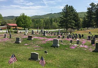
Acworth is a city in Cobb County Georgia, United States. It is part of the Atlanta metropolitan area. The 2016 estimate for Acworth's population is 28,502. As of the 2010 census, this city had a population of 20,425, up from 13,422 in 2000. Acworth is located in the foothills of the North Georgia mountains along the southeastern banks of Lake Acworth and Lake Allatoona on the Etowah River. Unincorporated areas known as Acworth extend into Bartow, Cherokee and Paulding counties respectively.

Belmont is a town in Belknap County, New Hampshire, United States. The population was 7,356 at the 2010 census.

Marlow is a town in Cheshire County, New Hampshire, United States. The population was 742 at the 2010 census. Marlow is home to Honey Brook State Forest.

Plaistow is a town in Rockingham County, New Hampshire, United States. The population was 7,609 at the 2010 census.

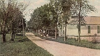
Charlestown is a census-designated place (CDP) and the primary village in the town of Charlestown in Sullivan County, New Hampshire, United States. The population of the CDP was 1,152 at the 2010 census, out of 5,114 people in the entire town of Charlestown.

Charlestown is a town in Sullivan County, New Hampshire, United States. The population was 5,114 at the 2010 census. The town is home to Hubbard State Forest and the headquarters of the Student Conservation Association.
U.S. Route 302 is an east–west spur of U.S. Route 2 in northern New England in the United States. It currently runs 171 miles (275 km) from Montpelier, Vermont, beginning at US 2, to Portland, Maine, at U.S. Route 1. It passes through the states of Vermont, New Hampshire and Maine.

New Hampshire Route 123 is a 63.055-mile-long (101.477 km) secondary north–south state highway in southwestern New Hampshire. The southern terminus of the route is at the Massachusetts state line in Mason where, as Mason Road, the road continues as an unnumbered local road in the town of Townsend. The northern terminus, as signed, is at the Connecticut River, where the highway continues west for 0.313 miles (0.504 km) to U.S. Route 5 in Westminster, Vermont, as Vermont Route 123. Route logs, however, place the terminus at New Hampshire Route 12 in Walpole.

The Candia Four Corners is an unincorporated community located near the center of the town of Candia, New Hampshire, in the United States.
The Indian River is a 12.8-mile (20.6 km) long river located in western New Hampshire in the United States. The river is a tributary of the Mascoma River, which in turn flows to the Connecticut River and ultimately Long Island Sound.
The Cold River is a 22.6-mile-long (36.5 km) river located in western New Hampshire in the United States. It is a tributary of the Connecticut River, which flows to Long Island Sound.
Great Brook is a 10.0-mile-long (16.1 km) tributary of the Cold River in western New Hampshire in the United States.
This article shows U.S. Census totals for Sullivan County, New Hampshire, broken down by municipality, from 1900 to 2010.
Fall Mountain Regional High School is a small high school located in Langdon, New Hampshire, in the United States. The school, part of SAU 60 in New Hampshire, serves the towns of Langdon, Acworth, Alstead, Charlestown, and Walpole.

Rye Beach is an unincorporated community along the Atlantic Ocean in Rye, New Hampshire, United States. It is located along New Hampshire Route 1A near the southern border of the town of Rye, directly south of Jenness State Beach and north of Little Boar's Head. Rye Beach has a separate ZIP code (03871) from the rest of the town of Rye.

South Tamworth is an unincorporated community in the town of Tamworth in Carroll County, New Hampshire, United States. It is located along New Hampshire Route 25, next to the Bearcamp River. Route 25 continues east past the village of Whittier to West Ossipee, where it intersects New Hampshire Route 16. To the west, Route 25 leads to Moultonborough, Center Harbor, and Meredith.


